Jump to content


Photo
- - - - -

Southwest Colorado


  • Please log in to reply
31 replies to this topic

#1 longhorn1

longhorn1

    Ouch, that stings!

  • Members
  • 2,826 posts
  • LocationCarmel, Indiana

Posted 15 February 2017 - 01:55 PM

In late September and early October we will head to Rocky Mountain National Park for 3-1/2 days (Glacier Basin Campground) before we head to Southwest Colorado.  We intend on spending 3 days at Black Canyon of the Gunnison National Park, with plans to stay at the South Rim.   Then it will be onto Mesa Verde National Park for 3 days, before we head into Telluride.  In Telluride we plan on staying in the City Park so we can enjoy Telluride, while making some day runs to Ouray and surrounding areas.  Our last stop will be Great Sand Dunes National Monument.


When we leave RMNP we plan on taking Trail Ridge Road and winding our way down to I-70 and then taking some scenic roads through the mountains to BCofGNP. 


1.  What are some of the things we should do and see in and around RMNP?


2.  From Trail Ridge Road, what roads should we take south to Black Canyon of the Gunnison.  I ordered my Benchmark Atlas, but everyone's experience and recommendations would be greatly appreciated.


3.  Looking for Pros and Cons between North Rim and South Rim campgrounds at Black Canyon of the Gunnison.  We are leaning toward South Rim, so I can take the road down into the canyon to do some fly fishing.


4.  Mesa Verde will be our next stop.  Any suggestions on what we should see and do.  Plenty of cliff dwellings to visit, your thoughts.  We also plan on taking a drive over to Four Corners for a photo Op.


5.  While in Telluride we plan on day excursions so information on Ouray and some of the surrounding area would be helpful.  "The Alpine Loop" - How hard is this trip and with our FWC Grandby?  We stepped outside our element traveling one lane gravel roads up into the mountains and across some passes in Montana and had a blast.  We used 4-wheel high a lot.  I have never used 4-wheel low.  I've never driven in 4-wheel low and don't have a clue what to do, other than common sense.  Advice on the Alpine Loop would be much appreciated and whether the trip can be done completely in 4-wheel high or whether there are some places that 4-wheel low is required and how much?  If we do it, it would be on our way to Great Sand Dune NM, so we would probably find some dispersed camping, since the loop takes 6+/- hours to complete.


6.  Great Sand Dune NM.  We plan on staying in the campground.  Andy information and suggestions would be helpful.


Looking forward to everyone's suggestions and recommendations.  jd


Edited by longhorn1, 15 February 2017 - 02:01 PM.

  • 0

http://texaslonghorns01.blogspot.com/


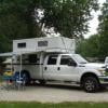
Ford F-250 Long bed, 2014 Grandby


#2 iowahiker

iowahiker

    Senior Member

  • Members
  • 487 posts
  • Locationiowa

Posted 15 February 2017 - 07:41 PM

We were at Black Canyon of the G. NP in October 2015 at both campgrounds, north and south.  The south has lots of views and road access to the river.  The north is primarily a hiking/climbing destination with a few views and off-the-beaten-path character.  The drive from the south to the north is long and moderately scenic.  If you are time limited, then exploring north of Durango is more scenic than the drive to the north rim of Black Canyon.  If the fishing does not work out below Black Canyon of the G. NP, then we hiked along the river starting just west of the Blue Mesa Reservoir in Curecanti NRA (east of Black Canyon) and saw folks catching nothing smaller than 5 pound lake trout.  The parking area is down a dirt road just west of the Blue Mesa Dam and Lake Fork Campground where you then walk down 100+ steps to reach an old railroad grade on the south side of the river below the dam.  The farther west you fish, the fewer people are fishing and the more fish because you are heading to the next lake down river.  All the fish were caught in the morning and so you could spend the day in the Black Canyon area and then camp near the Blue Mesa dam for an early start fishing followed by moving on in the afternoon after fishing.   No one was wading because the water was flowing fast and deep.


We visited some of the same places as you this past year: Green River Lakes, Atlantic City, Lake Como, and Skalkaho Pass.  All our past visits to RMNP, Great Sand Dunes, and Mesa Verde were all day hiking trips.


Edited by iowahiker, 16 February 2017 - 01:12 AM.

  • 0

#3 pikabike

pikabike

    Member

  • Members
  • PipPip
  • 14 posts

Posted 15 February 2017 - 08:14 PM

Instructions on driving in low range should be in your owner's manual. It is very easy to use.

Black Canyon's South Rim campground would be better for a first visit, unless you are tent camping. North Rim's has fewer sites, and they are designed for tents and smaller vehicles. Also, because potable water is trucked in there, you can't fill water tanks or other large containers.

South Rim has flat paved sites, hot showers, etc., AND it is closer to grocery stores.
  • 0

#4 elmo_4_vt

elmo_4_vt

    Advanced Member

  • Members
  • PipPipPip
  • 81 posts

Posted 15 February 2017 - 09:25 PM

Great discussion.  We're making almost the same trip in August.  Following along for as much info as possible.


One note on the Alpine loop, I've heard a few areas will be "fun" in a full sized rig like yours and mine.  I'll be carring a trailer with a cycle for some of that exploring and leaving the camper near the bottom, at least until it gets scouted out..  There are lots of YouTube videos of all of those trails and good rating websites that will give you an idea of what you're in store for.


Don


-


Edited by elmo_4_vt, 15 February 2017 - 09:26 PM.

  • 0

#5 longhorn1

longhorn1

    Ouch, that stings!

  • Members
  • 2,826 posts
  • LocationCarmel, Indiana

Posted 15 February 2017 - 11:32 PM

Guys,

Great stuff. Thanks for the response. I will check out You-Tube.

My Colorado Benchmark arrived and I'm looking forward to planning some our routes. jd
  • 0

http://texaslonghorns01.blogspot.com/


Ford F-250 Long bed, 2014 Grandby


#6 CougarCouple

CougarCouple

    Senior Member

  • Members
  • 1,376 posts
  • LocationLas Vegas

Posted 16 February 2017 - 01:01 AM

Hello longhorn 1
Can't help with a lot of your questions on Colorado. If you have never used 4L , after reading I would suggest you find a dirt road and use what you read to engage and drive in 4L. Slows everything down, does effect turning some what in my opinion. Assuming you have a automatic transmission. Say on a rough trail with some large rocks, you can keep the throttle constant, and apply , and ride the brake a little feathering it as needed to control speed. Can make for a less jerky ride over the rough stuff, also 4 L can help with decent.
Use it before you need it, will make it more comfortable when you do,as you'll know what to expect. Push button 4 L engagement is very different than a manual selector. Also read about the locking hub's and what each position is for.
Russ
  • 0
F250 extended cab, Cougar from ATC. You guys rock thank you!

#7 Foy

Foy

    Resident Geologist

  • Members
  • 1,295 posts
  • LocationRaleigh, NC

Posted 16 February 2017 - 11:03 AM

Echoing Russ' comments above, think of low range as a separate transmission for slower speeds.  The low range gearing is actually within the transfer case, but thinking of it as an extension of your transmission helps.


There are often stretches of road or trail which due to rockiness, ruts, or even limited sight distance, where your ideal travel speed is too fast for 1st and too slow for 2nd.  Oh, and when on a trail, I most often use my automatic as a manual to avoid unwanted upshifts and downshifts. Anyway, using low range allows you more flexibility to find a sweet spot where engine rpm and speed of travel are at ideal levels.


Probably the most frequent use of low range is on a steep descent. Especially with the diesel engines your truck and mine have, it's entirely possible to take on a steep descent and but rarely touch the brakes.  Once again, doing so with the greatest effectiveness requires using your transmission shift selector to hold in 1st or 2nd, but keeping it from upshifting is key to accomplishing your mission. On a particularly steep or long descent, or both, you'll find the brakes won't get hot because they're not often used. Cool brakes on a steep descent are good.


Cases in point related to places we have each been:  I used low range on the descent from Vipond Park to Canyon Creek in the Montana Pioneers. I wanted to engage my 4WD anyway in order to limit wheelspin or lockup on any loose gravel or rock, and I wanted to "pick my pace" within a narrow range of speeds I figured to be comfortable with. Most importantly, I wanted to stay off of the brakes to the greatest extent practical for the entire descent.  I also used low range while ascending and descending each side of the steep switchbacks at Hogback and Little Hogback along Rock Creek Rd when I had the trailer to drag up and had it pushing me on the downhill.  On the downhills, I used the manual override feature on the trailer brake controller to engage the trailer brakes without needing to ride the truck's brakes.  Worked great.


I think all modern vehicles have "lockouts" which prevent engaging low range unless also in 4WD.  This is because the rear drivetrain gearing, rear driveshaft, and axle halfshafts aren't designed to take the additional torque alone.  Since you must be in 4WD, you won't be using low range on dry paved surfaces.


I'll glance through my Colorado Benchmark for some routing ideas over the next few days.  Cottonwood Pass between Buena Vista and Taylor Park Reservoir comes to mind, but I'll bet I can come up with more.


Foy 


Edited by Foy, 16 February 2017 - 11:05 AM.

  • 1

#8 Foy

Foy

    Resident Geologist

  • Members
  • 1,295 posts
  • LocationRaleigh, NC

Posted 16 February 2017 - 06:52 PM

JD,


Today's lunch-at-the-desk routing guidebook entry is as follows:  From Granby, CO 9 to I-70 and west for a short distance (<20 miles?) to Vail Pass.  At Vail Pass, FS 709 to Red Cliff.  Then US 24 towards Leadville passing through Camp Hale, where the 10th Mountain Division trained in the 1940s.  Up and over Tennessee Pass and to and through Leadville. South of Leadville on US 24 to Buena Vista.


At BV, west on CO 306 (paved) to Cottonwood Pass.  CP is a +12,000' pass in the Presidential Range.  Awesome views.  On my only trip there, way back in 1994, it was gravel FS road 209 down the other side into the spectacular Taylor's Park Reservoir basin. From the reservoir (which has one or more great FS campgrounds) it's downriver through Taylor River canyon to Gunnison (town). Black Canyon of the Gunnison NP is not far west of Gunnison, if memory serves.


There are innumerable FS roads along the way from Grandby to I-70 but I am not individually familiar with any of them, nor do I know if any are through-routes.  Also, I have not run FS 709 from Vail Pass to Red Cliff.  I don't even know if it's paved or graded gravel.


From a little south of BV, a route passes through St Elmo over Tincup Pass, through the partially ghost town of Tin Cup, and comes out at Taylor Park Reservoir.  I've read of the Tincup Pass route but have no idea of its suitability for a fullsize truck + camper. That'll be some fun homework for you to engage in.  


The only time I've passed over Cottonwood Pass was in a Chevy Caprice rental (which may have never been the same after that week).  Seriously, though, the west side (gravel side) was graded gravel and easy-peasey Camry rated road.


Lots of hot springs south of BV in and around Salida, and a cool-looking hot spring "resort" right along CO 306 leading up to Cottonwood Pass from BV, appropriately named Cottonwood Hot Springs.


Have fun!


Foy


  • 1

#9 longhorn1

longhorn1

    Ouch, that stings!

  • Members
  • 2,826 posts
  • LocationCarmel, Indiana

Posted 16 February 2017 - 08:55 PM

JD,


Today's lunch-at-the-desk routing guidebook entry is as follows:  From Granby, CO 9 to I-70 and west for a short distance (<20 miles?) to Vail Pass.  At Vail Pass, FS 709 to Red Cliff.  Then US 24 towards Leadville passing through Camp Hale, where the 10th Mountain Division trained in the 1940s.  Up and over Tennessee Pass and to and through Leadville. South of Leadville on US 24 to Buena Vista.


At BV, west on CO 306 (paved) to Cottonwood Pass.  CP is a +12,000' pass in the Presidential Range.  Awesome views.  On my only trip there, way back in 1994, it was gravel FS road 209 down the other side into the spectacular Taylor's Park Reservoir basin. From the reservoir (which has one or more great FS campgrounds) it's downriver through Taylor River canyon to Gunnison (town). Black Canyon of the Gunnison NP is not far west of Gunnison, if memory serves.


There are innumerable FS roads along the way from Grandby to I-70 but I am not individually familiar with any of them, nor do I know if any are through-routes.  Also, I have not run FS 709 from Vail Pass to Red Cliff.  I don't even know if it's paved or graded gravel.


From a little south of BV, a route passes through St Elmo over Tincup Pass, through the partially ghost town of Tin Cup, and comes out at Taylor Park Reservoir.  I've read of the Tincup Pass route but have no idea of its suitability for a fullsize truck + camper. That'll be some fun homework for you to engage in.  


The only time I've passed over Cottonwood Pass was in a Chevy Caprice rental (which may have never been the same after that week).  Seriously, though, the west side (gravel side) was graded gravel and easy-peasey Camry rated road.


Lots of hot springs south of BV in and around Salida, and a cool-looking hot spring "resort" right along CO 306 leading up to Cottonwood Pass from BV, appropriately named Cottonwood Hot Springs.


Have fun!


Foy

Foy,  Thanks.  If I read your suggestions correctly you gave two routes from Buena Vista.  The first was 306 to Cottonwood Pass and 209 to Taylor's Reservoir, or the second was 162 south of BV till it runs into 267, passing through St. Elmo, past Mirror Lake and through Tincup to Taylor's Reservoir. 


As far as FS 709, you actually take FS 16 to Shrine Pass, then it becomes FS 712 to FS 709 (Shrine Pass Road) to Red Cliff.


I originally mapped out Trail Ridge Road to Granby, Hwy 40 West to Hwy 9 in Kremming, South on Hwy 9 through Breckenridge to Fairplay, and Hwy 285 South to Hwy 50 to Black Canyon.  Your ideas are intriguing.  jd


  • 0

http://texaslonghorns01.blogspot.com/


Ford F-250 Long bed, 2014 Grandby


#10 Foy

Foy

    Resident Geologist

  • Members
  • 1,295 posts
  • LocationRaleigh, NC

Posted 17 February 2017 - 01:57 AM

JD,


I'm sure you're right--still haven't looked at my CO Benchmark for exact route numbers and state vs FS designations.  Simply pulled Google maps off the Interwebs at lunchtime--could be less than precise--imagine that.


That said, yah, there's a single route up canyon from BV to Cottonwood Pass and it's paved.  At the county line/Continental Divide/NF boundary line, the surface changes to gravel and the route # and/or CO vs FS designation changes for the long descent to Taylor Park Reservoir.  I've never been over Tincup Pass south of Cottonwood Pass, but I'm confident the route through St Elmo to Tincup Pass is the only one available, so your route #s are surely correct.


Ain't anything wrong with CO 9 from I-70 through Breck, over the pass, to Fairplay.  IIRC, US 285 from Fairplay to the south comes out to US 24 at/near BV.  Maybe there's a connecter route from US 285 to BV which I don't recall. Our Chevy Caprice overland trip from Hite, UT through Mesa Verde to Durango/Ouray/Montrose/Gunnison/Cottonwood Pass went to Fairplay, thence to Breck, where a marathon of incredible luck at the 8-ball table in a brewpub won us so many pitchers that we had to share all of them with the drywallers/painters/carpenters we'd defeated. That allowed us NC boys to get out of there alive in order to spend the night napping in the rental Caprice outside of the brewpub before driving down to DEN in the morning for a flight back to NC. Good times. In some ways.


Foy 


  • 0


0 user(s) are reading this topic

0 members, 0 guests, 0 anonymous users