URGENT - WINTER WEATHER MESSAGE
National Weather Service Sacramento CA
239 AM PST Sun Dec 16 2018

...Heavy Mountain Snow Late Today Through Noon Monday...

.A winter storm will bring moderate to heavy snow to the
mountains of Western Plumas County and the Northern and Central
Sierra Nevada above 4500 to 5000 feet late today into late Monday
morning. Snow levels will start out near major pass levels but
lower tonight into Monday morning when the most significant
snowfall is expected below major pass levels.

CAZ069-161845-
/O.CON.KSTO.WS.W.0012.181216T2200Z-181217T2000Z/
West Slope Northern Sierra Nevada-
239 AM PST Sun Dec 16 2018

...WINTER STORM WARNING REMAINS IN EFFECT FROM 2 PM THIS
AFTERNOON TO NOON PST MONDAY ABOVE 5000 FEET...

* WHAT...Heavy wet snow expected. Plan on difficult travel
  conditions. Damage to trees and power lines is possible. Total
  snow accumulations of 4 to 7 inches, with localized amounts up
  to 19 inches above 6500 feet, are expected.

* WHERE...West Slope Northern Sierra Nevada.

* WHEN...2 PM today to noon Monday.

* ADDITIONAL DETAILS...Be prepared for significant reductions in
  visibility at times.

PRECAUTIONARY/PREPAREDNESS ACTIONS...

A Winter Storm Warning for snow means there will be snow covered
roads and limited visibilities. Travel is not recommended while
the warning is in effect. If you must travel, keep an extra
flashlight, food and water in your vehicle in case of an
emergency.The latest road conditions for the state you are
calling from can be obtained by calling 5 1 1.


Winter -- Wow!
Started by
MarkBC
, Dec 01 2018 06:08 PM
186 replies to this topic
#31

ski3pin
-

- Site Team
- 15,316 posts
Belay On
- LocationSierra Nevada Range
Posted 16 December 2018 - 04:10 PM
Winter Storm Warning
2003 Ford Ranger FX4 Level II 2013 ATC Bobcat SE "And in the end, it's not the years in your life that count. It's the life in your years."- Abraham Lincoln http://ski3pin.blogspot.com/
#32
MarkBC
-
- Site Team
- 6,599 posts
The Weatherman
- LocationBend, Oregon
Posted 16 December 2018 - 04:57 PM
Winter Storm Warning
URGENT - WINTER WEATHER MESSAGE
National Weather Service Sacramento CA
239 AM PST Sun Dec 16 2018
...Heavy Mountain Snow Late Today Through Noon Monday...
* WHERE...West Slope Northern Sierra Nevada.
* WHEN...2 PM today to noon Monday.
Wish we had some of that up here... 
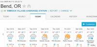
Lows above freezing are unseasonably warm for December in Central Oregon. 
FWC Hawk (2005) on a Ford F250 Supercab, 6.8L V10 gas (2000)
#33
MarkBC
-
- Site Team
- 6,599 posts
The Weatherman
- LocationBend, Oregon
Posted 18 December 2018 - 03:33 AM
High Wind Warning for Central Oregon, Oregon
From 10:00pm PST, Mon Dec 17 until 3:00pm PST, Tue Dec 18
...HIGH WIND WARNING REMAINS IN EFFECT FROM 10 PM THIS EVENING TO 3 PM PST TUESDAY... * WINDS...SOUTH 25 TO 40 MPH WITH GUSTS UP TO 60 MPH. THE HIGHEST GUSTS WILL BE SEEN IN THE BEND AREA WITH DIMINISHING WINDS TOWARD REDMOND. * TIMING...WINDS WILL INCREASE TONIGHT AND PEAK TUESDAY MORNING BEFORE DIMINISHING BY MID AFTERNOON TUESDAY. * IMPACTS...STRONG WINDS MAY BLOW DOWN LIMBS, TREES, AND POWER LINES. SCATTERED POWER OUTAGES ARE EXPECTED. TRAVEL WILL BE DIFFICULT, ESPECIALLY FOR HIGH PROFILE VEHICLES. PRECAUTIONARY/PREPAREDNESS ACTIONS... A HIGH WIND WARNING MEANS A HAZARDOUS HIGH WIND EVENT IS EXPECTED OR OCCURRING. SUSTAINED WIND SPEEDS OF AT LEAST 40 MPH OR GUSTS OF 58 MPH OR MORE CAN LEAD TO PROPERTY DAMAGE.
.................
Well, I'd prefer big precipitation on the way, but big winds might be interesting. Wish I was at the coast for wave-watching.
FWC Hawk (2005) on a Ford F250 Supercab, 6.8L V10 gas (2000)
#34
ski3pin
-
- Site Team
- 15,316 posts
Belay On
- LocationSierra Nevada Range
Posted 18 December 2018 - 06:29 AM
Batten down the hatches, Mark!
2003 Ford Ranger FX4 Level II 2013 ATC Bobcat SE "And in the end, it's not the years in your life that count. It's the life in your years."- Abraham Lincoln http://ski3pin.blogspot.com/
#35
MarkBC
-
- Site Team
- 6,599 posts
The Weatherman
- LocationBend, Oregon
Posted 18 December 2018 - 07:03 AM
Batten down the hatches, Mark!
Early Tuesday morning is garbage pickup in my neighborhood, and garbage bins have been dutifully set out at the roadside tonight. I wonder if by morning they'll still be standing and snatchable by the bin grabber on the garbage truck? 
FWC Hawk (2005) on a Ford F250 Supercab, 6.8L V10 gas (2000)
#36
CougarCouple
-

- Members
- 1,376 posts
Senior Member
- LocationLas Vegas
Posted 18 December 2018 - 01:07 PM
Morning Mark
I’ll check the sports book and let you know the odds.
Be safe.
Russ
I’ll check the sports book and let you know the odds.
Be safe.
Russ
F250 extended cab, Cougar from ATC. You guys rock thank you!
#37
MarkBC
-
- Site Team
- 6,599 posts
The Weatherman
- LocationBend, Oregon
Posted 18 December 2018 - 05:44 PM
Despite the wind, my trash bin was still standing tall and proud when I got up this morning...and I just saw the garbage truck snatch, lift, dump and replace it successfully.
Thanks, all, for your prayers.

......................
Turns out we're having rain, as well as wind -- a good thing. It's 40°F here at 3,500 feet, so it's probably snowing in the higher mountains.
FWC Hawk (2005) on a Ford F250 Supercab, 6.8L V10 gas (2000)
#38
craig333
-

- Members
- 8,014 posts
Riley's Human
- LocationSacramento
Posted 19 December 2018 - 03:10 AM
Maybe not. We got a lot of rain in the last storm but the mountains only got a couple of inches. Unusual storm track.
Craig K6JGV_________________________ 2004 2500 CTD 4X4 FWC HAWK 1960 CJ5
#39
MarkBC
-
- Site Team
- 6,599 posts
The Weatherman
- LocationBend, Oregon
Posted 19 December 2018 - 04:55 AM
...Unusual storm track.
Yep, "pineapple express"-ish
Still...at the local ski area, Mt. Bachelor, they received in the past 24 hours, 11 inches new snow at the 6,300-foot base and 16 new inches at 7,300 feet.
FWC Hawk (2005) on a Ford F250 Supercab, 6.8L V10 gas (2000)
#40
ski3pin
-
- Site Team
- 15,316 posts
Belay On
- LocationSierra Nevada Range
Posted 19 December 2018 - 05:52 AM
I don't know about you, but I'm ready for the amount of daylight to start increasing.
2003 Ford Ranger FX4 Level II 2013 ATC Bobcat SE "And in the end, it's not the years in your life that count. It's the life in your years."- Abraham Lincoln http://ski3pin.blogspot.com/


0 user(s) are reading this topic
0 members, 0 guests, 0 anonymous users

