I don't know about you, but I'm ready for the amount of daylight to start increasing.
We need a "LIKE " button on this site!
Just a few more days.


Lost again
Posted 19 December 2018 - 11:51 AM
I don't know about you, but I'm ready for the amount of daylight to start increasing.
Eddie
KO4CPL
Travel light. Travel far. Travel safe.
Resident Geologist

Posted 27 December 2018 - 07:32 PM
Even though we're early in the increasing daylight journey, we're very happy to have turned the corner. We love us some longer days!
Now if we could get a break from the rain! Another inch or four is headed our way tonight/tomorrow and it will put us over the top of 1996 for the greatest amount of rain ever recorded in a single year at the official weather station out at the airport. The 1996 year included Hurricane Fran and this year brought us Hurricanes Florence and Michael (or at least the tropical storm/depression remaining from each). We should top 60" in Raleigh by Monday with 41" having fallen since late August. The Boone/Blowing Rock area up on the Blue Ridge will top 90" by the time this last front during 2018 passes, and that's a full 7" over the previous record in 1979. The 12,500 acre drinking water closest to our house was up 8' over normal pool as of Sunday and its southern counterpart in the next county south/west , also a 12,000 acre reservoir, is 14' above normal pool. The Corps of Engineers is letting all the water it can out of both while being careful not to exacerbate downstream flooding still remaining from Florence.
Foy
Senior Member

Posted 27 December 2018 - 08:59 PM
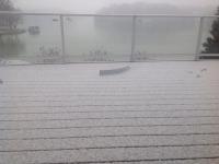
Foy, funny you should mention rain. It has been raining here all day! This after a few inches of snow last night which is rapidly melting. Temps in the high 30°s.
Weirdest Minnesota December weather ever!
Folks a couple hours north of us are getting socked with over a foot of the white stuff but we have to be content with slush puddles.
Smokecreek1
Posted 28 December 2018 - 06:48 PM
Yep.like these longer days and more sun! Boy, clear and cold today, me and "Bob" had only a short walk with everything frozen---to cold! Some snow on the hills-more on the mountains and gone in the valley floor. Yesterday the same only with a nasty "norther" type wind! Weather folks say that except with an occasional chance of rain/snow, more of the same. To the east the Skedaddle Mtns sure looks nice and all covered with snow. Come on Spring get here  --need to warm up!
Smoke
Edited by Smokecreek1, 28 December 2018 - 06:50 PM.
Belay On

Posted 05 January 2019 - 11:36 PM
We returned home to winter..................................
2003 Ford Ranger FX4 Level II 2013 ATC Bobcat SE "And in the end, it's not the years in your life that count. It's the life in your years."- Abraham Lincoln http://ski3pin.blogspot.com/
Belay On
Posted 12 January 2019 - 05:54 AM
2003 Ford Ranger FX4 Level II 2013 ATC Bobcat SE "And in the end, it's not the years in your life that count. It's the life in your years."- Abraham Lincoln http://ski3pin.blogspot.com/
The Weatherman
Posted 12 January 2019 - 06:08 AM
Today we noticed, daylight is getting longer!
👍 🌞
FWC Hawk (2005) on a Ford F250 Supercab, 6.8L V10 gas (2000)
Belay On
Posted 16 January 2019 - 06:58 PM
Mother Nature is ramping it up a bit............................................
Blizzard Warning
URGENT - WINTER WEATHER MESSAGE
National Weather Service Sacramento CA
1052 AM PST Wed Jan 16 2019

...Heavy mountain snows to impact the area through Friday morning
with Blizzard Conditions at times...

.A pair of weather systems will move through the region spreading
heavy snowfall accumulations to the Sierra Nevada and Southern
Cascades. The system arriving today will produce several feet of
snowfall accompanied by high winds leading to blizzard/whiteout
conditions across the higher mountain passes. Travel will be
dangerous to nearly impossible, and is strongly discouraged.

CAZ068-069-170500-
/O.CON.KSTO.WS.W.0002.000000T0000Z-190118T1200Z/
/O.CON.KSTO.BZ.W.0001.190117T0000Z-190117T2000Z/
Western Plumas County/Lassen Park-
West Slope Northern Sierra Nevada-
1052 AM PST Wed Jan 16 2019

...WINTER STORM WARNING REMAINS IN EFFECT UNTIL 4 AM PST FRIDAY
ABOVE 5500 FEET...
...BLIZZARD WARNING REMAINS IN EFFECT FROM 4 PM THIS AFTERNOON TO
NOON PST THURSDAY ABOVE 6500 FEET...

* WHAT...Heavy snow above 5500 feet. Blizzard conditions
  expected above 6500 feet later today through Thursday morning.
  Travel will be very difficult to impossible. Damage to trees
  and power lines is possible. Snowfall accumulations of 2 to 4
  feet likely above 5500 feet with local accumulations up to 6
  feet over the peaks.

* WHERE...Lassen Volcanic National Park and higher elevations of
  Western Plumas County.

* WHEN...For the Winter Storm Warning, until 4 AM Friday. For
  the Blizzard Warning, 4 PM today to noon Thursday.

* ADDITIONAL DETAILS...Be prepared for significant reductions in
  visibility at times. Winds gusting as high as 60 mph or higher
  will cause whiteout conditions in blowing snow. Significant
  drifting of the snow is likely.

PRECAUTIONARY/PREPAREDNESS ACTIONS...

A Winter Storm Warning for snow means there will be snow covered
roads and limited visibilities. Travel is not recommended while
the warning is in effect. If you must travel, keep an extra
flashlight, food and water in your vehicle in case of an
emergency.The latest road conditions for the state you are
calling from can be obtained by calling 5 1 1.

A Blizzard Warning means severe winter weather conditions are
expected or occurring. Falling and blowing snow with strong winds
and poor visibilities are likely. This will lead to whiteout
conditions, making travel extremely dangerous. Do not travel. If
you must travel, have a winter survival kit with you.  If you get
stranded, stay with your vehicle. The latest road conditions for
the state you are calling from can be obtained by calling 5 1 1.
2003 Ford Ranger FX4 Level II 2013 ATC Bobcat SE "And in the end, it's not the years in your life that count. It's the life in your years."- Abraham Lincoln http://ski3pin.blogspot.com/
Lost again
Posted 17 January 2019 - 09:11 PM
Eddie
KO4CPL
Travel light. Travel far. Travel safe.
Belay On
Posted 17 January 2019 - 10:26 PM
The storm warmed and we are getting rain here now. Temperature is dropping so may turn to snow this afternoon. Blizzard conditions are just up the hill with some mountain passes now closed. Heavy wind and thunderstorms overnight rocked the house. We were surprised power was on this morning. Phone, internet, everything else was out. Winter power outages are common. We deal with it by having propane cook top and hot water heater. We have a propane heatstove on the health in the livingroom that does not need electricity. Warm, fed, and clean is all we need.
We were without power with the storm last April for three days. Longest outage was over a week.
2003 Ford Ranger FX4 Level II 2013 ATC Bobcat SE "And in the end, it's not the years in your life that count. It's the life in your years."- Abraham Lincoln http://ski3pin.blogspot.com/


0 members, 0 guests, 0 anonymous users

