Jump to content


Photo
- - - - -

Mid-Atlantic Backcountry Discovery Route & Overland Expo East trip


  • Please log in to reply
9 replies to this topic

#1 Old Crow

Old Crow

    Searching....

  • Members
  • 1,059 posts
  • LocationSouth Central PA

Posted 17 October 2019 - 02:46 PM

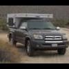
     My brother and I just returned Tuesday from a trip down the Mid-Atlantic Backcountry Discovery Route with a side-trip to Overland Expo East.


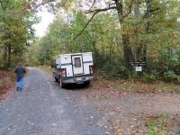
We had been talking about doing a Fall trip to West Virginia and somehow the subject of the MABDR came up about two weeks before departure.  The route is designed by and for adventure-bike riders but I'd seen enough YouTube footage to see a good bit of it is on paved country roads and state and national forest gravel roads.  We figured we'd do as much as we can in my Tundra/Hawk truck camper rig and if nothing else we'd get some GPS and map-reading experience routing around the sections we can't do. And we'd get some experience deciding when to avoid a section and when to turn back.  And we'd probably get experience backing longer distances on narrow two-track and in making 12-point turns.


The route runs 1000-plus miles from near the North Carolina-Virginia state line at Damascus, Virginia to the Pennsylvania-New York state line at Lawrenceville, PA. 


The route of the MABDR can be downloaded to import into a GPS.  I learned I could also order a micro-SD card version and simply plug it into my GPS.  That version is available from the Self-Guided Rides portion of gpsKevin Adventure Rides.   I had a great experience with them.  I learned of the micro-SD card version on a weekend and sent an email on Sunday saying I'd like to order but only if I can get it by the next weekend (they're in Escondido).   I had a response within hours saying they were on the road but would be back late Tuesday and could ship via FedEx Wednesday.  I had it Thursday morning.


My brother had just bought a Garmin Montana GPS for his adventure-bike so he brought it along after downloading the GPS file from ridebdr (and installing it via Basecamp).  He was just curious about the  route differences and wanted to get very familiar with his new GPS.


And there are indeed differences.  The ridebdr version doesn't show at all until you go into Track Manager and select a numbered track and slide the Show On Map slider.  The route displays as a small line overlaid on the map and it does not indicate direction of travel.  Each section has to be turned on individually.  Also, the sections are slightly different.


The gpsKevin version displayed the full route as soon as I powered up the GPS after installing the micro-SD card.  The main route is shown as a series of blue arrowheads jammed next to each other.  That version also shows a green-arrowheads route (typically a hard-road bypass of the blue route) and a red-arrowheads route indicating optional Expert sections of the route.  It also has what I call 'bullseyes'-- orange circles around important points like gas-stops in the more remote areas and route-section changes.


On the other hand, the ridebdr route may be kept updated more often than the gpsKevin route.  We were running both GPS units the whole time and we had two occurrences where the gpsKevin blue route ran into a closed road.  The first was a prominent private-property sign, the second a closed forest-road gate.  In a  third case, we just noticed the routes were different and thought perhaps the gpsKevin one was giving a more direct route to a bulls-eyed gas stop.


We had four road, bridge, and railroad-crossing construction closures to route around.  These were simply temporary closures due to bridge and crossing repairs and culvert installations. These route-arounds were good practice using the GPS and maps to figure out how to navigate to a point further along the route while not skipping too much of the route.


-- continued in another post below---


  • 0

'01 FWC Hawk shell on a '13 Tundra Double-Cab  + '19 Ford Transit van with Quigley 4x4 option


#2 Old Crow

Old Crow

    Searching....

  • Members
  • 1,059 posts
  • LocationSouth Central PA

Posted 17 October 2019 - 05:48 PM

-- continued from above --


Since my brother lives in western New York state and I'm in southern PA, we decided to do the trip backwards from how it's normally shown.  We met at Lawrenceville around 1 pm the first day and headed south.  We missed the very first turn off the hard road.  That reminded us the route isn't a turn-by-turn route with audible cues of an upcoming turn.... you have to keep an eye on the GPS display!


We had a light rain the first day and that seemed to bring out the deer and turkeys.  We saw more than two dozen wild turkeys and 30-some white-tailed deer, typically three or four at a time.  That night we had the hardest rain I've ever experienced in the camper and the noise was so loud we didn't get much sleep.  That hard rain lasted all night and I thought it likely we'd have some road washouts the next day.  That next day was a full day of driving in a steady rain but we had no washouts or water on the road.  After that, weather was great-- daytime temperatures in the 70s, night-time mostly 50s and a few 40s. 


We had originally planned to take my brother's Tundra/Northstar camping rig on the West Virginia trip but when we decided to to the MABDR, I volunteered to drive my Tundra/Hawk rig.  His Tundra is brand new and his Northstar has no blemishes or scratches while my rig is older and has been known to push aside some bushes.  I mention this as I see I picked up a few new pinstripes on the Tundra.  The camper seems to have gotten away unscathed though I know it took some light hits.  There were places where we went through tunnels of vegetation that appeared to be only big enough for the truck alone.


We were keeping an eye on our progress down the route to figure out where to break off to go visit the Overland Expo for a day.  That happened about 700 miles in at Brandywine, WV.   I made a few calls to check campgrounds but of course they were all full.  I happened to know of a municipal campground along our route to the Expo site and found there was plenty of space available.  That one is about an hour from the site so it would work out fine for us to stay there, visit the Expo the next day, and return to it that night before returning to rejoin the MABDR route at Brandywine.


The visit to Overland Expo East was great.  We got a chance to drive Jeeps around a small obstacle course, saw lots of overlanding rigs and gear, and spent a good bit of time at the Four Wheel Campers booth (and got to see a Project M camper up close). 


That also gave us a chance to take our GPSs to the Garmin booth as both of them had problems.  My brothers brand new Garmin Montana 680T had suddenly developed a problem the day before where it was losing the satellite connection, rendering it useless.  Since we were running two Montanas side by side and mine was working fine, it was obvious the new one was bad.   The Garmin guys checked it out and made a few calls and declared it was indeed bad.  My old 650T had a different problem-- the on-off button had broken a few days before. I could still use it by putting it in its powered windshield mount and turning on the truck key to power up. 


I had a wonderful time talking to Stan, Jay, and Shawn from the Four Wheel Campers factory at the booth.  I also enjoyed talking with WTW members veryactivelife and understand I missed meeting Happyjax.  As we drove back to our campground that night, we declared our Expo experience a great success.


I thought I might be sorry we took my Tundra on the MABDR route as it only has the 26.4-gallon tank while my brother's new one has the 38-gallon tank but that wasn't an issue.


Camping along the route is a little bit of an issue.  If you have only a route showing on a GPS, you may not know where you're going to end up at the end of the day.  That's not a big issue if you'll still be in a national forest.  In our case, I knew of state park campgrounds and state forest campsites and it just kind of worked out that we weren't far from a campsite at day's end.  We did run 10 miles off the route to a Virginia state park one night only to find the 87-site campground full. But then we got lucky... the desk lady told us of nearby sites in the national forest just outside the state park's boundary.


We were able to complete the MABDR main route (the blue one).  The only portions we missed were the short sections we had to skip because of route-arounds of road and bridge closures.  The route is supposed to be 1080 miles.  We kind of loosely kept track of route mileage and that added up to 1496 miles and I put 2200+ miles on the rig from home to home.  We did the northernmost Expert (red) route but the others were too grown over to do them without substantial pinstriping.


We were of course headed south on a north-bound route so expected to see adventure bikes.  We saw 29 of them on the route and a few others-- maybe a dozen-- we weren't sure about as they were on paved-road portions of the route.  We talked with five or six of the bikes on the route who happened to be taking a break when we came through.


We had one close call.  We happened to encounter an adventure-biker on a blind turn barely wide enough for our truck.  We were swinging as wide as we could entering each turn but he was running way too hot for a heavily-switchbacked road that could have a car around any corner.  I was driving at the time and saw his eyes widen as he slid toward my door with both wheels locked up.  Fortunately, he had the presence of mind to get off the brakes and gun it around the turn, missing us by inches.  He gave us a thumbs-up after passing.


After completing the route at Damascus (VA), we drove east to Galax to catch the Blue Ridge Parkway for the trip home. That then took us to Shenandoah National Park's Skyline Drive and then up I-81 to home.

.


Edited by Old Crow, 17 October 2019 - 09:43 PM.

  • 0

'01 FWC Hawk shell on a '13 Tundra Double-Cab  + '19 Ford Transit van with Quigley 4x4 option


#3 Stan@FourWheel

Stan@FourWheel

    Senior Member

  • Members
  • 2,376 posts
  • LocationWoodland, CA

Posted 17 October 2019 - 08:12 PM

It was very nice taking with you at the show!


Thanks for coming to the event and stopping by our booth.


:)


Stan


  • 0

Stan Kennedy --- Four Wheel Pop-up Campers
1400 Churchill Downs Avenue, Suite A

Woodland, CA 95776
(800) 242-1442 or (530) 666-1442
www.fourwh.com  ---  e-mail = stan@fourwh.com


#4 XJINTX

XJINTX

    Senior Member

  • Members
  • 552 posts
  • LocationEddy, TX

Posted 18 October 2019 - 11:49 AM

I did the route in June... being from TX it was a refreshing run. I broke off and went to the Flight 93 memorial too. Looking forward to planning another run maybe in the Fall. I too ran it backwards... on my way up I spent one night in Shenandoah National Park's Skyline Drive and REALLY want to spend more time there. I agree with the camping situations but was able to find places each night. Would love to see your pics.


  • 0

#5 Advmoto18

Advmoto18

    Senior Member

  • Members
  • 1,083 posts
  • LocationCoastal Low Country, SC

Posted 18 October 2019 - 02:03 PM

Great write-up Old Crow! 


I've done the MABDR as a round trip from end to end to end.  A great ride! 


I've also ridden the IDBDR, NMBDR, UTBDR and AZBDR.  All great rides.  I encourage you to ride them all!


The differences you are describing between the various files from ridebdr.com and Kevin are downloading and following a Track v Route respectively. 


Most folks using garmin units in their cars are following a  route, since tracks are not available in most of these units.  Moto riders (my observation/discussions having attended numerous moto rallies/rides from the east coast to west and down into Baja) prefer to follow tracks rather than routes.  Garmin units following a route can often automatically re-route you without warning leading to confusion and disorientation if you do not notice the re-route when it happens.  And if you miss seeing the re-route, you may not know you've been re-routed for some time.  Not a very big deal on the east coast since topography and rural settings frequently change grabbing your attention to a possible off planned route situation.  But, out west, it can look the same for many, many miles and you may not know you are off your desired route for quite some time.  For this reason, most riders prefer Tracks to Routes since a Track will not re-route.  


Another technique I use, in BaseCamp, I change the color of each BDR stage in Track Manager to a different color.  Once I begin a stage on the bike, I use Montana's Track Manager to change the color of the active track to Magenta.  I now know when I have reached the end of a stage.  I use Magenta since that is what Boeing uses as the active track for navigation.  Having 30+ years flying Boeing aircraft, I subconsciously follow the Magenta Line.


If you get off-Track or off-Route, and need to back-track, it is very easy to enable Montana's bread crumb trail back to where you became disoriented.


I prefer to download the GPX files from RideBDR web site, research the stages and modify them as desired in BaseCamp's Track Manager.  I've been using the Montana since it was first introduced and now on my third unit.  The previously two work fine, I just wanted the updated features in the newer units.


For additional information on BDRs and places to visit along a BDR, AdvRider forum is the place to go.  


gpsfiledepot.com also has a good library of both route-able and non-routeable maps in GPX format that you can use in conjunction with the BDR GPX files.  It just takes a bit of work in BaseCamp to incorporate the info into a track with Track Manager, but, well worth the effort IMO.  And off course, all the work with BaseCamp is merely a plan.  You certainly don't have to ride the "plan" if you discover or hear about great side trips off the BDR once you begin the ride.


While the Montana has been the mainstay for moto overlanders for years, like other Garmin products (especially their aviation products) are not all that intuitive for the end user.  I think Garmin products are designed by engineers for engineers.  As such, my next moto GPS unit will be the Trail Tech Voyager Pro.  A unit designed by moto riding engineers for moto riders.


Bill


Edited by Advmoto18, 19 October 2019 - 01:12 AM.

  • 0

South Carolina Low Country.  


#6 Happyjax

Happyjax

    Senior Member

  • Members
  • 1,444 posts
  • LocationMaryland

Posted 18 October 2019 - 03:42 PM

I was there! Sorry I did not know you would be. We will have to catch up at another event. This year Overland East was much nicer:)


  • 0

2018 Ford F-250. Customized Bundutec Sable :)


#7 Old Crow

Old Crow

    Searching....

  • Members
  • 1,059 posts
  • LocationSouth Central PA

Posted 19 October 2019 - 05:05 PM


I did the route in June... being from TX it was a refreshing run. I broke off and went to the Flight 93 memorial too. Looking forward to planning another run maybe in the Fall. I too ran it backwards... on my way up I spent one night in Shenandoah National Park's Skyline Drive and REALLY want to spend more time there. I agree with the camping situations but was able to find places each night. Would love to see your pics.


I'm sorry to say I don't have much in the way of photos. Here's a quick shot of my rig at the turnoff to the red section we did..


RedTongueTrail.jpg


...and one of fog in the valley from Penns View in Bald Eagle State Forest...


PennsCreekValleyFog.jpg


I've been looking at YouTube videos hoping to find a better representation of what we saw. This recent video by a guy who did it on his Africa Twin does it pretty well...


Great write-up Old Crow! 


I've done the MABDR as a round trip from end to end to end.  A great ride! 


I've also ridden the IDBDR, NMBDR, UTBDR and AZBDR.  All great rides.  I encourage you to ride them all!


The differences you are describing between the various files from ridebdr.com and Kevin are downloading and following a Track v Route respectively. 


Most folks using garmin units in their cars are following a  route, since tracks are not available in most of these units.  Moto riders (my observation/discussions having attended numerous moto rallies/rides from the east coast to west and down into Baja) prefer to follow tracks rather than routes.  Garmin units following a route can often automatically re-route you without warning leading to confusion and disorientation if you do not notice the re-route when it happens.  And if you miss seeing the re-route, you may not know you've been re-routed for some time.  Not a very big deal on the east coast since topography and rural settings frequently change grabbing your attention to a possible off planned route situation.  But, out west, it can look the same for many, many miles and you may not know you are off your desired route for quite some time.  For this reason, most riders prefer Tracks to Routes since a Track will not re-route.  


Another technique I use, in BaseCamp, I change the color of each BDR stage in Track Manager to a different color.  Once I begin a stage on the bike, I use Montana's Track Manager to change the color of the active track to Magenta.  I now know when I have reached the end of a stage.  I use Magenta since that is what Boeing uses as the active track for navigation.  Having 30+ years flying Boeing aircraft, I subconsciously follow the Magenta Line.


If you get off-Track or off-Route, and need to back-track, it is very easy to enable Montana's bread crumb trail back to where you became disoriented.


I prefer to download the GPX files from RideBDR web site, research the stages and modify them as desired in BaseCamp's Track Manager.  I've been using the Montana since it was first introduced and now on my third unit.  The previously two work fine, I just wanted the updated features in the newer units.


For additional information on BDRs and places to visit along a BDR, AdvRider forum is the place to go.  


gpsfiledepot.com also has a good library of both route-able and non-routeable maps in GPX format that you can use in conjunction with the BDR GPX files.  It just takes a bit of work in BaseCamp to incorporate the info into a track with Track Manager, but, well worth the effort IMO.  And off course, all the work with BaseCamp is merely a plan.  You certainly don't have to ride the "plan" if you discover or hear about great side trips off the BDR once you begin the ride.


While the Montana has been the mainstay for moto overlanders for years, like other Garmin products (especially their aviation products) are not all that intuitive for the end user.  I think Garmin products are designed by engineers for engineers.  As such, my next moto GPS unit will be the Trail Tech Voyager Pro.  A unit designed by moto riding engineers for moto riders.


Bill


Thanks for the tips, Bill!  That's helpful to me and to others who may be considering a BDR trip. 


I was glad we had both the gpsKevin and RideBDR tracks on our trip.  We did notice it was a good idea to change colors on the RideBDR tracks to differentiate them but the gpsKevin tracks were better for me, particularly when the sun was in my eyes.  I wish I knew how Kevin does that trick of overlaying the large arrowheads (he calls them 'chevrons') and what I called 'bulls-eyes' (I just noticed he calls them 'donuts') onto the map.  Those chevrons were helpful during route-arounds as it can be tough to tell which way the track is going when you zoom out to plan the route-around.  In the end, though, I think the greatest advantage of the gpsKevin tracks for me was that I could just plug in the micro-SD card and go. 


I was there! Sorry I did not know you would be. We will have to catch up at another event. This year Overland East was much nicer:)


Heck, I didn't know I was going to be there either :) .   (We weren't planning to attend when we left for the trip-- I just happened to look at the date along the way and realized Expo was coming up and we were kinda-sorta headed that direction.) 

.


  • 0

'01 FWC Hawk shell on a '13 Tundra Double-Cab  + '19 Ford Transit van with Quigley 4x4 option


#8 Advmoto18

Advmoto18

    Senior Member

  • Members
  • 1,083 posts
  • LocationCoastal Low Country, SC

Posted 21 October 2019 - 01:27 PM

Old Crow...


Good to hear Kevin's maps worked for you!  That is most important and the bottom line!  You pay a premium, but, some times the premium is worth the coin!


Sadly, Garmin Montana and Basecamp both have steep and long learning curves.  As mentioned, I've been using them for years and still get frustrated at the lack of intuitiveness.  Same goes for their aviation products, which is NOT a good thing in my book.  It baffles me why Garmin doesn't go to an end-user friendly, intuitive approach to both planning in Basecamp and use in their products, especially when it comes to user defined tracks.  The most frustrating part for me in BaseCamp is editing tracks with Track Manager. It is cumbersome, not intuitive and very easy to mess the track up requiring even more editing.


I should note, you can not plan tracks within Trail Tech Voyager Pro.  It is pretty much a display unit for GPX files you planned/saved on your computer/tablet and then loaded into the Voyager Pro.  If you don't carry a laptop or tablet when you travel/ride, this could be a major downside to the Voyager Pro.  Also, the Voyager Pro incorporates engine sensors and displays the info.  As such, I really don't see the need for the Voyager Pro on a big adventure bike;  it is more suitable for small enduros, like the KTM 500 EXC used for adventure traveling/rides. Thereby allowing you to use the VP for both moto and nav displayed info;  eliminating the small factory display.


Bill


Edited by Advmoto18, 21 October 2019 - 01:32 PM.

  • 0

South Carolina Low Country.  


#9 ski3pin

ski3pin

    Belay On

  • Site Team
  • 15,334 posts
  • LocationSierra Nevada Range

Posted 21 October 2019 - 03:43 PM

Old Crow, that was a delightful read! Keep it up and we might head East one of these days. :)


  • 0

2003 Ford Ranger FX4 Level II 2013 ATC Bobcat SE "And in the end, it's not the years in your life that count. It's the life in your years."- Abraham Lincoln  http://ski3pin.blogspot.com/


#10 takesiteasy

takesiteasy

    Senior Member

  • Members
  • 2,588 posts
  • LocationMinnesota

Posted 21 October 2019 - 09:20 PM

Thanks for the report. We also need to head east one of these days.


  • 0
2011 Tacoma AC TRD
ATC Custom Shell

travelswithrockythedog.blogspot.com


0 user(s) are reading this topic

0 members, 0 guests, 0 anonymous users