It will take me a while -- couple days, probably -- to get this trip report posted.
It wasn't really a photo-heavy trip for me this year, but still...maybe I'm just slow.
[Here's the official start of this trip report, where I tell it in chronological order]
So to get me off my ass, trip-reporting-wise...
...I'll jump to late in my trip, to one of the high points, not photographically or physically, but experientially for me, what I was most excited about: I saw a small herd of bighorn rams at about 13,000 feet while hiking up White Mountain Peak!
(these few photos were all taken with the camera in my phone -- I didn't bring my SLR on the hike)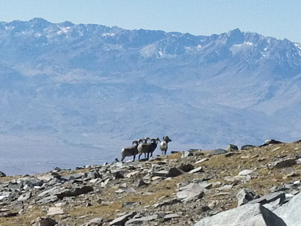
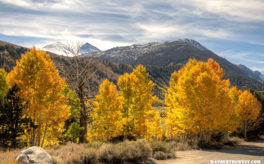
OK, these following were at the literal high-point of my trip, taken at the 14,246-foot summit of White Mt. Peak.
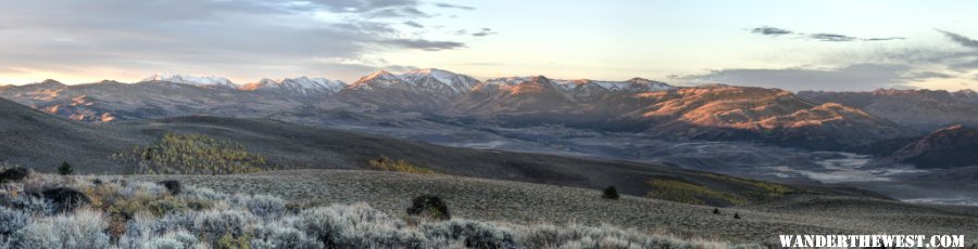
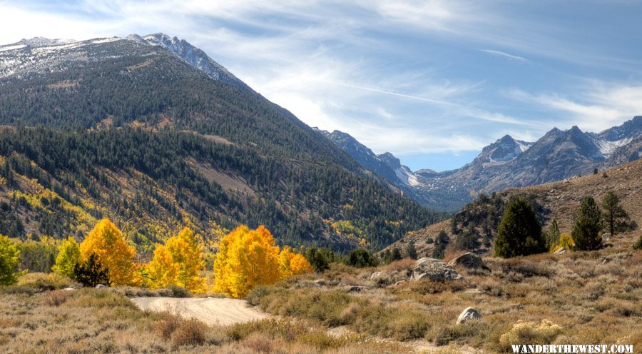
The view north along the crest of the White Mountains. In the distance can be seen high and remote Pelissier Flats, which I'd like to explore some time.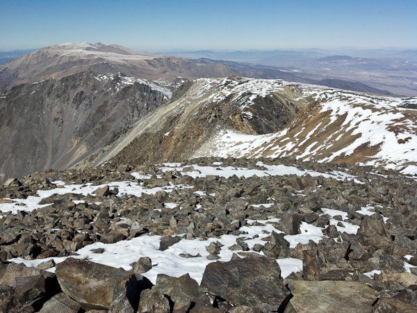
The view east into (mostly) Nevada from the summit: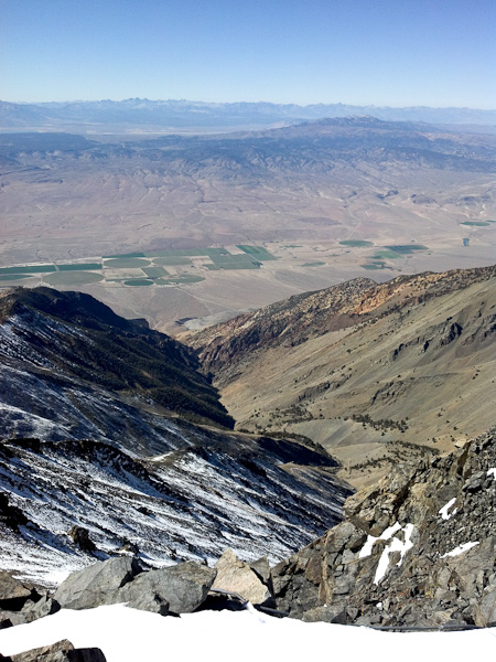
"Proof" of my summiting: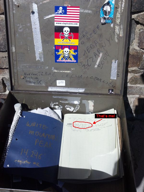
Much more to follow...mostly using photos with my "real" camera (but also a few more fone-fotos from this great hike): "to be continued" over the next day.


Eastern Sierra Nevada & White Mts -- October 2012
#1

-
- Site Team
- 6,600 posts
The Weatherman
- LocationBend, Oregon
Posted 26 October 2012 - 06:14 PM
FWC Hawk (2005) on a Ford F250 Supercab, 6.8L V10 gas (2000)
#2
-
- Site Team
- 9,295 posts
C'est la vie
- Locationmonterey bay area
Posted 26 October 2012 - 09:42 PM
Frank
2002 Tundra AC TRD 4WD Limited 2009 ATC Bobcat loaded http://sharychic.blogspot.com/
#3
-
- Members
- 1,474 posts
It's good to be Stew
- LocationSE CO
Posted 27 October 2012 - 03:24 PM
The view north along the crest of the White Mountains. In the distance can be seen high and remote Pelissier Flats, which I'd like to explore some time.
Mr BC,is that Boundary Peak way off in the distance past Pelissier Flats?
Stew
2007 Custom All Terrain Camper Panther Shell on 2012 Toyota Tundra 4x4 in SE CO
#4
-
- Site Team
- 6,600 posts
The Weatherman
- LocationBend, Oregon
Posted 27 October 2012 - 03:26 PM
I think so...must be. Montgomery (in CA) and then Boundary just over the border.Mr BC,is that Boundary Peak way off in the distance past Pelissier Flats?
FWC Hawk (2005) on a Ford F250 Supercab, 6.8L V10 gas (2000)
#5
-
- Members
- 1,121 posts
Fire Proof
- LocationSouth Shores California
Posted 27 October 2012 - 03:35 PM
marc
2016 Sprinter Silver Gray 144 Std. Roof 4x4. 3.0 diesle, Cooper "Dicoverer" ST Maxx 255/85/16
#6
-
- Site Team
- 6,600 posts
The Weatherman
- LocationBend, Oregon
Posted 27 October 2012 - 05:33 PM
Part 1: THE BEGINNING
I drove from Bend, OR to Redding, CA midday Oct 9...not because that's the best route to the eastern Sierra, but in order to visit my parents, who live in the Redding area.
While still in south-central OR, driving down US 97 along the east shore of Upper Klamath Lake, I drove through huge flocks of flying bugs, thick enough that I stopped at a gas station on the north edge of Klamath Falls, mainly just to clear the windshield (though it turned out to be a good place to gas up, after seeing the gas prices just a few miles south in CA.)
I didn't, however, clean the front of the camper:
 Oh, well...I don't care much about appearances.
(In my parents' house driveway. BTW: Those tall evergreens on the right are coast redwoods, sequoia sempervirens. Who says you need the cool-and-foggy coastal environment for them to thrive? They LOVE Redding if they're watered enough!)
I spent two nights in that land of oaks, manzanita, and poison oak (spending a couple hours during the intervening day installing a set of roof-lifting shocks on the back end of my camper...learned that the aluminum frame is not continuous on the back end...drilled several "test holes" through the camper skin
) before heading east mid-morning Oct 11 on CA 44 past Lassen N.P. and joined US 395 at Susanville.I didn't get an alpine start on that day, so it was 4pm-ish when 395 got back into California, and I managed to suppress my usual urge to find the perfect view-spot to camp and instead settled for Sonora Bridge USFS campground, a couple miles off 395 up CA 108, for the night -- one of the very few c.g. still open in mid-October.
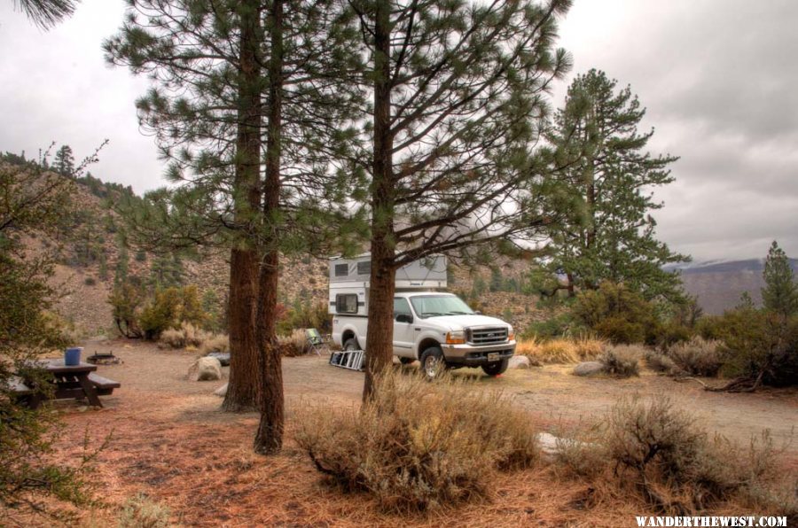
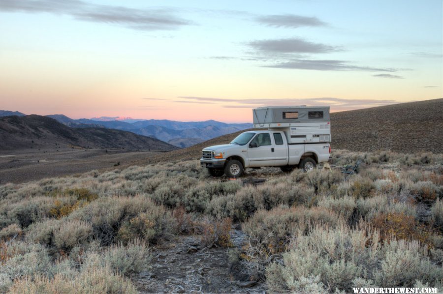
I always take at least one photo of my campsites, just to record the historical event, whether it's photogenic or not.
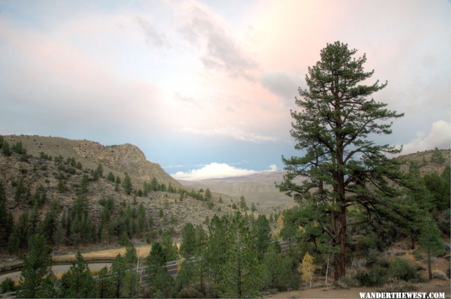
This was the ONLY cloudy-and-damp night of my trip (it rained off-and-on all night), but the clouds got a little pastel-pink at sunset, so I wasn't complaining.
The next morning, Oct 12, I decided to drive up CA 108 a few miles towards/past the USMC Mountain Warfare Training Center (MWTC) at Pickel Meadows, along the West Walker River. Despite the military presence, it's a pretty area. And it's an oasis of Verizon cellular coverage, presumably so that the Marines can update their Facebook/Twitter accounts ("OMG! my feet r so sor!").
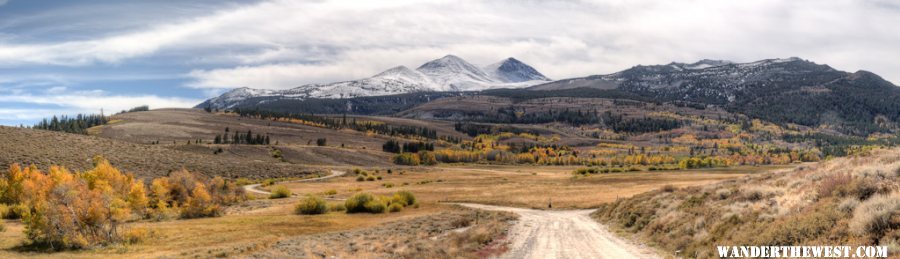
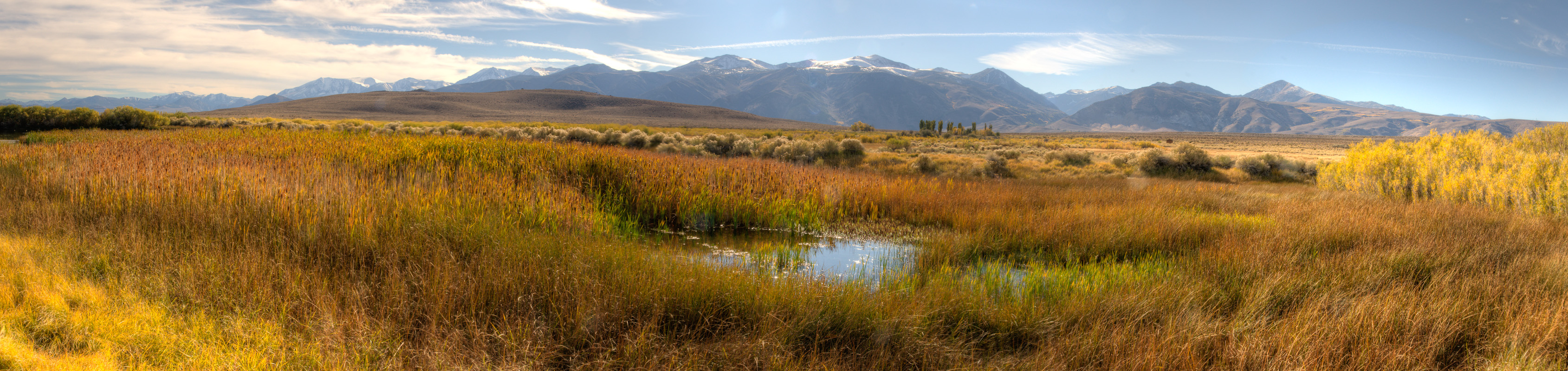
Here's a thumbnail of a ~300° panorama I shot from the western end of the Meadow:
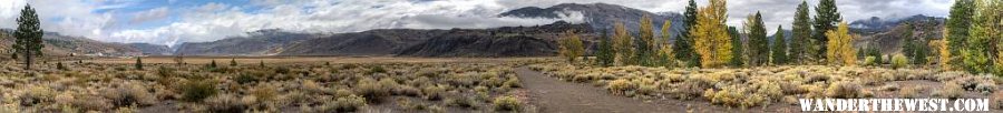
To see the real/full-size-ish version of this panorama, click-download here: 201210_Pano-01
Full-size should display 800 pixels high (by 7000+ wide).
A couple miles further west, the Leavitt Meadows USFS c.g. was closed for the season, as expected. I stopped at the trailhead parking lot to view the view:
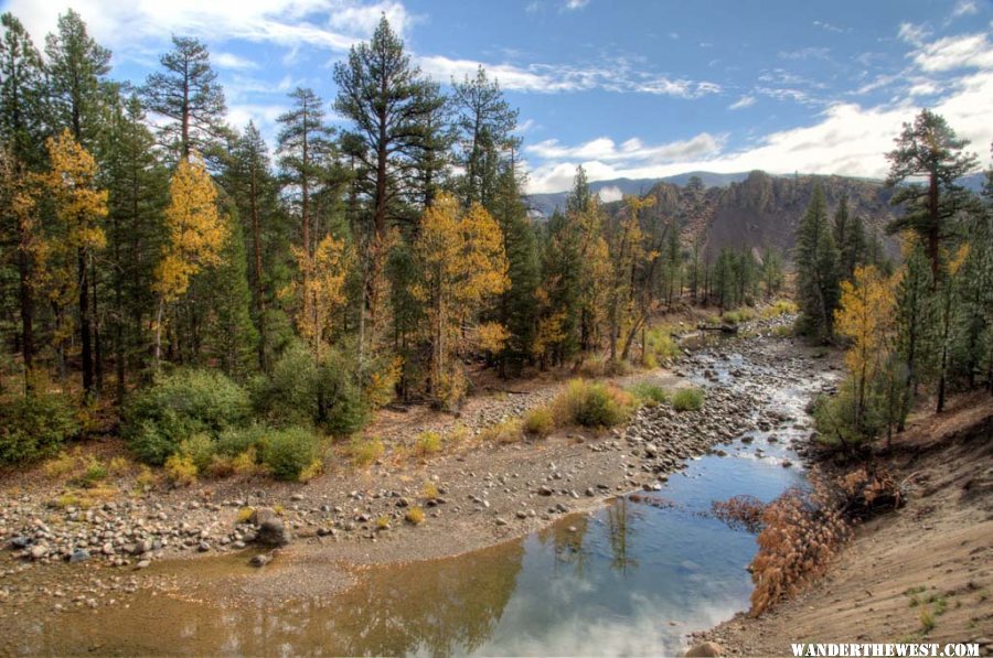
River sure is low...
Heading back east on 108 (towards 395), I decided to stop at the day use area on the West Walker river, between the MWTC and Sonora Bridge c.g.
I'd noticed that my new dual-panel-in-series-240-watt solar system was not charging
 ...and though it was cloudy it was still light enough that there should some current flowing. Had I damaged my new charge controller by forcing too much current through it? Its capacity was rated at 10 amps, and the theoretical output of my two panels in series (at 13 volts) could be over 15 amps...
 . So, I spent some time in that nice spot next to the river, fiddling with my solar-charge system...and discovered that one of the Powerpole connectors was not quite seated properly, or had come loose. Yay! Nothing burnt out!
But to prevent charge-controller-over-current in the future, I had a great idea, based on the fact that I had a second identical charge controller along with me, which I already had for my first solar panel: split the output of the panels upstream of the controllers so that each 10amp controller would process just half of the current!
I had had the foresight to bring all of my tools and parts with me since I left home with a not-quite-ready-for-prime-time project. I spent a while making a neat little Powerpole-ended current splitter:
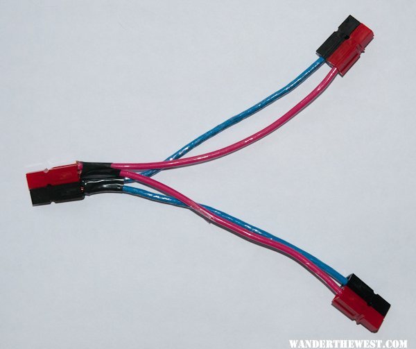
clever, eh?
 Well, maybe...but turns out that the charge controllers do not behave like simple analog circuit elements (thars sumpin digidle goin on inside, ah reckon!) -- the current went through either one or the other (randomly alternating between one or the other, as measured by the Watts Up meters I had downstream of each charge controller) but didn't split between them. Oh well...guess I just use one charge controller and hope that the 10amp rating has a conservative safety margin built in.
As I was putting away my project and lowering the camper roof I saw a group of guys walking up from the river with fishing gear in hand. These guys were in civilian fishing garb, but it turned out they they were Marines from the MWTC...apparently returning from a morning mission to make war on trout.
One of the Marines noticed the OR plates on my truck and came over, "Where in Oregon are you from?", he asked. "Bend", I said, and he said he was from Coos Bay, and we chatted a bit. He said that guys who wintered at the MWTC didn't get much real winter training since there was so little snow...Where next? I planned to spend Saturday/night at/with a friend who lives in Bridgeport, but for Friday night I decided to cross 395 and head up Burcham Flat road into the Sweetwater Mountains. I'd been up there before, in July of 2011, and was bound for the same nice view spot as before. But I took one wrong turn...couldn't remember exactly the route from 15 months prior, "This road seems more primitive than I remember..." and I ended up wedging my camper between a couple of aspens. Not tightly wedged, but I scraped the paint off the upper edge on one side. Sigh...
Then I back-tracked and found the right turn-off, then the next turn-off, then the next turn-off. It's a nice spot, at around 9000 feet (as I recall) as seen in this pre-sunrise photo the next morning:
There's a big view to the west and north. I shot a 360° panorama from this spot. Here's a partial/segment of that full pano, looking west at the Sierras:
And here's a link to the full 360° rotatable panorama:
201210_Pano-02
(As usual, you need QuickTime installed on your computer to view it.)
You can see Pickel Meadows and a bit of the USMC MWTC in this view if you know where to look.
...more to come...
FWC Hawk (2005) on a Ford F250 Supercab, 6.8L V10 gas (2000)
#7
-
- Members
- 335 posts
Senior Member
- LocationBend OR
Posted 27 October 2012 - 05:51 PM
#8
-
- Site Team
- 9,295 posts
C'est la vie
- Locationmonterey bay area
Posted 27 October 2012 - 07:24 PM
Frank
2002 Tundra AC TRD 4WD Limited 2009 ATC Bobcat loaded http://sharychic.blogspot.com/
#9
-

- Members
- 2,588 posts
Senior Member
- LocationMinnesota
Posted 27 October 2012 - 09:31 PM
#10
-
- Site Team
- 6,600 posts
The Weatherman
- LocationBend, Oregon
Posted 27 October 2012 - 10:42 PM
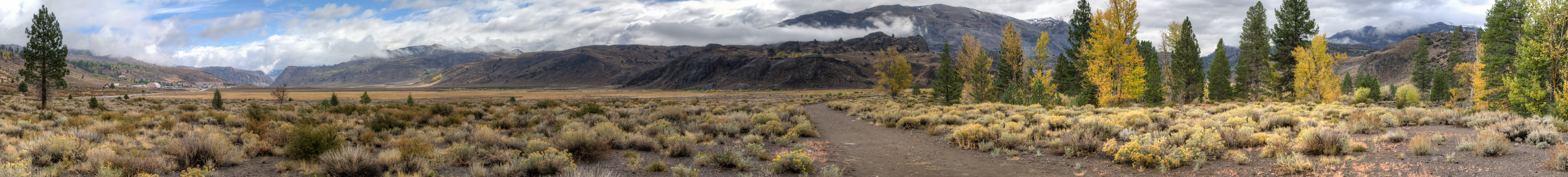
I left the Sweetwaters the morning of October 13 and drove to the home of a friend who lives in Bridgeport. He's lived there about a dozen years, works for the USFS (Inyo NF), and likes to hike, so he's very familiar with the area. He was experiencing some foot/leg problems, so instead of a big hike we went on a mostly-driving tour of the area to view the fall color...and to introduce me to a few areas that I didn't know about.
We started with Upper Summer Meadows...an obvious spot to those in the know, but still worth visiting. My friend was surprised at how many people were up there photo-ing, more than he'd ever seen before there: "It's been discovered!
 " he bemoaned.
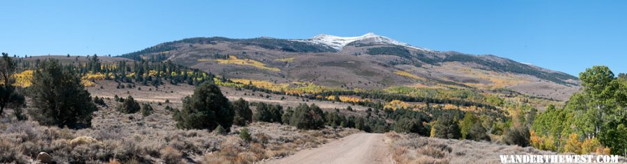
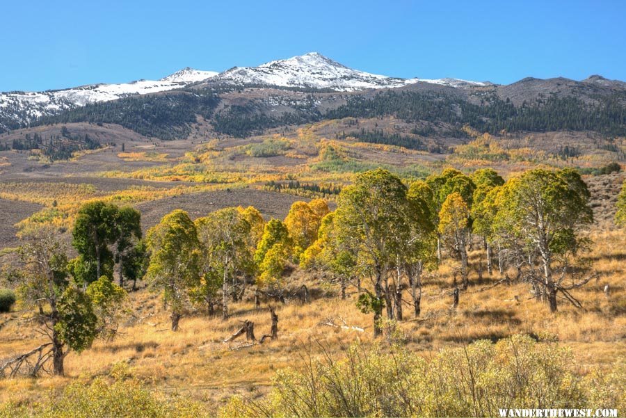
Even though it was midday light and it wasn't a record year for fall-foliage color, I still found plenty of times when I decided it was worth getting out of the car and snapping a few shots. Why not? A sampling...
We turned back and took the main Green Creek Rd, stopping at Dynamo Pond. I'd seen the name on the map and had driven by it more than once before, but this was one of those spots that I knew nothing about. Apparently this is the site of one-of/THE(?) first places anywhere in which electricity was generated at one spot and carried by wires to a remote spot (rather than being used next to the generator).
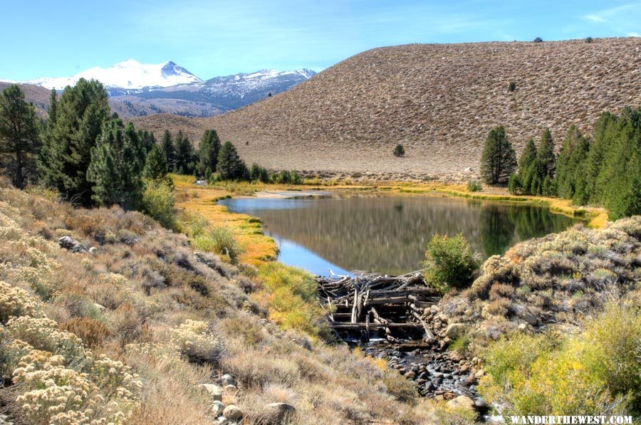
Having been to the same area the two previous years, I think it's true to say that this year was not one of the best for fall color in general...but in some areas it sure looks mighty-fine:
We took the turn-off to Dunderberg Road. I'd been across this connector from Green Creek to Virginia Lakes once before, but it was nice to have a guide to point out various spot where dispersed camping could be found, info to file away for another trip...or for this trip, as we'll see later.
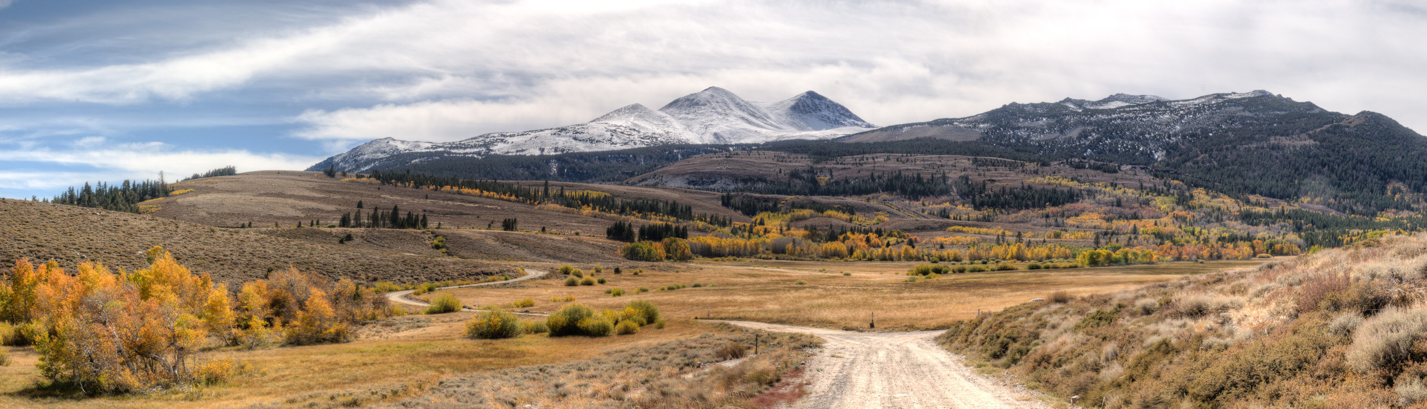
Here's a "thumbnail" of a panorama I took near the north end of Dunderberg Road:
Here's a link to a full-size version of the same view: Pano-04
("full-size" is 800 pixels high, so if your browser doesn't show it that big, zoom in)
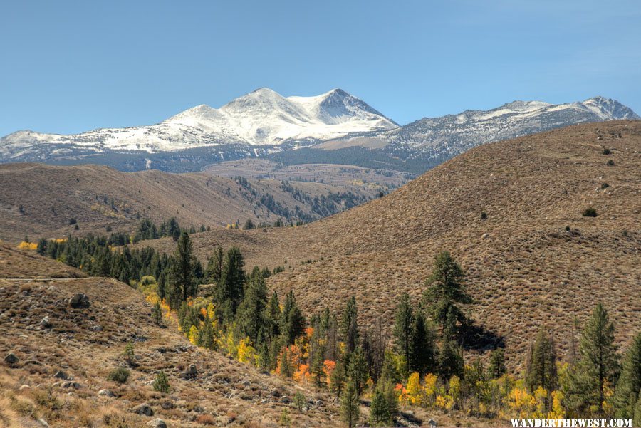
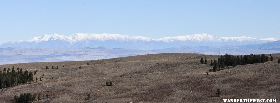
Near the south end of Dunderberg Rd we pulled off onto a spur that would later be a WTW rendezvous spot. From that wide-open view I saw what looked like a lot of recent early-season snow on the White Mts (as was also found on the Sierras), and I wondered if my plan to hike up White Mt Peak was going to work out.
First of all, I'd need to be able to drive to the trailhead...we'll see.
Reaching the Virginia Lakes Rd we went east back to 395, over Conway Summit, then half-way down that big drop to a turn-off to a granite-boulder-studded area called/near Rattlesnake Gulch. There are several roads there, with lots of opportunities for dispersed camping, and the road(s) lead down to the north side of Mono Lake.
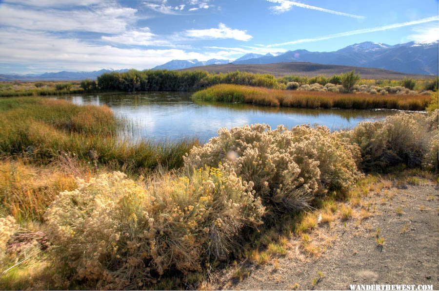
Another maze of roads, but my friend knew where to go and we ended up at/near the old DeChambeau Ranch, which was deeded to public. One of the cool features here are some ponds -- apparently the result of drilling that released artesian wells/springs...something like that. Look it up. "DeChambeau Ponds", which look extra lush in that pumice-y moonscape on the rim of Mono Lake.
Tules and waterfowl...mostly coots/mud-hens at this time.
Here's a thumbnail of a panorama I shot of one of the ponds:
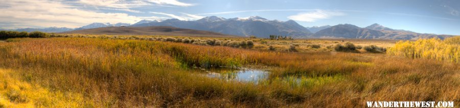
Here's a link to a full-size version: Pano-05
We did a hike around towards the lakeshore...not all the way, but a nice loop. Lots of interesting rocks to see if you walked with your face pointing down at the ground.
We wanted to have dinner at the Virginia Creek Settlement restaurant, but it was shockingly packed...damn fall-foliage-seeking tourists! So we dined at the mexican restaurant, Michaela's, and had a good meal.

--more to come--
FWC Hawk (2005) on a Ford F250 Supercab, 6.8L V10 gas (2000)


0 user(s) are reading this topic
0 members, 0 guests, 0 anonymous users

