Jump to content


Photo
- - - - -

Craters of the Moon backcountry

idaho

  • Please log in to reply
9 replies to this topic

#1 daverave

daverave

    Senior Member

  • Members
  • 233 posts
  • LocationSacramento, CA

Posted 17 June 2021 - 03:05 AM

On our recent trip to Montana, we came back via southern Idaho because I had always been curious about the vast area of the CotM national monument that is not NPS administered. We've backpacked in the NP portion previously and really enjoyed the scenery and volcanic environment.


We spent an unfortunate night in a dismal motel in Arco due to very high winds that proceeded us there but the next morning we went to the NPS visitor center. (We drove through the campground which is very tight and generally crowded, close to the highway.) I asked a ranger at an outside info desk if he could help us out with some info on the areas I was interested in and he immediately produced a HUGE map of the entire monument that showed which areas were NPS and which were BLM. The NPS portions were typically the lava flows while the BLM areas were the sagebrush/grassland "parks" in between. Dispersed camping was permitted only on the BLM portions but I figured I could just work on the edges for camping since I was most interested in the lava flows.


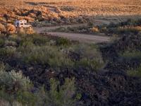
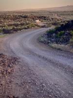
Driving west we turned south on a road that turned into the Laidlaw Road that eventually traverses the entire monument and exits on the southern edge. The lava flow portions were not as impressive as those around the park HQ and the road was bouncy. The "parks" were dedicated to cattle grazing as BLM land often is. There were cattle guards at every transition from lava to park and vice versa.


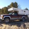
We drove towards something called Piss Ant Butte which turned out to be a tiny little butte with cattle watering. Another butte to the north also had cattle denizens watering. So we backtracked to the edge of a lava flow and camped there were there were no cattle. In retrospect it wasn't a bad spot for the night and the wind was light fortunately. We hiked a bit on the lava looking for an "Indian Spring" that turned out to be virtually dry. Lava hiking is generally pretty difficult.


There was a surprising amount of ranch traffic which included large trucks for cattle movements and watering trucks. The roads on the parks were typically very dusty and on the lava kind of rocky.


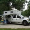
We left the next morning and headed south west back on the highway towards Three Island State Park. We got a much needed truck camper wash on the way there.


Bottom line I'm not sure we'd go back without doing some serious Google Earth research to find someplace worth the trouble, cattle, dust, and traffic. Sometimes not every idea pans out ;-)

Attached Thumbnails

  • IMG_5552.JPG
  • IMG_5345.jpg
  • IMG_5341.jpg

  • 1

https://www.flickr.c...tos/da_edwards/

Instagram removed my account because I couldn't prove I was over 13 y.o. :unsure:


#2 Casa Escarlata Robles Too

Casa Escarlata Robles Too

    C'est la vie

  • Site Team
  • 9,285 posts
  • Locationmonterey bay area

Posted 17 June 2021 - 06:15 PM

Thanks for the trip daverave. We have driven past there many times on the way to Yellowstone.

One of out last trips we actually stopped and drove /hiked around the NP.

It was interesting nice views and scenery. Camping didn't look all that great.


That whole area of Idaho has so many lava formations.

Out on the interstate between Twin Falls and Idaho Falls some of the rest stops are worth a longer stop.

There a lot of trails through the flows and signed info.


Frank


  • 0

2002 Tundra AC TRD 4WD Limited 2009 ATC Bobcat loaded http://sharychic.blogspot.com/


#3 alano

alano

    Senior Member

  • Members
  • 255 posts
  • LocationSilicon Valley

Posted 17 June 2021 - 10:24 PM

We camped in the CotM NP a couple of years ago. Pretty typical NP campground though not a lot of trees, so privacy a bit less than most. Staying out on "the range" sounds pretty good if next day's activities aren't in the main part of the park.


Alan


  • 0

#4 Casa Escarlata Robles Too

Casa Escarlata Robles Too

    C'est la vie

  • Site Team
  • 9,285 posts
  • Locationmonterey bay area

Posted 17 June 2021 - 11:50 PM

Alan your visit was around the same time period as ours.

I think also that there was a search going on for a lost elderly woman hiker.

Don't think they ever found her.

We found it a interesting place.Just did the walks around the main area.

Frank


  • 0

2002 Tundra AC TRD 4WD Limited 2009 ATC Bobcat loaded http://sharychic.blogspot.com/


#5 Lighthawk

Lighthawk

    Weekend warrior

  • Members
  • 3,319 posts
  • LocationNevada City, CA

Posted 20 June 2021 - 05:30 AM

Sounds pretty rough and dry.

Thanks for the TR.


  • 0

2021 RAM 3500 Crew 4x4, 6.4 hemi/8 speed trans with 4.10 gears, Timber Grove bags, Falken Wildpeak 35" tires.

OEV Aluma 6.75 flatbed, Bundutec Odyssey camper on order for 2024

For this year we're still using our 2008 FWC Hawk with victron DC-DC charger, 130w solar, MPPT controler

with 2000w inverter and external 120v output and 12v solar input with 100w portable solar.   http://lighthawkphoto.com


#6 AWG_Pics

AWG_Pics

    Into the Great Empty

  • Members
  • 1,194 posts
  • LocationOregon

Posted 20 June 2021 - 03:35 PM

I spent a good part of a summer in the late 1970's working all over the eastern snake river plain, which encompasses the Craters of the Moon monument. Measuring groundwater levels. No doubt much of it is bleak, dry, dusty, hot and sometimes just sad. But if you are persistent and study google earth and are careful about timing it is also an amazing, beautiful under-used area with lots of interesting and fun surprises such as ice caves, undisturbed enclaves, wildlife and peaceful solitude that makes you feel as if you are the only person on earth. Like so many parts of the under-used west, you have to poke around a bit to find the nice spots.


  • 1

lived for several years each in Montana, Utah, Idaho, Texas, Washington, Oregon.

2019 Tundra, Hawk.

https://www.flickr.c...hotos/awg_pics/


#7 daverave

daverave

    Senior Member

  • Members
  • 233 posts
  • LocationSacramento, CA

Posted 20 June 2021 - 04:39 PM

I spent a good part of a summer in the late 1970's working all over the eastern snake river plain, which encompasses the Craters of the Moon monument. Measuring groundwater levels. No doubt much of it is bleak, dry, dusty, hot and sometimes just sad. But if you are persistent and study google earth and are careful about timing it is also an amazing, beautiful under-used area with lots of interesting and fun surprises such as ice caves, undisturbed enclaves, wildlife and peaceful solitude that makes you feel as if you are the only person on earth. Like so many parts of the under-used west, you have to poke around a bit to find the nice spots.


Agreed A_P but you forgot “windy”!
I haven’t given up on the area especially now that I have the ultimate map to the monument and its fringes. Next time I’m going to poke around on the east side near the Blue Dragon lava flow and the southeast corner. The Big Southern Butte also looks interesting. Like you said, a lot of it has to do with timing.
  • 1

https://www.flickr.c...tos/da_edwards/

Instagram removed my account because I couldn't prove I was over 13 y.o. :unsure:


#8 rando

rando

    Senior Member

  • Members
  • 1,638 posts
  • LocationColorado

Posted 21 June 2021 - 07:09 PM

This is the best trip report I have read in a while - thanks for sharing!


One the attractions to wandering and exploring is finding the hidden gems off the beaten track.   But the reality is, this gems are few and far between.   Often that blank spot on the map really is just a cowed up, dusty, sage brush sea.    Occasionally you find that awesome volcanic plug with a great scrambling route, a cool lava tube, hit the wildflowers right at peak bloom, or the surprise canyon with a little creek, but it is nice to hear about some of the trips where you don't.    These trips are usually still fun,  but it is a good reminder that it is not all rainbows and unicorns.  


  • 2

2016 Fleet Flatbed

2016 Toyota Tacoma


#9 2Z Bundok

2Z Bundok

    Advanced Member

  • Members
  • PipPipPip
  • 40 posts

Posted 26 June 2021 - 11:35 PM

We did 60 miles of trail south of Arco and found along the way BLM "Cox Airstrip" and Bear Trap Cave.  Our story published in https://wandrlymagazine.com/  Hope its OK to cross reference websites?


  • 0

2Z Bundok

Truck Camper...The box from which we think outside.


#10 longhorn1

longhorn1

    Ouch, that stings!

  • Members
  • 2,826 posts
  • LocationCarmel, Indiana

Posted 14 September 2021 - 11:09 PM

Loved Crater of the Moon NM. Amazing hikes and views
  • 0

http://texaslonghorns01.blogspot.com/


Ford F-250 Long bed, 2014 Grandby


Also tagged with one or more of these keywords: idaho

0 user(s) are reading this topic

0 members, 0 guests, 0 anonymous users