Jump to content


Photo
- - - - -

Nevada Calls


  • Please log in to reply
42 replies to this topic

#31 AWG_Pics

AWG_Pics

    Into the Great Empty

  • Members
  • 1,197 posts
  • LocationOregon

Posted 08 May 2022 - 02:15 PM

you bet - an old friend who is a geology prof recommended it. I am looking forward to using it a lot in the near future since I retire on June 30th and can start to have more time

Ahhhh, retirement. I have been retired for 2 and a half years. So far, once you get the paperwork sorted, it is the best part of my life. Time to travel, explore, learn more about old interests and discover some new interests too. Have great fun!


  • 0

lived for several years each in Montana, Utah, Idaho, Texas, Washington, Oregon.

2019 Tundra, Hawk.

https://www.flickr.c...hotos/awg_pics/


#32 AWG_Pics

AWG_Pics

    Into the Great Empty

  • Members
  • 1,197 posts
  • LocationOregon

Posted 08 May 2022 - 02:17 PM

Nice work on the photo and including the ruler for scale.


Tony's "heft test" for relative denisty is entirely on point and very helpful. I'm sure he's nailed the hand sample rock type.


The glassy luster and appearance of "crystals in mush" makes me think welded tuff, also, initially deposited as a pyroclastic flow.  Such volcanic rocks are often interbedded with sandstones and other clastic rocks due to having been extruded from volcanic vents within and around shallow lakes or marine waters.  Those who mapped the two quadrangles (credited above) identified a mappable stratigraphic horizon which included a wide variety of volcanic and closely related sedimentary rocks and named the horizon "Ts". Estimates of its thickness range from as little as 120 meters to > 1,000 meters, where post depositional deformation and poor exposure make detailed measurement of thickness impossible. The "mappable horizon" is one with definable upper and lower contacts with other mappable horizons.  In the case of Ts, a laterally extensive and unaltered basalt flow horizon overlies the Ts "almost everywhere" and the Ts horizon itself overlies dacitic, rhyolitic, and basaltic horizons mapped as Trd, Trb, and Teh.  Among the rock types mapped within the Ts horizon are lithic tuffs, pumicious tuffs, and, interestingly, rhyolitic pyroclastic agglomerate.  The workers go on to say the unit is widely silicified and altered by post depositional introduction of hot fluids (hydrothermal alteration) and that highly silicified zones appear today as horns and crags when exposed by erosion.  So, I suspect you found a highly silicified crag of welded tuff within the Ts map unit, and the occurrence of Liesegang banded wonderstone in the vicinity supports that SWAG.


It's also good to see that some of the nomenclature hasn't changed in the 47 years since my last class in igneous and metamorphic petrology.  The term "greenstone" is traditionally applied to a dense metamorphic rock composed largely of the minerals chlorite, epidote, and actinolite.  The original rocks (protoliths) which were metamorphosed into greenstones would have been basalts, gabbros, and other igneous rocks high in ferromagnesian minerals.  The central and Southern Appalachians include extensive greenstones (Catoctin Formation) which were originally basalts deposited in a spreading sea floor (continental rift) environment, so we fossil geologists from East Coast schools are quite familiar with the term, but we must contend with thick residual soils, kudzu, ticks, and snakes to find good exposures. I have a loose understanding that some of the Precambrian metamorphic rocks exposed in the Basin and Range include greenstone horizons.


Thanks to all for this fascinating discussion.  It's great to get the gray matter lubed up and the synapses firing on matters not pertaining to tax law.


Foy

Great analysis Foy. And you are right about the benefits of no pesky vegetation between you and the rocks out in the basin and range country and the desert southwest!


  • 0

lived for several years each in Montana, Utah, Idaho, Texas, Washington, Oregon.

2019 Tundra, Hawk.

https://www.flickr.c...hotos/awg_pics/


#33 PaulT

PaulT

    Need gumbo

  • Members
  • 2,612 posts
  • LocationHillsboro, Oregon

Posted 08 May 2022 - 02:48 PM

Having grown up in Jackson & Haywood Counties, NC, I am familiar with the ticks and snakes as mobile nature. Kudzu is also a form of mobile nature if somewhat slower. It moves only about a foot/day during growing season. If you’re paying attention, you can see it “run” up power poles, “sprint” across roads using wires like squirrels and “leap” to the ground to invade the land across the road.  :P


We found laurel thickets also had good barrier characteristics. Sometimes, the best path was to climb to the top so as to see where to go and “wade” through the laurel.  Fun for kids but not necessarily for older folk.


Paul


  • 0
I thought getting old would take longer.

#34 searching for nowhere

searching for nowhere

    Senior Member

  • Members
  • 257 posts
  • LocationWestern Washington

Posted 09 May 2022 - 12:43 AM

Thanks Foy.  I think I'm understanding it now.  It was confused that the wonderstone and the green rock were both classified as a Ts.  Now I understand, both of volcanic sedimentary origin.  


Yes, Nevada is great where you can see the rocks and formations.  Unlike my western Washington home.  


  • 1

Camping with a small trailer.  Everyday is a good day to go camping.


https://searchingfor.wordpress.com/


#35 Foy

Foy

    Resident Geologist

  • Members
  • 1,295 posts
  • LocationRaleigh, NC

Posted 09 May 2022 - 01:39 AM

Thanks Foy.  I think I'm understanding it now.  It was confused that the wonderstone and the green rock were both classified as a Ts.  Now I understand, both of volcanic sedimentary origin.  


Yes, Nevada is great where you can see the rocks and formations.  Unlike my western Washington home.   geologists seek to group named rock units which occur at more or less the same "level" within a sedimentary or volcanic pile as distinct mappable units


Geologists typically seek to assign rocks seen at more or less the same "level" within a sedimentary or volcanic pile to one particular mappable unit.  While many sedimentary units are homogeneous and bear disctinct lithostratigraphic names (such as the Flathead Sandstone), many if not most are assemblages of differing lithologies (such as the Morrison Formation, which is composed of all sorts of conglomerates, sandstones, siltstones, shales, and some dirty limestones).  There is a lot of fairly tedious (but necessary and useful) nomenclature as to describing units as formations, groups, supergroups, series, etc.  But the effort is noble in that once you can feel comfortable that a given sequence of rocks belongs together and you know what it lies upon, how it contacts the older rocks, and what lies over it, and the sequence and its underlying and overlying beds are are identifiable over a fairly wide area, the tectonic deformation of the pile can be more readily analyzed and itself mapped into named folds (such as the Massanutten Syncline back here in the East) and faults (such as the San Andreas Fault out in California).  Simply determining what section of sediments "belong together" allows tracing of its outcrop over the topography of a given area, and with such, the principal elements of the cross-sectional (three dimensional) structure are developed. 


Field geology is totally cool. Observed geomorphology (why does that river bend into such odd shapes?) and the realization that geologic mapping is the essential tool to reaching an understanding of why the surface appears as it does, is what got my attention as an 18 year-old college freshman, and it's held my attention since that time just 49 years ago.  And Tony is dead on when it comes to wonderfulness of absence of vegetation in much of the West.  Lack of thick soils and heavy vegetation doesn't make mapping easy--nothing is ever truly easy--but it makes is imminently more possible.  When my Field Camp at the University of Montana began with a morning in a classroom in Dillon, MT, the TAs started by handing out our base topo maps and stereoscopic airphotos of the same field area.  At first glance there was a glaringly obvious pair of folds (an anticline and its neighboring syncline), and the folds were truncated by an equally obvious fault.  I thought they'd erred and handed out the instructors' and TAs' topos and airphotos.  Once I realized they handn't, I felt a huge relief---" I've got this!".  Going from 3% to 5% outcrop, mostly in creekbeds, to 30% to 50% to nearly 110% outcrop was pure heaven.  I still enjoy seeing geology in the field immensely and keep returning to Southwestern Montana on vacation largely for that reason.


Foy


  • 0

#36 AWG_Pics

AWG_Pics

    Into the Great Empty

  • Members
  • 1,197 posts
  • LocationOregon

Posted 09 May 2022 - 02:45 PM

Foy is right on when he says early geology experiences influence our recreation for the rest of our lives.


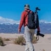
When I consider the experience I rely on and gear used for remote camping, even with a four-wheel popup and a 4WD vehicle, it is remarkable how much of what I carry and use regularly has direct links to my geology education and experience many years ago. A partial list:


- I always have a rock hammer, a gad, an estwing miner's pick, brunton compass and several types of hand lens.

- Cameras and various lenses.

- Maps, maps and more maps -- with a knowledge of how to use them.

- Geology reference books for the areas we visit. It is amazing how often geology books go hand in hand with hiking and backcountry access guides.

- Good boots, including a spare pair, sturdy clothes, a good sun hat, and a great pack, with food, water and first aid kit, for day hikes.

- Gloves of various kinds. For various purposes I use leather with Kevlar lining gloves, nomex gloves, mechanic's' gloves, electronic device compatible gloves and latex gloves.

- Good wrap around sunglasses that do not change the color cast of what I am looking at.

- Lots of different flashlights. Spare batteries in abundance.

- Reliable vehicle repair tools and supplies.

- Outdoor cooking gear. We almost never cook in the camper, preferring to use a propane cook stove outside. Same with coffee making -- I use a Jetboil for pour over outside every morning. (I have some colorful memories about dining experiences while on geology field trips. Results in both lowered and raised expectations!)

- Most importantly, a feel for the terrain and the terrane, and how wind, rain and other weather can change on the ground conditions.


I highly recommend a geology education for anyone that wants to spend much of their life outdoors, as well as for those of us that dreamed of doing so while desk-bound for decades.


Edited by AWG_Pics, 09 May 2022 - 02:55 PM.

  • 1

lived for several years each in Montana, Utah, Idaho, Texas, Washington, Oregon.

2019 Tundra, Hawk.

https://www.flickr.c...hotos/awg_pics/


#37 Foy

Foy

    Resident Geologist

  • Members
  • 1,295 posts
  • LocationRaleigh, NC

Posted 09 May 2022 - 05:50 PM

Foy is right on when he says early geology experiences influence our recreation for the rest of our lives.


Friends ask:  Foy, what do you do for days on end out in Montana?  


Me:  I sleep well, eat well, do a little fishing, some hiking, and a lot of bombing around in the truck looking at cool outcrops showing folds, faults, uncomformities, and looking at old mines.  


Few understand.  Hopefully Searching for Nowhere is one of those who does, and as such may forgive this complete hijacking of his or her post!


Foy


  • 2

#38 searching for nowhere

searching for nowhere

    Senior Member

  • Members
  • 257 posts
  • LocationWestern Washington

Posted 10 May 2022 - 01:45 AM

I love the hijack of the post and want to thank both you and AWG_Pics for helping me understand what I see.  And Foy, I understand what you enjoy.  


A bit about me.  I was clueless about careers when I went off to college and choose to study civil engineering.  I had heard that if one was good in math, you should be an engineer and I was good at math.  At the end of my junior year, I took an introduction to geology class and loved it.  But being practical, I wasn't going to switch majors so close to graduating.  I had a satisfying and rewarding career as an engineer - a good career.  But as a retired person, I now have time to explore geology.  I never forgot my introduction to geology class.  Fortunately, now there are a lot of geology professors giving lectures on Youtube.  I watch the Youtubes and attempt to understand their technical papers.  I enjoy it.  And I enjoy looking at the rock formations and reading about their history.  I am in awe at how people can create the geologic maps with cross sections.  You both have inspired me.  On my next wander I'm going to look at one geology map and spend time to try to understand how the map was made from what people see.   


Thank you both for your comments.


Edited by searching for nowhere, 10 May 2022 - 12:52 PM.

  • 3

Camping with a small trailer.  Everyday is a good day to go camping.


https://searchingfor.wordpress.com/


#39 Foy

Foy

    Resident Geologist

  • Members
  • 1,295 posts
  • LocationRaleigh, NC

Posted 10 May 2022 - 10:20 AM

Great story Searching for Nowhere!  


I imagine you're already a fan of the Mountain Press "Roadside Geology of (insert state name here) series of paperback guidebooks. The publishers are (and were) present or former University of Montana faculty.  They employ experts in state and regional geology for principal content and use their well honed organizational skills to put together some Class A work for states all over the lower 48.  In the past 2 years, both the Montana and the Idaho volumes have been updated and released. The text includes up to date plate tectonic and related deformational histories, and improvements in graphic design, applied by the extraordinary talents of one Chelsea Feeny, make the many maps really pop. My brand new Montana volume is already dog-eared and dirty and by late July, my Idaho volume will be, as well.


Your idea of spending time in one particular map area is brilliant. At the core of detailed mapping exercises performed by Masters and PhD graduate students, state geologic survey agencies, and the USGS are quadrangle maps based on standard USGS 7.5' topographic map boundaries.  The Nevada Survey maps and accompanying text you used in the "green mountain" exploration were published as two 7.5' quads.  In lots of the Basin and Range and just east/northeast of it you can find considerable variety within a single quad.  With my own viewing preferences towards folds and faults, I've enjoyed the so-called Overthrust Belt and the Disturbed Belt in western Montana a great deal.  Seeing some complex folds and faults and sprinkling in some post depositional intrusions of granitic rocks producing metallic mineral deposits along the contacts with sedimentary rocks is my cup of tea.  Hardly a single quad in western Montana and much of eastern and northern Idaho doesn't include such a mix.


Have a great time chasing rocks in retirement.  I diverted from mineral exploration to tax law 39 years ago (I know, I know.....) but my practice is now sold and I'm pedaling as fast as I can to return to my former vocation, now an avocation.


Foy


Edited by Foy, 10 May 2022 - 10:21 AM.

  • 1

#40 AWG_Pics

AWG_Pics

    Into the Great Empty

  • Members
  • 1,197 posts
  • LocationOregon

Posted 10 May 2022 - 01:51 PM

You both may be interested in the Grand Tour of the Ruby-East Humboldt Metamorphic Core Complex in NE Nevada -- Includes an introduction and a detailed road log -- which you can follow along and have each stop described geologically.


http://cholla.mmto.o...e/ruby_tour.pdf


There is a lot to do and see in Ruby valley and in the Ruby Mountains.


  • 1

lived for several years each in Montana, Utah, Idaho, Texas, Washington, Oregon.

2019 Tundra, Hawk.

https://www.flickr.c...hotos/awg_pics/


0 user(s) are reading this topic

0 members, 0 guests, 0 anonymous users