Jump to content


Photo
- - - - -

Desert Trip 2022, Tour De Hanksville


  • Please log in to reply
28 replies to this topic

#11 Zoomad

Zoomad

    Senior Member

  • Members
  • 289 posts
  • LocationColorado

Posted 17 July 2022 - 03:15 AM

Day 3 


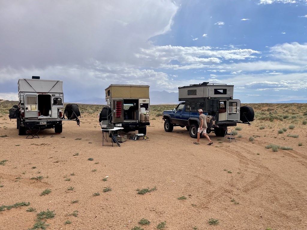
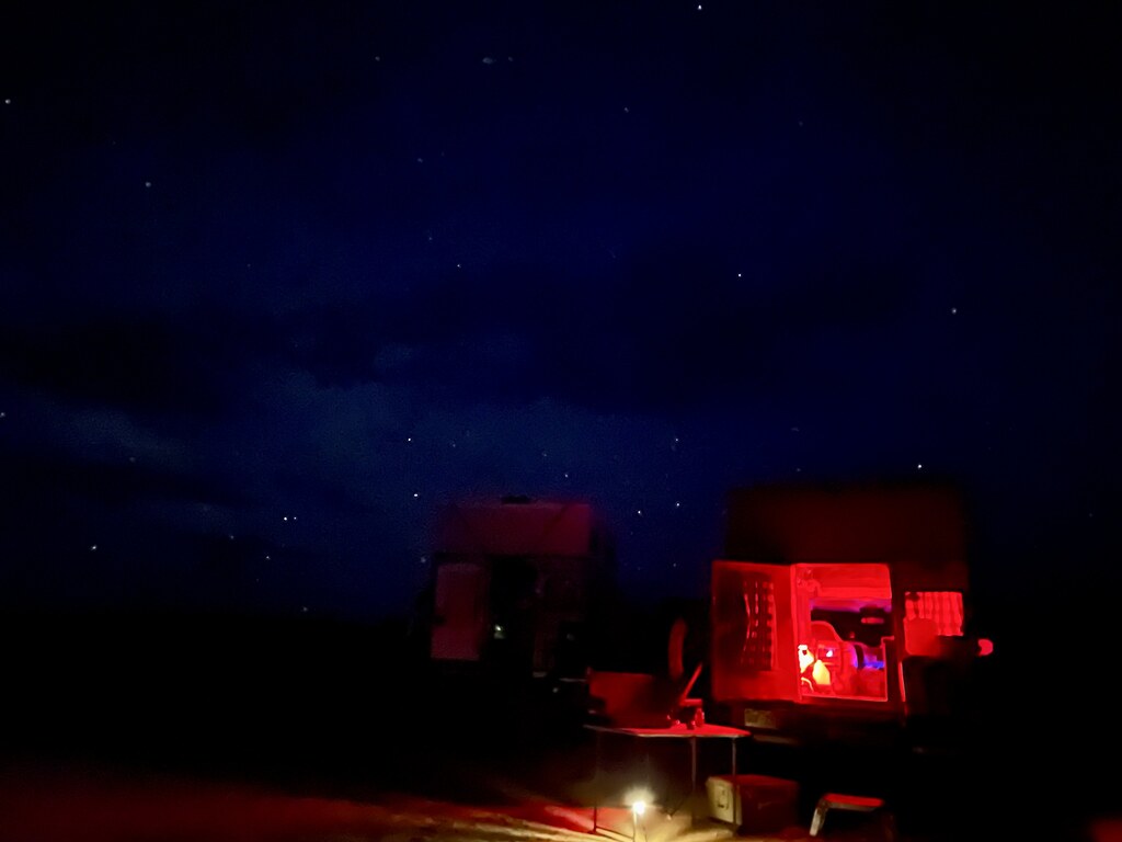
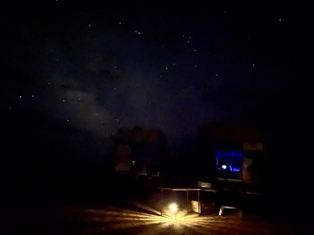
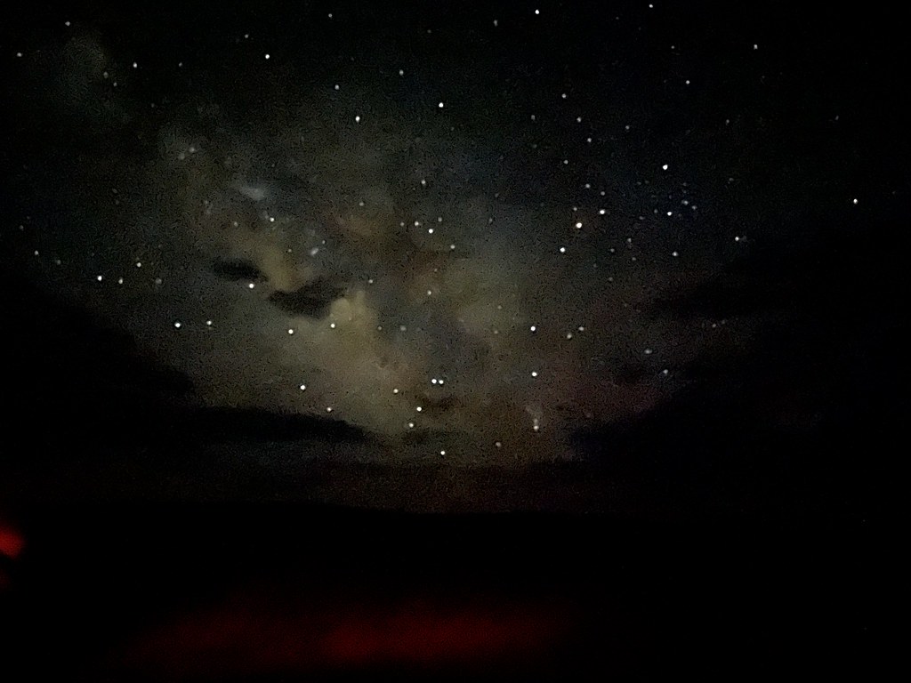
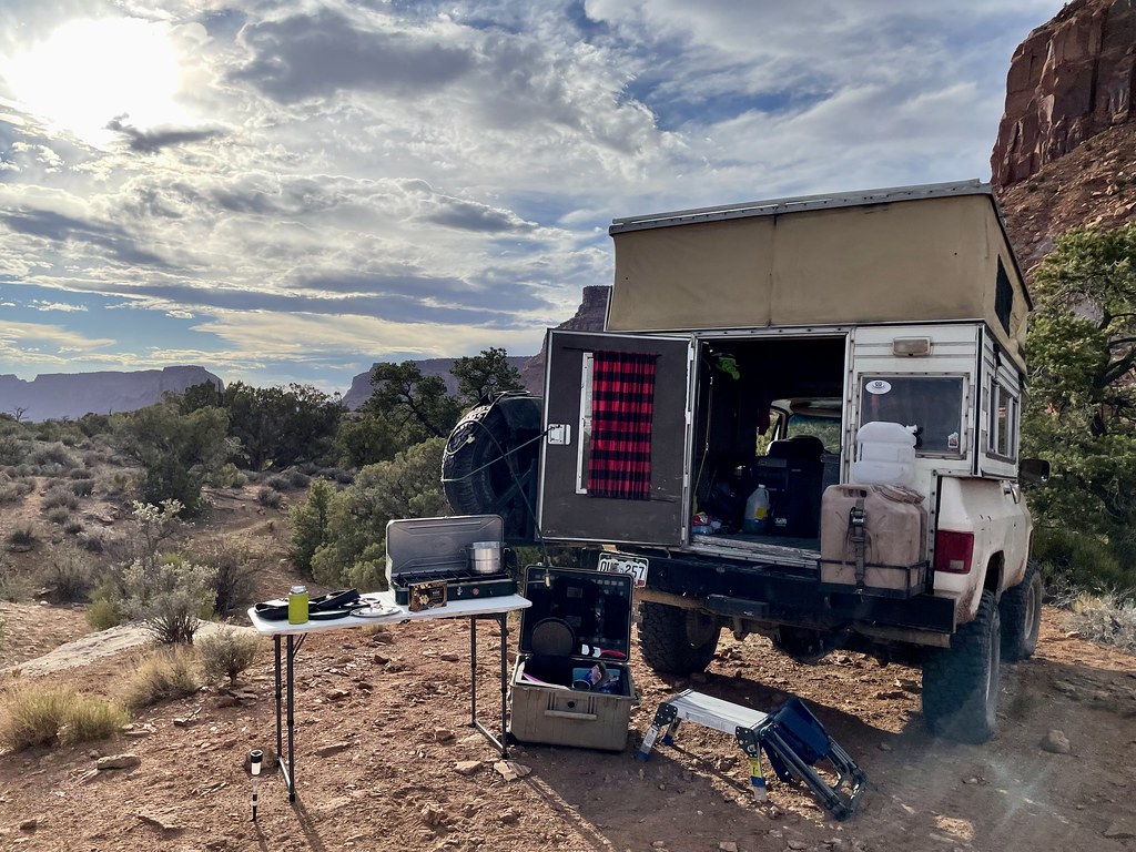
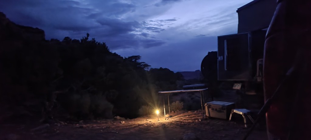
By now we are in the full routine.  But our late nights are keeping us from venturing out to catch the sunrise. But the morning dew added a little more moisture to the dirt.   Meaning it’s barefoot time still.  


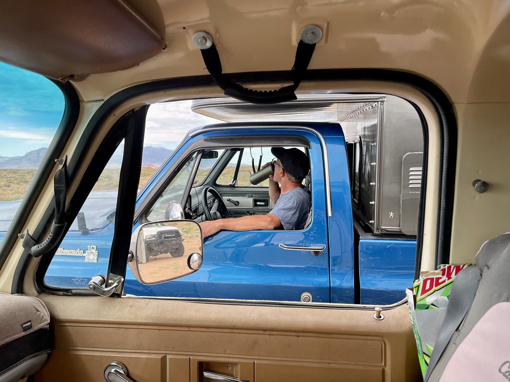
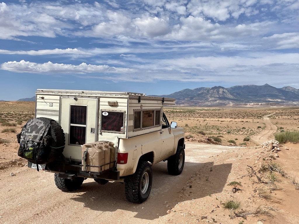
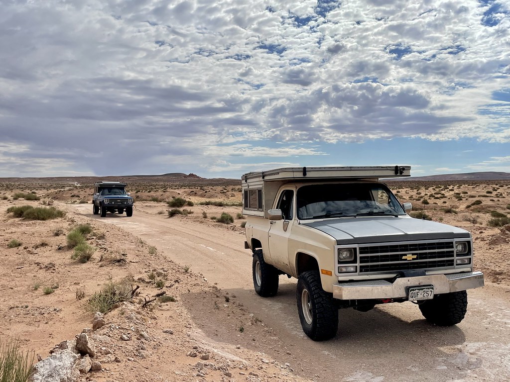
We all pack up and are ready for the run today.  I managed to sort out the electrical issue with my radio so I could actually hear people again.  I call out the turn and we point the trucks north to head to Factory Butte and then further into the moonscape.  

52189735966_234db7aa90_b.jpg

52190220500_abc4409bc7_b.jpg

52198592427_db61139e76_b.jpg


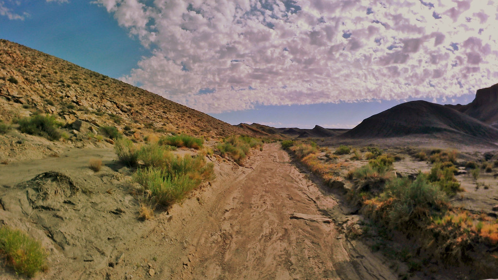
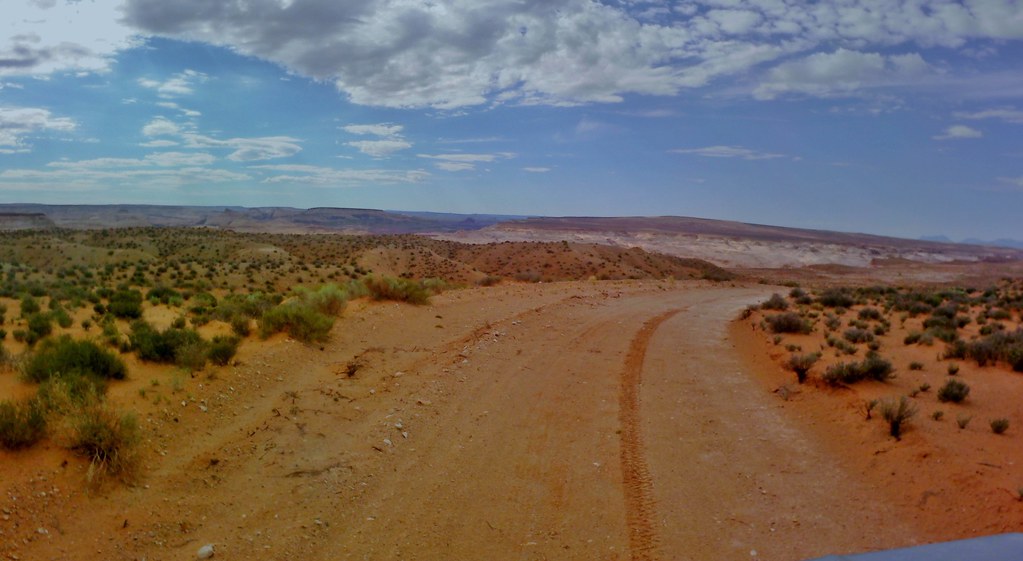
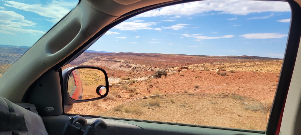
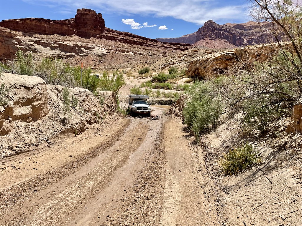
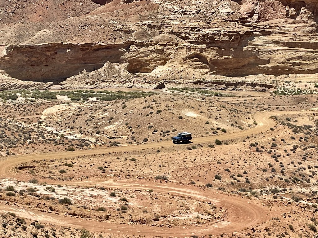
As the previous days have gone, the trails aren’t crazy rock crawling technical.  There are some challenging climbs or drops down that require full attention but the most part it’s unimproved roads with some spicy spots.  52199852894_23653cc502_b.jpg

52189735001_7257ed9df8_b.jpg


We are miles or better off paved roads so going nuts rock crawling is risky when you need to drive the beast home.  Our trucks are capable if we run into some things but my plan was to not focus on the crawling as much. 52199849339_bfb78535d7_b.jpg


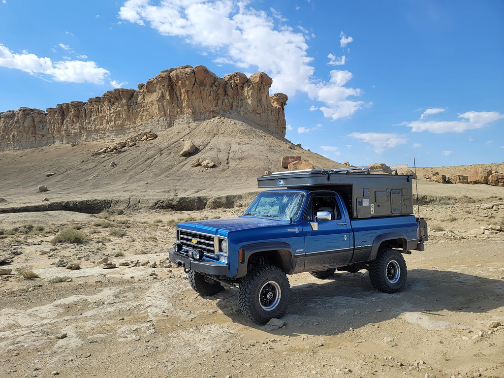
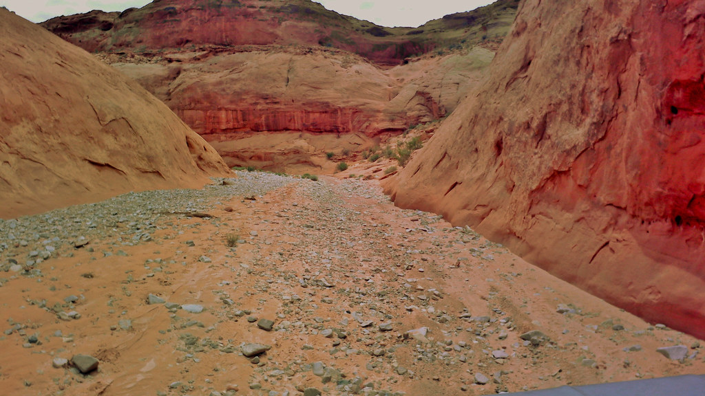
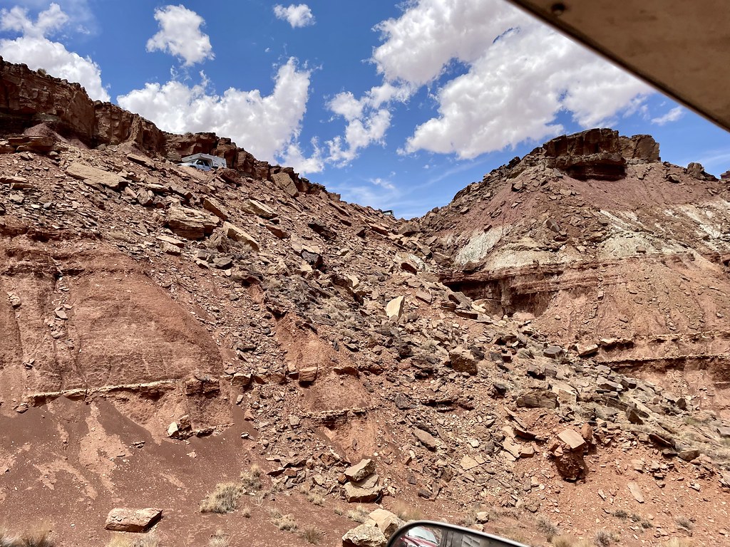
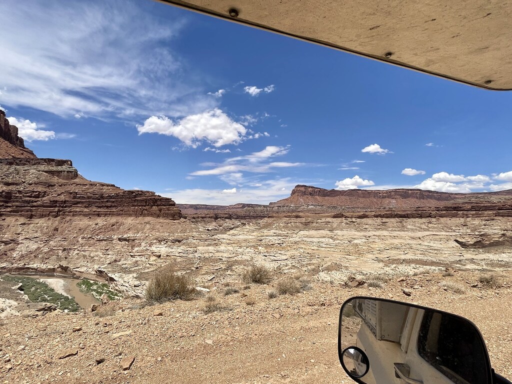
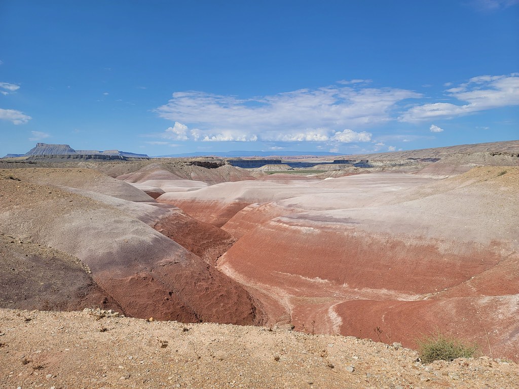
The trail winds through the crazy grey dirt mounds eventually getting out on top and then diving back into a wash for a while.  We pull up to a trail intersection at Factory Butte and head left. 

52199577936_e78a47a171_b.jpg


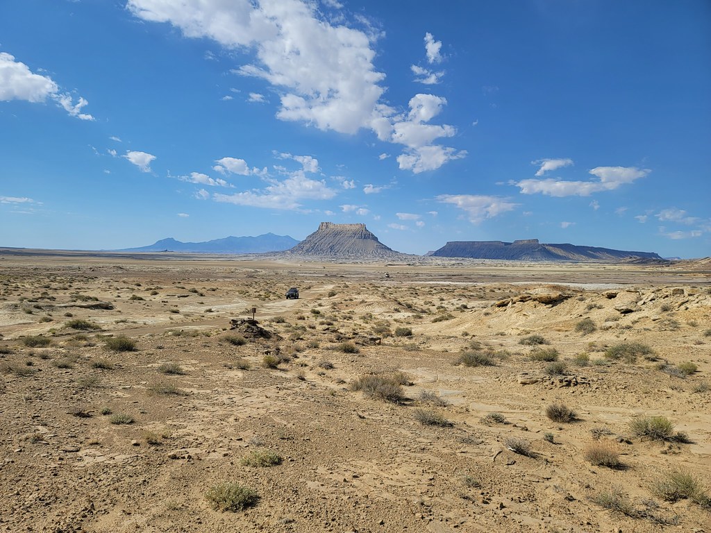
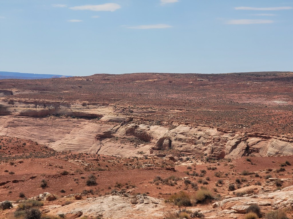
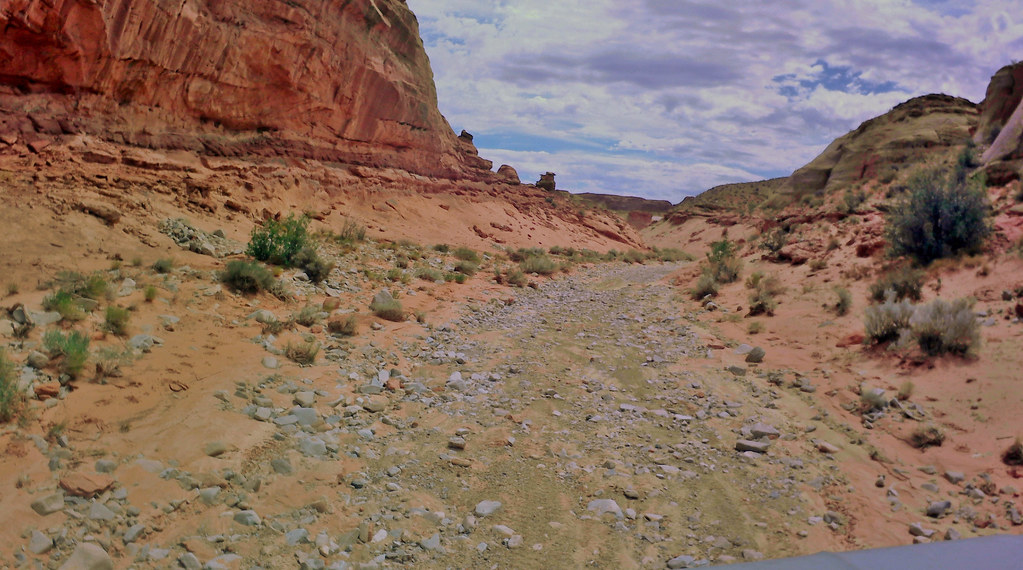
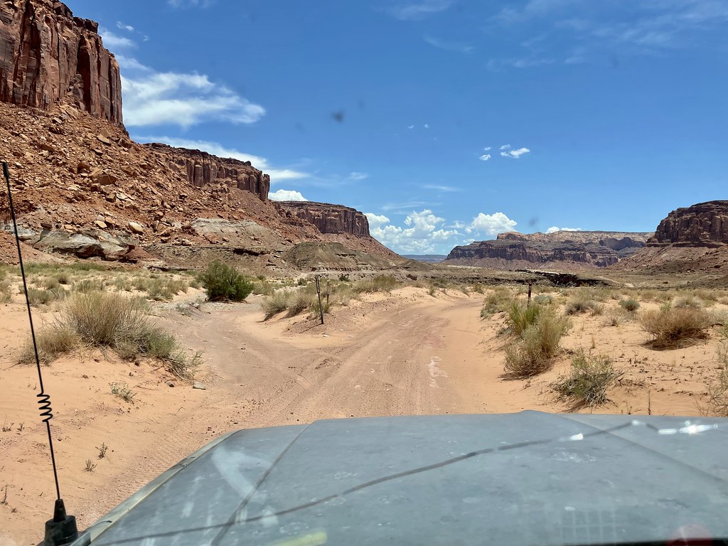
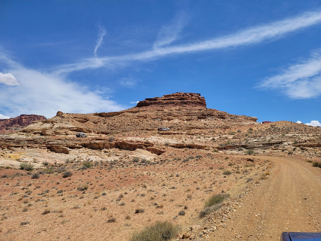
The trail climbs again and then comes around a blind corner and opens up to a wide flat landscape that has such a lunar-like look to it.  Just stunning and I’ve never seen anyplace like it.  So cool.  

52199577936_e78a47a171_b.jpg

52191840410_2ac987c6da_b.jpg

52199837159_349370841d_b.jpg

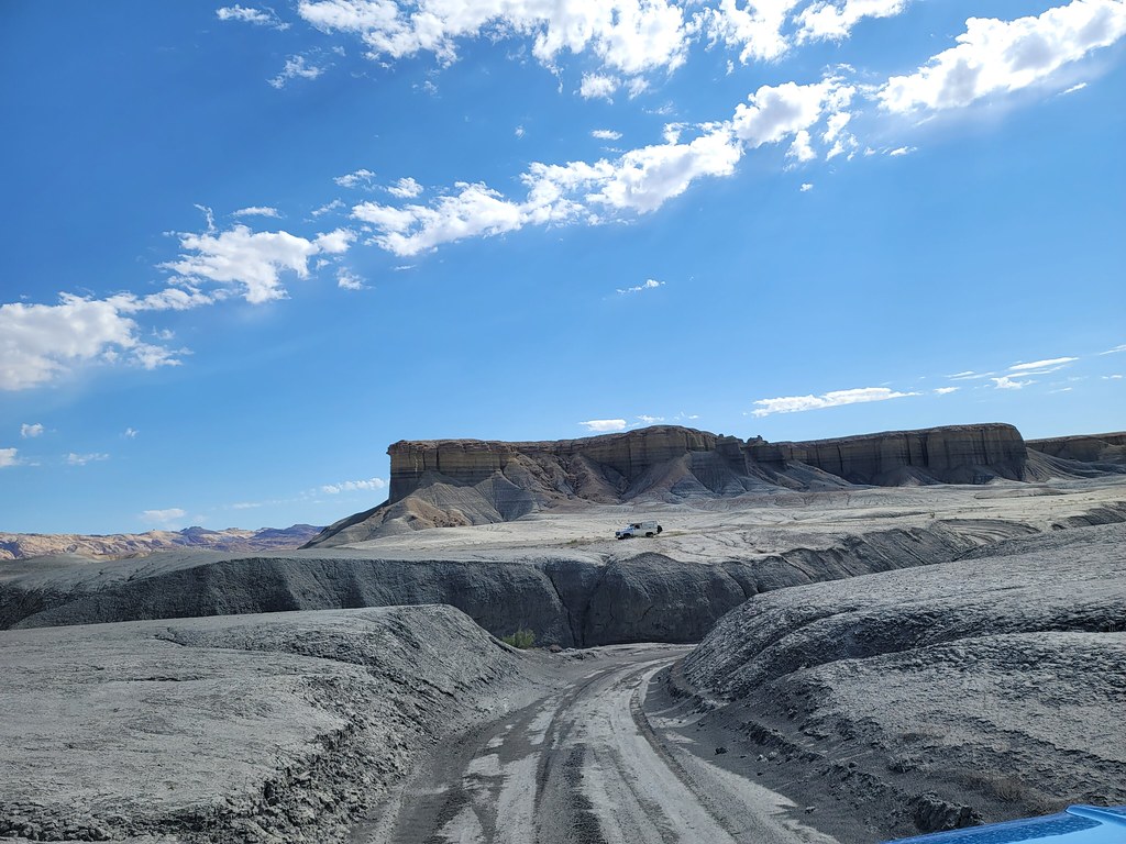
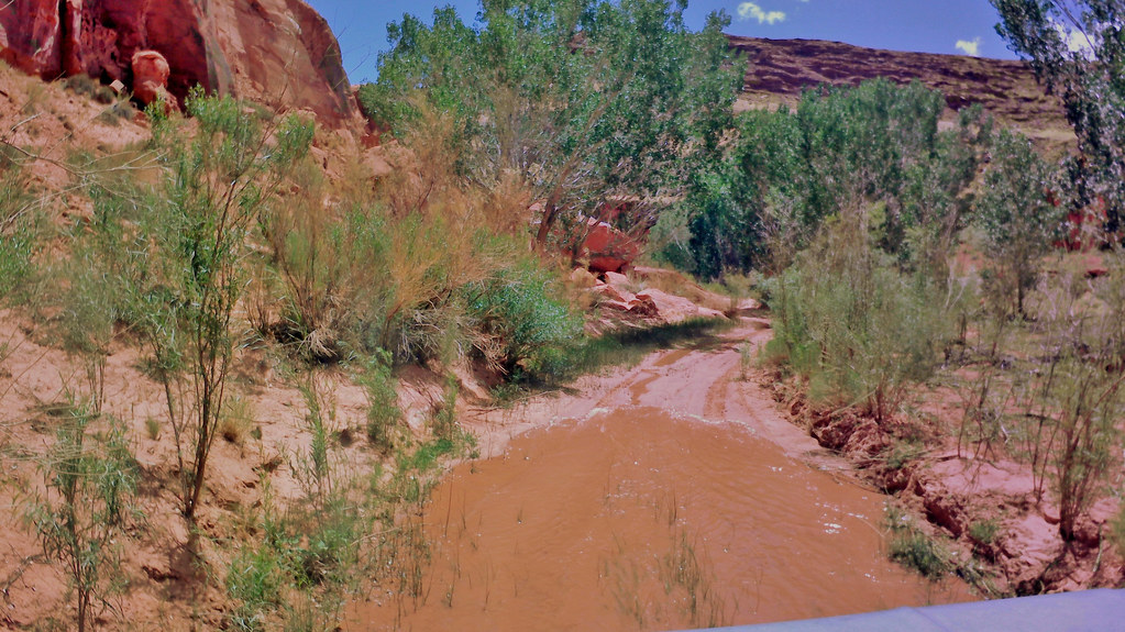
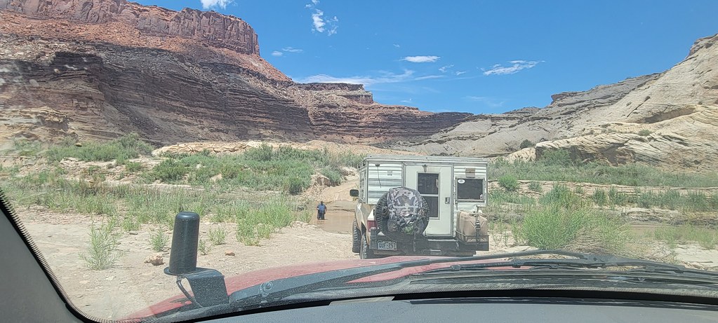
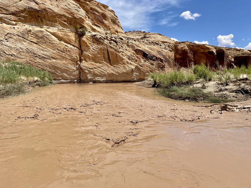
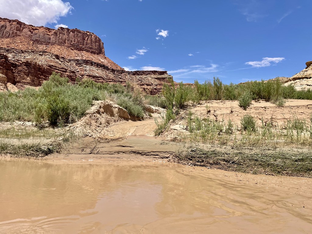
You end up climbing up and over  the mounds as the trail continues.   We turn again and find a wide valley with a surprising amount a green in it.   That green is hiding Muddy Creek somewhere within it.  

52189747468_ceb199c059_b.jpg


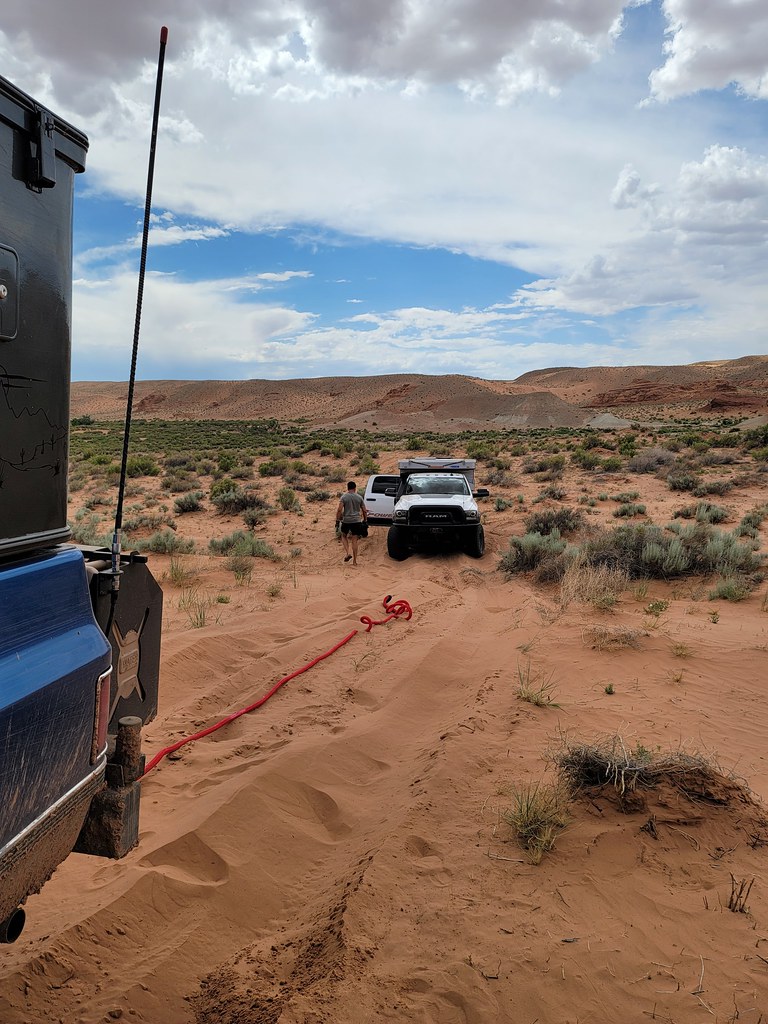
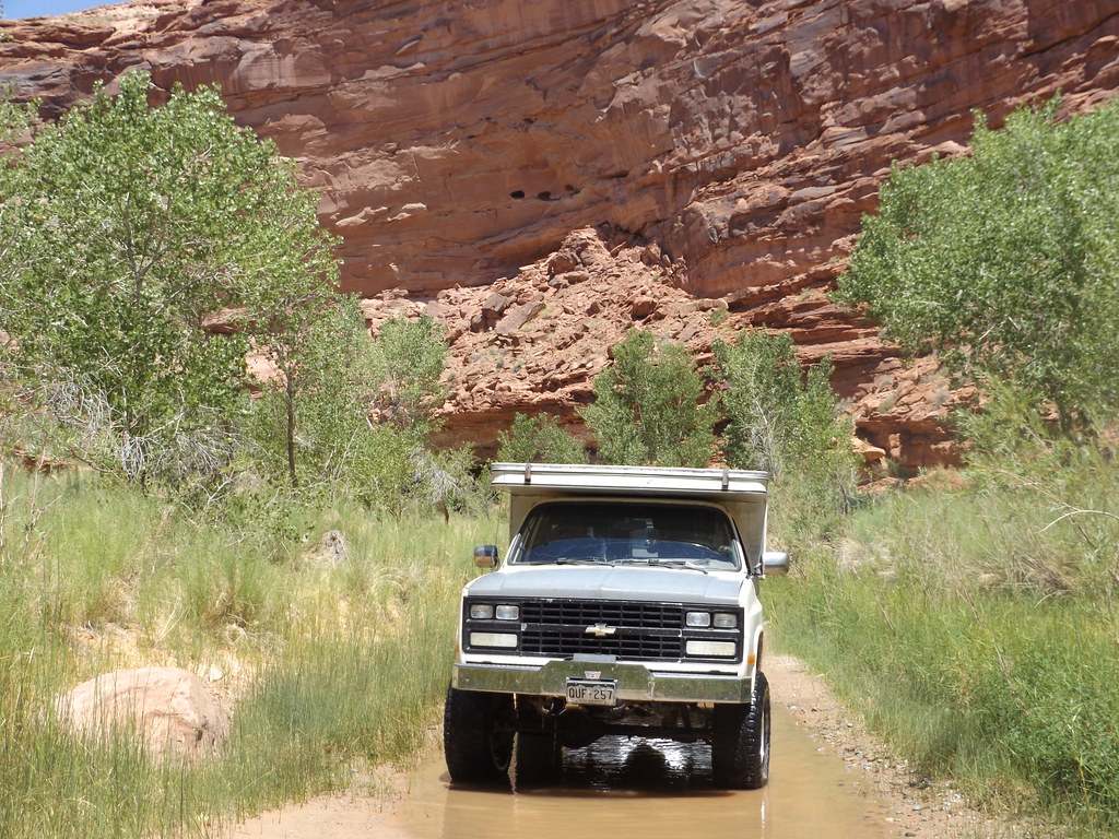
A creek we will have to cross to proceed.  My previous Gaia track led me right to it and I stop to inspect with the group.  It’s a steep entry into the water and the water is moving fairly quickly.   You can see a higher waterline from the recent rains too.  No recent tracks either.  So with the group watching over me  I put the trans in low gear and creep into the water. 

52200056825_1f040d15cb_b.jpg

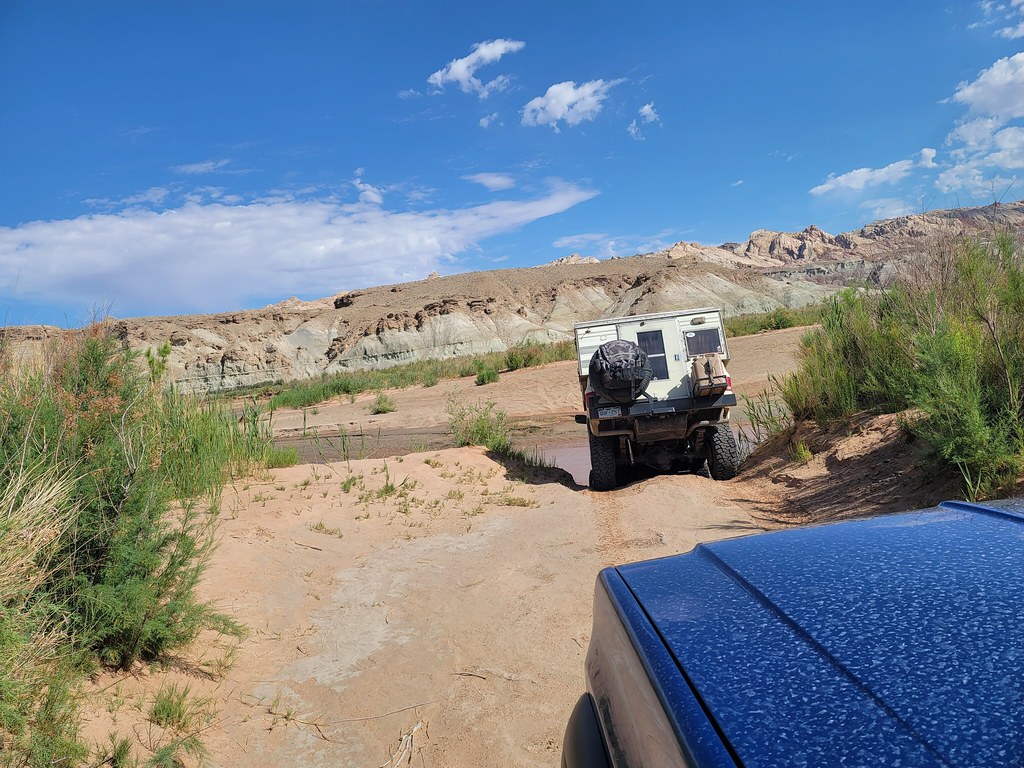
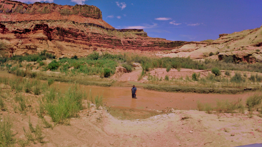
 It’s steep enough and deep enough that my front bumper enters the water.  I start applying power and it’s not going anywhere.  Crap.  I put it in reverse and it’s pretty obvious to those outside my front wheels aren’t driving.  

52200054385_d190105e37_b.jpg

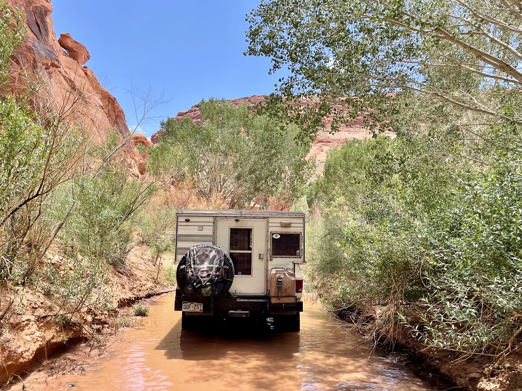
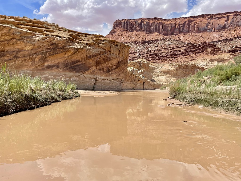
My hubs are well under water and the creek is living up to its name as it looks like a river of chocolate milk.  We need to check the hubs but I’m not quite ready to go swimming.   So Larry  hooked up his which an tugged my Blazer back up to higher ground. 

52200052650_d42683fb08_b.jpg

 Sure enough the left hub was unlocked.   I think I unlocked it on the last air up, but missed doing the other side.   But it don’t work unlocked.  Ty locked it in and Don checked the other and confirmed it was locked.  I dropped back in and had a hump on the creek floor to  go over.   It took a couple of tries but I packed it down and drove out of the creek.  The rest crossed with ease behind me.  


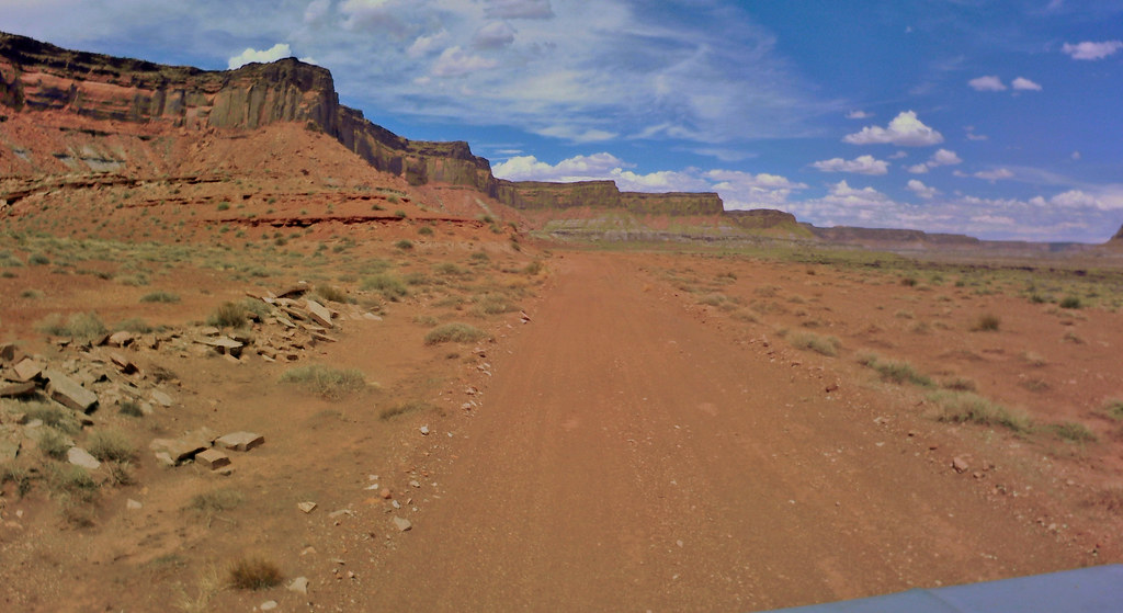
More moonlike landscapes.

52200049875_f65c547d98_b.jpg

52199567363_9a60f9d81e_b.jpg


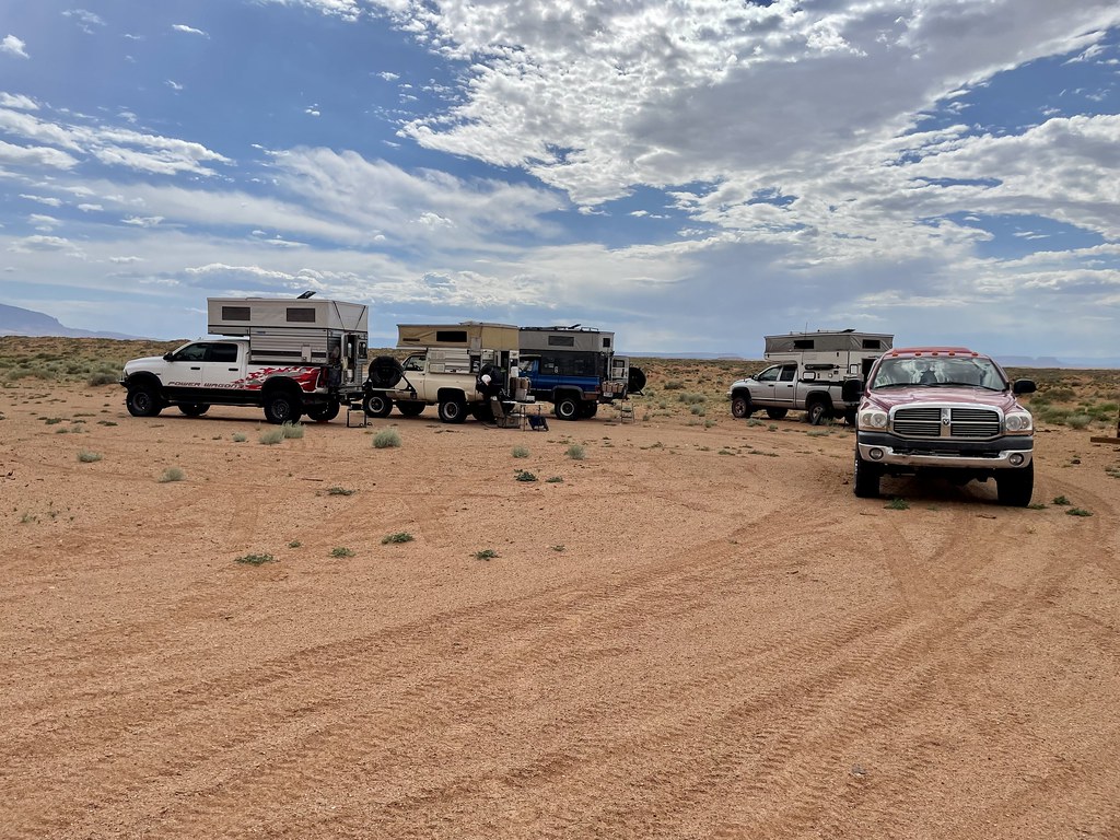
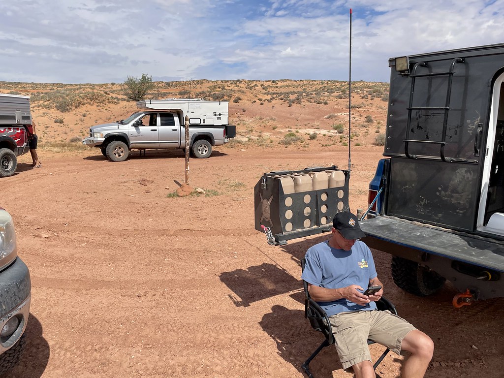
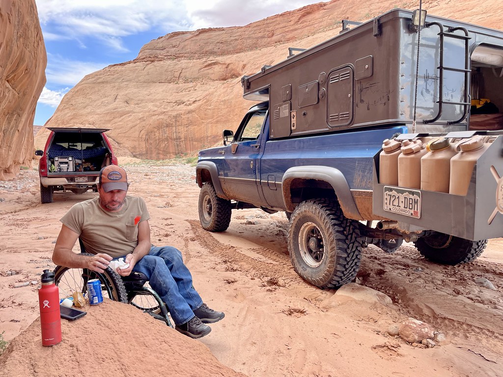
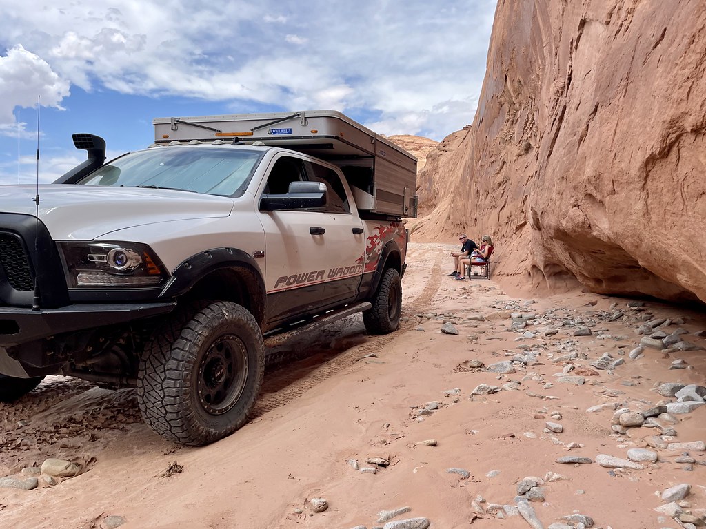
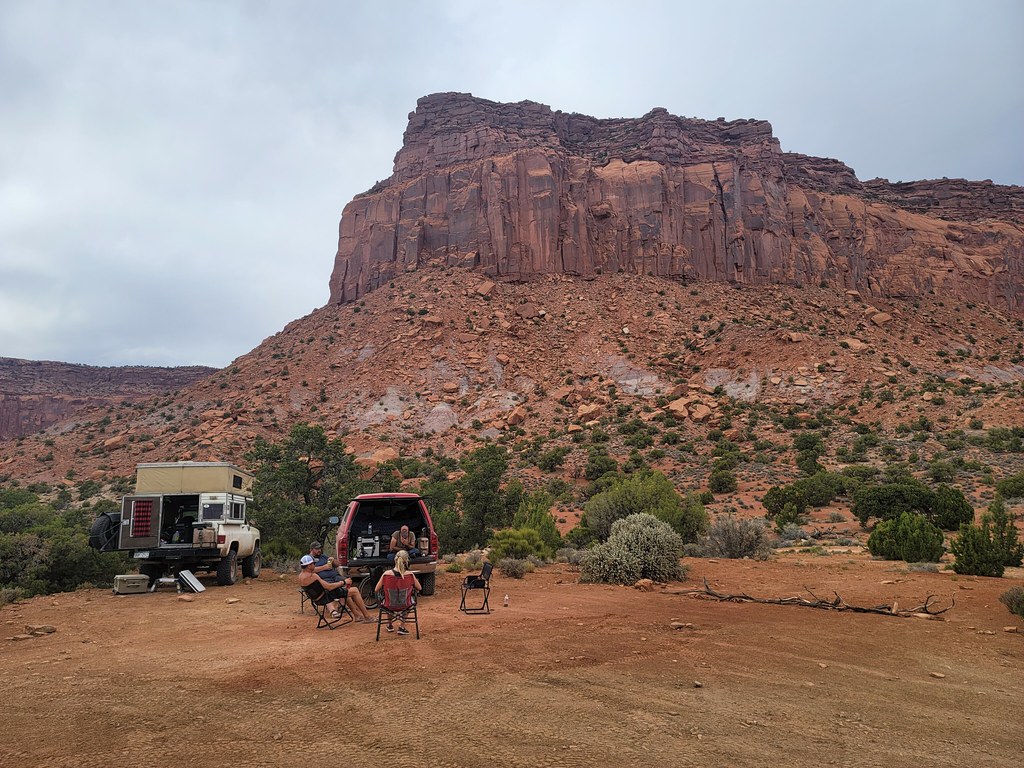
  I found a spot in the crook of one of the dry riverbed where the wall provided some shade to stop for lunch.  52198549482_5c58716fac_b.jpg

52198548637_5f91c86f61_b.jpg


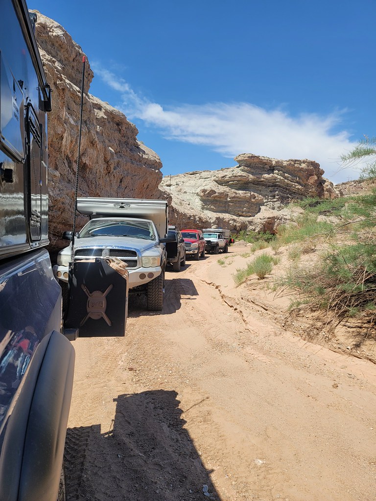
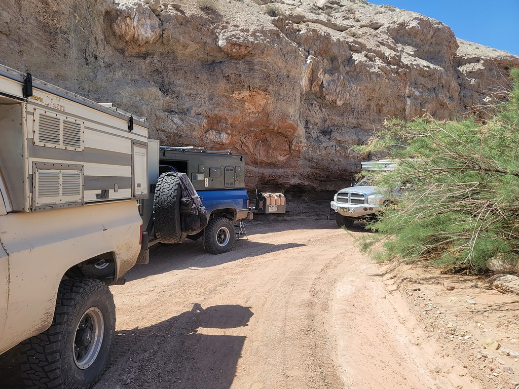
We compared fuel levels and all agreed we could make a run back to Hanksville to refuel and resupply. 


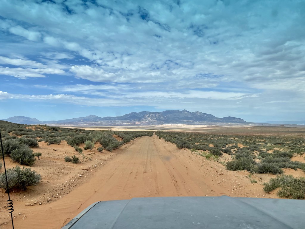
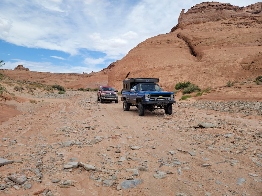
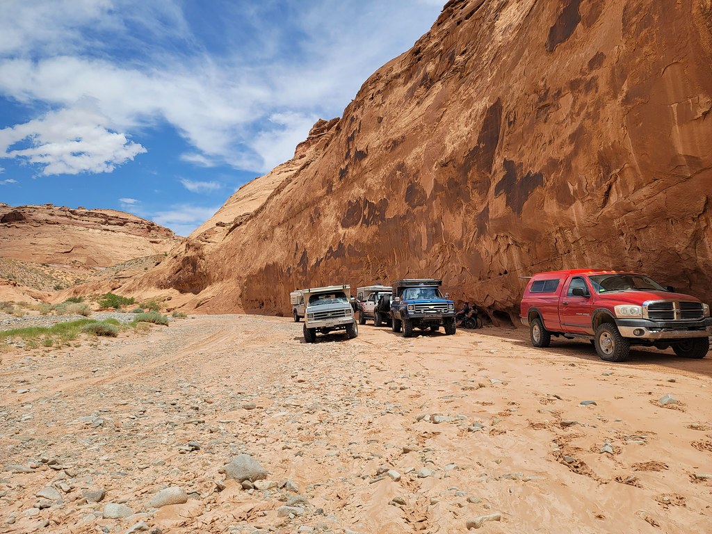
Now entering Ding and Dang canyons.

52199815834_416dc1b2a9_b.jpg


 So after lunch we exited the canyon and pounded a little pavement to take a dirt shortcut back to highway 24 past Goblin Valley state park.   

52188716052_8b1f60350f_b.jpg


***Continued…


  • 0

#12 Zoomad

Zoomad

    Senior Member

  • Members
  • 289 posts
  • LocationColorado

Posted 17 July 2022 - 03:16 AM

The Henry Mountains on the horizon give an idea of the ground we had covered in two days.  

52189745798_78fcd723e2_b.jpg


The trail is a fun one with a lot of sand to cruise through.  We came back to highway 24 and was far enough out of Hanksville to need to air up again.   While doing so Bill and I both heard a horrible dragging noise as a car sped down the road with a pop up trailer behind it and dragging a large 5 gallon orange water container under the front of the trailer.   Shortly after passing us the container exploded all over the road sending orange and white plastic shards everywhere.  


We laughed.   


Aired up we sped back to Hanksville and topped off again.    Tony decided to split off to go find a family mining claim.  Truck count down to five we head south another 1/2 mile and make a left turn to the east to run a trail that skirts the rim of the canyon the Dirty Devil River runs through.   We got close to the river in the canyon but with dark skies to the west we all agreed to keep moving and gain elevation for safer camping. The new trail now has us heading east with the sun behind us in the afternoon.

52189745648_b24029a45c_b.jpg


We loop back away from the river and find we are running in dry fluffy sand.  Almost like flour. 

52189984449_c4a2a7d8ab_b.jpg


On our way up we hit a deep sandy climb that was quite the challenge.   Fun to hit sand but as Don found out too hard to run in 2wd.   He got stuck good.  Myself and Ty had already got up and over and moved up to a higher spot expecting all to follow.  Radio chatter proved what was the delay.  Don needed help so Larry and Bill went back for the rescue.   It took a few tugs with Don’s Yankum kinetic rope but once he realized the problem and shifted into 4hi he popped right over.   

52198541592_cbf2b7d36c_b.jpg


The crisis tended to we started moving again noting the dark cloud is getting closer.   Efforts are stepped up to find a spot to camp at.   The track was dead straight and I could see a corral a ways out.  


It was big enough for all.  Pretty basic but It did have a great view of the Henry mountains.   

52191273111_3ca728d45d_b.jpg

52191224176_87e066d7ee_b.jpg

52200033645_ef4bc835d2_b.jpg

The rain blew through quickly and didn’t make the mess it did the night before.   I cooked up some Marinated flank steak for another run of tacos.   

52200032135_9b52940938_b.jpg

52191708530_d840ffcbc9_b.jpg


Again amazing with the fresh salsa and roasted chilies.  

52191224071_7a7520b153_b.jpg


The drone went up again for more shots.  I caught Ty and Jody out for a walk.

52191206463_67707ec334_b.jpg

52191206428_0f158a8c5e_b.jpg


Good camp shots.  

52191673950_0718860fda_b.jpg

52191206443_f0c0dfb129_b.jpg

52191673945_f92b3a6679_b.jpg

52191217198_a731fbc326_b.jpg

52191217208_87f338cc66_b.jpg


Looking back on the Henry’s.

52191684340_ee244f46dd_b.jpg


  • 0

#13 Zoomad

Zoomad

    Senior Member

  • Members
  • 289 posts
  • LocationColorado

Posted 17 July 2022 - 03:17 AM

The stargazing was peak at this camp with less clouds and stellar views.   It was a great way to cap a good day on the trail.   

52191183556_13aa4b87bc_b.jpg

52191201318_fdaa8cc4d6_b.jpg


More night shots. 

52188685717_f094fb6b6c_b.jpg

52190186950_e3e1f71a2f_b.jpg


Sleep came easy this night.  A long day, but a good one.   


  • 0

#14 craig333

craig333

    Riley's Human

  • Members
  • 8,019 posts
  • LocationSacramento

Posted 17 July 2022 - 04:18 AM

Thanks for the trip report. Looks like a good time.


  • 1

Craig K6JGV_________________________ 2004 2500 CTD 4X4 FWC HAWK 1960 CJ5


#15 Zoomad

Zoomad

    Senior Member

  • Members
  • 289 posts
  • LocationColorado

Posted 17 July 2022 - 05:26 PM

Thanks for the trip report. Looks like a good time.


You’re welcome. Still got more to write up. It’s not done yet.
  • 0

#16 goinoregon

goinoregon

    Senior Member

  • Members
  • 519 posts
  • LocationPDX

Posted 18 July 2022 - 05:22 PM

great report. good team


  • 1

Oregon


#17 Zoomad

Zoomad

    Senior Member

  • Members
  • 289 posts
  • LocationColorado

Posted 19 July 2022 - 04:02 AM

Day 4 


We woke up to another great morning at the cow corral.   As we go through our morning chores Larry had some unfinished business with a tablet  he was going to use for his navigation on the trip.  He had all his maps loaded with my tracks and the morning we left it would not turn on.  Attempts were made to revive it but frustration won out and Larry advised we were going to go “office space” on it at some point on the trip.   That point was now.  


Bill pulled out a sweet little “pistol” and Larry set the target out in the dirt.  It still didn’t power up after it had a few .223 sized holes punched in it.   Larry was satisfied and we finished packing up to move out again.   

52191199058_ef0ac938f8_b.jpg


Larry getting his caffeine fix. 

52190170517_4195b89047_b.jpg


The trail cut back to the east to a nice overlook point of the canyon cut by the Dirty Devil river.   

52190215940_8ddf821195_b.jpg

Much to our surprise Larry zoomed in on the map on his phone to find it was indeed named “Larry’s Canyon”.   

52202525006_2ca5a67246_b.jpg

Pretty cool, though Don did quip it was a bit shallow.    We took in the sights and stretched out a little before taking off again.   

52199493188_f1a974d2d8_b.jpg

52198475032_2b994baa14_b.jpg

52198472047_9d8bd95df2_b.jpg

That’s a wellhead poking up out of the ground there.

52190911338_a73999f7f8_b.jpg


The trail points us back at the Henry’s again. 

52190162907_e70e41679e_b.jpg

52191658920_fd7456b88d_b.jpg

52191191523_b2630a0836_b.jpg


The next target trail was only a mile or two down the highway from where this one ended.  


Poison Spring Canyon was the next to hit.  It was funny to compare notes as Larry, Ty and Jody, our buddy Ian and myself hit this trail two years ago.  Don had realized he was on it also that year with another guy after we split up the large group after Reds canyon.   They were probably no more than an hour or two behind us that time.  


The trail starts into another little canyon. 

52189744333_b08a0ba0ed_b.jpg


Now this is my opinion, but Poison Spring Canyon is the coolest and most picturesque way to get to Canyonlands.  It’s very similar to the Grand Canyon but the key thing is you can drive it.  From one side down to the Dirty Devil River and back to the other side.   It’s a place where you really can’t have a bad view or take a bad picture.  


The trail drops into the first of three distinct separate canyons.  The first being the tightest of all.    It’s another dry wash but since far the weather is clear for the area.   The wash seems much more rocky than last time. 

52188714142_450f1a1cae_b.jpg

52199484068_6263836d40_b.jpg


 I think the blow sand was washed out by the previous flash flooding in the canyon.  Travel through it is slower but it just gives us longer to enjoy the view.   

52189743758_028068b140_b.jpg

52189885577_c86a80d3aa_b.jpg

Eventually I find a shady spot in the canyon to have lunch.  

52191140274_a5cf3090a7_b.jpg

52190899338_30e696d2f6_b.jpg

52191139899_0723785a24_b.jpg

52198460872_8dc92858f9_b.jpg


***Continued 


  • 0

#18 Zoomad

Zoomad

    Senior Member

  • Members
  • 289 posts
  • LocationColorado

Posted 19 July 2022 - 04:03 AM

 With our bellies fueled up we took back off.   I came into an oasis with leafy cottonwoods and water.   I was pretty far ahead so I stopped for a soak with my feet to cool off.  Maybe take a pic or two. 

52189743468_8ebf2ab62d_b.jpg

52190876531_69e3a744aa_b.jpg

Same canyon, slightly different spot two years earlier, truck is slightly different too:

50039214506_5c0d5bf5c1_b.jpg


52189982139_de0a5deb79_b.jpg  


I won’t lie I almost went all the way in by accident.  I walked behind the truck and found the tire ruts were a solid foot deeper than up front.  Stepped into the rut and kept going when my foot didn’t hit bottom where I thought it would. 

52190876796_c1e5db6c25_b.jpg

52191133149_d59aa4b772_b.jpg

 Given the heat I probably would have been dry in minutes but the water was more like chocolate milk and full of bugs.  I let the guys catch up and we take back off again.  


Eventually we spill out into the next larger canyon.  

52191339680_2575c118b6_b.jpg

That one leads to a really steep decent into the main canyon.  

52190873233_a11a3e916f_b.jpg

52191112284_ecc50454af_b.jpg


The improved granny gear on my truck was making short work of the steep downhill runs.   

52199955330_e471de656c_b.jpg

52199472283_b2edc4ac72_b.jpg

52199950345_a7169be2e9_b.jpg

52199467438_e93090c8dc_b.jpg


We make it to the Dirty Devil river crossing.   I park on the bank and immediately walk out in the river to check the depth and cool off.   

52202895890_0198199574_b.jpg

52188712252_17f3f35230_b.jpg


Again, the water is fitting of the name as it’s brown.  Two years ago the depth was barely to my ankle.  Now it’s darn near to my knee at it’s deepest.  

52190850638_142348d4ea_b.jpg

52190833796_05673d7e75_b.jpg

 Looking at the banks showed a much higher level and zero evidence of any recent crossing.   This was going to be fun.  

52190833706_7683e1acfa_b.jpg


The entry to the river is pretty shallow and at a low angle.  The exit  goes up quickly and the bank was really soft and gooey.  Crossing the river itself was easy as it had a firm rocky bottom.  I squared up to the bank and fed it some beans.   I got the front tires up the bank but the rears were in a hole and felt like they needed to get over a hump.  


I backed down for another shot and I noticed the ruts I created close up due to the firm pudding-like mud.  In the end it took four runs at it to pave the way and pop over the bank.   The rest cruise right up the bank that I paved the way for them.  I park up from the bank to give everybody room and come back to take pics of the rest crossing.   I figured they would wait for me.  They must not have got the memo because I barely caught them.  Here’s Ty getting up the bank. 

52191070889_d135eb76d0_b.jpg

Don’s turn:

52190850893_1912abec69_b.jpg


****Continued


  • 0

#19 Zoomad

Zoomad

    Senior Member

  • Members
  • 289 posts
  • LocationColorado

Posted 19 July 2022 - 04:04 AM

The long climb up and out of the canyon begins right away.   We wind up and around as we go.   With each switchback we climb the river below gets smaller and smaller again.   52190803321_31497ce014_b.jpg

52190819833_93c60ca7a0_b.jpg


The views are so epic it’s almost a distraction.   This section is a shelf so there’s a good risk to going over if you aren’t paying attention.   So it’s best to stop and snap pics rather than driving and taking pics at the same time.   Pictures like this take me back to childhood playing with Hotwheels in the dirt having an imaginary adventure. 

52189804872_56a0ebd557_b.jpg

Same trucks, just from below instead of above.  

52199464523_9e373ca794_b.jpg


I got to a great spot to take a group shot when some smart guy (Larry) recommended to send the drone out and take the pics that way.

52199936010_8409b437cd_b.jpg

   I’ve got a  grand total of maybe 30 minutes flight time with fairly calm winds and there’s a definite added risk off of the side of a canyon and the winds were higher than I’ve had flown in yet.   I only get it a few feet off the trail and you can see the drone is struggling to stay stable.   So I take it higher and fly out over the edge, because I’m smart that way.   I fumble around and click off a couple of pics and barely record video as the drone is now dropping below the trail with a strong downdraft negating the upward thrust I give it.  

52195015481_f51d82accc_b.jpg

 Not quite full panic mode I keep giving it throttle to climb.  It barely crests the trail side and get the drone over the trail and get it on the ground.   Whew.   


Moving on, the trail gets to a point it winds along the base of a large butte. In and out of individual fingers of the larger canyon. 

52189741688_368c58191e_b.jpg

We are spending just and much time going north and south as we make an easterly heading to the climb out.   


It’s pretty cool to note that outside of the volunteer park ranger we passed on the trail on day two we haven’t passed anybody else all week.  That’s partially by design heading into this area in June when it’s hot as hell.  Plus weekdays limit the weekend warriors.   


I happened see a white Jeep Rubicon coming at me.  I think are streak got broken.   He pulled to the side to let me pass and I stop to see it’s a park ranger from Canyonlands national park.  He asked where we were going and how the river crossing was.   He was heading this way to warn anybody of the continued threat of flash flooding in the forecast.   He was headed back to the highway and appreciated our report on how the crossing was.  He said all that rain that flooded Capitol Reef all drains into the Dirty Devil river.  The park service has a flow gauge at the crossing and they measured 1,200 cubic feet per minute.  As in a lot of water.   We got lucky it was low enough to cross.  


The Ranger was cool to talk to.  He waited for everyone to pass before proceeding.  


It was about then I could see more dark clouds to the west and we didn’t want to make it to the final climb if it was wet. 52199446963_ab8c113564_b.jpg

The climb drops right back down the other side.  Steep too. 

52199423361_5036fc06b5_b.jpg


The campsite isn’t much further and we make it there well before the storm. 

52199919115_32ac9e7f5a_b.jpg


52191273200_236506ef90_b.jpg

52199439533_587c90367f_b.jpg

52199676444_5ef167d7fe_b.jpg

52199429158_a728302aaa_b.jpg

52190782643_9d4a4e165c_b.jpg

Happy hour before dinner was well earned..

52199911140_3e16de5886_b.jpg


We had enough time to cook up some great steaks and pasta for dinner.   Bills grill didn’t seem to have a big enough flame to cook right so we took the regulator apart to find out why.  The oriface on the inlet side was too restrictive so we opened it up a little.  Bingo. Good flame.   Bill cooked the steak while I cooked up the pasta.   It was yummy as usual and we hung out again until dark.  

52190767186_24547f1f40_b.jpg

52190782778_c83aff6e82_b.jpg

52190756836_bd3306d6f3_b.jpg


52199405336_92aae4b6c1_b.jpg


***Continued


  • 0

#20 Zoomad

Zoomad

    Senior Member

  • Members
  • 289 posts
  • LocationColorado

Posted 19 July 2022 - 04:06 AM

52199401721_dcd3e38aa9_b.jpg


Socked in with clouds, no stargazing was done on this night.  We had a little rain come but nothing really worth worrying about. 

52202658184_e07392e268_b.jpg


One last day out after this one. The next days adventure has us heading south.


  • 0


0 user(s) are reading this topic

0 members, 0 guests, 0 anonymous users