Jump to content


Photo
- - - - -

Can anyone name this route?


  • Please log in to reply
4 replies to this topic

#1 buckland

buckland

    Senior Member

  • Members
  • 3,078 posts
  • LocationNew England

Posted 29 September 2022 - 08:49 PM

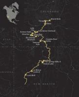
In my haste some months ago I simple screen shot a map ....then forgot to name it... and in so doing I now see I need a whole bunch of more details. This I am pretty sure it is all Public lands or Forest roads. Being a geezer I can't remember where I got it. 

TIA

Attached Thumbnails

  • Route-west.jpeg

  • 0

2016 Duramax 2.8 Diesel long bed Colorado 4WD with 2011 Eagle

Lordwoodcraft  instagram        Rob
The only people who ever get anyplace interesting are the people who get lost.
Henry David Thoreau
"Work to achieve not to acquire"


#2 Wallowa

Wallowa

    Double Ought

  • Members
  • 2,173 posts
  • LocationNE Oregon

Posted 29 September 2022 - 09:01 PM

Overland Journal?  Looks like what I have seen...but could be wrong.


  • 0

#3 buckland

buckland

    Senior Member

  • Members
  • 3,078 posts
  • LocationNew England

Posted 29 September 2022 - 10:33 PM

Yup thanks .........the Continental Divide trail.

NO winter or Spring travel there!

Appreciate the quick response as I am trying to consolidate my maps for a trip.


  • 0

2016 Duramax 2.8 Diesel long bed Colorado 4WD with 2011 Eagle

Lordwoodcraft  instagram        Rob
The only people who ever get anyplace interesting are the people who get lost.
Henry David Thoreau
"Work to achieve not to acquire"


#4 Cottonww

Cottonww

    Advanced Member

  • Members
  • PipPipPip
  • 80 posts

Posted 30 September 2022 - 01:06 PM

Not sure about New Mexico, but in CO you took Hwy 285 to Alimosa, then 160 to South Fork, then Hwy 149 to Creede, Lake City, then

Hwy 50 to Gunnison, then northeast over Cottonwood Pass to Buena Vista. A beautiful drive, especially now with the aspen in color.


  • 0

#5 Foy

Foy

    Resident Geologist

  • Members
  • 1,295 posts
  • LocationRaleigh, NC

Posted 30 September 2022 - 03:41 PM

Not sure about New Mexico, but in CO you took Hwy 285 to Alimosa, then 160 to South Fork, then Hwy 149 to Creede, Lake City, then

Hwy 50 to Gunnison, then northeast over Cottonwood Pass to Buena Vista. A beautiful drive, especially now with the aspen in color.

  Yep, that northernmost end looks like the paved State/County road west out of Buena Vista to Cottonwood Pass.  Goes right by Cottonwood Hot Springs on the way up--a nice, quiet, alcohol-free soak.  Dunno about campsites there but they're on the Intertubes.


Lots of the rest of it looks like the CDT backpacking trail and/or the CDT moto/vehicle route.


Foy


  • 0


0 user(s) are reading this topic

0 members, 0 guests, 0 anonymous users