
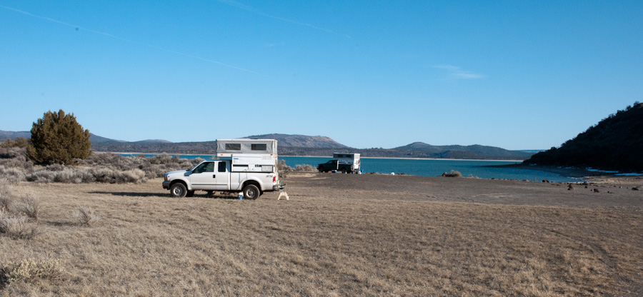
Kinda cold...windy...but sunny. And nobody else here.


The Weatherman
Posted 23 March 2013 - 12:02 AM
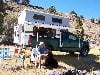
FWC Hawk (2005) on a Ford F250 Supercab, 6.8L V10 gas (2000)
Riley's Human

Posted 23 March 2013 - 12:32 AM
Craig K6JGV_________________________ 2004 2500 CTD 4X4 FWC HAWK 1960 CJ5
The Weatherman
Posted 23 March 2013 - 12:49 AM

FWC Hawk (2005) on a Ford F250 Supercab, 6.8L V10 gas (2000)
The Weatherman
Posted 23 March 2013 - 02:37 AM
FWC Hawk (2005) on a Ford F250 Supercab, 6.8L V10 gas (2000)
Riley's Human
Posted 23 March 2013 - 03:08 AM

Craig K6JGV_________________________ 2004 2500 CTD 4X4 FWC HAWK 1960 CJ5
The Weatherman
Posted 23 March 2013 - 03:28 AM
Steens Mt -- especially the view from on top, when you can drive the loop road in summer -- is really/almost/I-think national-park spectacular! This time of year the 4000-foot-high east face with snow on it is super, too -- which you can see from the road at its eastern base, next to the Alvord Desert -- the road I drew in up north from Fields. The view of the gently-sloped west side of Steens without being up on it to see the gorges, etc., is not spectacular, not that special at all. That's the side you see from the Catlow Valley, the side you see if approaching from Hart Mt.No dog pics? I'm ashamed to admit it. I like maps also and I never really looked that area over all that well. For some reason I had a feeling the Steens were much further north. To add a bit of those and the Alvord while also do black rock and the rest? I may just get why you like the area so much.
Did you bring a fishing pole?


 )
) I'm not sure that's even legal...but I think the statute of limitations has run out. (I used to fish -- caught my first fish in Clear Lake when I was 4 or 5)
FWC Hawk (2005) on a Ford F250 Supercab, 6.8L V10 gas (2000)
The Weatherman
Posted 23 March 2013 - 03:50 AM
FWC Hawk (2005) on a Ford F250 Supercab, 6.8L V10 gas (2000)
Smokecreek1
Posted 24 March 2013 - 08:21 PM
Windy here too. Ordered maps. Looked at the maps I do have. More confused than ever on what route to take. Not worried, routes have a tendency to work themselves out. They're all good. Can't find any info on whether or not the Nobles Emigrant road would be wise this time of year. Love to take that and avoid Reno.
The Weatherman
Posted 24 March 2013 - 08:34 PM
FWC Hawk (2005) on a Ford F250 Supercab, 6.8L V10 gas (2000)
Smokecreek1
Posted 24 March 2013 - 08:41 PM
I am here: 40 52.524 N 118 44.143 W http://maps.google.c...?q=loc:40.87541,-118.73573
At Sulfur...heading north up the east side of the east arm of the Black Rock. Destination: McGill Canyon, at the base of the Jackson Mts, below King Lear Peak.
Spent last night camped on a bench above the Smoke Creek Desert, just north of Smoke Creek.
So...there IS cell phone coverage here after all...


0 members, 0 guests, 0 anonymous users

