Jump to content


Photo
- - - - -

April North Georgia Mtns

georgia

  • Please log in to reply
3 replies to this topic

#1 iowahiker

iowahiker

    Senior Member

  • Members
  • 487 posts
  • Locationiowa

Posted 16 May 2014 - 01:29 AM

Section 1:  Campgrounds and Details, pictures to follow in section 2


We set out in early April for a three week camping and hiking trip to the North Georgia mountains and a side trip to northeast Alabama.  This was our first spring trip in over 20 years (After Children, AC) and we escaped a cool and rainy northeast Iowa for what proved to be three weeks of good weather in the southern Appalachian Mountains.  North Georgia was a long planned trip because of the string of state parks across North Georgia with lots of hiking including the beginning of the Appalachian Trail (AT) at Springer Mountain.  In our travels, only two places have a series of state parks with connecting hiking trail systems:  North Georgia and Northeast Minnesota (Superior Hiking Trail system).  The day hiking and camping opportunities are almost endless at these two locations.  


Living near the Mississippi, we will admit to "heretical" WTW values:      

1.  The pictures we take hiking the West are better than the experience.     

2.  The experience of hiking the East is better than the pictures.      

3.  After hiking three or more weeks in the West, we are ready to go home.      

4.  After hiking three or more weeks in the East, we are ready to come back.      

5.  The pictures we take in the West inspire us to come back.       

6.  The pictures we take in the East make us wonder why we went.     


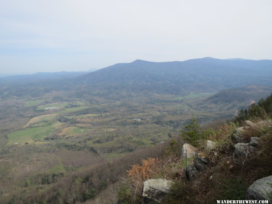
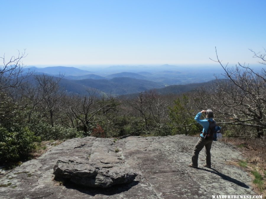
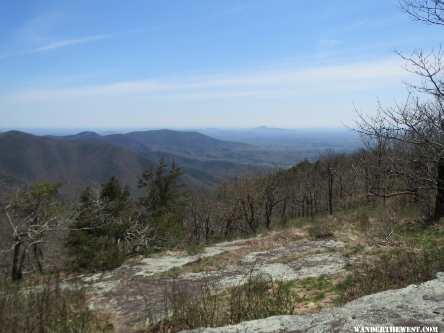
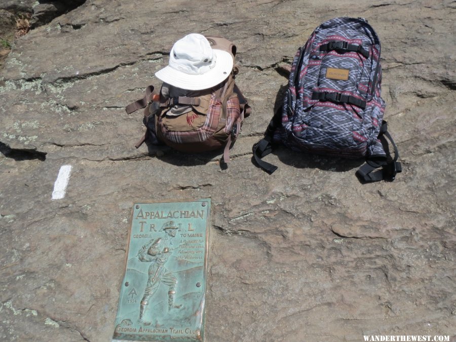
Hiking to the southern end of the AT at Springer Mountain was a pilgrimage for us since we have hiked AT sections as far away as Maine but the view at Springer is weak.  We day hiked (out and back) the AT from Amicalola Falls (near Springer Mtn) to Brasstown Bald (highest point in Georgia) a distance of around 50 miles, one way, plus side trips.  The AT was busy with through hikers (heading to Maine), section hikers (backpacking a section), day hikers (us), and locals following their tradition of camping in the mountains.  


Our trip campground itinerary was:         

1.  Ferne Clyffe SP in southern Illinois for one transit night.         

2.  DeSoto SP in northeast Alabama for three nights.        

3.  Fort Mtn SP in Georgia for three nights.       

4.  Amicalola Falls SP in Georgia for two nights.      

5.  Vogel SP in Georgia for 12 nights.        

6.  Weldon Springs SP in central Illinois for one transit night.        


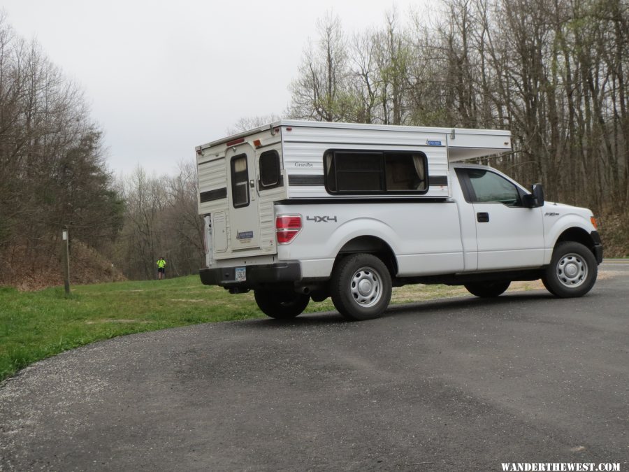
All these campgrounds had the same character: hookups, rolling terrain, lots of shade, showers, and were quiet after 9-10pm.  Campgrounds routinely fill on weekends and so we made reservations for weekends but no campground filled from Sunday noon to Friday noon.   Alabama and Georgia reservations are not site specific and you pick a site on arrival to prevent one or two day checkerboard gaps between reservations since no one wants to move their trailer or tent to fill the checkerboard.  


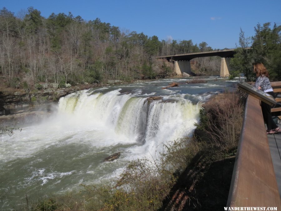
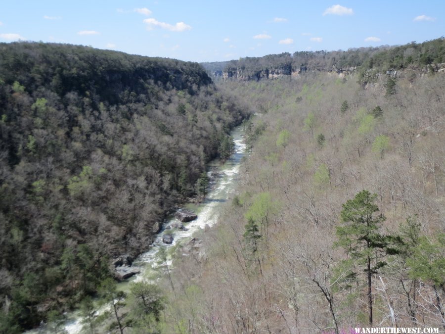
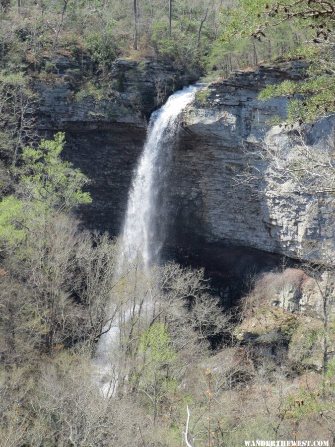
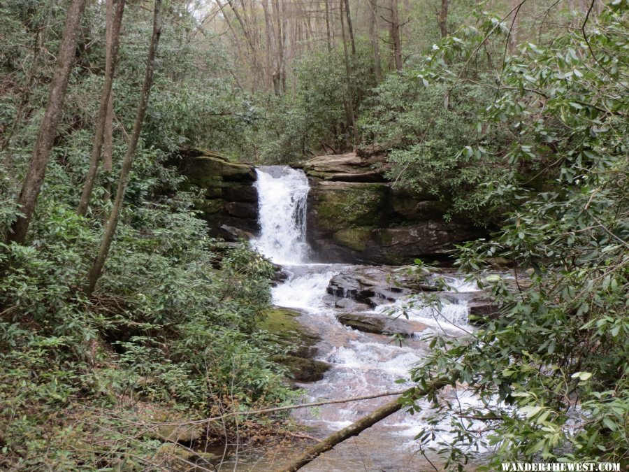
DeSoto SP in Alabama has one of the longest eastern rivers, Little River, whose course is only on a mountain top, Lookout Mtn.  DeSoto SP is next to the scenic Little River Canyon National Preserve which is operated by the National Park Service.   Fort Mtn SP has a good trail system and prehistoric Indian ruins.  Amicalola Falls SP has a long trail to access Springer Mtn and the AT as well as the tallest falls in Georgia.  Vogel SP is a quiet park near the AT.  We planned to return to day hike the AT from Brasstown Bald to Smokey Mtn NP next year before we left Georgia and before we looked at our pictures.  


  • 0

#2 clikrf8

clikrf8

    Senior Member

  • Members
  • 494 posts
  • LocationBellingham, WA

Posted 16 May 2014 - 02:23 PM

Some of the waterfalls in the Midwest are spectacular particularly with fall colors or spring flowers. What about poisonous snakes? Looking forward to your images.
  • 0
2008 Ford F250 diesel 4x4 off road pkg 2013 Hallmark Ute http://www.clikrf8images.com/ http://clikrf8.wordp...com/2010/09/01/

#3 Bosque Bill

Bosque Bill

    Senior Member

  • Members
  • 743 posts
  • LocationAlbuquerque, NM

Posted 18 May 2014 - 01:42 PM

Looking forward to your pictures.


  • 0

"I'm not an expert; I'm an enthusiast!" - New Mexico, U.S.A - The Land of Enchantment

http://bosquebill.blogspot.com My Travel Blog

http://www.bosquebill.com My New Mexico Website

2013 Toyota Tacoma Access Cab SR5 V6 4x4 - 2013 FWC Fleet


#4 iowahiker

iowahiker

    Senior Member

  • Members
  • 487 posts
  • Locationiowa

Posted 19 May 2014 - 01:57 PM

Section 2, Pictures


Sorry for the delay, but we used the last few nice days to cut, split, haul, and stack firewood for the next ice age after burning almost all my inventory this past winter.  Today we have rain, so...


Our first touring day was at Little River Canyon National Preserve just south of DeSoto SP in northeast Alabama.  This is the Little River Falls with a prime seasonal water flow.  The Little River is little in the summer with less than one tenth of this high season water flow.


gallery_5179_756_555660.jpg


Little River Canyon National Preserve has a scenic drive along the west rim to several views and this was are favorite canyon overlook:


gallery_5179_756_133441.jpg


Graces High Falls, shown here, goes completely dry during the summer and so the early spring is the best time to visit if you enjoy waterfalls in Little River Canyon.


gallery_5179_756_1714943.jpg


Early spring flowers were just emerging in early April and our favorites were these Dwarf Iris in DeSoto SP.  The large flowers (rhododendron, Mountain Laurel, and azalea) are weeks if not months away.  


gallery_5179_756_126015.jpg


We enjoyed hiking the trail system at Fort Mtn SP in northern Georgia but this summit view shows the difficulty of creating good East pictures with haze and ground clutter creating an uninspiring picture of the view north.


gallery_5179_756_491129.jpg


Amicalola Falls is over 700 feet tall with a board walk climbing beside and this view from the bottom.  The board walk is an official "approach trail" to the AT and so has blue blazes.  AT trail blazes are white over it's 2200 mile course.


gallery_5179_756_1010255.jpg


A cold night reduced the haze and morning light produced this better picture from near Blood Mtn on the AT looking south.


gallery_5179_756_578374.jpg


Besides reducing the haze, the cold night produced this large frost which reached 4 inches tall along the AT on Blood Mtn a few miles south of Vogel SP.


gallery_5179_756_194704.jpg


Less haze also greeted us at Cowrock Mtn above Tesnatee Gap on the AT looking south.


gallery_5179_756_1175688.jpg


We hiked the Raven Cliff Falls trail a few miles south of the AT which had numerous falls along the route.


gallery_5179_756_1934299.jpg


Reaching the beginning of the AT at Springer Mtn was a goal for the past 20 years and finally realized on this trip.  The white blaze beside the plaque is the first of thousands along the 2200 mile route.


gallery_5179_756_275547.jpg


The plaque text is more readable in this picture link.


2014 GA MTNS 73 AT SPRINGER MTN


The AT crosses numerous roads providing lots of access for day hikers in Georgia, less so in other regions.  Hogpen Gap was the only place to capture a white blaze and the camper.  We met the section hiker in this picture several times during our day hike.


gallery_5179_756_896103.jpg


These Yellow and Purple Trillium were the most common woodland flower along the AT in early to mid April.


2014 GA MTNS 81 AT HOGPEN GAP PURPLE TRILLIUM


2014 GA MTNS 80 AT HOGPEN GAP YELLOW TRILLIUM


And no trip report would be complete without this picture link given my icon:


2014 GA MTNS 24 FORT MTN SP SQUIRREL


If you explore the National Forest in northern Georgia then bring a good paper map, GPS, and know latitude and longitude.  The SP's warned us not to follow GPS voice directions because not all maintained NF roads are in GPS maps and there are no road signs :blink: in the NF.  We found maintained roads not on our detailed maps but taking a latitude and longitude reading when uncertain always got us to our destination.


Edited by iowahiker, 19 May 2014 - 05:01 PM.

  • 0


0 user(s) are reading this topic

0 members, 0 guests, 0 anonymous users