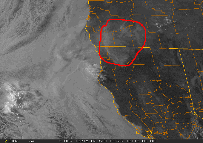
I wholeheartedly agree that for certain styles of outdoor travel and recreation, the "West is the best". Fire season adds another layer of complexity to travel planning. For that reason, and given that I must dedicate a full week to simply getting to and home from MT, ID, and WY, I always have a roughed-in "Plan B and Plan C" in the event of forest fire closures.
In late July 2000, we departed Rock Creek, MT for Missoula, turned in our (badly thrashed) Dodge Durango, and flew home. Two days later all of Rock Creek and much of the Lolo NF and Beaverhead-Deerlodge NF was closed to all camping and recreational use due to an extreme outbreak of fires. Had we been headed IN for our trip then, all of our plans would have had to change. By the way, we had NOTHING to do with the fires. Dry lightning storms had passed over a wide area during our final night at the Stony Creek cabin, and as we drove the final 35 miles out of the Canyon to I-90, we saw several smoke plumes along the ridges, choppers dipping water out of Rock Creek, and an army of firefighters headed up the canyon.
In that part of the West, there is a "sweet spot" roughly mid-June to mid- late July, when the rivers and streams have fallen back below peak runoff stage (so are more likely fordable and fishable) and before the annual fire problems are so widespread.
Foy


 , it was smoke all the way up and back on 395 and windy, hot and unconfortable everywhere
  ---and I forgot my camera so I couldn't record camping in the Red Flag zone
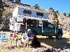
  ! Soup Springs is a horse camp and starting point for both backpacking and horse riding in the South Warners Wilderness area. I was surprised that it was not a bad place-I was the only camper for the last week and stayed on the side away from the corrals and those folks were okay--campers one side, horse people on the other. The camp is at 6700' in the lodgepole and aspens and is a good location if you want to back pack in and fish. I was originally heading up to Cave Lake (fishing was supposed to be great there) in the northern Warners, but I ran by the CG's in the South Warners just to check them out & found no one at Soup Springs so stayed, the horse folks arrived later with lot's of beer!. Planned to leave yesterday for the Cave Lake then over toward the Steens, then south, but my dog "Bob" got into something (dead rat??), got sick and crapped all over the inside of the FWC
  one midnight-(glad no camara ).Bob doesn't do those things and actually seemed embarassed by it all-I had to keep cleaning him up-his long hair no help, and yestertday he got better and ready to play, but boy, I couldn't get the FWC cleaned out so I'm home again to clean it up-in the smoke, wind and heat! Hope to leave soon again-with camera, but despite the bad weather it was not that bad at Soup Springs CG! Last night up there had lot's of thunder and lightning, and some rain-another reason to come home!
 !
!
 ! But where to go? I was thinking of meeting a buddy out near Austin early next week, but the red flag warnings are still about, so anyone have any ideas
  of where it's safe to run with out fighting fire----shark week will be over so got to find a place go with my clean and nice smelling FWC camper