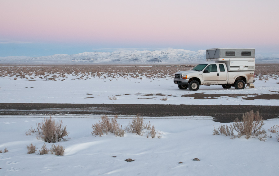
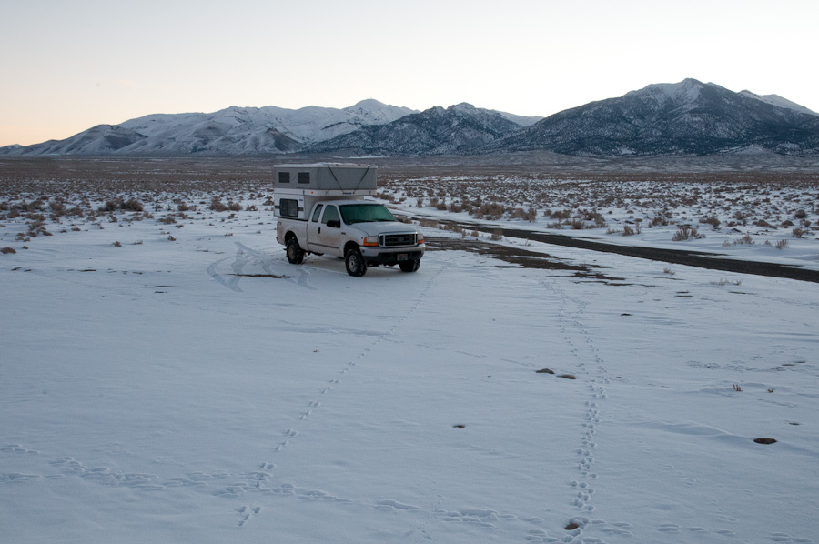
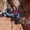
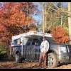
That night, Dec, 27, I made it as far as about 20 miles south of Battle Mountain/I-80 on the wonderful NV 305.  I pulled off 305 a couple hundred yards at a road that's access to a BLM area, "Mill Creek". I think I spent a night here before...last winter?
Dec. 28, 2012
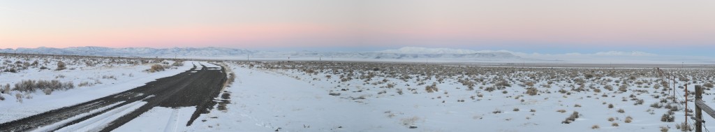
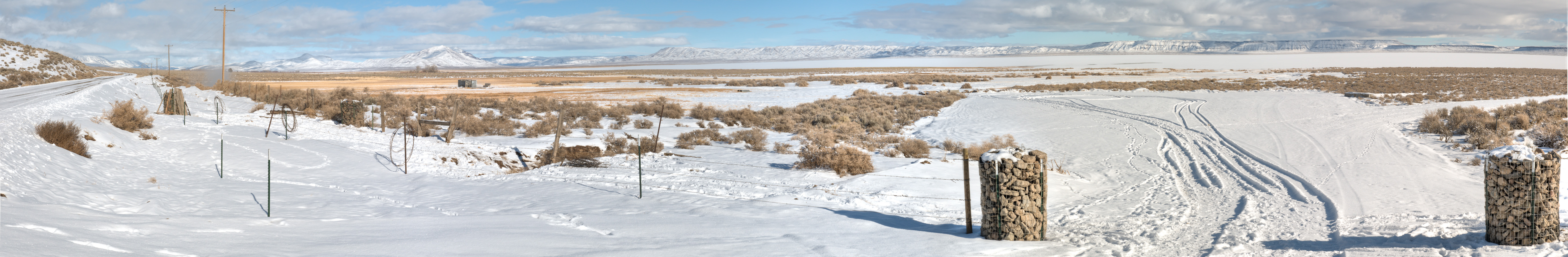
Full-size: Pano-03
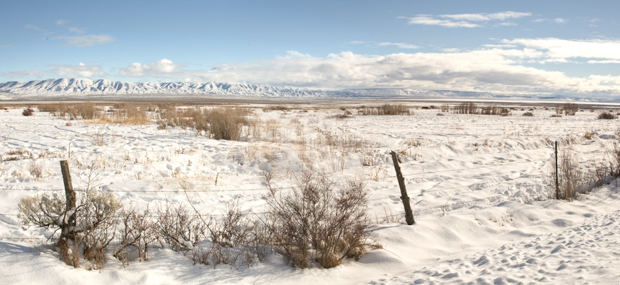
It was cold, of course, this morning...but since I waited so long to post this report I don't remember how cold. Nothing record-breaking (that would come much later in the trip!  ).
).
Even though this spot wasn't far from very-busy I-80 it looked like the middle of nowhere (well...except for the huge gold mine visible a few miles away, but it is Nevada, after all, so of course there's a mine!  ). But it was still close enough to I-80 that the Verizon 4G signal that traced the route of the interstate leaked over the hills. So...before heading off from that spot I took advantage of the very-broadband connection and did a Skype video call with Craggyman using my Android smartphone (with him on his Android tablet at his home in Bend) -- my first time to make use of this very-cool techno-marvel. I panned the phone around and showed him where I was camped. I love the wild outdoors...and I love technology, too -- and NO, there is no contradiction in that.
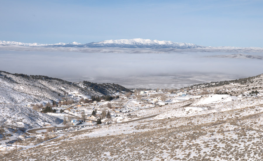
On down that wonderfully remote 305 to where it joins the "loneliest road in America" (that would be US 50) at Austin. I fueled the truck in Austin, and on east up the ridge...
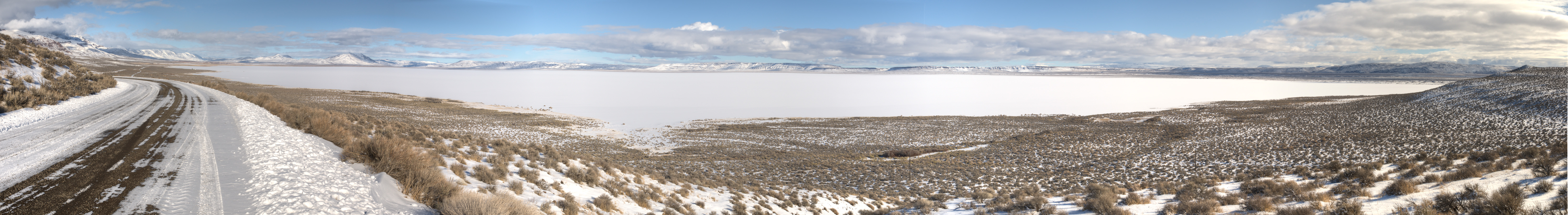
Looking back, down and west, at Austin, the fog-enshrouded Reese River Valley and the Shoshone Mts.:
After passing over the Toiyabe Range and dropping down into the Big Smoky Valley I considered stopping, maybe camping, at Spenser Hot Springs...even considered maybe crossing over the Toquima Range to the Monitor Valley (snowy-roads permitting, of course):
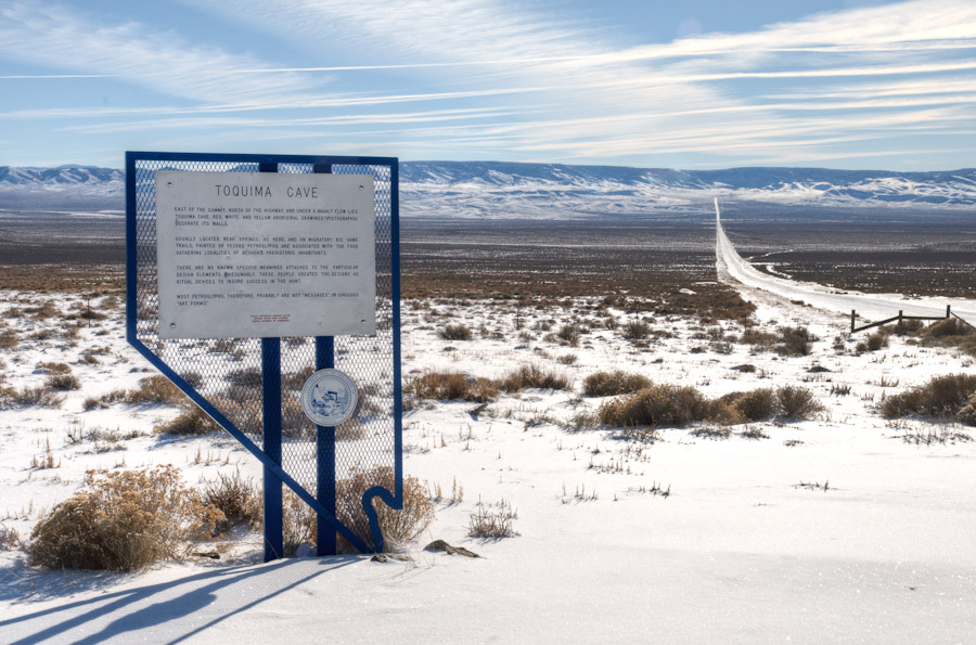
But I decided that my destination really was GBNP, and I really didn't need/want to take two nights to get there (why not? just 'cause), and it was still early-ish in the day so I continued east on "the loneliest road in America".
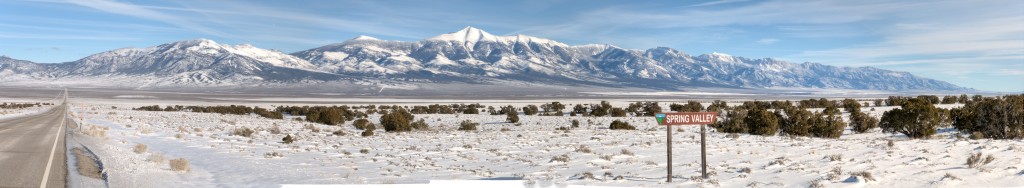
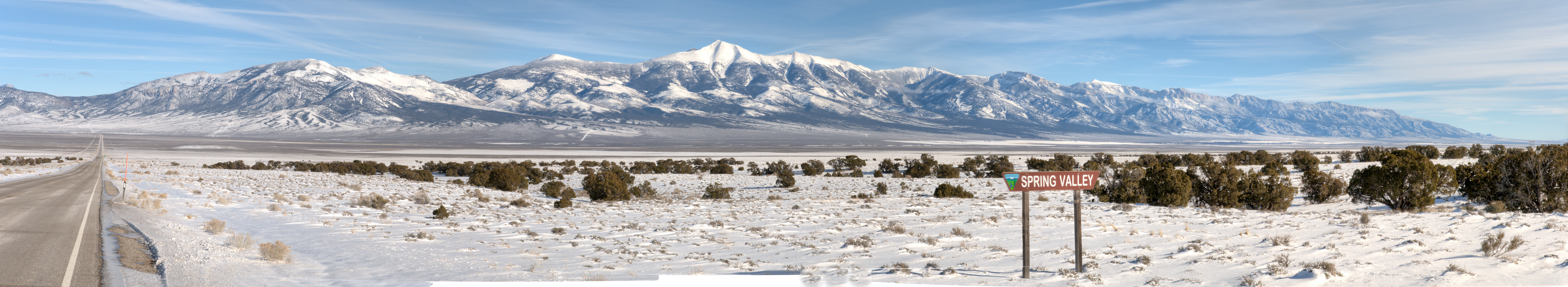
Refueled and got provisions in Ely, then over the Schell Creek Range to this familiar and wonderful view of the Snake Range, featuring 13,065 (or ,063 or ,064)-foot Wheeler Peak in Great Basin National Park.
Full-size: Pano-04
However...on the north side of US 50 the view was neither familiar nor wonderful. In what had been wide-open spaces of sagebrush, etc. there is now a wind-turbine power-generating farm:
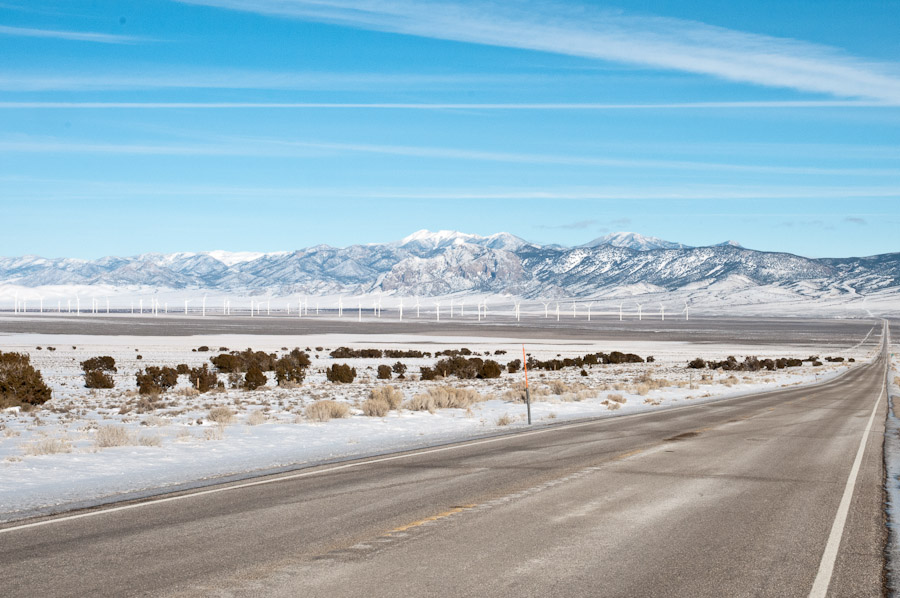
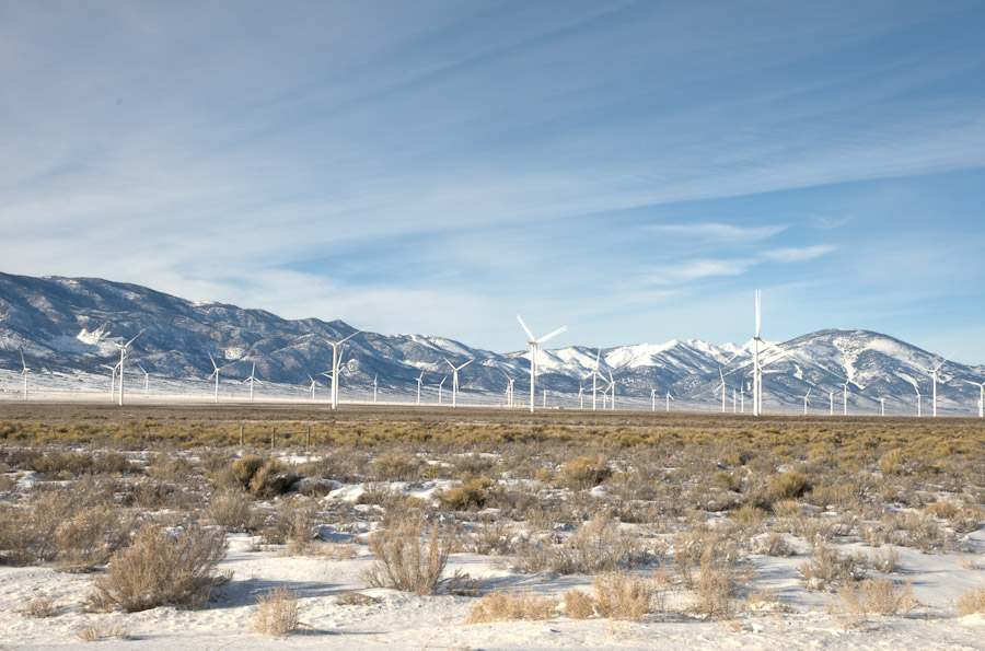
The last time I'd been through here was on my way home from my Utah trip in May of 2011, and these were not there at that time.
Now...I'm a bleeding heart liberal and environmentalist...so I haven't figured out how I can ethically argue against implementation of this renewable-energy-generating facility. But rationality aside, it still made me sad to see a wild area (no, not wilderness -- there are roads and cattle and mines in the area..but still...) become festooned with technology...the visual impact was what bothered me.
[and NO need to take up the argument for/against this in my trip report-- make your own thread if you feel argumentative...PLEASE]
So, shaken to my core (OK, not really shaken to my core ...but not full of joy, either  ) I continued north and east, over the Snake Range at Sacramento Pass and down the east side and south and then up (west) into Great Basin National Park.
I found Lower Lehman Creek Campground (the only c.g., open year round) empty -- ALL MINE!...as it frequently is this time of year. I set up my rig in good old site #11, my frequent (though not always) favorite 'cause it has a wide-open view of mountain to the west and desert to the east.


 )
)


