Jump to content


Photo
- - - - -

Ponderosa way/ peligreen jeep trail


  • Please log in to reply
8 replies to this topic

#1 john101477

john101477

    Advanced Member

  • Members
  • PipPipPip
  • 48 posts
  • LocationVina, Ca.

Posted 12 July 2010 - 10:05 AM

Hey folks, earlier this summer I led a group of guys from Sacramento and the bay area up Hogsback Rd Through the Peligreen Jeep trail and across the Ponderosa Way. We called it the Second Annual Northern Cal Off-Road Expedition. Reason being is that I guided the same trail last year in a more off-road than expedition manor but because we are trying to add new things to the trip and let people see the area in a broader outlook than just a place for beginning crawlers to gain experience we added the much longer trip out the Ponderosa into Cohassett and Chico.
This trip is best done around the memorial day weekend. less dust, more bugs. I can carry more bugs spray.

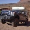
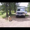
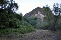
Our first night found us at the lower slab camp grounds in Ishi rd. in the Tehama Wildlife Area.
Posted Image
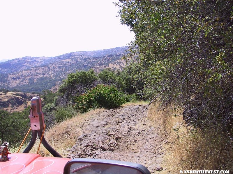
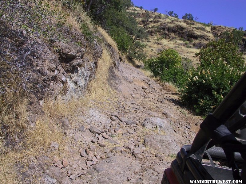
It was a pretty tough road to travel down from hogsback and I would not recommend it to long trucks or even stock trucks. Very steep in areas. far better to find the alternate route that comes in from the other side of the creek.

Posted Image
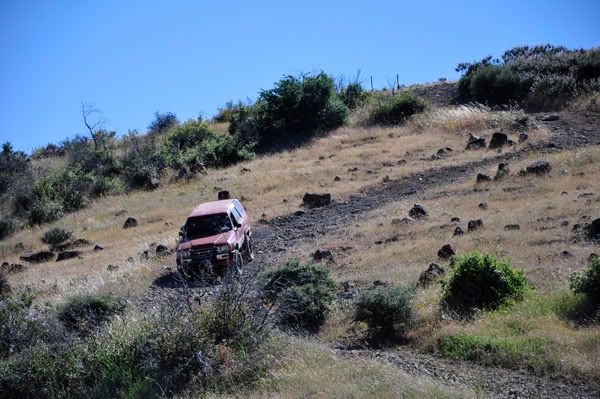
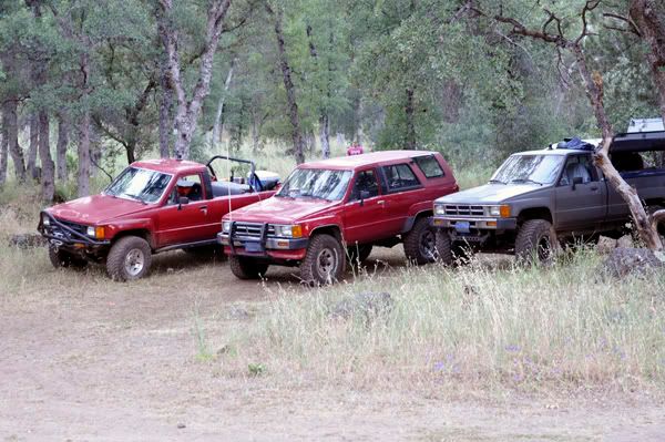
Our second day found us splitting up for mechanical issues. 2 trucks took the much longer but far easier road out for an overheating issue while 2 of us braved the Peligreen Jeep Trail. A very moderate trail with lots of loose rocky steep hills. Not the ideal place for guys worried about paint as there is a lot of brush. that night we stayed at Black Rock on mill creek along the ponderosa Way. our other drivers caught up for the night setting up for some good food and good company.

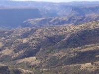
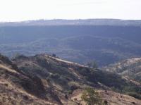
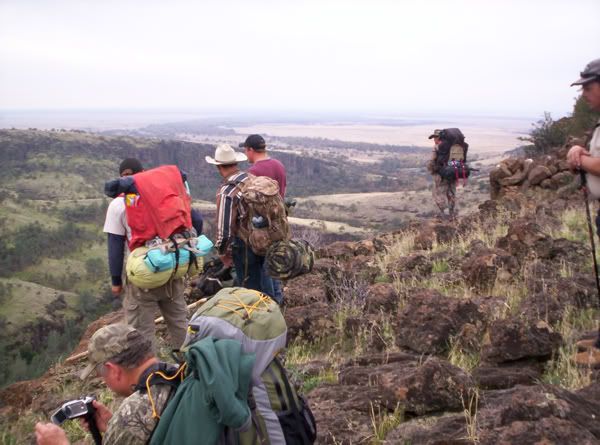
The next morning we hit the road again. The Ponderosa Way, Not exactly the hardest road but worth the slow drive. Quite a few trails cross paths through this section, The Lassen Trail and the Buena Vista/Moak trail both travel through here. I have hiked the Moak trail from Ponderosa Way to the Vina Plains roughly 27 miles give or take a mile. An amazing trip with lots of sentimental feeling for my family and I.
Posted Image

Anyways Sundays trip out was fairly easy stopping through out for a quick bite or various other reasons. We made it down to Chico Via the Cohassett Hwy.
  • 0
86 4runner Northern Cal Images northerncalimages.com

#2 Silvertip47

Silvertip47

    The Chair Bandit

  • Members
  • 478 posts
  • LocationBoise, Idaho

Posted 12 July 2010 - 12:42 PM

Nice!!! Interesting country. Was it a combined backpacking trip or do you guys just carry some serious day packs?!!!
  • 0
2011 F250 SCAB 6.2 gas 373 FX4 Lariat 4" Lift 35" Toyos 16.5 Warn Locked & Loaded 2007 SunLite

#3 HERR42

HERR42

    01110010110101

  • Members
  • 797 posts
  • LocationSacramento, Ca

Posted 12 July 2010 - 02:04 PM

wow i have been up there! are you familiar with kingsley cave?

is that the road that drops down.....just a bit west of finley lake/pond?

the lava up there is hell on tires. too easy to rip a sidewall.
  • 0
Jeff Herr WW6L '07 Hawk & '00 F250 SuperDuty CrewCab, Warn 12K, BFG AT KO 'E' rated, TransferFlow 48Gal tank

#4 john101477

john101477

    Advanced Member

  • Members
  • PipPipPip
  • 48 posts
  • LocationVina, Ca.

Posted 12 July 2010 - 03:32 PM

Nice!!! Interesting country. Was it a combined backpacking trip or do you guys just carry some serious day packs?!!!

The backpacking trip is a separate trip that we usually do as a family the weekend after thanksgiving. I only show it because I mentioned the trail above.picture shows a bunch of my cousins as well as my father and his brother

wow i have been up there! are you familiar with kingsley cave?

is that the road that drops down.....just a bit west of finley lake/pond?

the lava up there is hell on tires. too easy to rip a sidewall.

You know I have been all over those mountains as a kid with my dad and grand dad and even today spend quite a bit of time up there, but I have never been to any caves besides one when i was really young. have been trying to find it for about a year now to show my wife. You used to be able to drive right up to the cave and now I can not find it so been a little bummed about that.

Ishi rd is kind of a horse shoe loop that starts about a mile west of Finley Lake. As it is marked anyways. and the ways it is mapped and marked are different lol. They can all be determined by the crossings of antelope creek. the lower slab (lower ishi), middle slab (upper ishi), and then the three crossings above after the creek forks. Lower slab is at latitude 40°14'26.84"N longitude 121°57'59.73"W where as the middle crossing is Latitude 40°13'51.73"N Longitude 121°52'58.15"W . Then of course the three crossings on Ponderosa Way.

The lava is rough on tires. I generally air down up there and have been fortunate but my tires have an aggressive side wall as well. The lower slab rd (Lower ishi rd) and the peligreen are the worst for tires. luckily there are ways to go that are not nearly as bad for less aggressive tires, long vehicles, or fully stock 4wd that will get you to nearly the same places.

Jeff either you were out exploring or you are a hunter that got drawn for the wildlife area. good stuff.
  • 0
86 4runner Northern Cal Images northerncalimages.com

#5 HERR42

HERR42

    01110010110101

  • Members
  • 797 posts
  • LocationSacramento, Ca

Posted 12 July 2010 - 06:00 PM

i got into the ishi story and began to research the area.

man its hot up there.....those slab crossing are such a blessing on a hot day.

i towed a friends jeep from sac, out the hogback and stopped at the "road" west of finley.
took the jeep down to to wildhorse corral. by the time we got there we were beat! and then we had to come back!

the cave is within a mile of wild horse corral.

i have never made it.

big massacre there back in 18?? ... those whites sure were a bunch of killin racists back then.

this guy thinks he was there but....he has made a mistake. http://rogerwmanderson.com/


heres a shot of the road in front and a shot looking back from whence we came.... no explanation needed.
Posted Image
Posted Image
that light rock in the middle of the road was pretty nicked up .. on the end facing up hill.
i am surprised to see no evidence of old oil spills.
  • 0
Jeff Herr WW6L '07 Hawk & '00 F250 SuperDuty CrewCab, Warn 12K, BFG AT KO 'E' rated, TransferFlow 48Gal tank

#6 john101477

john101477

    Advanced Member

  • Members
  • PipPipPip
  • 48 posts
  • LocationVina, Ca.

Posted 12 July 2010 - 08:28 PM

hahaha yeah that guy is WAYYYY off. I dug into the bit about the Pinery. based on the images he was no where near the pinery because the pinery is near flat and filled with pines hence the name. it also has a couple of cabins on it one of which is called the bowden cabin. not to mention the pinery is not part of the wilderness area and is 100% privately owned buy friends of ours lol. I think he is the same guy that posted pictures claiming to be on the moak trail that was 4 miles the other way lol. Looks like this guy is fond of going out ill prepared after reading some of his stories. I am trying to gind a detailed map of the area as I type here as I think I know where the "cave" is. down near the apperson cabin (now just a pile of rocks that once was an oven) in the bottom of deer creek. If I am not wrong I seem to recall seeing Kingsly cove on a map in that area (north west side of the big red bluff)
I spent 16 years in that canyon hunting all the way up just below the state game refuge. When I place images on Google Earth I am very precise about where I put them as it helps me to relive my child hood through out the year lol.


hahaha nice pictures. that is most definitely the lower slab road lol
How long ago where you there? We went two weekends after memorial day.
  • 0
86 4runner Northern Cal Images northerncalimages.com

#7 john101477

john101477

    Advanced Member

  • Members
  • PipPipPip
  • 48 posts
  • LocationVina, Ca.

Posted 12 July 2010 - 08:42 PM

awe come on man you didn't take the full size down? lol i do not blame you at all.

Attached Thumbnails

  • _DSC0104.jpg

  • 0
86 4runner Northern Cal Images northerncalimages.com

#8 HERR42

HERR42

    01110010110101

  • Members
  • 797 posts
  • LocationSacramento, Ca

Posted 12 July 2010 - 09:38 PM

that was 2003

ugh

its been too long, need to go again and get all the way in there.

there is another guy that made it in and the pics prove it. i have all the research stuff baumhoff did in '53....his paper.

i know where it is and i know a route to it.

it just takes getting as close as possible, parking at the fence line and hoofing it down. i have to watch every footfall in that lava....makes for slow going.
maybe one of these days. i wouldnt go in june july or august .... too hot
  • 0
Jeff Herr WW6L '07 Hawk & '00 F250 SuperDuty CrewCab, Warn 12K, BFG AT KO 'E' rated, TransferFlow 48Gal tank

#9 john101477

john101477

    Advanced Member

  • Members
  • PipPipPip
  • 48 posts
  • LocationVina, Ca.

Posted 13 July 2010 - 12:24 AM

Yeah you gotta be careful of the Ishi documents that you read many were given to false information as far as locations go to keep others out what they found may be real just locations are changed. If you ever get a chance to get into the bottom of deer creek there is still a lot of info waiting to be found. Luckily on the deer creek side all the roads on the northern side are private and have kept people out of some of the richest of it. dense brush and lack of area knowledge have kept the other half out.

If your ever in that area and happen to find an apple tree, stop and take a look around, it is worth it. Getting their is the hard part. land locked from the western side and a heck of a walk from the eastern side.

It is a Big canyon as you can see from the first image. If you have done a lot of reading on Ishi the second image might ring a bell based on some descriptions that where given in a few books.

Attached Thumbnails

  • hunting and hike031.jpg
  • hunting and hike046.jpg

  • 0
86 4runner Northern Cal Images northerncalimages.com


0 user(s) are reading this topic

0 members, 0 guests, 0 anonymous users