Jump to content


Photo
- - - - -

Black Friday Traverse of Sheldon National Wildlife Refuge -- in My Honda Civic


  • Please log in to reply
15 replies to this topic

#1 MarkBC

MarkBC

    The Weatherman

  • Site Team
  • 6,608 posts
  • LocationBend, Oregon

Posted 27 November 2011 - 03:04 AM

After spending a couple of days visiting my family in the Redding, CA, area for Thanksgiving, I was ready to leave. I wanted to take a drive on the way home rather than just head up I5 and 97 straight home. I longed for the freedom of of being "out there" doing exactly what I wanted -- even if just for a long day or two, after spending a couple of family-occupied days not always doing exactly what I wanted. And since I was driving my Honda Civic sedan and getting almost 40 mpg it wouldn't be too expensive to do some recreational driving.
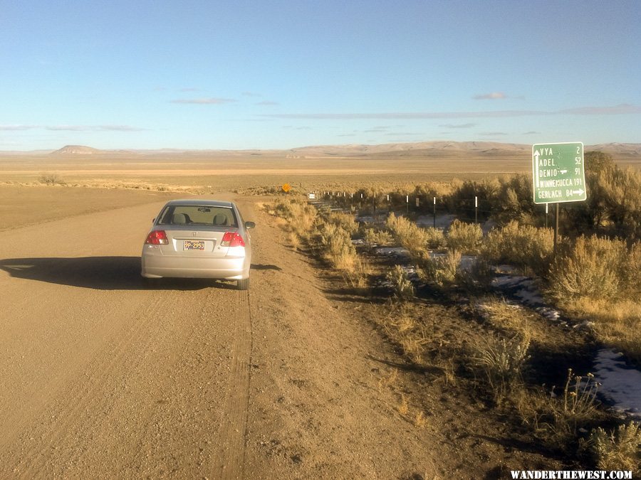
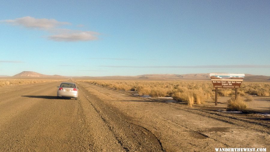
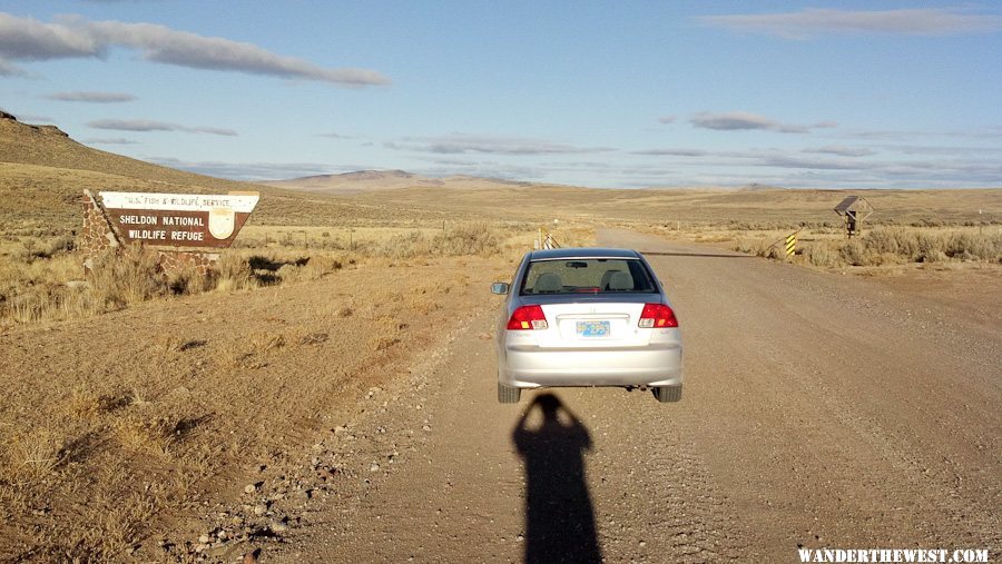
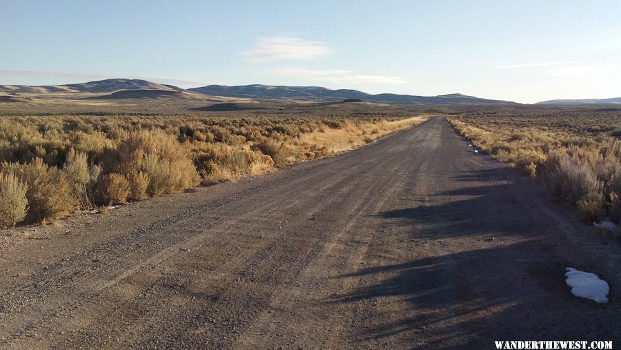
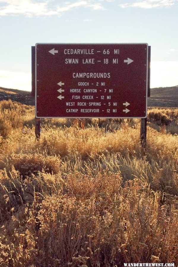
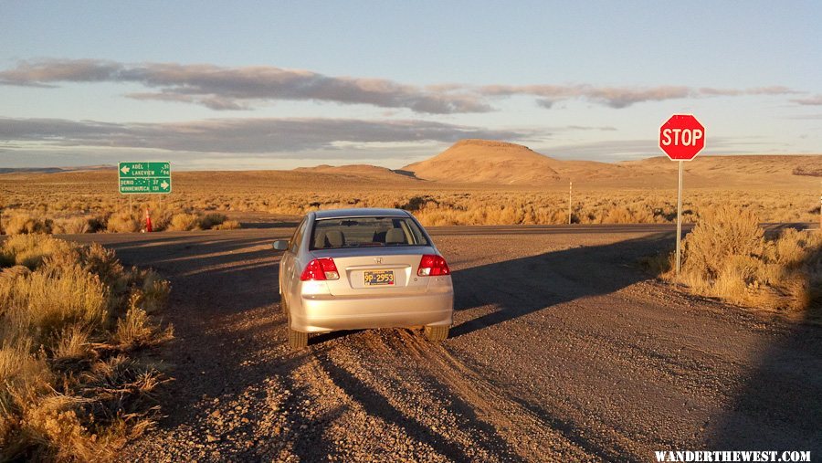
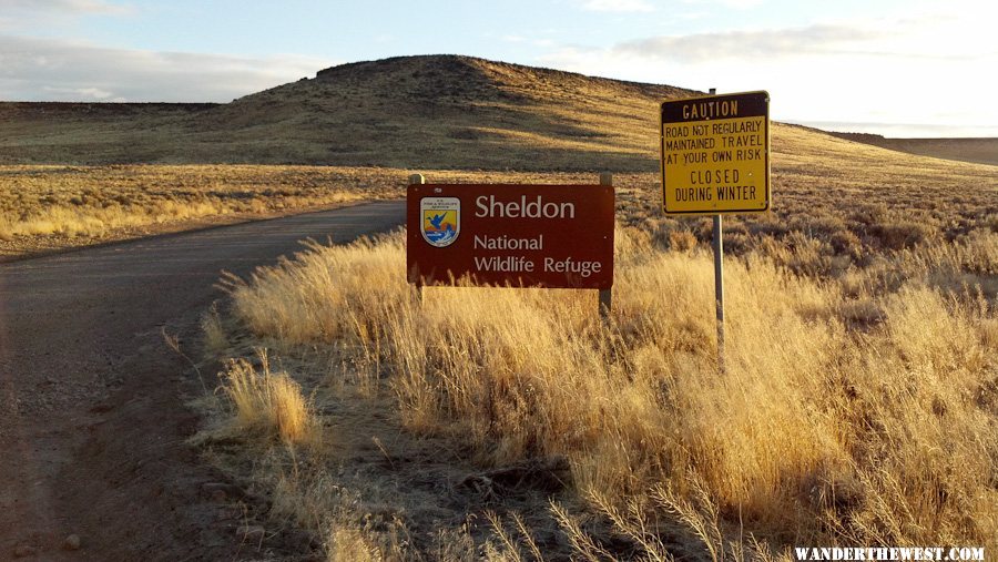
I decided to start by driving up CA 299 to Alturas. That drive along 299 was very nice in itself, and I could have just gone north on 395 to Lakeview and then on to Bend...but I wanted more -- something a little less familiar. So I crossed over the Warners to Cedarville, still not certain where I'd go from there. There were 3 options: North, East or South -- I chose east, continuing on CA 299 which become Washoe County 34 where it enters Nevada.
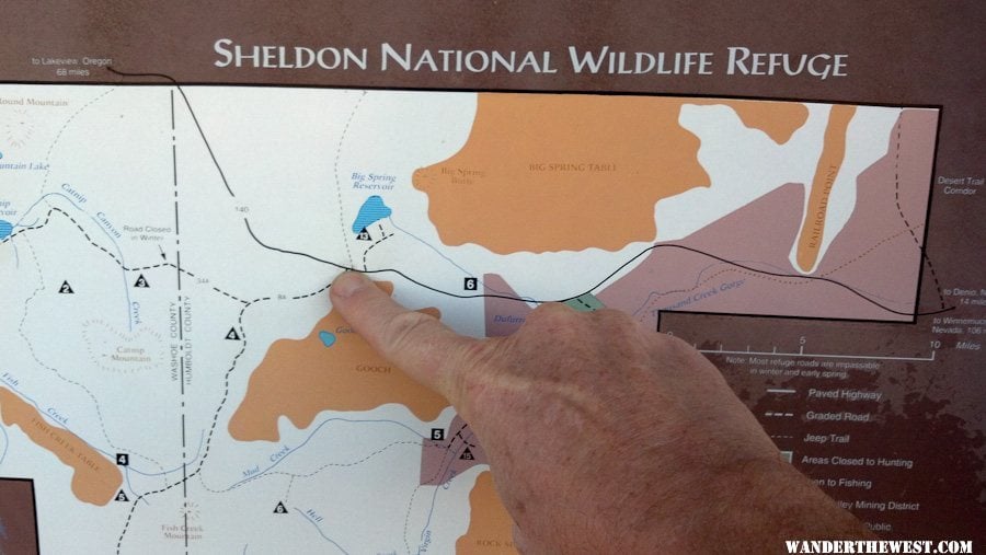
Here's my route (blue is unpaved):

Route.jpg

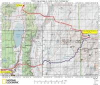
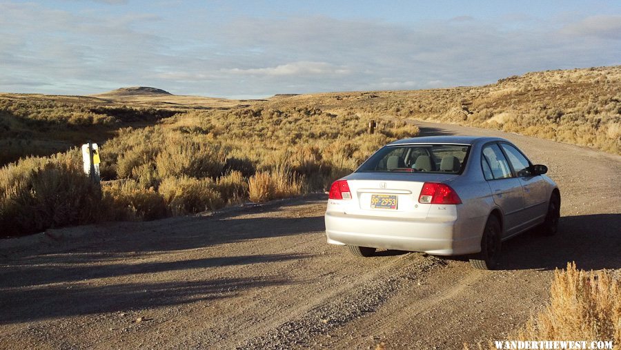
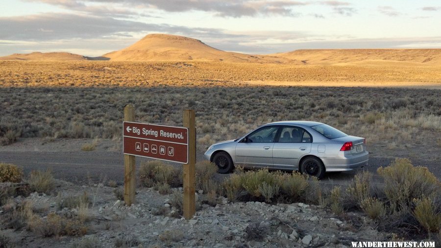
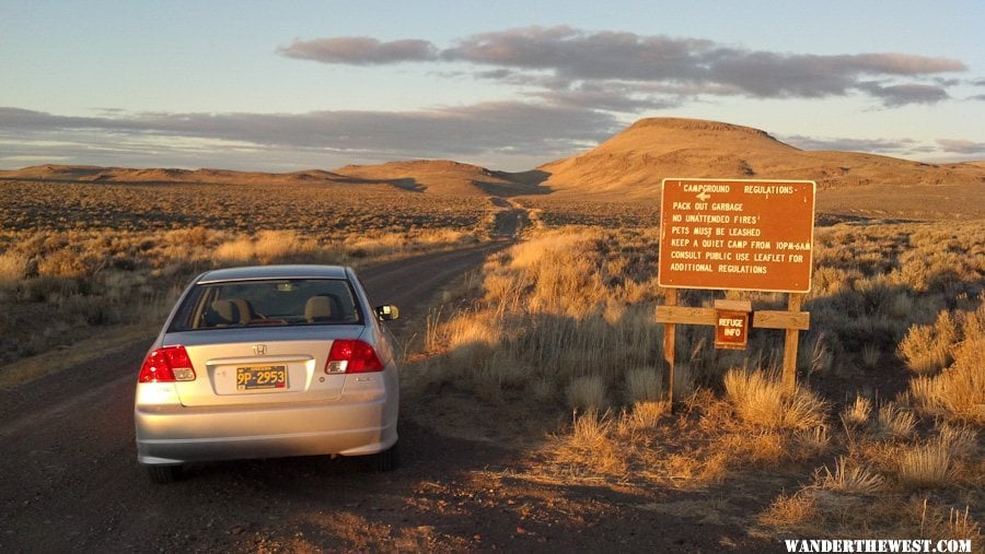
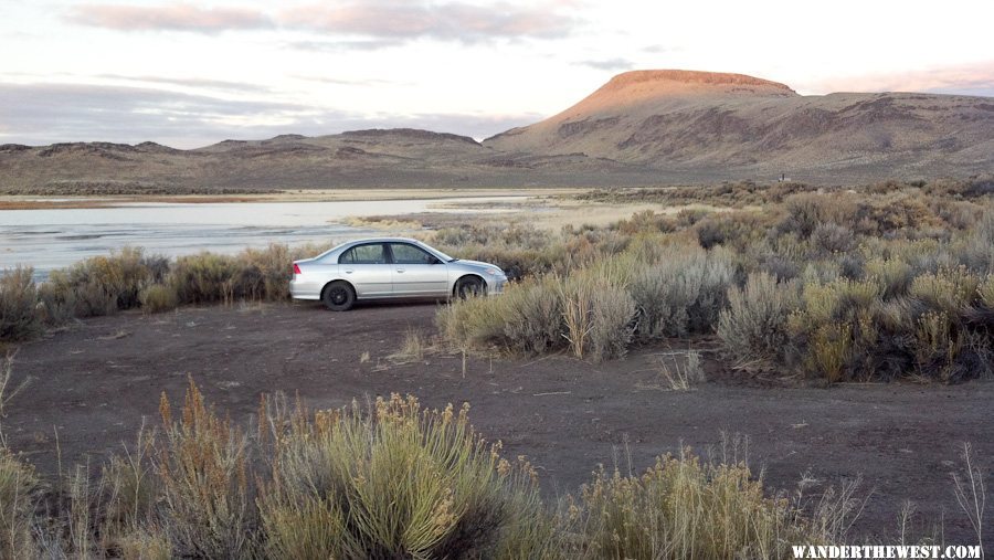
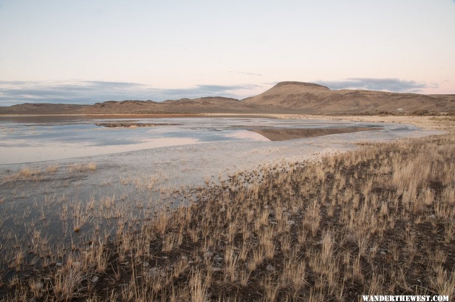
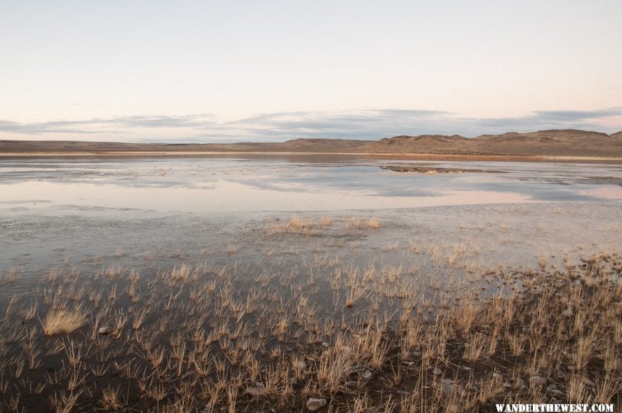
I could see on the hills to the east across the Surprise Valley that there was little/no snow, and I'd actually taken the same route a couple of years previous -- in the same car -- so I knew that it was very-drivable by car as long as there was no snow or mud. Still...I bet that the typical vehicle to take this route is not a Honda Civic sedan. Posted Image
Interestingly, this is the same route that those foolish Stolpas took some years ago and didn't do so well (with the feet amputation and all)...but they were driving in snow in December.
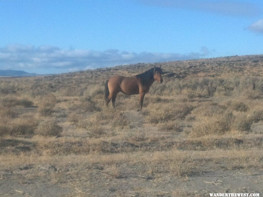
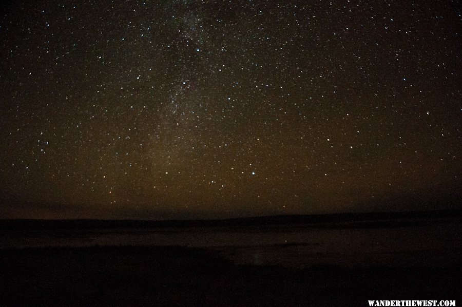
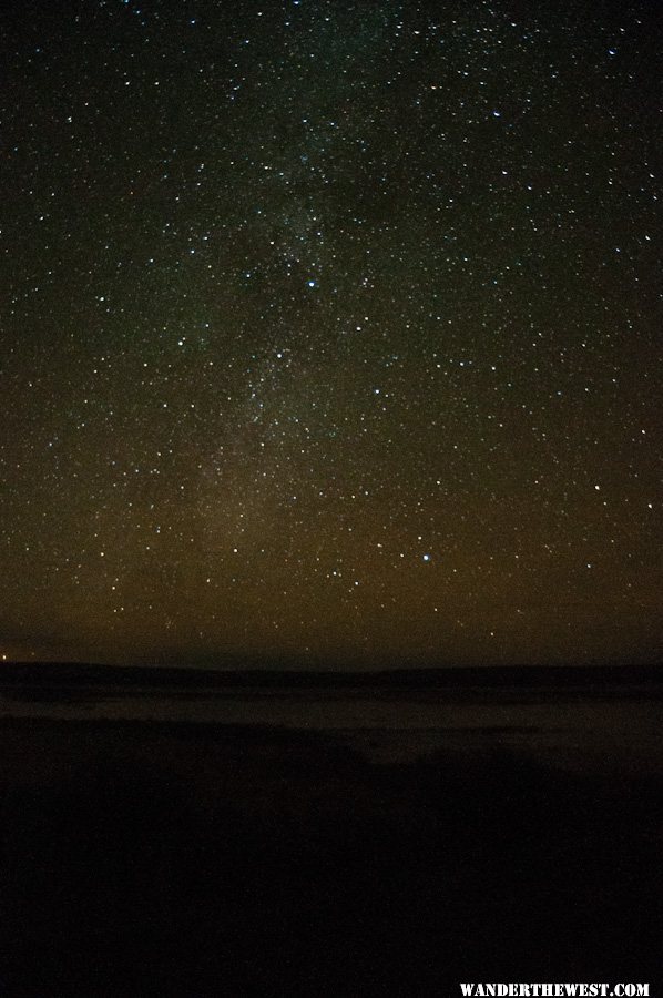
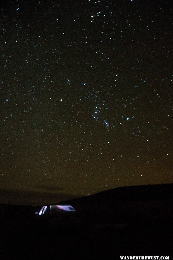
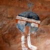
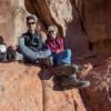
(photos to follow)
  • 0

FWC Hawk (2005) on a Ford F250 Supercab, 6.8L V10 gas (2000)


#2 MarkBC

MarkBC

    The Weatherman

  • Site Team
  • 6,608 posts
  • LocationBend, Oregon

Posted 27 November 2011 - 04:11 AM

These photos are mostly just documenting my drive...nothing that spectacular, but I love the wide-open wild emptiness of the area.
One unusual thing for me was that I took all of these photos with my new Droid Bionic smartphone (except the night shots at the end, which I took with my real camera -- Nikon D300S). I'm pretty happy with the Bionic's camera, though it doesn't do so well when digitally "zoomed in" (such as the kinda fuzzy shot of the horse, below...or maybe the lens was just smudged). I don't plan to use the phone-camera for more than the most casual snapshots, but it worked OK for this duty.

Before I'd quite left the Surprise Valley, but after I'd crossed into Nevada and the pavement ended, 3 wild (well, feral, actually) horses crossed the road very casually. Surprising because some of these horses are very spooky and run at any sight of humans.

Posted Image

After crossing over the hills that make the eastern border of the Surprise Valley, the road (Washoe 34 at this point) goes south to the Black Rock or north towards the Oregon border. I turned left, north, and then a couple miles north turned right, east, on road 8A which continues mostly northeast to NV 140, about 45 miles away.
Posted Image

Passing by/through the northern edge of the BLM-designated Black Rock/High Rock region:
Posted Image

Entering Sheldon National Wildlife Refuge:
Posted Image

Posted Image

Here's at least one private inholding -- 40 acres with a 565-foot-deep well available if you want you own little piece of heaven:
Posted Image

Looking back the way I came...I love the emptiness and solitude. I saw no one for 50 miles.
Posted Image

At Fish Spring campground. Piles of wire and posts accumulated by a "fence pull" (barb wire removal)....somebody needs to haul that mess off.
Posted Image
  • 0

FWC Hawk (2005) on a Ford F250 Supercab, 6.8L V10 gas (2000)


#3 MarkBC

MarkBC

    The Weatherman

  • Site Team
  • 6,608 posts
  • LocationBend, Oregon

Posted 27 November 2011 - 04:12 AM

Nearing the end of my route, looking back at sign of where I'd come from:
Posted Image

Back to pavement, NV 140:
Posted Image

I are here:
Posted Image

Notice the warning for those heading south back the way I'd come:
Posted Image
  • 0

FWC Hawk (2005) on a Ford F250 Supercab, 6.8L V10 gas (2000)


#4 MarkBC

MarkBC

    The Weatherman

  • Site Team
  • 6,608 posts
  • LocationBend, Oregon

Posted 27 November 2011 - 04:21 AM

Reaching 140 I drove less than a mile east then turned off, north, to Big Spring Reservoir Campground (a BLM c.g.). It's about 2 miles off the highway. The high-point in the background is Big Spring Butte.
Posted Image

Entering the campground area:
Posted Image

The campground has a pit toilet and some brush-free areas to camp, but no other facilities:
Posted Image
There was nobody else around.

Posted Image

Posted Image

As twilight came I shot a couple of panoramas of the view (to be posted later -- I haven't worked them up yet). The sounds of waterbirds -- their calls and their splashing -- carried across the water, though they weren't that close.
  • 0

FWC Hawk (2005) on a Ford F250 Supercab, 6.8L V10 gas (2000)


#5 MarkBC

MarkBC

    The Weatherman

  • Site Team
  • 6,608 posts
  • LocationBend, Oregon

Posted 27 November 2011 - 04:44 AM

When I left Bend to visit my folks I brought some warm clothes/hat/gloves for "just-in-case", but I didn't bring a sleeping bag or other camping equipment.
So when I went through Alturas I bought a few food items that didn't require cooking, and I bought a $37 sleeping bag.
I was looking forward to getting up the next morning and shooting some dawn photos, then heading east and north up to Fields, Oregon (south end of the Alvord Basin) for breakfast.
After "dinner" it was only 6:30pm, but I figured I might as well go to sleep. So I took an OTC sleeping aid, reclined the passenger seat as far as it would go...zipped up in the sleeping bag (the zipper of which was already failing on it's first use) and soon fell asleep.
After a couple hours of sleep I woke up, around 9pm and stepped outside for, you know. I got back in the bag and I couldn't get the zipper to zip up at all. Posted Image Oh well...I wasn't cold.
But I wasn't comfortable, either. 9pm meant that it would be 9+ hours before it would even start to get light...and I was feeling that I might be spending much of it awake.

So I decided to bag the camping and drive home, even though it would be wee hours of morning before I got home.
Before I did that I took some photos (with my Nikon) of the fabulous sky. Looking north at stars over the reservoir:
Posted Image

A bit of the Milky Way over the reservoir:
Posted Image

Looking east towards Orion and my car (which was running, warming up so I could make my get-away):
Posted Image

I took a caffeine tablet and drove off, listening to my liveliest music -- hardcore new wave/punk -- to help me stay awake for the 4-5 hour drive home. It was kinda weird driving home over a route that I know very well, but was completely anonymous since all I could really see was the road.
I got home at 2:30 am this morning and went to sleep in a real bed. Posted Image

It was a fun detour!
  • 0

FWC Hawk (2005) on a Ford F250 Supercab, 6.8L V10 gas (2000)


#6 Foy

Foy

    Resident Geologist

  • Members
  • 1,295 posts
  • LocationRaleigh, NC

Posted 28 November 2011 - 07:28 PM

Mark,

As soon as I saw "Sheldon" in the thread title, I thought "Stolpa". Sure enough, you traversed the "Stolpas' Toes Memorial Parkway". As best I can determine, the Fish Creek campground you pictured is where they made their last wrong turn--they turned south/southeast there, away from 8A,and dropped into the upper Hell Creek basin, went around 10 more miles, and then found the cave (which I believe was at about 6,000', so not too cozy).

Nice pics from the smartphone. That northern 1/3 of Nevada, from UT to CA, is some pretty wild, remote "wandering" territory, isn't it? One of these days...........

Foy
  • 0

#7 Dughlas Stiubhart

Dughlas Stiubhart

    It's good to be Stew

  • Members
  • 1,474 posts
  • LocationSE CO

Posted 28 November 2011 - 10:18 PM

What is amazing about the Stolpas was they managed to get on the wrong road, get trapped and very lost before everybody had a GPS in the car to point the way to disaster. If I recall, they even had a paper map!

Thanks for the photos, Mark. I love that country up there East of the three Saline Lakes!
  • 0

Stew


2007 Custom All Terrain Camper Panther Shell on 2012 Toyota Tundra 4x4 in SE CO


#8 Lighthawk

Lighthawk

    Weekend warrior

  • Members
  • 3,320 posts
  • LocationNevada City, CA

Posted 28 November 2011 - 11:05 PM

Nice route, Mark. Good way to turn a family holiday into a bit of wandering.
Next time we're in Cedarville, I'll be tempted to head out east into the big wide open.

Don't get me wrong. Somehow, following the Stolpas doesn't seem like such a good idea.
I know, I know, they drove in December! ;) And in the snow! ;)

Great night shots too. Susan and I have been admiring the stars on our Thanksgiving desert journey (to be chronicled soon) too. But I was too lazy to get out of the hot springs and set up tripod!
  • 0

2021 RAM 3500 Crew 4x4, 6.4 hemi/8 speed trans with 4.10 gears, Timber Grove bags, Falken Wildpeak 35" tires.

OEV Aluma 6.75 flatbed, Bundutec Odyssey camper on order for 2024

For this year we're still using our 2008 FWC Hawk with victron DC-DC charger, 130w solar, MPPT controler

with 2000w inverter and external 120v output and 12v solar input with 100w portable solar.   http://lighthawkphoto.com


#9 MarkBC

MarkBC

    The Weatherman

  • Site Team
  • 6,608 posts
  • LocationBend, Oregon

Posted 29 November 2011 - 03:10 AM

RE: The Stolpa Connection

Foy: I first traveled through, camped, in the Sheldon area a few years before the Stolpas, back in my Toyota-Tacoma-with-canopy days. In fact, when I heard about their "experience" (I think it was via the movie) I wondered exactly where they were 'cause I'd never heard of "Hell Creek". Posted Image I thought that the made-for-TV movie had just made up the name for dramatic effect. Posted Image

Stew: Yeah, the Stolpa journey sounds very-much like one that would have been inspired by GPS mis-guidance...but as you said, NO -- this was good old-fashion human decision-making! Posted Image

Lighthawk: Yeah, you should explore this region of the really-high desert of NW NV...maybe if/when you visit the Black Rock region, not far to the south.


One little episode I forgot to describe -- the only encounter I had with people on this drive:
Just after I got to the edge of this region, just east of the Surprise Valley, just past this sign:
Posted Image
I pulled over to the side of the road to look at my Michelin Road Atlas (I recommend it!).
A pickup came down the road from behind me and pulled up next me. A guy with bad teeth leaned out of the passenger window and looked down at me in my little car:
"Do you know where you're going?", he asked. He had the aspect of a local.
"Yep, Denio", I answered confidently. "The road looks dry."
"There's a lot of empty between here and 140", he said, looking skeptically at me and my car.
"I know...I've been through here before. If I hit any mud I'll turn back." And I gave him the thumbs up sign.
He seemed satisfied that I wasn't going to re-enact the Stolpa experience, so he waved and drove on.
  • 0

FWC Hawk (2005) on a Ford F250 Supercab, 6.8L V10 gas (2000)


#10 ski3pin

ski3pin

    Belay On

  • Site Team
  • 15,396 posts
  • LocationSierra Nevada Range

Posted 30 November 2011 - 04:30 AM

Mr. BC, thanks for letting us tag along on your holiday adventure. We are so lucky we have places we can just disappear into when we get the urge!

Would you like to share some of the suspension mods on your civic? :rolleyes:
  • 0

2003 Ford Ranger FX4 Level II 2013 ATC Bobcat SE "And in the end, it's not the years in your life that count. It's the life in your years."- Abraham Lincoln  http://ski3pin.blogspot.com/


1 user(s) are reading this topic

0 members, 1 guests, 0 anonymous users