Jump to content


Photo
- - - - -

March 2013 CA-NV-OR Loop of MarkBC


  • Please log in to reply
39 replies to this topic

#1 MarkBC

MarkBC

    The Weatherman

  • Site Team
  • 6,607 posts
  • LocationBend, Oregon

Posted 07 April 2013 - 04:52 AM

The route I took for this 3-state loop -- through northeast California, northwest Nevada, southeast Oregon -- turned out to be a little different than I'd originally planned, but mostly the same.
(craig333 would follow much of this same route -- but in the opposite direction -- a couple of days after I did)

2013-March_Eagle-Black-Alvord_Route.jpg

To be continued: OK...I've finally edited and uploaded photos to my server, but now realize that I'm too tired tonight to write the narrative that links them into a proper "report". Then why even start the report? Good intentions!...but ran out of steam. Tomorrow morning for sure! Posted Image Posted Image
  • 0

FWC Hawk (2005) on a Ford F250 Supercab, 6.8L V10 gas (2000)


#2 LuckyDan

LuckyDan

    Senior Member

  • Members
  • 644 posts
  • LocationBased in Eastern, NOW CENTRAL Oregon

Posted 07 April 2013 - 06:02 AM

As a public service to bring a bit of decorum:

“Every eye fixed itself upon him; with parted lips and bated breath the audience hung upon his words, taking no note of time, rapt in the ghastly fascinations of the tale”.

Mark Twain; Tom Sawyer

For the practical wanderer:

"Please carry on, my curiosity has piqued"

James Coburn; from where exactly I don't remember
  • 0

Old, bum around in Ford and an even older FWC Grandby

New Mantra: "Everyday camping is just making up for lost time"


#3 Jamesiam

Jamesiam

    Senior Member

  • Members
  • 237 posts
  • LocationStateline Nevada

Posted 07 April 2013 - 02:52 PM

I noticed on the 3rd and 4th night you camped near King Lear. That has been on my peak to climb list for years!
  • 0

#4 Smokecreek1

Smokecreek1

    Smokecreek1

  • Members
  • 2,767 posts
  • LocationNE Calif/NW Nev

Posted 07 April 2013 - 03:52 PM

:lol:
We are waiting with baited breath-especially "Bob" to see some pictures of his handsome self!

Smoke
  • 0
Smokecreek1:99F1504x4with05Granby

#5 imcolej

imcolej

    Advanced Member

  • Members
  • PipPipPip
  • 64 posts
  • LocationBend, Oregon

Posted 07 April 2013 - 04:10 PM

Ok, its "tomorrow morning". We are ready to see an epic trip report! :)
  • 0
2006 Toyota Tundra Double Cab 4x4
2013 Hawk Shell

#6 MarkBC

MarkBC

    The Weatherman

  • Site Team
  • 6,607 posts
  • LocationBend, Oregon

Posted 07 April 2013 - 04:14 PM

I'm familiar with the area I traveled on this trip -- the high desert, Great Basin, zone that surrounds the junction of these three states (I've been to the point where CA and NV and OR meet -- there's a monument). I've visited some parts of this zone many times. However, thanks to a suggestion by Smokecreek1, the first third of this trip followed many miles of new-to-me roads, both paved and dirt, and led me to a couple of new camp spots. And that's a good thing! :)
(especially when the new doesn't have unpleasant downsides, like getting lost or getting stuck).

Friday, March 22

My first destination was Eagle Lake in northwest California, north of Susanville, suggested by Smokecreek1 to join him there at his regular spot -- Rocky Point on the northwest side of the lake.
To get to Eagle Lake I took CA 139 -- and south of Lava Beds National Monument this road was all new to me. (Interestingly, whenever I've asked map-routing software for a route from my place in Bend, Oregon, to the eastern Sierra it always includes 139 to get to Susanville...but I've always taken a more-eastern route through Lakeview and 395). Smokecreek1 suggested I take the Lookout cutoff as a shortcut, which I did -- scenic and probably quicker. I didn't take any photos of my route to Eagle Lake...but if I hadn't already been a couple of hours "late" leaving Bend and meeting Smoke I would have dawdled along the way and shot pics.

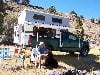
Our spot at the BLM primitive campground (pit toilets are the only "improvement") at the boat launch at Rock Point:

Posted Image

Posted Image
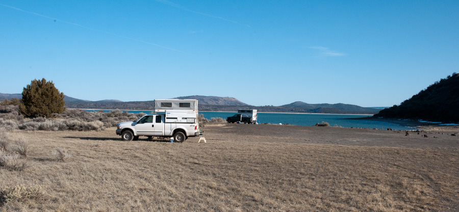
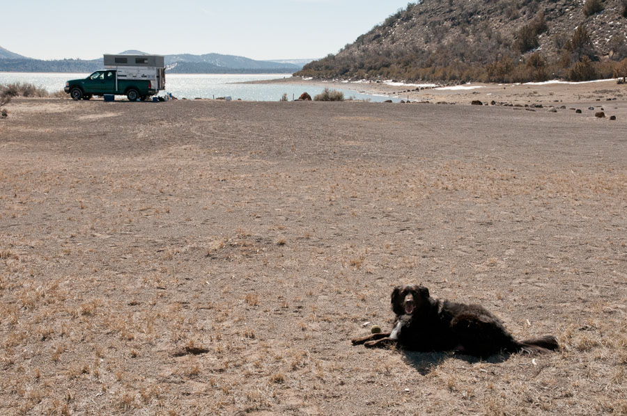
Bob, the rattlesnake-bite-death-defying wonder dog!

Saturday, March 23
This spot on Eagle Lake was pleasant enough...but I was in wandering mode on this trip, so after one night camped with Smoke and Bob it was time for me to mosey.

WARNING-DISCLAIMER: Though it's late March on this trip...that's NOT spring in the high desert, nothing had greened out, and for those who appreciate green vegetation this area may have been at its least attractive -- mostly brown and/or leafless. But I like it anyway. :)

_DSC8651.jpg
The area around Eagle Lake is high-desert around the north and northeast side, pine forest around most of the rest of it. When I left Rocky Point I drove down the west side as far as I could, into the forested area, but the road is closed after a few miles by winter snow.
So, back on down CA 139 towards Susanville, stopping at the NE side of the Lake to shoot a panorama (the first of many on this trip). This is a little thumbnail, followed by a link to the full-size version:
Posted Image
A link to the full-size version:
Pano 1
Like all of the full-size panoramas in this report, when it opens in a new browser window "full-size" should be 600 pixels high, so make it so, and to see the whole width you'll scroll back and forth.

I'd like to visit the snow-inaccessible parts of Eagle Lake -- another time.

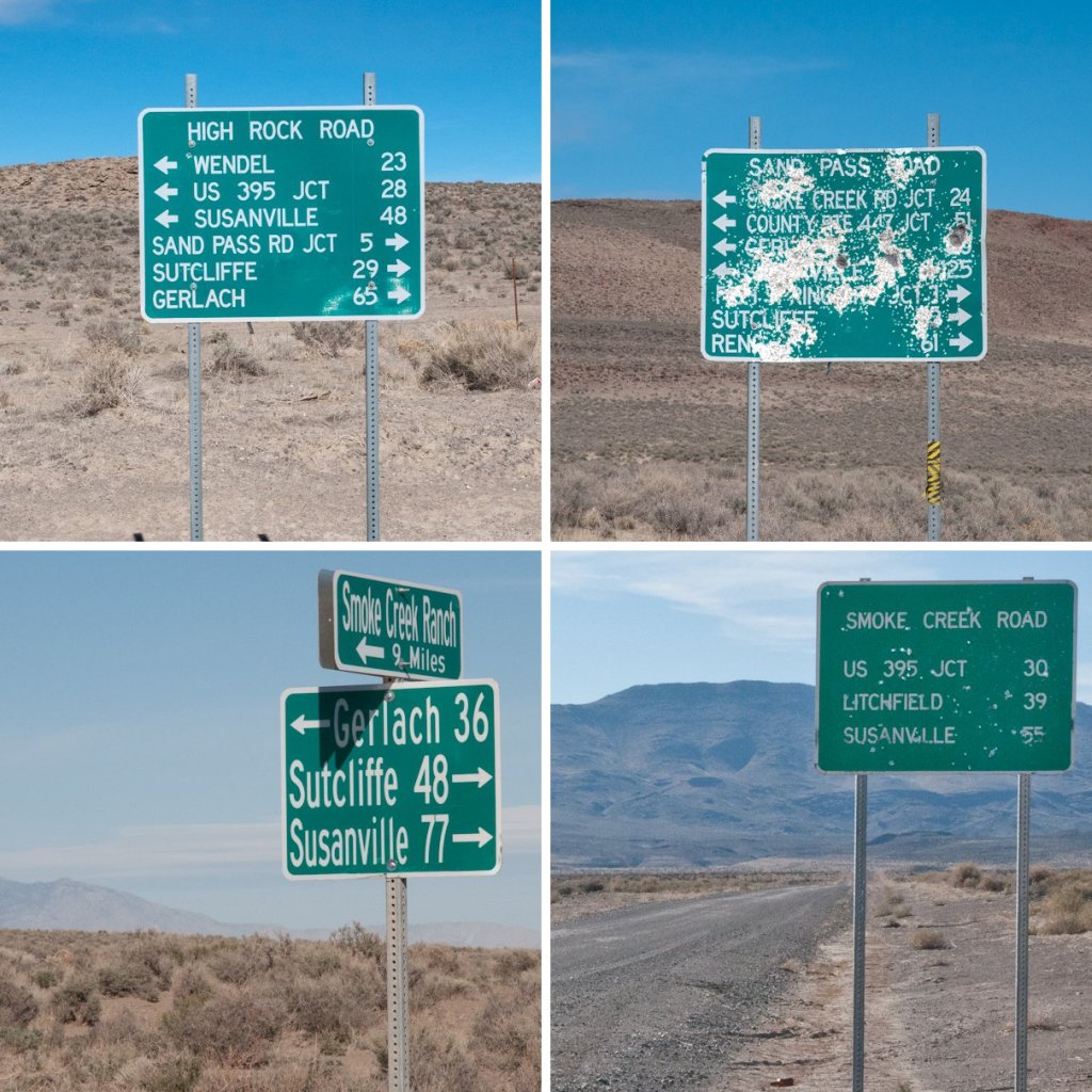
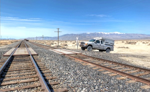
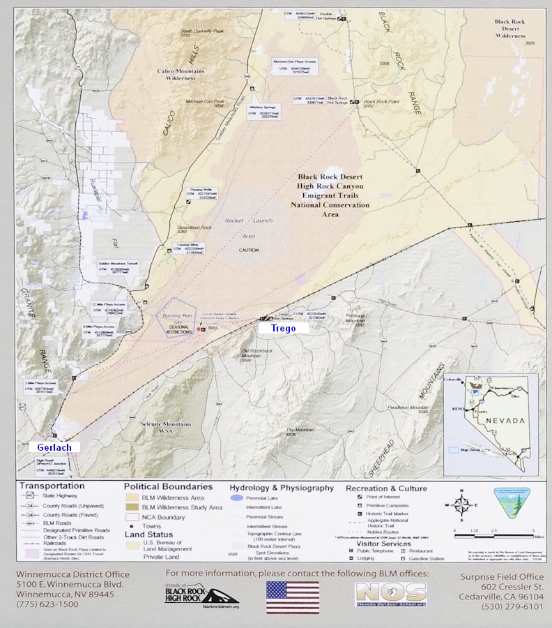
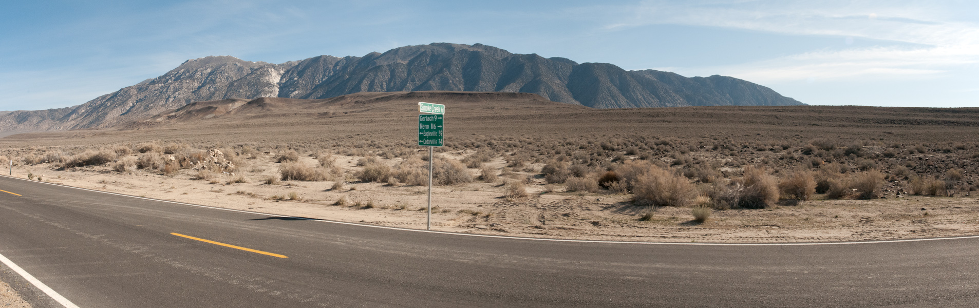
I refueled the truck and got a few supplies in Susanville, then I headed north on US 395 a few miles until I took the turnoff to Wendel, following Smokecreek1's advice (reasonable to assume that he'd be wise on his namesake Posted Image
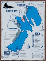
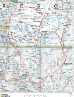
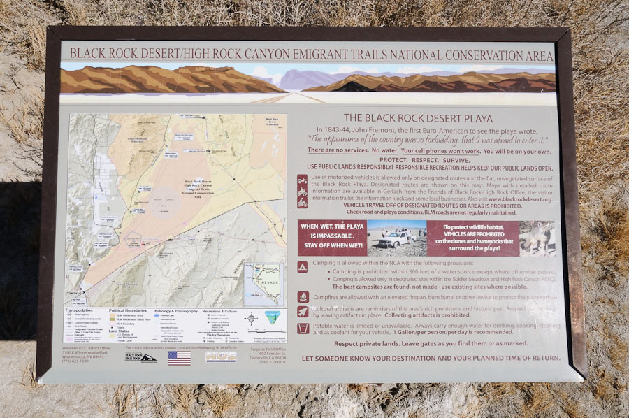
) to take the all-weather/season road via Sand Pass to the Smoke Creek Desert, my destination for that day, rather than the possibly-muddy Smoke Creek road that crosses to the north. See the map in Post #1.

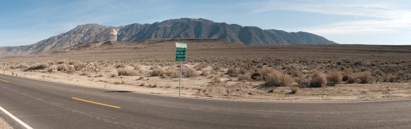
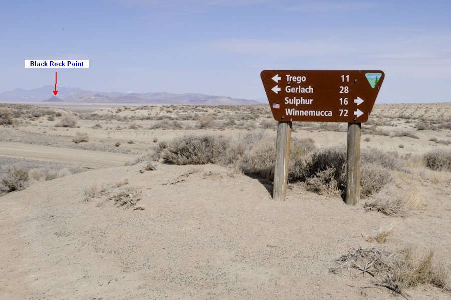
The route is well-signed:
Posted Image

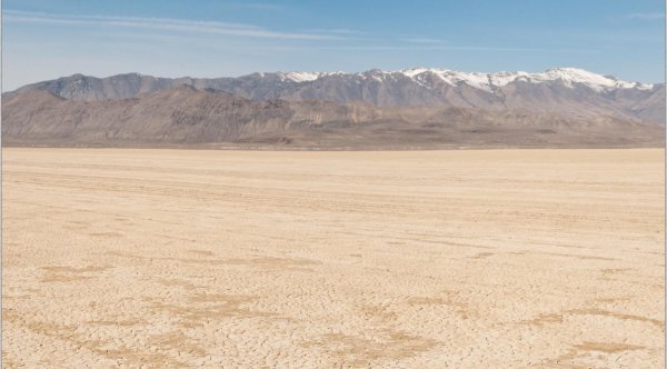
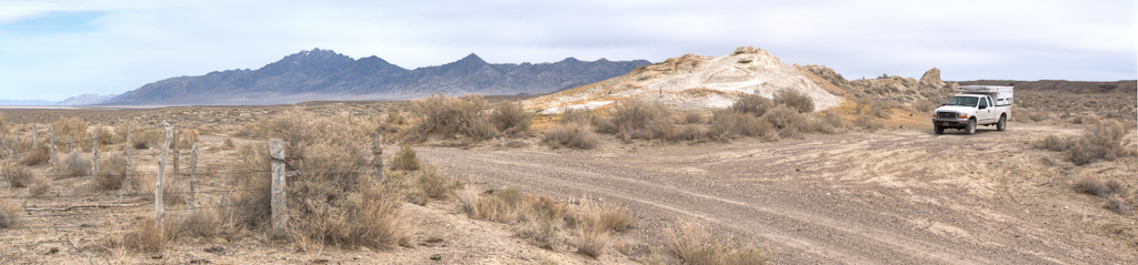
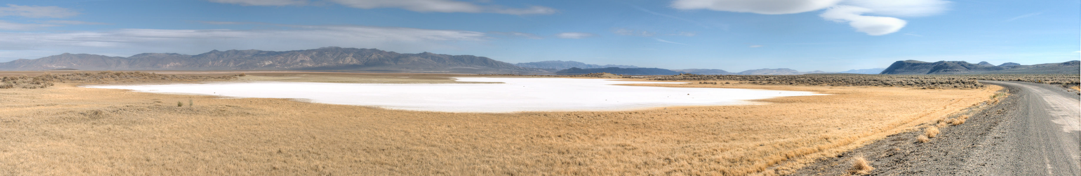
I stopped to shoot a pano at this point next to the Smoke Creek Desert, impressed by the very-white area:
Posted Image
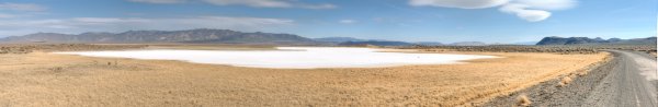
Full-size version: Pano 3
("Where's Pano 2?? Posted Image" After I created and named the files, some panoramas didn't make the final cut. Posted Image
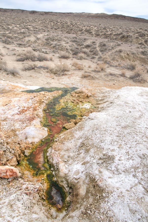
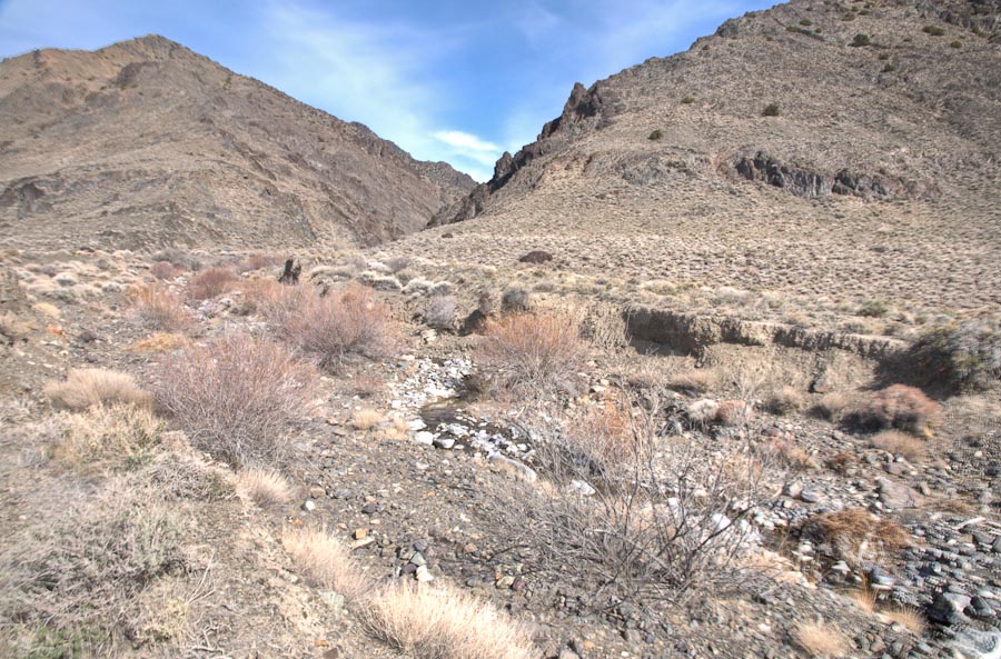
)

The route from Susanville to Sand Pass was new to me, but many years ago I'd driven down the west side of the Smoke Creek Desert, from Gerlach to Pyramid Lake). On that long-ago trip I spent the night camped at this spot next to Smoke Creek...where craig333 camped on his trip, too.
I didn't camp at this exact spot this time, but I stopped to check it out and shoot a few pics. I was surprised to see the creek wide and sluggish at this spot:
Posted Image
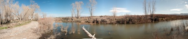
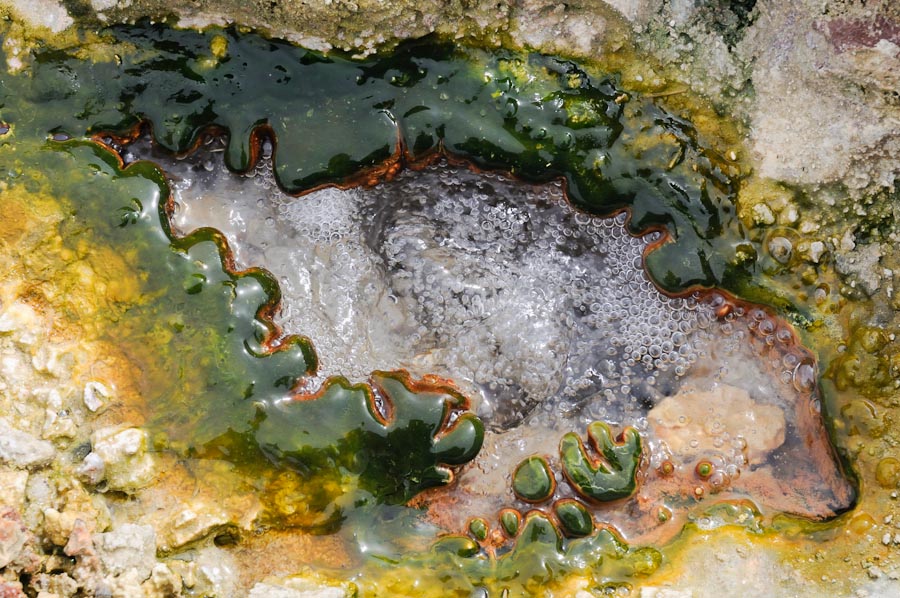
Full-size version: Pano 4

As I got out of my truck I startled some ducks...and as I approached the creek I heard some splashing in the water, which I thought was more ducks...but I think it might have been beavers diving into the water, once I discovered that this "sluggish" water was a beaver pond behind a beaver dam:
Posted Image

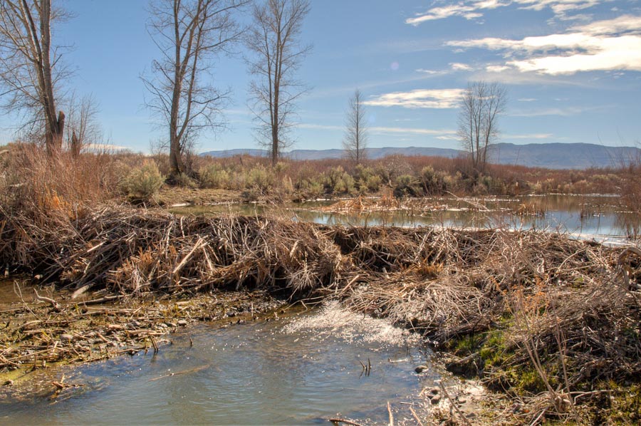
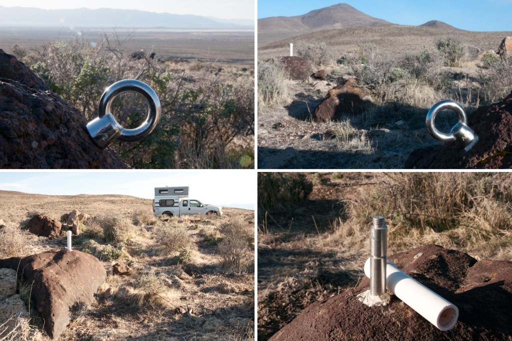
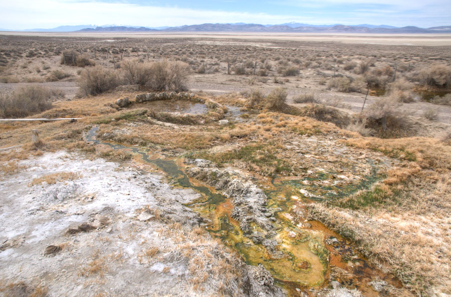
There are ruins of a stone building here (took pics, but not worth sharing), so this must have been a homestead/ranch at some point. As it's the only water for a long way, this is an obvious spot for a dwelling...or a WTW rally.
Posted Image
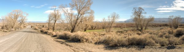
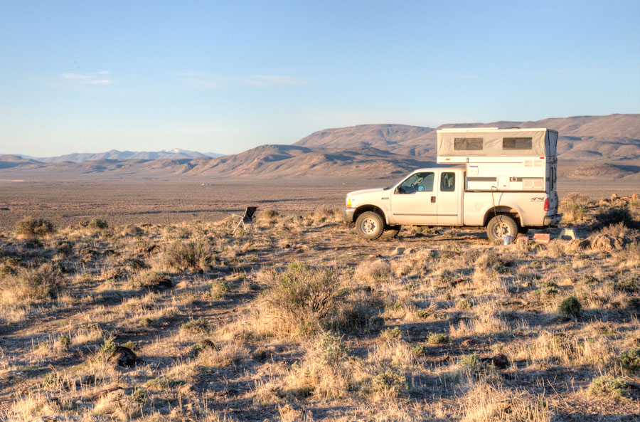
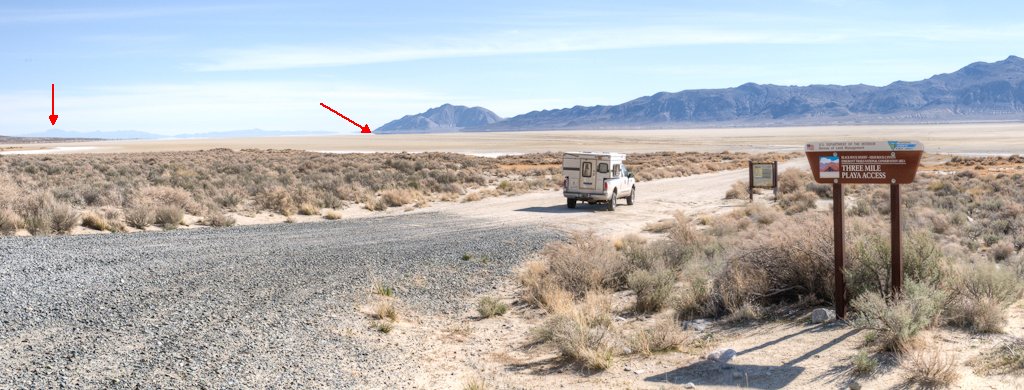
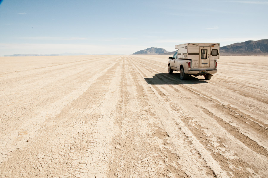
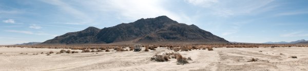
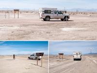
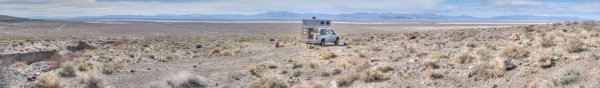
Full-size version: Pano 5

There was actually a little "traffic jam" at this spot in the middle of nowhere. A couple were checking out the view downstream from where the road crosses the creek, and as I pulled out from the "camping area" two rigs, going opposite directions, caused me to stop and wait for them to pass. Posted Image

I drove a mile or two on north, past the Smoke Creek Rd (see sign-photo above), looking for a place to camp. (why not camp next to the creek? because I'd been there before and wanted a new view) Across the main road road from a gravel pit, on the west side, I found the Burro Mountain Road and went up there a few hundred yards to a bench and a great expansive view spot -- where I camped for the night.

Near sunset I shot a 360° panorama here, of which this thumbnail is one panel:
Posted Image
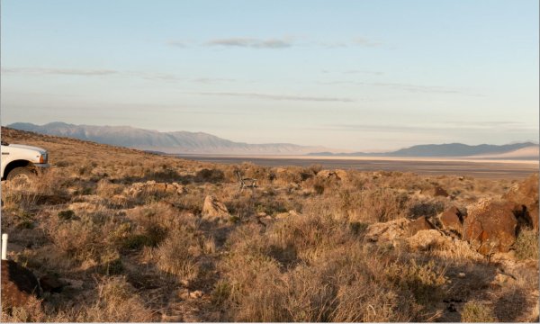
Here's a link to the full-size, 360°-rotatable version: Pano 7
As with all of these 360° panos, you need QuickTime viewer/player installed on your computer to view it. Pan round and round...in some cases, up and down a bit, too.
To the south -- left of the sun in this pano -- you can see the trace of the gully of Smoke Creek, and the streamside cottonwoods if you look closely.
  • 0

FWC Hawk (2005) on a Ford F250 Supercab, 6.8L V10 gas (2000)


#7 takesiteasy

takesiteasy

    Senior Member

  • Members
  • 2,588 posts
  • LocationMinnesota

Posted 07 April 2013 - 05:58 PM

snip...I found the Burro Mountain Road and went up there a few hundred yards to a bench and a great expansive view spot -- where I camped for the night. ...snip

That looks like a real nice campsite. Looking forward to the next installment.
  • 0
2011 Tacoma AC TRD
ATC Custom Shell

travelswithrockythedog.blogspot.com

#8 Smokecreek1

Smokecreek1

    Smokecreek1

  • Members
  • 2,767 posts
  • LocationNE Calif/NW Nev

Posted 07 April 2013 - 06:14 PM

Mark BC

Ahhh, those pictures of the Smoke Creek Desert bring back allot of memories (mostly good) of those 25 years of working there with the old Susanville District (lot's of stories). I think I could forget the "Bob" and the Rattle Snake part though!. A quick story concerning beavers might be interesting; when I first got to the area in 1980, grazing had completely hammered Smoke Creek and unless there were a few beavers hiding in the cottonwoods by the campground or in the delta that was formed there-there were no beavers in the area. Over the next few years we managed to get grazing under control in the creek and reached an agreement with the Smoke Creek Ranch over the flow rates from Smoke Creek Res (there was a water valve there that controlled the amount of down stream flow and the rancher was pretty stingy over opening it up-even though by law we- BLM -was supposed to get so many % of it sent down stream-we got him to open it more).

As the water flow increased"boom" there were suddenly willows, grass and birds and things everywhere and free flowing water and beaver dams and beaver ponds. Now beaver are not local to this area now, but we figured during one of the wet years, some beaver(s) must have followed some creeks down from the Warners and Bingo-we had a beavers in the creek. :lol: I remember some folks wanted them out, but, we and the majority of locals enjoyed them and we always a highlight of our public desert tours or a drive down the canyon-there is something about a beaver pond in the desert that is really really neat. Just think what a little water and some good management will do to that barren land that ain't worth nothing-or so some people say. I have not been down Smoke Creek Ranch road since I retired-(along with most of old ecosystem team, i worked with), I think maybe from what I heard a while back, they cranked the value back down-I hope that's wrong!

Smoke
  • 0
Smokecreek1:99F1504x4with05Granby

#9 MarkBC

MarkBC

    The Weatherman

  • Site Team
  • 6,607 posts
  • LocationBend, Oregon

Posted 07 April 2013 - 06:19 PM

Sunday, March 24

Morning shot, looking south:
_DSC9024_5_6_tonemapped.jpg

In this obvious dispersed camping spot next to Burro Mt Rd I found a couple of...things...embedded in the rocks. Not sure what/why they're there...huh.gif:
things_near_Smoke-Creek.jpg
Maybe archaeologist Smokecreek1 could speculate on the origin of these artifacts in his namesake and formerly employed region...blink.gif They look Paiute to me, but I'm no expert.

Breaking camp mid-morning morning, I drove along the west side of the Smoke Creek Desert, north/northeast towards Gerlach. Coming over a rise I saw a herd of sheep (domestic) partially blocking the road. Moving their charges out of the way were two big white Great Pyrenees dogs -- traditional guardians of livestock in some areas...presumably in the Pyrenees. The human in charge (?) was sitting off to the side. Northern Nevada is/was home to traditional Basque shepherds -- from the Pyrenees, and that tradition lives on in some areas. Around the next bend a modern pick-up pulling a new-ish camp trailer -- but in traditional Basque sheepherder design -- pulled onto the road. Now, technically, I'm not a fan of livestock grazing on public lands...but I actually get pleasure from seeing traditional stuff like that, as I've said before.

Rounding the north end of the Smoke Creek Desert, where its northern tip kisses the southern tip of the Black Rock (hope that image isn't too racey...) the dirt road joins the pavement of Nevada 447.
Sometimes when on a road trip, like on this morning, I listen to "lively" music to get me going first thing...so I started with the traditional "Rebel Yell" by Mr. Idol, and as I stopped to take this picture Sonic Youth were loudly dissonating "The Sprawl" from my truck's speakers. biggrin.gif
2013-03_3state_Pano-08_thumb.jpg
Full-size version: Pano 8
What's the point of this shot? Well, partly just to show the road sign, to establish location...but mainly to show the great example of pleistocene beaches -- the horizontal features in the low hills behind the sign. These beaches were made back in the time when living in the Great Basin meant you really should have a boat!

In Gerlach I fueled the truck and bought ice cream at Bruno's -- to go...I was in movin'-on mode. Instead of heading south a couple miles from there and swinging around the south edge of the Black Rock, I drove north a couple of miles along the west side then took to the playa route with my destination being the established access point at Trego Springs.
2013-03_3state_Pano-09.jpg
The left-side, down-pointing arrow in this pic points at King Lear peak, the base of which -- McGill Canyon -- was my destination for the day. The angled arrow points roughly to where I was to exit the playa -- Trego.

I've been on the Black Rock playa many times...but it's always surreal cool. Of course, because it's well-known and only a 2-hour drive from Reno it's rare to have the drivable-playa area completely to yourself...but you usually can get privacy by distance. That is, you may see another rig parked a couple of miles away...but unless they're checking you out with a telescope, who cares?

_DSC9182.jpg

I stopped where I saw some fence-protected areas (to keep motorcycles/atvs off the formations), I stopped to read the signs describing them. Put up by Friends of Black Rock Desert. And I shot a 360° panorama here. It's poor light and I'm near the "shore", so it's not as cool as it could be, but still interesting -- to me, anyway. A thumbnail section of the pano:

2013-03_3state_Pano-10_thumb.jpg
A link to the full-size 360° rotatable pano: Pano 10

Exiting the playa at Trego after an 11 mile drive. I didn't know if it would be obvious where to head to "shore", but I just followed the majority of tracks:
2013-03_3state_Pano-11_thumb.jpg
Full-size: Pano 11

For some reason I felt inspired to set up in the middle of the tracks and shoot another 360° panorama. These tracks are actively used daily...but I figured I'd have time to get out of the way if a train came. Thumbnail:
2013-03_3state_Pano-12_thumb.jpg
Link to 360° version: Pano 12

_DSC9369.jpg

_DSC9369_detail.jpg

At this point I joined the Gerlach-Sulfur road.

Signs...of modern routes:
_DSC9441.jpg

And old, historical routes:
Oregon-Trails_signs.jpg

At Sulfur I took the road that heads north, along the east side of the east arm of the Black Rock (which, unlike the west arm, is not drivable hard playa, and is mostly designated wilderness), along the foot of the west side of the Jackson Mts.
sulfur.jpg

The industrial mining area at Sulfur is not an attractive spot -- best to be left quickly. dry.gif


  • 0

FWC Hawk (2005) on a Ford F250 Supercab, 6.8L V10 gas (2000)


#10 MarkBC

MarkBC

    The Weatherman

  • Site Team
  • 6,607 posts
  • LocationBend, Oregon

Posted 07 April 2013 - 06:20 PM

On the way up to McGill Canyon, my destination that day, at the foot of the Jackson Mts, there's a kinda interesting thermal area right next to the road:
Posted Image
In the years I've been coming by there (though my visits are rare) I think the water course has changed a bit...

Posted Image

Close-up of the only spot that's bubbling hot water:
Posted Image

Posted Image
There is a bit of a man-made pool visible in the image above...a tub? But you'd have to be crazy-desperate to get in that mess...maybe it's just for animals. Posted Image

Finally arriving at my campspot -- the mouth of McGill Canyon:
Posted Image
Water is flowing in the creek.
This is the spot where craggyman and I did a full-on Thanksgiving feast many years ago.

As I said in my earlier warning: This area is at its least attractive at this time -- it's at its nadir of green-ness...but still, there is a fabulous-big view here:

Posted Image
Full-size version: Pano 14
This is looking west, at the Black Rock Range, a little of the Granite Range peeking above, and the Pine Forest Range to the north.
  • 0

FWC Hawk (2005) on a Ford F250 Supercab, 6.8L V10 gas (2000)


0 user(s) are reading this topic

0 members, 0 guests, 0 anonymous users