Jump to content


Photo
- - - - -

Northern Nevada Roads Less Traveled


  • Please log in to reply
38 replies to this topic

#1 locrwln

locrwln

    Senior Member

  • Members
  • 113 posts
  • LocationReno, NV

Posted 11 July 2011 - 10:49 PM

We shall call this trip the roads less traveled. It was a great trip and we saw some amazing country (as usual anytime you travel through northern Nevada). This trip started like most of ours, we picked a direction, looked through the maps and found an interesting point to shoot for. I was looking in the northern Washoe/Humboldt areas of the state (Northeast corner) and noticed a lake by the name of New Year Lake that ran parallel to the CA/NV border and looked both remote and of a good size.

Saturday morning, all loaded up, we headed out. We topped off in Gerlach and headed north on Hwy 34. Just north of the Petrified Forest and the summit, we noticed a road off to the west that looked interesting so we took it. There was a great camping spot next to a little creek with plenty of shade and open areas as well. We had two Hawks circling above us as we walked around talking to each other.

Once we were done drove north on 34 before turning west again and followed a road to SR 447 just south of the Wall Canyon area. We turned north and drove into Cedarville (fuel stop, damn small factory tank). I learned after my first trip into the Blackrock, that you always want to get fuel every chance you can. So after topping off, we turned east and headed back into Nevada. Just after crossing over the border, we found the road we were looking for and turned north.

The map and gps showed it as being a pretty decent road...And it started out that way, shortly after turning off of 8A, there was even a camp with a 5th wheel parked and several trucks, so we were feeling pretty good. Further up the road we came to our first gate. It was a large metal gate, so everything was still good. We hit another wire gate (the first of many) and still the road isn't too bad, but the further we traveled, the less use the road had seen. The only tracks I saw were from a ATV other than that, nothing since the snow melt. Soon after, the road really became overgrown and at times, I had to get out and look through the vegetation and rely on the gps to ensure I was still on the trail. We slowly worked our way along most of the time in 4low. The truck did great, it just needs more clearance, I don't think there is one part on the underside that didn't kiss a rock at some point.

Posted Image

Posted Image

Posted Image

The road didn't get any better and the adventure continues.

Jack
  • 0

2007 Chevy 2500HD Max/Ali combo 2008 FWC Hawk Shell

My build thread:  http://www.expeditio...007-Chevy-Build


#2 locrwln

locrwln

    Senior Member

  • Members
  • 113 posts
  • LocationReno, NV

Posted 11 July 2011 - 10:52 PM

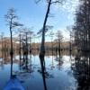
After working our way over the many fields and ridges, we finally started down towards the lake. It took us roughly 2.5 hours from the turn off of 8A until we reached the lake. With better clearance and suspension, it would take less time, but for a stock truck, it did great. The veiw as we approached the lake.

Posted Image

Posted Image

Posted Image

We made it down to the lake and decided to call it a day and make camp.

Posted Image

Posted Image

There were no visible use of this rather large and pretty lake. And if you look at the maps, there are no "big" roads leading to it, the only ones we could find were small trails.

The lake at sunset, we were on the south end of the lake looking north.

Posted Image

The only downside, were the mosquitos, they were voracious and were more than happy to have some fresh blood. It was a great night and it was really nice to have the place to ourselves.

Jack
  • 0

2007 Chevy 2500HD Max/Ali combo 2008 FWC Hawk Shell

My build thread:  http://www.expeditio...007-Chevy-Build


#3 locrwln

locrwln

    Senior Member

  • Members
  • 113 posts
  • LocationReno, NV

Posted 11 July 2011 - 10:53 PM

Sunday morning the plan was to continue around the south end of the lake and head north and exit onto Ft. Bidwell road. As they say the best laid plans...

As we were working our way around the lake, I had to get out and scout the road out, at this point it didn't look like any one had traveled this way in a really long time. As we got to the southern most point, there was a large male antelope that acted like we were the first vehicle he had ever seen, he wasn't afraid and kept coming toward us to "check" us out. He would only get about 300 yds away, before his courage would break and he would move away. Then he would come back and do it all over. We were stopped and watched him do it several times, before it was time to keep moving.

Posted Image

After working our way around the lake, the road just kind of stopped at a very old corral. I got out and began scouting out the trail. I figured out why the road had seen so little use, there were two sizeable creeks feeding the lake and the second one was much too deep to cross the sides were several feet tall, so no vehicles are crossing and driving north around the lake. So we had to turn around and head back the way we came. Which was really surprising, considering the gps and the map showed it going through. Oh well, we decided to try the road heading south at what we were calling antelope crossing and it too petered out after climbing up into a very neat valley. So back out the way we came. The vegitation was so thick that even after we had just driven through, I really had to concentrate to find the trail and even scout it out again. It took us about three hours from the time we left camp until we were back at the spot where we had camped. Pretty wild.
  • 0

2007 Chevy 2500HD Max/Ali combo 2008 FWC Hawk Shell

My build thread:  http://www.expeditio...007-Chevy-Build


#4 locrwln

locrwln

    Senior Member

  • Members
  • 113 posts
  • LocationReno, NV

Posted 11 July 2011 - 10:54 PM

Once we made it back out 8A, we headed east towards Vya. Vya is a town again. For anyone who has passed through the crossroads of Vya before would be shocked by how much is there. The pipeline has created a town once again.

Posted Image

Posted Image

We continued east on 8A until we reached the Sheldon turn off and up we went. We crossed the Sheldon to SR140 and turned right to head down to the Thousand Creeks/Durfferena Ponds area. I had been told that the campground, Virgin Valley CG, had a geothermal heated pool. We decided to give it a try. The campground was free and the pool was very well done. The bottom is natural, but there has been some concrete work with a ladder to get in and out of the pool. The temperature isn't really "soaking" hot, but it is one of the nicest temperatures you could ask for after a long day on the trail. Plus right next to the pool is a building with showers. There are these little fish in the pool that if you stand still will start "cleaning." It is a really weird feeling but kind of cool at the same time, the fish are very social and as soon as you stop moving, come near you.

Posted Image

Swimming with the fishes...
Posted Image

The pool.
Posted Image

We got in gear on Monday morning and headed south out of the CG. We passed near the old Virgin Valley Ranch and noticed this Black Crowned Night Heron hanging out.

Posted Image

We turned west again and decided to follow a road back across the Sheldon to intersect with 8A. This too was a road that had seen little use and we had the area to ourselves. Just us a few deer, antelope and wild horses. Not to mention various birds that we saw along the way. This was very open, remote country and we really enjoyed it.

Posted Image

Posted Image

Posted Image

Posted Image

For anyone looking to "get away from it all" you owe it to yourself to head to Northern Nevada area, you really feel like you are the only ones out there.

Time for the cleanup.

Jack
  • 0

2007 Chevy 2500HD Max/Ali combo 2008 FWC Hawk Shell

My build thread:  http://www.expeditio...007-Chevy-Build


#5 MarkBC

MarkBC

    The Weatherman

  • Site Team
  • 6,602 posts
  • LocationBend, Oregon

Posted 11 July 2011 - 11:42 PM

Can you supply coordinates of that lake you visited (unless it's a secret)? Is its name shown on a topo? I wouldn't say I'm familiar with the area...but I've been through there, on 8A and 34, several times over the years, and am curious where you ended up. Posted Image Apparently I haven't been through there recently enough, though, 'cause I had no idea that Vya had all that stuff going on there. Posted Image Interesting.

I like the pool with the fish that volunteer to clean you! I've 'cleaned' many fish, but I've never been cleaned by fish. Posted Image

Thanks for the report on this little-visited area of high desert!
  • 0

FWC Hawk (2005) on a Ford F250 Supercab, 6.8L V10 gas (2000)


#6 Dughlas Stiubhart

Dughlas Stiubhart

    It's good to be Stew

  • Members
  • 1,474 posts
  • LocationSE CO

Posted 11 July 2011 - 11:57 PM

Great report and photos, Locrwin! I'm with MarkBC, where/what is that lake? Maybe Wall Canyon Res? And look at Vya! Wow, the last time I was there it was only a name on a map; now it's a city!
  • 0

Stew


2007 Custom All Terrain Camper Panther Shell on 2012 Toyota Tundra 4x4 in SE CO


#7 Mark W. Ingalls

Mark W. Ingalls

    Senior Member

  • Members
  • 1,248 posts
  • LocationHouston, TX

Posted 12 July 2011 - 12:50 AM

Man.

Oh, man, that was cool!
  • 0

#8 Darryla

Darryla

    Senior Member

  • Members
  • 318 posts
  • LocationLivermore, CA

Posted 12 July 2011 - 01:40 AM

Iv'e done some back roading in NV, but you are braver than I. Wow. I would have called it good at the gates.

Darryl
  • 0
ATC Bobcat, 2001 Tacoma 4X4, Supersprings, Bilsteins, Hewig Stabalizer

#9 MarkBC

MarkBC

    The Weatherman

  • Site Team
  • 6,602 posts
  • LocationBend, Oregon

Posted 12 July 2011 - 02:01 AM

Anybody else remember (back in the early-'90s) that family (husband, wife, baby -- the Stolpas) that headed east from Cedarville at Xmas -- as a shortcut to Idaho -- and traveled along 8A. Naturally, they got stuck in the snow on that unmaintained-road for several days or more...they tried to walk on/out, etc. Long-story-short: Mom and Dad lost their feet to freezing, but the baby was just fine.
They made a TV movie out of the story, starring Neil Patrick Harris. The story (the actual story, not the movie) intrigued me because I'd been through and camped in the area...but not in the dead of winter! I love winter camping, but I avoid areas where I'll get stuck. Posted Image

Stolpa Story Part 1
Stolpa Story Part 2
  • 0

FWC Hawk (2005) on a Ford F250 Supercab, 6.8L V10 gas (2000)


#10 locrwln

locrwln

    Senior Member

  • Members
  • 113 posts
  • LocationReno, NV

Posted 12 July 2011 - 02:15 AM

Thanks for the compliments guys. I don't "track" my adventures, so I had to look up the coordinates on Google Earth. 41 degrees 45' 15.52" N by 119 degrees 57' 00.00" W Elevation of 5989 ft.

We have been following those kind of roads in Nevada for almost 20 years, you just have to be careful when it's wet or there is snow.

Jack
  • 0

2007 Chevy 2500HD Max/Ali combo 2008 FWC Hawk Shell

My build thread:  http://www.expeditio...007-Chevy-Build


0 user(s) are reading this topic

0 members, 0 guests, 0 anonymous users