Arizona Strip Area
#1
Posted 23 March 2008 - 01:39 AM
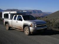
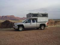
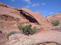
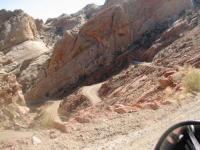
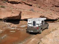
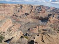
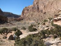
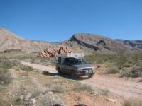
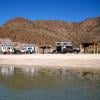
I visited the North Rim of the Grand Canyon in several places as well as hiking in the Paria Canyon area.
My All Terrain Panther kept me warm in dry in all these conditions and functioned flawlessly.
Desertrat
#2
Posted 23 March 2008 - 02:03 PM
The small amount of rain and snow I encountered lent a whole new meaning to the numerous "Impassable when wet" signs I encountered. No big deal tho', I'd just wait a couple hours for the "grease" covered tracks to get tacky again.
The worst part of the whole trip was my extremely bad tire karma! The almost new Firestone A/Ts I had turned out to be suitable only for pavement. The first flat tire occurred on a gnarly stretch of track near Gold Butte - cactus spines. The phony "donut" spare I put on lasted about 10 miles but got me back onto a gravel road before it exploded. I put the flat tire back on and used a can of fix-a-flat and my walmart compressor to get to a tire shop in Mesquite. The next day I was back in the Arizona strip with another rear tire flat, sharp rock in the tread this time. More fix-a-flat and compressor time got me 70 miles to the pavement near Colorado City UT where the other rear tire blew out half a mile from the tire shop. The four new heavier LT tires I bought performed great for the rest of my explorations (~500 miles of gravel and atv tracks).
Now I'm back home in Montana and it seems that there is more of the snow here that I wanted to escape than when I left. Hopefully spring will arrive soon allowing more access to "local" camp spots.
Rob
#3
Posted 23 March 2008 - 02:38 PM
Special Engel Pricing For WTW Members
Click here to see my ATC Cougar
JayAronowSales.com
(520)579-9610
jayaronow@gmail.com
#4
Posted 23 March 2008 - 06:05 PM
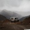
How about sharing those GPS coordinates so we all can go.
Thats an interesting idea. We could create a database with GPS coords and descriptions, organized by state, available to WTW members. I've been doing this on my own travels (mostly in UT, NV) but it might be great to benefit from others as well. Of course, then your secret spots wouldn't be so secret. Thoughts?
Now, just roaming around in a stock Land Cruiser (not stock for long though... bawahahha [evil laugh])
#5
Posted 23 March 2008 - 10:23 PM
A lot of the areas I've explored have numerous camp sites and half the fun is finding the perfect spot. Some I wouldn't want to post but would be glad to send descriptions etc thru private mail.
It'd be nice to have regions with camping possibilities available. It would certainly take a lot of the guess work out of travelling by being able to plan trips. I always like to be seeking a camping "area" by late afternoon. And it really sucks when you're in an area that has only paved "designated" pay campsites and thats heavily patrolled by the ranger gestapo.
Conversely I met a BLM ranger last week who pointed me toward a great spot. Technically it was a bit inside a non-motorized vehicle area but he said there wouldn't be any problem as long as I stayed only on existing tracks. Wish they were all that helpful.
I'll be doing a broad writeup on the San Rafael Swell area soon once I get some maps etc finished. A great place to explore, even in the winter.
Rob
#6
Posted 24 March 2008 - 05:26 PM
Marc:)
2016 Sprinter Silver Gray 144 Std. Roof 4x4. 3.0 diesle, Cooper "Dicoverer" ST Maxx 255/85/16
#7
Posted 25 March 2008 - 02:34 AM
Thats an interesting idea. We could create a database with GPS coords and descriptions, organized by state, available to WTW members. I've been doing this on my own travels (mostly in UT, NV) but it might be great to benefit from others as well. Of course, then your secret spots wouldn't be so secret. Thoughts?
I'm going to be adding a GPS database later this year, hopefully integrated with Google Maps. The private DB is an interesting idea. We'll have to throw some ideas around.
0 user(s) are reading this topic
0 members, 0 guests, 0 anonymous users