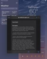
This coming week (8/20-21) is going to be extremely wet in the desert areas of So California and Nevada. Check the weather reports for the areas you might be thinking of visiting. Furnace Creek is forecasted to get about 4”.


Weather Warning - SoCal and NV Rain Event
Started by
Wandering Sagebrush
, Aug 18 2023 01:30 PM
17 replies to this topic
#1

Wandering Sagebrush
-
- Site Team
- 10,594 posts
Free Range Human
- LocationNortheast Oregon
Posted 18 August 2023 - 01:30 PM
I am haunted by waters
#2
Dipodomys
-

- Members
-

- 76 posts
Advanced Member
Posted 18 August 2023 - 07:02 PM
I read that Yuma AZ could get 5”. What I think will be really interesting is that the east-facing mountain slopes should get hit harder than west-facing slopes, reversing the usual rain shadow of coastal ranges. That might result in some significant erosion in places. But all that cool stuff aside, … ditto Wandering Sagebrush: stay safe!
#3
PaulT
-

- Members
- 2,612 posts
Need gumbo
- LocationHillsboro, Oregon
Posted 19 August 2023 - 12:47 AM
Could be a good opportunity to earn a Darwin award with weather like that in Death Valley.
Perhaps, rescheduling after the storm is done would be wise.
Paul
I thought getting old would take longer.
#4
Foy
-

- Members
- 1,295 posts
Resident Geologist
- LocationRaleigh, NC
Posted 19 August 2023 - 12:26 PM
Welcome to the East Coaster's world of tropical storm warnings. I just read this is the first such warning from NOAA to Sou Cal?
#5
Wandering Sagebrush
-
- Site Team
- 10,594 posts
Free Range Human
- LocationNortheast Oregon
Posted 19 August 2023 - 01:15 PM
Looks like parts of NE & SE Oregon are in the path, too. I was planning on a Steens trip tomorrow, but perhaps a reschedule is in order.
I am haunted by waters
#6
Dipodomys
-
- Members
-
- 76 posts
Advanced Member
Posted 19 August 2023 - 11:43 PM
Welcome to the East Coaster's world of tropical storm warnings. I just read this is the first such warning from NOAA to Sou Cal?
I was just imagining how people from the east and gulf coasts might look at the rain totals and think, “that’s nothing!” But in a lot of these areas there’s almost no vegetation holding the soils in place (compared with the coasts, anyway) and they’re looking at 48 hour rainfalls exceeding what they usually get in a year. I’m expecting some pretty significant erosion. On which note, I’ve often wondered about how water erosion has formed a lot of our desert landscapes. Specifically, is erosion dominated by normal seasonal precipitation or by rare, cataclysmic storms? I suspect the latter, but I’m not sure how that hypothesis could be tested. Any geologists out there?
#7
teledork
-

- Members
- 577 posts
Pinyon Jay
- Locationeastern sierra
Posted 20 August 2023 - 07:17 PM
Unless something dramatically changes this afternoon this storm is likely to go down as one of biggest, best hyped nothing burgers in Mono County history.
#8
Wandering Sagebrush
-
- Site Team
- 10,594 posts
Free Range Human
- LocationNortheast Oregon
Posted 20 August 2023 - 08:58 PM
Unless something dramatically changes this afternoon this storm is likely to go down as one of biggest, best hyped nothing burgers in Mono County history.
I hope that is the case.
I am haunted by waters
#9
Casa Escarlata Robles Too
-

- Site Team
- 9,296 posts
C'est la vie
- Locationmonterey bay area
Posted 20 August 2023 - 09:25 PM
We here on Monterey Bay are having some nice sunny weather.
Early this morning a few thunder booms and some "rain drops".
Nothing else.Just a Chamber of Commerce day.
Frank
2002 Tundra AC TRD 4WD Limited 2009 ATC Bobcat loaded http://sharychic.blogspot.com/
#10
Wandering Sagebrush
-
- Site Team
- 10,594 posts
Free Range Human
- LocationNortheast Oregon
Posted 21 August 2023 - 01:44 PM
We have a steady rain here at Fort Sagebrush
Flood Watch
Flood Watch
National Weather Service Boise ID
557 AM MDT Mon Aug 21 2023
.Expect Record setting rainfall today across the region
associated with the remnants of Tropical Storm Hilary. This will
likely produce flash flooding, rock slides and debris flows.
IDZ011-013-033-ORZ062-220000-
/O.CON.KBOI.FA.A.0004.000000T0000Z-230823T0300Z/
/00000.0.ER.000000T0000Z.000000T0000Z.000000T0000Z.OO/
West Central Mountains-Boise Mountains-Upper Weiser River-Baker
County-
Including the cities of McCall, Cascade, Idaho City, Lowman,
Garden Valley, Pine, Council, Cambridge, Midvale, and Baker
557 AM MDT Mon Aug 21 2023 /457 AM PDT Mon Aug 21 2023/
...FLOOD WATCH REMAINS IN EFFECT THROUGH TUESDAY EVENING...
* WHAT...Flash flooding caused by excessive rainfall continues to be
possible. Up to 3" of rainfall is possible this morning especially
across Baker County in Oregon as well as Washington and Adams
Counties in Idaho.
* WHERE...Portions of west central Idaho, including the following
areas, Boise Mountains, Upper Weiser River and West Central
Mountains. Portions of northeast Oregon, including the following
area, Baker County.
* WHEN...Through Tuesday evening.
* IMPACTS...Excessive runoff may result in flooding of creeks,
streams, and other low-lying and flood-prone locations. Flooding
may occur in poor drainage and urban areas. Low-water crossings
may be flooded. Storm drains and ditches may become clogged with
debris. Extensive street flooding and flooding of creeks and
rivers are possible.
* ADDITIONAL DETAILS...
- http://www.weather.gov/safety/flood
PRECAUTIONARY/PREPAREDNESS ACTIONS...
You should monitor later forecasts and be prepared to take action
should Flash
I am haunted by waters


0 user(s) are reading this topic
0 members, 0 guests, 0 anonymous users

