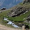
It looks like I might be able to squeak in a brief wander, leaving Minneapolis about June 4th and needing to be in Salt Lake City about June 10th. I am planning on SW Colorado for the fall, so I don't want to go that route.
I was thinking about the White Rim Trail, and possibly the Dollhouse road I just read about here. Other options would be something in nortern Colorado, eastern Utah, southern Wyoming.
I have a special fondness for prmitive hot springs, but other than that I am looking for the same things most people on this site are; moutains, solitude, memories, etc.
I have a double cab 4x4 tacoma with an FWC Bobcat, stock. It makes me pretty capable, but not unstobable. I figure there will still be snow in some of the higher areas, even with the wimpy snows this winter.
Suggestions much appreciated. Thanks


Suggestions Please, Early June
Started by
brp
, May 11 2012 08:06 PM
10 replies to this topic
#2

Barko1
-
- Members
- 1,635 posts
Senior Member
- LocationSouthern Appalachians
Posted 12 May 2012 - 02:08 AM
It looks like I might be able to squeak in a brief wander, leaving Minneapolis about June 4th and needing to be in Salt Lake City about June 10th. I am planning on SW Colorado for the fall, so I don't want to go that route.
I was thinking about the White Rim Trail, and possibly the Dollhouse road I just read about here. Other options would be something in nortern Colorado, eastern Utah, southern Wyoming.
I have a special fondness for prmitive hot springs, but other than that I am looking for the same things most people on this site are; moutains, solitude, memories, etc.
I have a double cab 4x4 tacoma with an FWC Bobcat, stock. It makes me pretty capable, but not unstoppable. I figure there will still be snow in some of the higher areas, even with the wimpy snows this winter.
Suggestions much appreciated. Thanks
Not a lot of time, have you explored Badlands, back country camp, and the Black Hills/Devils Tower?
Granby on an F250 in S. NM
#3
brp
-
- Members
-

- 81 posts
Advanced Member
Posted 12 May 2012 - 03:03 AM
I have done a decent amount in the Black Hills, but not west of there in the Devil's Tower area. I am interested in hiking the Mah Dah Hay Trail (spelled something like that) through the ND badlands, but my knee is a little iffy right now.
Please tell me more about the Devil's Tower area and what you would suggest. Thanks.
Please tell me more about the Devil's Tower area and what you would suggest. Thanks.
#4
ski3pin
-

- Site Team
- 15,387 posts
Belay On
- LocationSierra Nevada Range
Posted 12 May 2012 - 05:10 AM
If you are close by, Devils Tower is a must see.
Devils Tower
If you are into western history and the overland trail, you should stop at Independence Rock.
Devils Tower
If you are into western history and the overland trail, you should stop at Independence Rock.
2003 Ford Ranger FX4 Level II 2013 ATC Bobcat SE "And in the end, it's not the years in your life that count. It's the life in your years."- Abraham Lincoln http://ski3pin.blogspot.com/
#5
Lighthawk
-
- Members
- 3,320 posts
Weekend warrior
- LocationNevada City, CA
Posted 12 May 2012 - 06:48 AM
When we visited Devils Tower in the 80's there was a paved trail around the anomaly of the Tower. It's just so out of place standing there on the northern prairie.
The park system has ranger tours as I recall. You can see climbers hanging off various crack systems. I found it hard not to channel Close Encounters when visiting. We climbed the Durrance Route between intense thunderstorms common in July. I remember doing a few other classic crack routes, but forget the names now.
I've heard good things about the Bad Lands
The park system has ranger tours as I recall. You can see climbers hanging off various crack systems. I found it hard not to channel Close Encounters when visiting.
We climbed the Durrance Route between intense thunderstorms common in July. I remember doing a few other classic crack routes, but forget the names now. I've heard good things about the Bad Lands
2021 RAM 3500 Crew 4x4, 6.4 hemi/8 speed trans with 4.10 gears, Timber Grove bags, Falken Wildpeak 35" tires.
OEV Aluma 6.75 flatbed, Bundutec Odyssey camper on order for 2024
For this year we're still using our 2008 FWC Hawk with victron DC-DC charger, 130w solar, MPPT controler
with 2000w inverter and external 120v output and 12v solar input with 100w portable solar. http://lighthawkphoto.com
#6
Barko1
-
- Members
- 1,635 posts
Senior Member
- LocationSouthern Appalachians
Posted 12 May 2012 - 08:49 AM
We climbed the Durrance Route between intense thunderstorms common in July. I remember doing a few other classic crack routes, but forget the names now.
I've heard good things about the Bad Lands
Climbed Durance as well
 , saw a couple getting married om top complete with veil but she freaked out rappelling down, I imagine she finally made it! There is also a Sierra Trading Post nearby which is always fun to spend $$ on more gear
  . And Fossil Butte National Monument to the West is pretty cool as well.
Granby on an F250 in S. NM
#7
Foy
-

- Members
- 1,295 posts
Resident Geologist
- LocationRaleigh, NC
Posted 14 May 2012 - 01:18 PM
And now, for something completely different.................
......you might have a look at the Nebraska Sandhills. The Sandhills are grass-stabilized sand dunes liberally pocked with small to large pothole lakes and several nice rivers. Covering some 20,000 square miles, they are in north-central Nebraska extending to just into SD and with I-80 cutting across the southern lobe. The Niobrara River is a National Scenic River and there are two units of the Nebraska National Forest plus some National Wildlife Refuges full of waterfowl in the Sandhills, with one NF unit along NE-2 and a fork of the Loup River, the other closer to Valentine and on the Merritt Reservoir. The latter is VERY remote, and one can take some sand roads west/northwest of the reservoir to link up to N-S state roads taking you back up to US 20. Just west of the Sandhills, in the far corner of the Nebraska panhandle, lie Chadron and Crawford, the former being home to the Museum of the Fur Trade and the Sandoz High Plains Center, two fine archives of late 19th century Homestead Act settlement, and the latter being next to Fort Robinson State Park. Fort Robinson is a restored US Army cavalry post with a nice conventional campground, set in the midst of high butte and mesa country with many foot trails and pack trails.
Closer to Salt Lake, and more alpine in nature, are the Unita Mountains of northeastern UT. US 191 cuts through the range and across the Flaming Gorge Reservoir dam (an impressive sight in and of itself), and there are many, many miles of USFS roads and trails there (none of which I've personally traveled). US 191 drops down to Vernal, UT and there US 40 takes you west to Heber City, Park City, and then I-80 drops down to SLC. The whole stretch of US 40 between Vernal and Park City takes you past many roads leading up into the Uintas, and there are two nice reservoirs along the way, too. Strawberry Reservoir looks particularly appealing to me as it's fed by a nice trout stream (Strawberry River) and a wilderness area to the north. I passed by in July 2011 but could not explore. Lastly, there are some nice nooks and crannies on the eastern edge of the Wasatch Range, roughly between Provo Canyon and Ogden, UT, which look entirely worthy of exploring. East Canyon and its reservoir are among those nooks and crannies.
If you like badlands topography, you can consider the Teddy Roosevelt National Park in western North Dakota. There are units of National Grasslands contiguous to the NP, so a very large area is open to WTW-style travel. Gotta watch the weather closely, however, as June is thunderstorm season and a heavy downpour can make the bentonite clay roads impassible to even a 4WD for a day or two. Ask me how I know. The ND-MT border area between I-94 and US 12, along the Little Missouri River, is VERY remote and very scenic.
Enjoy the planning and the trip!
Foy
#8
Barko1
-
- Members
- 1,635 posts
Senior Member
- LocationSouthern Appalachians
Posted 14 May 2012 - 02:48 PM
Please tell me more about the Devil's Tower area and what you would suggest. Thanks.
There are FS campgrounds in the area, Devils Tower, a national monument, has a standard camground, (next to a big prairie dog town), the rock is cool, important to Native American traditions, lovely surrounding territory. Spearfish Canyon on the W side of the Black Hills is nice, great rock climbing at DT or in the Needles areas of the Black Hills. On the way there from the Denver area stopped for the night at I think Guernsey State Park, nice lake for cooling off.
Granby on an F250 in S. NM
#9
brp
-
- Members
-
- 81 posts
Advanced Member
Posted 15 May 2012 - 04:10 PM
I appreciate all of the replies and I am going to look into the Sandhills, I had not even thought of Neb.
Does anybody know much about the Wasatch Mountains in NE Utah? That area looks like it has potential. My Benchmark shows a decent amount of 4x4 roads up in those mountains, and I found some hotsprings.
The Neb. option is nice because there is no snow concern lower.
Thanks everyone, keep 'em coming.
Does anybody know much about the Wasatch Mountains in NE Utah? That area looks like it has potential. My Benchmark shows a decent amount of 4x4 roads up in those mountains, and I found some hotsprings.
The Neb. option is nice because there is no snow concern lower.
Thanks everyone, keep 'em coming.
#10
Foy
-
- Members
- 1,295 posts
Resident Geologist
- LocationRaleigh, NC
Posted 15 May 2012 - 04:37 PM
I appreciate all of the replies and I am going to look into the Sandhills, I had not even thought of Neb.
Does anybody know much about the Wasatch Mountains in NE Utah? That area looks like it has potential. My Benchmark shows a decent amount of 4x4 roads up in those mountains, and I found some hotsprings.
The Neb. option is nice because there is no snow concern lower.
Thanks everyone, keep 'em coming.
Glad to contribute, brp.
I've spent considerable time in the Wasatch Range in the immediate vicinity of Salt Lake City and Park City. There, the range is VERY rugged and excepting what are established roads up Big Cottonwood Canyon and Little Cottonwood, and the Alpine Loop which goes from Robert Redford's Sundance up and over to the Provo area, I don't think there are any through routes between Provo Canyon and Parley's Canyon (I-80), nor between Parley's and the I-84 canyon (Weber Canyon?). Oh, and the road up Little Cottonwood does NOT go through, period. The road up Big Cottonwood traverses Guardsman's Pass and it's of course seasonal. Shouldn't be too difficult to determine status from Utah local sources.
North of I-84 I've never spent any time poking around, but the Snowbasin Ski resort lies between I-84 and Ogden Canyon, so I suspect there's zero "through trail" potential there. There's a popular hot spring directly on the road which goes up Ogden Canyon towards Eden Reservoir. Several more in the Wasatch, but I think they're mostly heavily-used given the high population density of the Logan-Ogden-SLC-Provo corridor.
For the Sandhills, I heartily recommend two navigating resources: A copy of the DeLorme Atlas and Gazetteer for Nebraska and the series of 4 Cherry County Road Maps, available from the Nebraska Department of Roads. According to a phone conversation I had with the Roads Commissioner for Cherry County back in 2010, the various GPS/mapping software vendors routinely send folks on a wild goose chase down sand roads, where they get stuck and only then discover there "ain't no cellphone coverage". He assured me his road maps show only drivable roads, and when you put the road map up against the DeLorme, you get the picture that many of the roads shown on the DeLorme are not readily drivable. Another local also encouraged me to just head up any ranch road which may appeal, stopping at the first or nearest ranch house to ask permission, which she assured me would be uniformly granted.
There are big canoe/kayak/shuttle outfits in Valentine, NE, and one down in Mullen, NE, for the Niobrara and Loup/Dismal Rivers, respectively. The outfit in Mullen includes "tanking" trips on the Loup, where you and a gang of others float the Loup in large galvanized stock watering tanks. Looks like a hoot, and they pick you up and take you back to Mullen, where your rig or a motel awaits, enabling a few cold beers along the way.
In case it's not obvious, I was blown away by the one day I spent traversing the Sandhills, on pavement, at that. Can't wait to go back and spend a week or so.
Foy


0 user(s) are reading this topic
0 members, 0 guests, 0 anonymous users

