Mark.loved the PANO 2.Didn't have any problems viewing it.
Frank


Eastern Sierra Nevada & White Mts -- October 2012
Started by
MarkBC
, Oct 26 2012 06:14 PM
34 replies to this topic
#11

Casa Escarlata Robles Too
-
- Site Team
- 9,296 posts
C'est la vie
- Locationmonterey bay area
Posted 27 October 2012 - 11:39 PM
2002 Tundra AC TRD 4WD Limited 2009 ATC Bobcat loaded http://sharychic.blogspot.com/
#12
Lighthawk
-
- Members
- 3,319 posts
Weekend warrior
- LocationNevada City, CA
Posted 28 October 2012 - 03:03 AM
Nice report, Mark. I've had some good meals at Michaela's as well.
Amazing how much more snow you had than when we got down there a few days later.
Amazing how much more snow you had than when we got down there a few days later.
2021 RAM 3500 Crew 4x4, 6.4 hemi/8 speed trans with 4.10 gears, Timber Grove bags, Falken Wildpeak 35" tires.
OEV Aluma 6.75 flatbed, Bundutec Odyssey camper on order for 2024
For this year we're still using our 2008 FWC Hawk with victron DC-DC charger, 130w solar, MPPT controler
with 2000w inverter and external 120v output and 12v solar input with 100w portable solar. http://lighthawkphoto.com
#13
MarkBC
-
- Site Team
- 6,600 posts
The Weatherman
- LocationBend, Oregon
Posted 28 October 2012 - 06:12 PM
Part 3: Jordan Basin
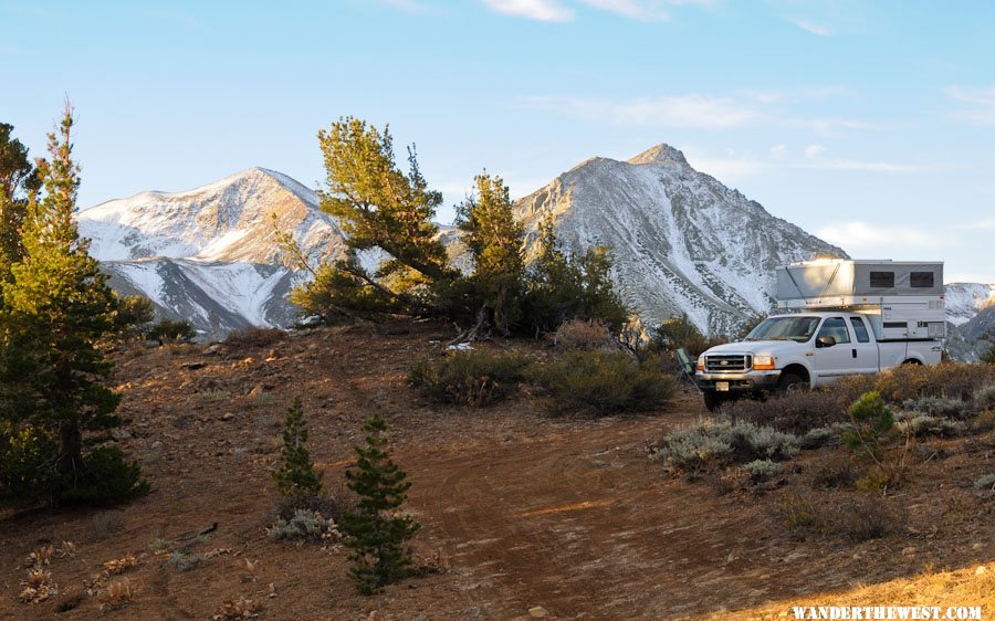
In the driving tour with my Bridgeport friend, as we drove east on the Virginia Lakes Rd, just before reaching US 395, he pointed out to me the turn-off south for Jordan Basin, a high basin/bench between the Virginia Lakes drainage and Lundy Canyon. He didn't want to head up there in his Honda Element, but he told me it's a great area -- lots of opportunities for dispersed camping -- with big views and much less-visited than the two well-known-and-heavily-visited areas that border it. Maybe less-visited because the only access road is narrow and slanted a bit and unsuitable for cars.
Sunday October 14 I left my friend's house and discovered that he was right about Jordan Basin -- very cool! I spent two nights up there. The first mile or two the two-track road has no opportunity to pass with heavy road-side shrubbery and steep side-slopes, so if you meet someone head-on somebody's gonna have to back up a ways.
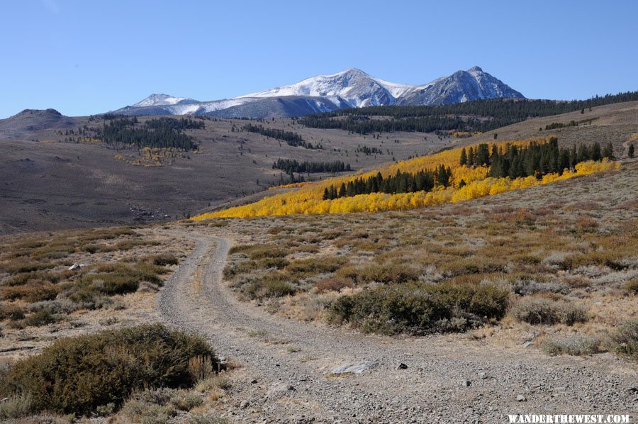
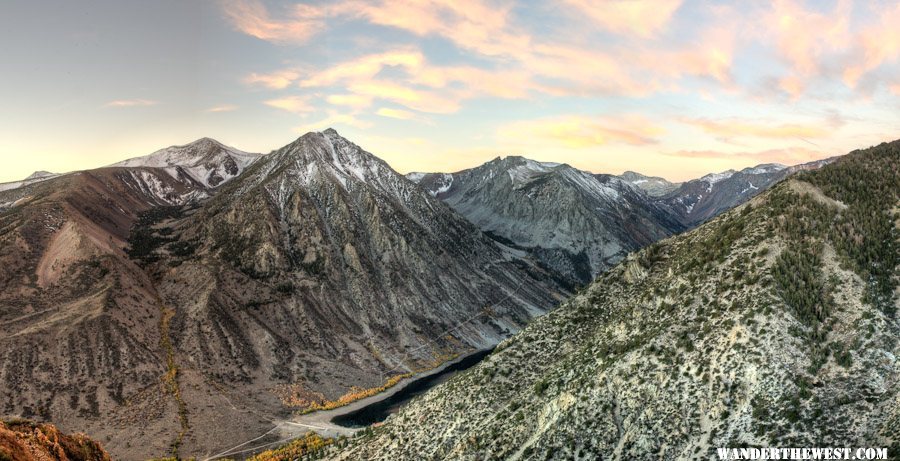
This photo is after you get up into the basin proper, after the narrow-no-room-to-pass zone.
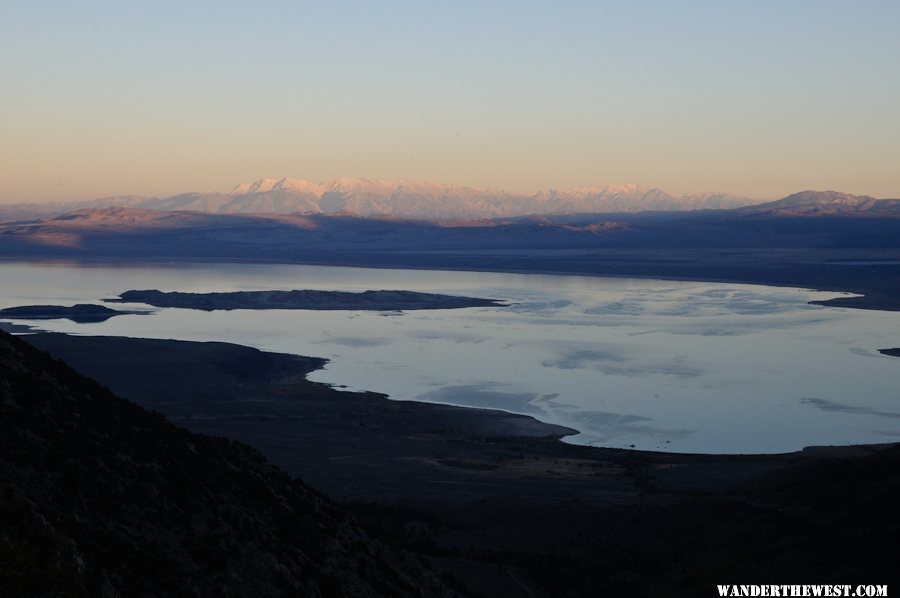
I drove around the basin, getting views to the north of the Dunderberg Rd area and to the northwest of the Virginia Lakes area...just exploring around. I remembered my friend told me that there's a spot where you can look right down, almost vertically, into Lundy Canyon, and that sounded pretty cool, so that became what I was looking for.
And I found it:
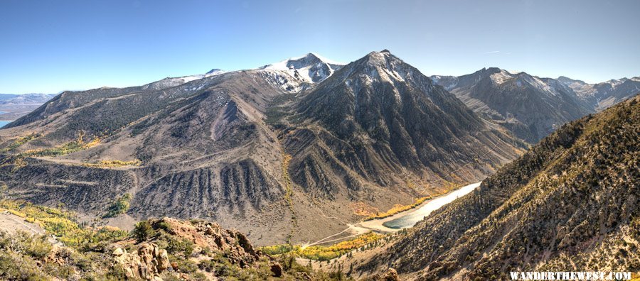
This is a thumbnail-segment of a panorama that I shot midday soon after arriving at this incredible view spot.
Here's a link to the full-size 360° rotatable panorama: Pano-06
It was a great campsite, but it took 4-low (maybe not required, but it helped) and tolerance of a paint-scratching brushy avenue to reach it.
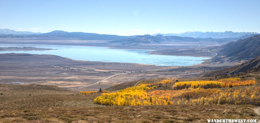
(great-view campsite, but not perfect: trees blocked the view of Mono Lake requiring a 100-yd walk to see it all...damn vegetation! )
)
I watched the sunset from that spot, including the last rays on the White Mts while Mono was already in dark.
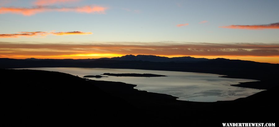
The next morning I took that long walk again to the prime view-spot I watched the dawn dawn over Mono Lake:
During that intervening day between the two night spent there I didn't do much...except that I managed to finish the installation/mounting of my solar charge controller with dual Watts Up meters: One upstream of the controller to see exactly what the dual-in-series PV panels were putting out and one downstream to see how the MPPT controller massaged the power to the voltage the battery required while converting the "extra" into more current.
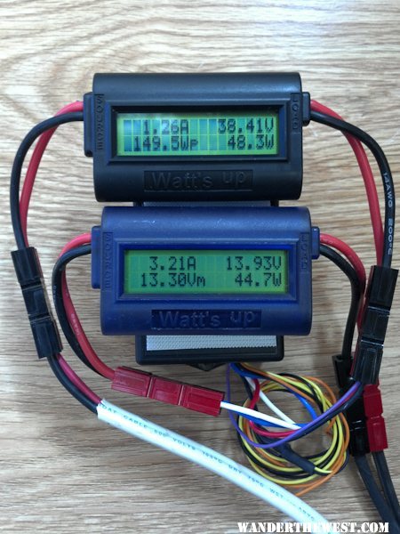
The controller is mostly hidden by the two meters velcro-ed to its face. The top meter shows 1.26 amps at 38.41 volts coming from the panels and the bottom meter shows the conversion to 3.21 amps at 13.93 volts being fed to the batteries. The batteries were almost full, but if they were lower voltage the MPPT effect/benefit would be even greater.
Next morning, Oct 16, I got up pre-dawn again and shot another full-round panorama from the spectacular view-spot, of which this is a thumbnail-segment:
Here's the link to the full-size 360° panorama: Pano-08
Finishing morning photo chores I got myself organized and packed and headed down. I more-or-less went back to the pavement via the way I'd come, rather than following the rest of the Jordan Basin loop, so there's some of it that's left for exploring next time.
At this point I stopped and admired the view of fall color and Mono Lake...even uploaded a photo from my phone to Facebook! (but this one was taken with my real camera):
On down the road, down to Bishop for supplies, etc. Cheapest gas I saw was at the Paiute casino/gas station at the NW end of town.
--more to come...up next, Part 4: The White Mts--
In the driving tour with my Bridgeport friend, as we drove east on the Virginia Lakes Rd, just before reaching US 395, he pointed out to me the turn-off south for Jordan Basin, a high basin/bench between the Virginia Lakes drainage and Lundy Canyon. He didn't want to head up there in his Honda Element, but he told me it's a great area -- lots of opportunities for dispersed camping -- with big views and much less-visited than the two well-known-and-heavily-visited areas that border it. Maybe less-visited because the only access road is narrow and slanted a bit and unsuitable for cars.
Sunday October 14 I left my friend's house and discovered that he was right about Jordan Basin -- very cool! I spent two nights up there. The first mile or two the two-track road has no opportunity to pass with heavy road-side shrubbery and steep side-slopes, so if you meet someone head-on somebody's gonna have to back up a ways.
This photo is after you get up into the basin proper, after the narrow-no-room-to-pass zone.
I drove around the basin, getting views to the north of the Dunderberg Rd area and to the northwest of the Virginia Lakes area...just exploring around. I remembered my friend told me that there's a spot where you can look right down, almost vertically, into Lundy Canyon, and that sounded pretty cool, so that became what I was looking for.
And I found it:
This is a thumbnail-segment of a panorama that I shot midday soon after arriving at this incredible view spot.
Here's a link to the full-size 360° rotatable panorama: Pano-06
It was a great campsite, but it took 4-low (maybe not required, but it helped) and tolerance of a paint-scratching brushy avenue to reach it.
(great-view campsite, but not perfect: trees blocked the view of Mono Lake requiring a 100-yd walk to see it all...damn vegetation!
)I watched the sunset from that spot, including the last rays on the White Mts while Mono was already in dark.
The next morning I took that long walk again to the prime view-spot I watched the dawn dawn over Mono Lake:
During that intervening day between the two night spent there I didn't do much...except that I managed to finish the installation/mounting of my solar charge controller with dual Watts Up meters: One upstream of the controller to see exactly what the dual-in-series PV panels were putting out and one downstream to see how the MPPT controller massaged the power to the voltage the battery required while converting the "extra" into more current.
The controller is mostly hidden by the two meters velcro-ed to its face. The top meter shows 1.26 amps at 38.41 volts coming from the panels and the bottom meter shows the conversion to 3.21 amps at 13.93 volts being fed to the batteries. The batteries were almost full, but if they were lower voltage the MPPT effect/benefit would be even greater.
Next morning, Oct 16, I got up pre-dawn again and shot another full-round panorama from the spectacular view-spot, of which this is a thumbnail-segment:
Here's the link to the full-size 360° panorama: Pano-08
Finishing morning photo chores I got myself organized and packed and headed down. I more-or-less went back to the pavement via the way I'd come, rather than following the rest of the Jordan Basin loop, so there's some of it that's left for exploring next time.
At this point I stopped and admired the view of fall color and Mono Lake...even uploaded a photo from my phone to Facebook!
(but this one was taken with my real camera):On down the road, down to Bishop for supplies, etc. Cheapest gas I saw was at the Paiute casino/gas station at the NW end of town.
--more to come...up next, Part 4: The White Mts--
FWC Hawk (2005) on a Ford F250 Supercab, 6.8L V10 gas (2000)
#14
takesiteasy
-

- Members
- 2,588 posts
Senior Member
- LocationMinnesota
Posted 29 October 2012 - 12:56 AM
Here's the link to the full-size 360° panorama: Pano-08
MarkBC, these panoramas are really great. For someone from the midwest, they are pretty spectacular. I am curious how you take them. Does your camera do them more or less automatically or do they require a lot of work after the fact. I like to do simple panoramas by taking multiple photos with my point and shoot and stitching them together later but these of yours are obviously of a different order. -Al
#15
MarkBC
-
- Site Team
- 6,600 posts
The Weatherman
- LocationBend, Oregon
Posted 29 October 2012 - 03:47 AM
Thanks, Al.MarkBC, these panoramas are really great. For someone from the midwest, they are pretty spectacular. I am curious how you take them. Does your camera do them more or less automatically or do they require a lot of work after the fact. I like to do simple panoramas by taking multiple photos with my point and shoot and stitching them together later but these of yours are obviously of a different order. -Al

The photos are taken manually, then special software in my computer is used to combine them. To account for the distortion inherent in mapping a curved view of the world onto a flat sensor/film and then combining several -- as many as 24 or even 36 images for a full-360° view -- the software has to do lots of calculating/matching/warping/blending. And then there's the final step of magic that joins the two ends of the strip into a rotatable movie-like thing...which is what I find most-amazing.
I use software called "Panorama Factory", which is software that does nothing but various types of panoramas. I've used it for years and am used to it...but there are other choices out there, including panorama functions as one tool in a general photo editor.
If you want to know more, send me a PM/message or e-mail and I'll talk your ear off.
========================================================================
BTW WTWers: Sorry for dragging out this trip report over days...I'm not doing it for dramatic effect -- it's just sloth.
(I wish that was the only of the Seven Deadlies in my nature...but I guess you can only die once.
)
FWC Hawk (2005) on a Ford F250 Supercab, 6.8L V10 gas (2000)
#16
takesiteasy
-
- Members
- 2,588 posts
Senior Member
- LocationMinnesota
Posted 29 October 2012 - 12:54 PM
The photos are taken manually, then special software in my computer is used to combine them.
Ok, I'm familiar with that process, I just don't have either the camera or the software to get the results you do. I sometimes take video panoramas which is another way to get a sense of the whole scene. I should invest in a real camera one of these days. Anyway, I look forward to seeing more panos. Thanks.
#17
MarkBC
-
- Site Team
- 6,600 posts
The Weatherman
- LocationBend, Oregon
Posted 29 October 2012 - 06:49 PM
Part 4a: White Mountains Camping
My original more-or-less motivation for visiting the east side of the Sierras again, third year in a row in October, had been to take in the fall foliage colors...but when I read reports that it doesn't look like a stellar year I realized that I didn't really care that much, that I loved the area any time and wasn't going to change my plans.
BESIDES...I'd come up with the idea that I had gotten in good enough hiking shape this summer (after a few years of fatness and/or laziness) that it would be reasonable for me to set a hike/climb up White Mountain Peak as a goal for this trip. The last time I did this hike -- the highest peak I've ever been up -- I was about 20 years younger... .
.
But before we can climb (or even hike) we must camp (or so this story goes), so this next installment are photos I took before my hike.
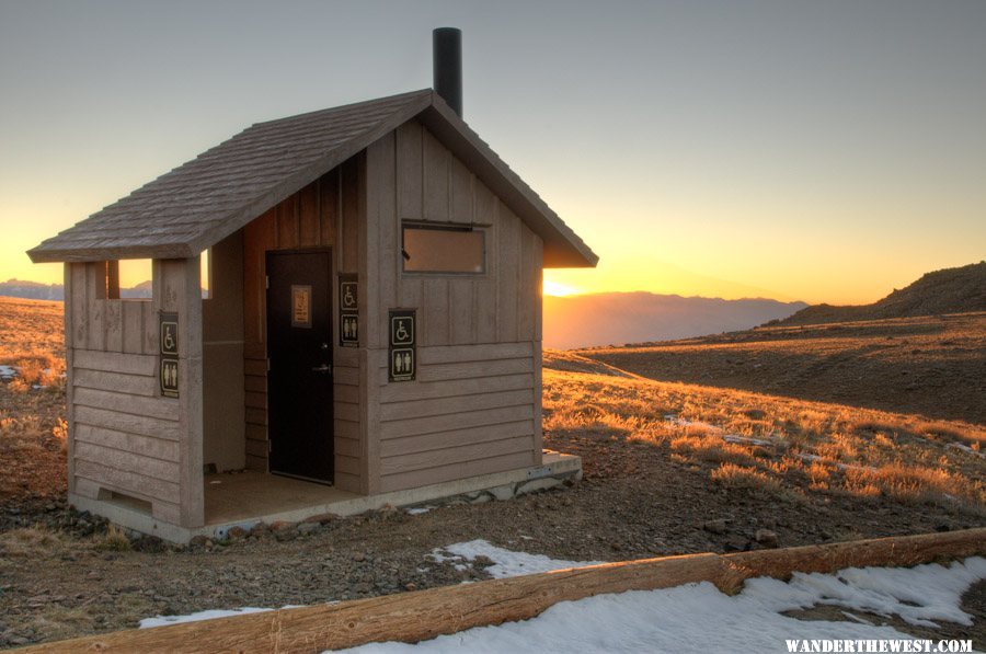
I've been in the White Mts many times over the years, and nearly all of those times I spend a night or two in Grandview Campground, preferably in good old site #22. This time I drove through the c.g. when I got up there (Oct 16), and I checked to see that site #22 was vacant -- it was, as was nearly every other site in the campground (though a couple of sites were occupied by folks who had large telescopes set up...at least, I think they were telescopes. They were covered when I went through, so they may have been anti-aircraft weapons -- not sure...).
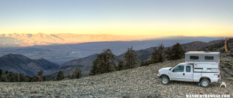
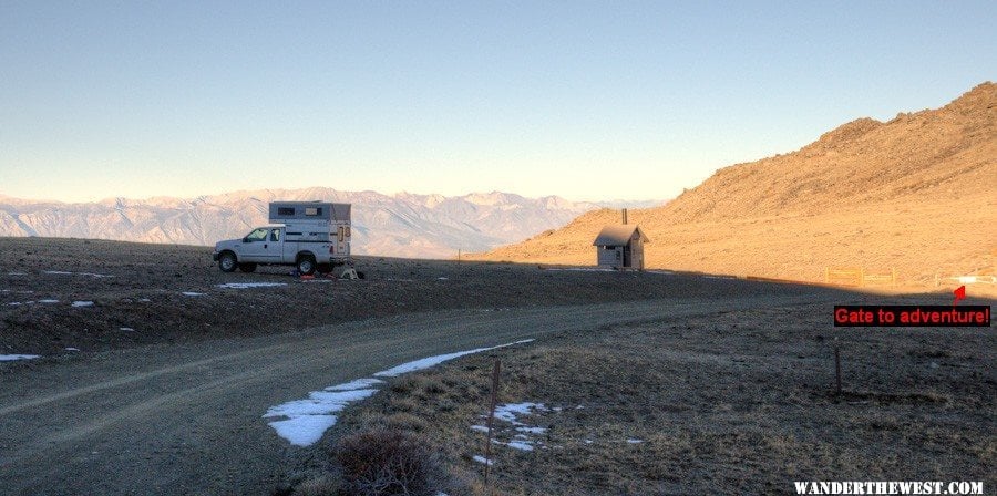
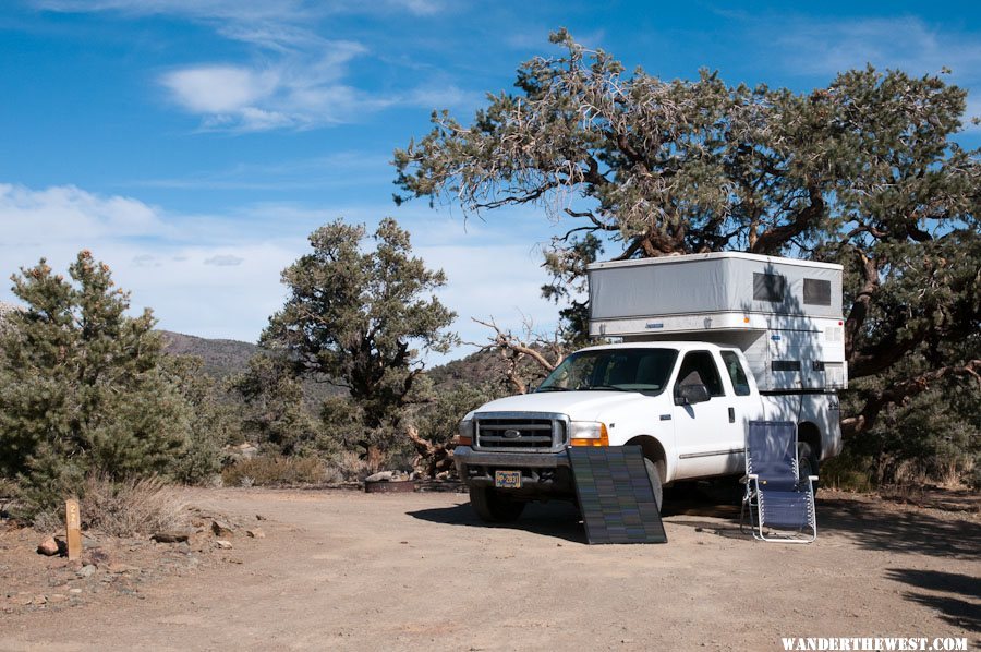
But since I found in October 2011 the very-nice, flat, and relatively close-by spot below the radio towers near the top of the Silver Canyon Road (and because Grandview C.G. doesn't have cell coverage, so how good is it really...?) I decided to drive those last few miles to the big view spot.
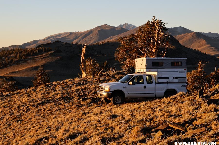
This spot was a few hundred feet from where I camped in October 2011, but on this perch it has a better view. In getting my truck parked in the perfect position, if I had suddenly hit the accelerator instead of the brakes I'd have had a wild ride down the west face of the Whites -- even better than the wild ride down the Silver Cyn Rd!
My truck is point at the east side of the Sierras, and that's White Mt. Peak way off to the north.
The view west, next morning:
I shot a few 360° panoramas in the morning...round and round and round as it got lighter. I think this one turned out the best.
Thumbnail-segment:
Here's a link to the full-size 360° rotatable panorama: Pano-09
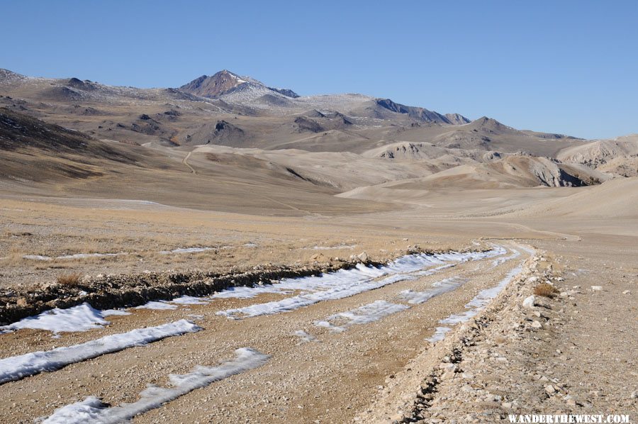
My plan was to hike up The Peak on Thursday the 18th, that date selected to maximize the amount of time for the new snow to have melted and yet give me time to get back down and meet up with WTW folks on Friday the 19th ("Part 5"). I decided that it would be best if I camped at the trailhead the night before my hike, so late-afternoon of the 17th I broke camp at the Radio Towers and drove up...and up...and up...
Love this really-cool lunar-oid landscape!
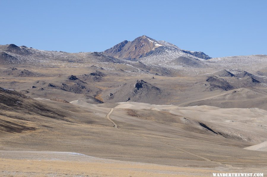
I said this last year in response to the same view, but this reminds me of the Altiplano of the Andes...though I've never been there -- yet.
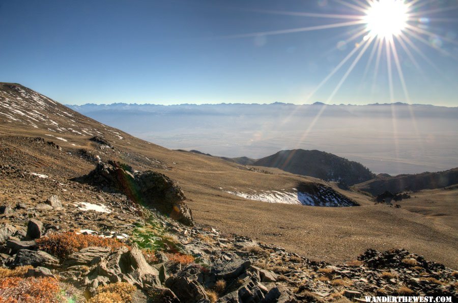
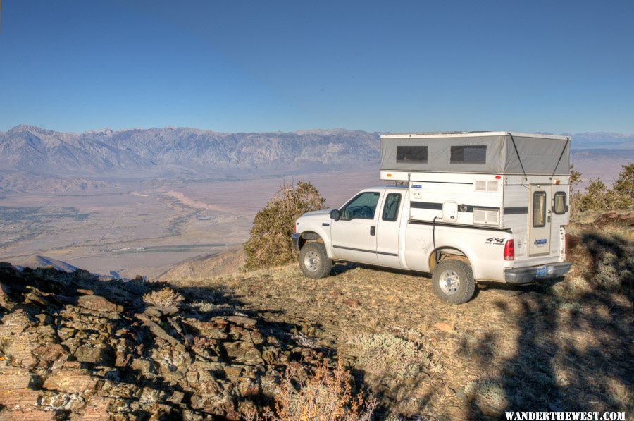
I hike about half a mile to this spot to get a cell signal...and to take in this smoggy view of the Owens Valley.
I don't turn up my nose at camping-convenience, I welcome it!
Though I may hold my nose...
Morning of the hike:
--more to come...very soon--
My original more-or-less motivation for visiting the east side of the Sierras again, third year in a row in October, had been to take in the fall foliage colors...but when I read reports that it doesn't look like a stellar year I realized that I didn't really care that much, that I loved the area any time and wasn't going to change my plans.
BESIDES...I'd come up with the idea that I had gotten in good enough hiking shape this summer (after a few years of fatness and/or laziness) that it would be reasonable for me to set a hike/climb up White Mountain Peak as a goal for this trip. The last time I did this hike -- the highest peak I've ever been up -- I was about 20 years younger...
.But before we can climb (or even hike) we must camp (or so this story goes), so this next installment are photos I took before my hike.
I've been in the White Mts many times over the years, and nearly all of those times I spend a night or two in Grandview Campground, preferably in good old site #22. This time I drove through the c.g. when I got up there (Oct 16), and I checked to see that site #22 was vacant -- it was, as was nearly every other site in the campground (though a couple of sites were occupied by folks who had large telescopes set up...at least, I think they were telescopes. They were covered when I went through, so they may have been anti-aircraft weapons -- not sure...).
But since I found in October 2011 the very-nice, flat, and relatively close-by spot below the radio towers near the top of the Silver Canyon Road (and because Grandview C.G. doesn't have cell coverage, so how good is it really...?) I decided to drive those last few miles to the big view spot.
This spot was a few hundred feet from where I camped in October 2011, but on this perch it has a better view. In getting my truck parked in the perfect position, if I had suddenly hit the accelerator instead of the brakes I'd have had a wild ride down the west face of the Whites -- even better than the wild ride down the Silver Cyn Rd!
My truck is point at the east side of the Sierras, and that's White Mt. Peak way off to the north.
The view west, next morning:
I shot a few 360° panoramas in the morning...round and round and round as it got lighter. I think this one turned out the best.
Thumbnail-segment:
Here's a link to the full-size 360° rotatable panorama: Pano-09
My plan was to hike up The Peak on Thursday the 18th, that date selected to maximize the amount of time for the new snow to have melted and yet give me time to get back down and meet up with WTW folks on Friday the 19th ("Part 5"). I decided that it would be best if I camped at the trailhead the night before my hike, so late-afternoon of the 17th I broke camp at the Radio Towers and drove up...and up...and up...
Love this really-cool lunar-oid landscape!
I said this last year in response to the same view, but this reminds me of the Altiplano of the Andes...though I've never been there -- yet.
I hike about half a mile to this spot to get a cell signal...and to take in this smoggy view of the Owens Valley.
I don't turn up my nose at camping-convenience, I welcome it!
Though I may hold my nose...
Morning of the hike:
--more to come...very soon--
FWC Hawk (2005) on a Ford F250 Supercab, 6.8L V10 gas (2000)
#18
Smokecreek1
-
- Members
- 2,763 posts
Smokecreek1
- LocationNE Calif/NW Nev
Posted 29 October 2012 - 08:28 PM
Part 3: Jordan Basin
In the driving tour with my Bridgeport friend, as we drove east on the Virginia Lakes Rd, just before reaching US 395, he pointed out to me the turn-off south for Jordan Basin, a high basin/bench between the Virginia Lakes drainage and Lundy Canyon. He didn't want to head up there in his Honda Element, but he told me it's a great area -- lots of opportunities for dispersed camping -- with big views and much less-visited than the two well-known-and-heavily-visited areas that border it. Maybe less-visited because the only access road is narrow and slanted a bit and unsuitable for cars.
Sunday October 14 I left my friend's house and discovered that he was right about Jordan Basin -- very cool! I spent two nights up there. The first mile or two the two-track road has no opportunity to pass with heavy road-side shrubbery and steep side-slopes, so if you meet someone head-on somebody's gonna have to back up a ways.
This photo is after you get up into the basin proper, after the narrow-no-room-to-pass zone.
I drove around the basin, getting views to the north of the Dunderberg Rd area and to the northwest of the Virginia Lakes area...just exploring around. I remembered my friend told me that there's a spot where you can look right down, almost vertically, into Lundy Canyon, and that sounded pretty cool, so that became what I was looking for.
And I found it:
This is a thumbnail-segment of a panorama that I shot midday soon after arriving at this incredible view spot.
Here's a link to the full-size 360° rotatable panorama: Pano-06
It was a great campsite, but it took 4-low (maybe not required, but it helped) and tolerance of a paint-scratching brushy avenue to reach it.
(great-view campsite, but not perfect: trees blocked the view of Mono Lake requiring a 100-yd walk to see it all...damn vegetation!
I watched the sunset from that spot, including the last rays on the White Mts while Mono was already in dark.
The next morning I took that long walk again to the prime view-spot I watched the dawn dawn over Mono Lake:
During that intervening day between the two night spent there I didn't do much...except that I managed to finish the installation/mounting of my solar charge controller with dual Watts Up meters: One upstream of the controller to see exactly what the dual-in-series PV panels were putting out and one downstream to see how the MPPT controller massaged the power to the voltage the battery required while converting the "extra" into more current.
The controller is mostly hidden by the two meters velcro-ed to its face. The top meter shows 1.26 amps at 38.41 volts coming from the panels and the bottom meter shows the conversion to 3.21 amps at 13.93 volts being fed to the batteries. The batteries were almost full, but if they were lower voltage the MPPT effect/benefit would be even greater.
Next morning, Oct 16, I got up pre-dawn again and shot another full-round panorama from the spectacular view-spot, of which this is a thumbnail-segment:
Here's the link to the full-size 360° panorama: Pano-08
Finishing morning photo chores I got myself organized and packed and headed down. I more-or-less went back to the pavement via the way I'd come, rather than following the rest of the Jordan Basin loop, so there's some of it that's left for exploring next time.
At this point I stopped and admired the view of fall color and Mono Lake...even uploaded a photo from my phone to Facebook!
On down the road, down to Bishop for supplies, etc. Cheapest gas I saw was at the Paiute casino/gas station at the NW end of town.
--more to come...up next, Part 4: The White Mts--
Nice view Mark! Good trip>
Smoke
Smokecreek1:99F1504x4with05Granby
#19
MarkBC
-
- Site Team
- 6,600 posts
The Weatherman
- LocationBend, Oregon
Posted 29 October 2012 - 09:20 PM
Part 4b: White Mountain Peak Hike
(NOTE: All these "hike" photos were taken with my Droid Bionic phone camera...wish it had optical zoom, but other than that lack, I'm satisfied with its photos...for a phone)
The last time I did this hike, the only other time, I was a lot younger and in much better shape. It's 14 miles roundtrip, and though the elevation gain is (net) just 2500 feet, it starts at almost 12,000 feet, so altitude is a factor. But, I've never experienced altitude sickness (at these altitudes), so I wasn't worried about that.
I started my hike at 8:20am, picked so that I could start after the sun was fully up (so not as cold) and yet with 9+ hours of full daylight. I brought a headlamp and extra batteries, just in case. I also brought way more warm clothes than I ended up needing. It was NOT cold and not windy.
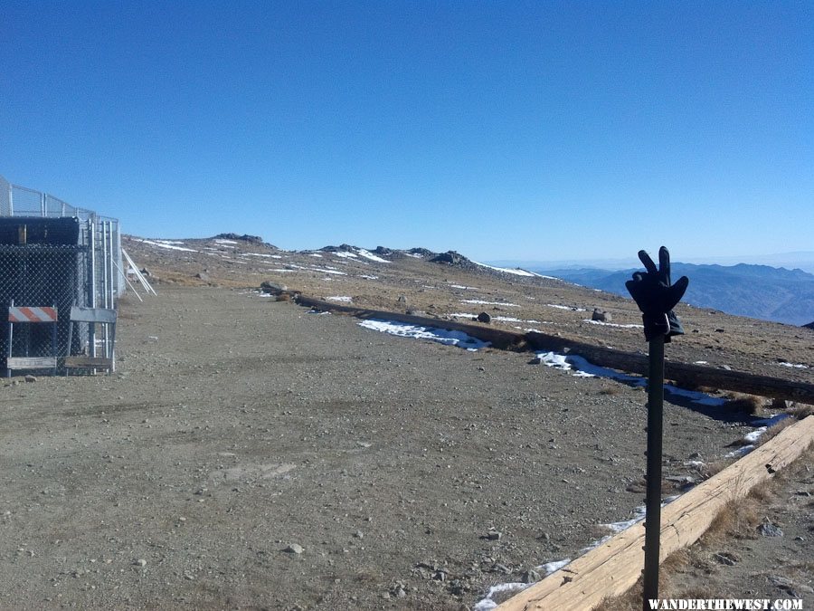
The trail (that is, the road that you walk along as a trail) starts at about 11,700 feet. Here we go!
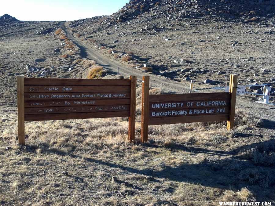
The road beyond the trailhead parking (or camping) is closed except to those with business at the UC Barcroft Lab, which is a couple miles further on.
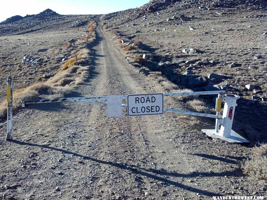
Yes, closed...but is it actually locked?
NOPE!
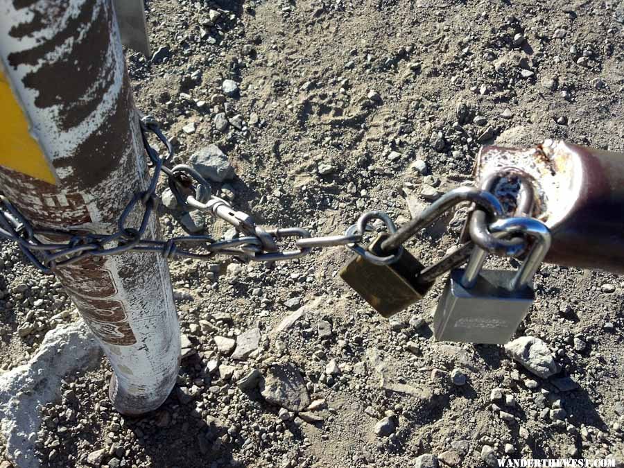
I guess it must be locked on the honor system!
In a couple miles I arrive and pass through the Barcroft Lab.
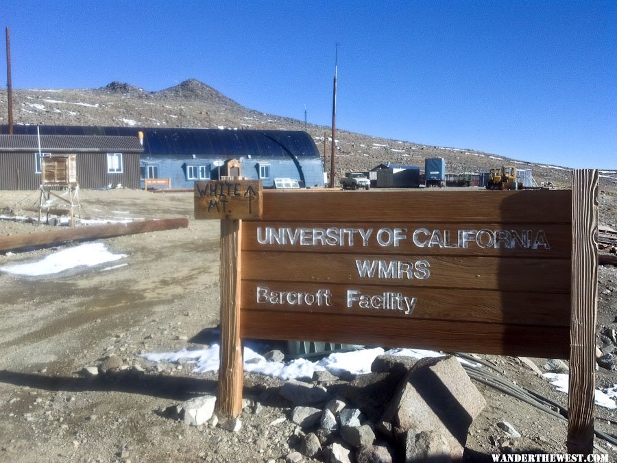
Nice they have a sign pointing the way for lost hikers...
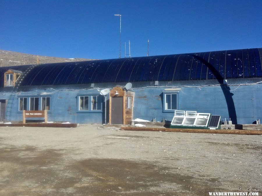
The roof of this quonset hut is covered with flexible solar panels!
See ya later, dude!
I was NOT pleased to see snow covering the road-trail this far down (~12,000 feet). Walking in snow would make this much harder -- probably harder than my fitness level would permit.
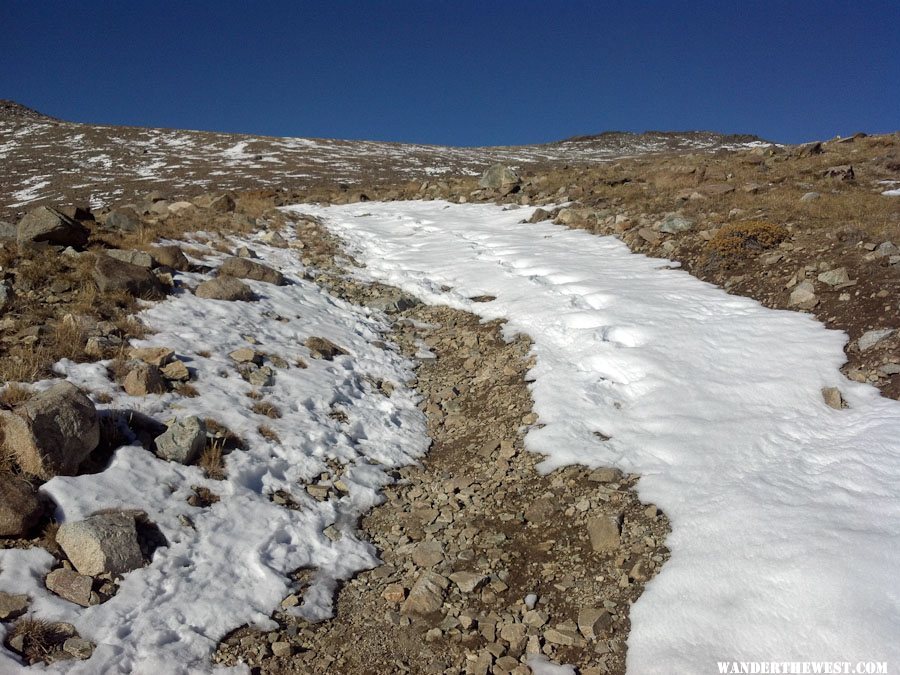
Fortunately, though the road/trail continued to be snow-covered right to the summit, for almost all that way the berms at the edge of the road were snow-free, so that's where I walked, mostly.
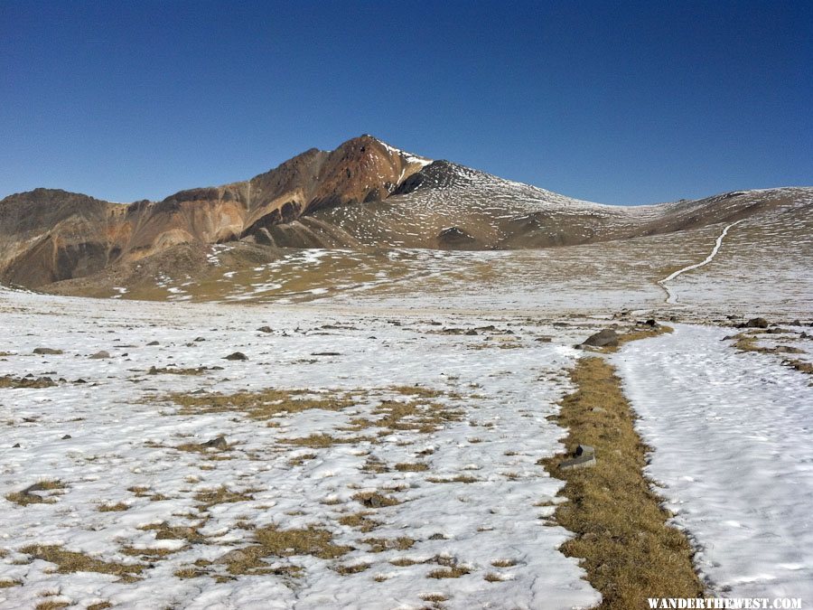
Unlike a lot of mountains where you start at the bottom and just grunt your way up, most of the distance of this hike/climb is traversing along the crest of the White Mt range before you get to the Peak proper. And like a lot of ranges, it's up and down -- flat if you're lucky. Just means that the hike back to the rig is not necessarily all down hill.
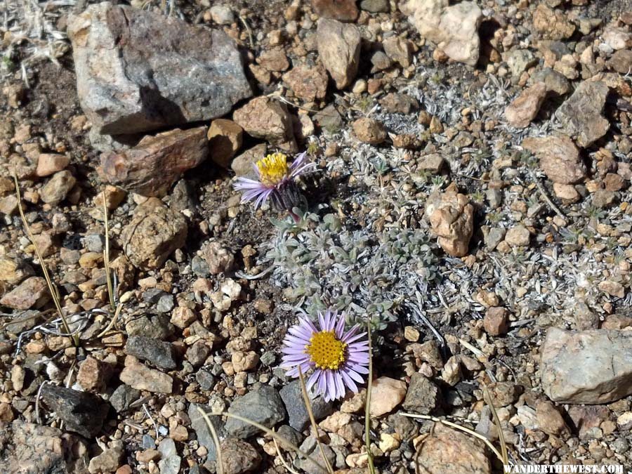
Amazing to see this delicate little flower blooming at around 12,500 feet in mid/late October!
Damn, it's still a long way up!
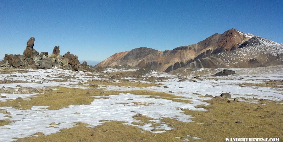
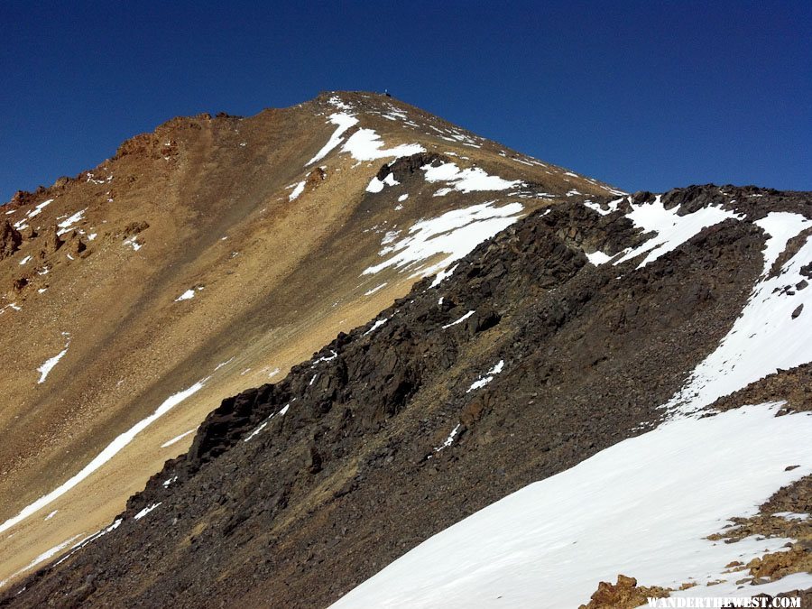
Rugged...almost brutal...maybe even ugly terrain:
But I like it.
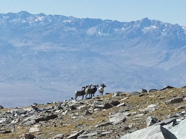
I saw these guys -- and they saw me -- at around 13,000 feet:
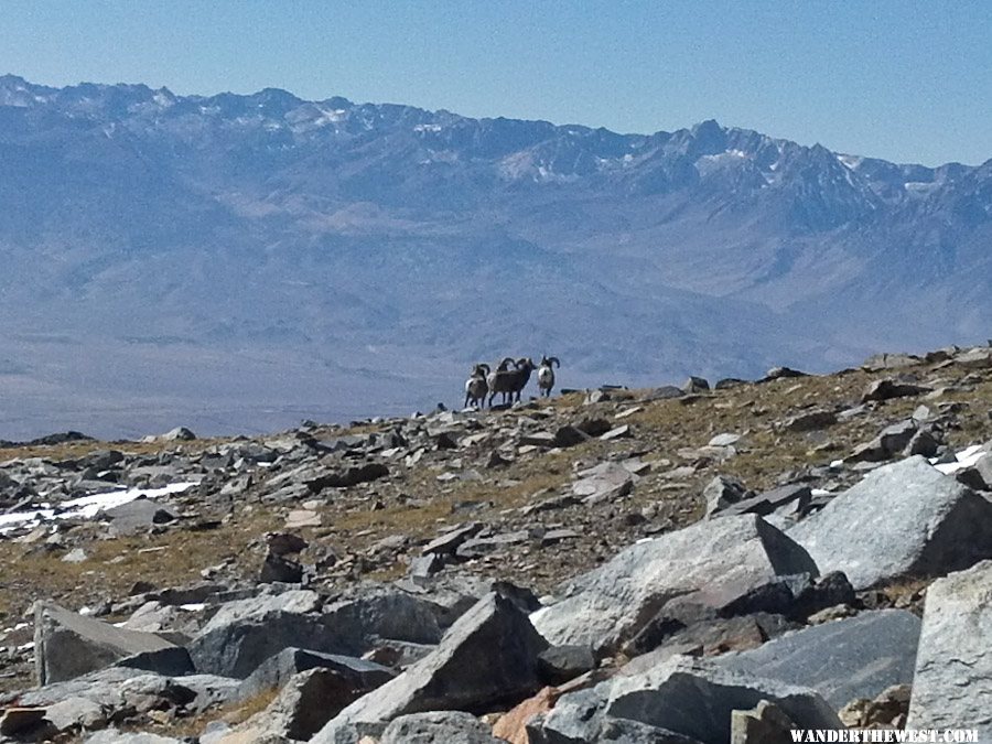
All rams...probably gay...not that there's anything wrong with that.
(NOTE: All these "hike" photos were taken with my Droid Bionic phone camera...wish it had optical zoom, but other than that lack, I'm satisfied with its photos...for a phone)
The last time I did this hike, the only other time, I was a lot younger and in much better shape. It's 14 miles roundtrip, and though the elevation gain is (net) just 2500 feet, it starts at almost 12,000 feet, so altitude is a factor. But, I've never experienced altitude sickness (at these altitudes), so I wasn't worried about that.
I started my hike at 8:20am, picked so that I could start after the sun was fully up (so not as cold) and yet with 9+ hours of full daylight. I brought a headlamp and extra batteries, just in case. I also brought way more warm clothes than I ended up needing. It was NOT cold and not windy.
The trail (that is, the road that you walk along as a trail) starts at about 11,700 feet. Here we go!
The road beyond the trailhead parking (or camping) is closed except to those with business at the UC Barcroft Lab, which is a couple miles further on.
Yes, closed...but is it actually locked?
NOPE!
I guess it must be locked on the honor system! In a couple miles I arrive and pass through the Barcroft Lab.
Nice they have a sign pointing the way for lost hikers...
The roof of this quonset hut is covered with flexible solar panels!
See ya later, dude!
I was NOT pleased to see snow covering the road-trail this far down (~12,000 feet). Walking in snow would make this much harder -- probably harder than my fitness level would permit.
Fortunately, though the road/trail continued to be snow-covered right to the summit, for almost all that way the berms at the edge of the road were snow-free, so that's where I walked, mostly.
Unlike a lot of mountains where you start at the bottom and just grunt your way up, most of the distance of this hike/climb is traversing along the crest of the White Mt range before you get to the Peak proper. And like a lot of ranges, it's up and down -- flat if you're lucky. Just means that the hike back to the rig is not necessarily all down hill.
Amazing to see this delicate little flower blooming at around 12,500 feet in mid/late October!
Damn, it's still a long way up!
Rugged...almost brutal...maybe even ugly terrain:
But I like it.
I saw these guys -- and they saw me -- at around 13,000 feet:
All rams...probably gay...not that there's anything wrong with that.
FWC Hawk (2005) on a Ford F250 Supercab, 6.8L V10 gas (2000)
#20
MarkBC
-
- Site Team
- 6,600 posts
The Weatherman
- LocationBend, Oregon
Posted 29 October 2012 - 09:24 PM
During the hike I drank A LOT of water -- about 3.5 quarts on the way up. I've learned the hard way that staying well-hydrated makes a HUGE difference in how I feel when doing a long deal like this, systemically as well as to avoid muscle-cramps. And I ate regularly, too, during the hike.
So...I made it to the summit in 5 hours...which has gotta be a slow time, but I'm just glad to have done it cramp-free.
Re-posting the summit photos from the beginning of this report:
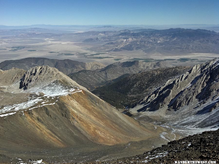
The view north along the crest of the White Mountains.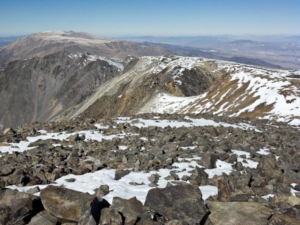
The view east into (mostly) Nevada from the summit: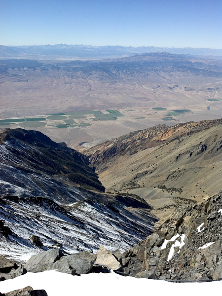
"Proof" of my summiting: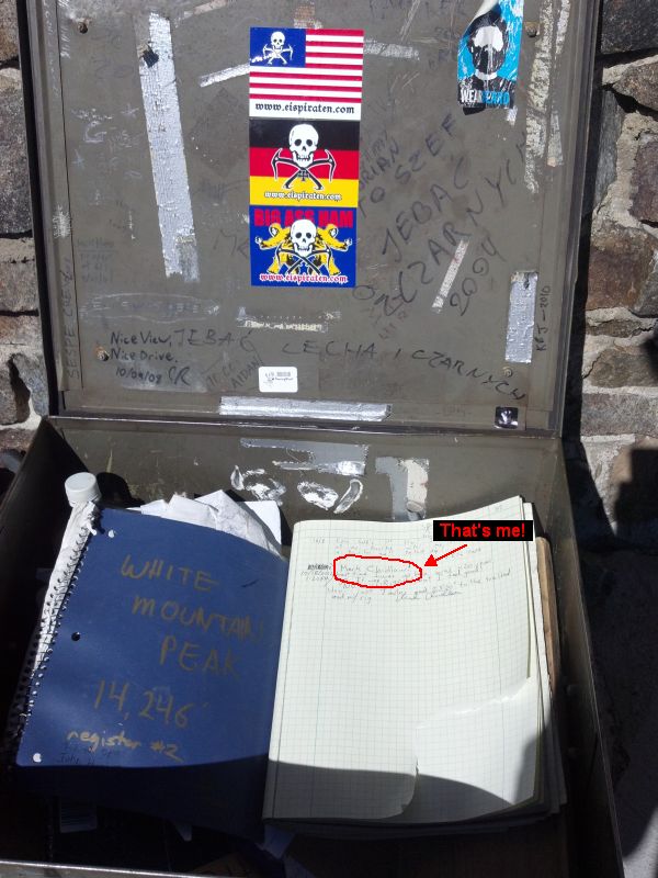
I spent about 45 minutes on the summit, resting, posting to Facebook ("I made it!"), enjoying the view -- and the silence. There was NO WIND! No wind at a place that regularly experiences extreme winds. So comfortable that I didn't have to bundle up while motionless. Very nice.
My hiking food posed on the summit-register box: Ibuprofen and diet snacks...the diet that helped me shed enough weight that I could get my ass (less of it) up this hill!
The hike down was a completely different activity, of course. I can walk fast when it's easy, and this was mostly downhill, but not too steep downhill, so it went quick. What took 5 hours up took 3 hours down.
But it wasn't all downhill or even flat -- this part was uphill...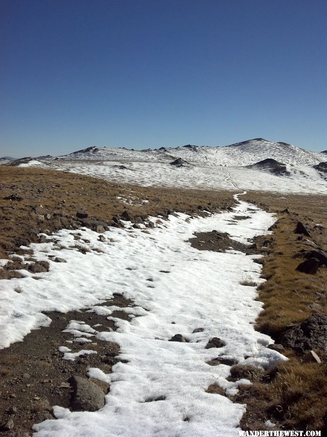
Oh well...
With the Lab back in site, I knew it was all downhill from here: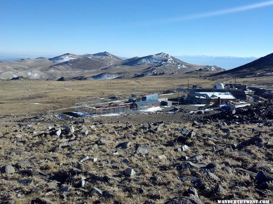
Made it back!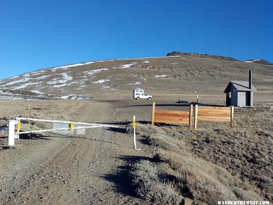
Earlier in the day, thinking about what I'd do when I got back to the truck I considered:
- Drive down to Bishop and get a cheap motel and eat calorie-laden food.
- Drive to Grandview Campground to save money (compared to Bishop), but still have an easy camp
- Drive to a spot near the top of Silver Cyn Rd that's flat and easy and has cell-signal so I can report to worriers that I didn't die on the descent
- But I opted for this choice: Stay and camp another night at the trailhead so that I didn't have to drive -- just eat and sleep. I felt great...tired, but great.
--more to come: Part 5: WTW Rendezvous/& The End--
FWC Hawk (2005) on a Ford F250 Supercab, 6.8L V10 gas (2000)


0 user(s) are reading this topic
0 members, 0 guests, 0 anonymous users

