Mark,
From what I have come to believe are your traveling preferences, I can offer the following suggestions:
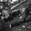
Rock Creek Canyon, east of Missoula- Rock Creek Canyon runs about 60 miles south from its mouth at I-90 around 20 miles east of Missoula. The first 10 miles is paved and developed, then it turns to graded gravel and runs another 31 miles upstream to MT 348 west of Philipsburg. You may also stay on gravel past MT 348 to MT 38, the Skalkaho Highway. The headwater streams branch off upstream (south) of MT 38 and drain the Anaconda-Pintlar Wilderness Area astride the Continental Divide. From the end of the pavement at MP 10, it's a beautiful drive in a fairly narrow canyon with many opportunites to see mountain sheep, moose, eagles, and deer. A good half-dozen primitive NF campgrounds are sprinkled along the way, and streamside disbursed campsites abound. From MP 0 to about MP 35 are within the Lolo NF or the Beaverhead-Deerlodge NF.
Pioneer Mountains Scenic Byway- The Byway is all paved and runs N-S from the Grasshopper Valley southeast of Jackson, MT north over a divide then down the Wise River to the village of Wise River along MT 43. There are about a half-dozen or more NF campgrounds and unless the rules have changed, some very nice streamside disbursed campsites in the vicinity of the Little Joe CG and Vista Point.
Lemhi Pass and Sharkey's Hot Spring- Lemhi Pass is where Lewis and Clark first crossed the Divide and discovered something OTHER THAN an easy glide downstream to the Pacific. The imagery is powerful driving up from the MT side to the BLM visitor's kiosk just below the pass. Park the truck there and hoof it the couple of hundred yards on up the road to the pass for the same view they saw. Two roads descend the ID side from the pass. Agency Creek Rd is straight ahead and is signed as steep and winding. Warm Springs Road runs northerly and stays high along the dividing ridge for a couple or three miles, then drops down lower on the ID side. Sharkey's Hot Spring is a natural spring within the sagebrush-covered hills at point which the BLM has piped the flow into a nice pair of large jacuzzi-like pools. There are bathrooms and changing rooms and a concrete apron around all. Pretty nice facility for having a soak, catching a few rays, and enjoying an early Fall afternoon. You can drop on down to ID 28 and enjoy the fun outdoorsy town of Salmon, ID, just a few miles north along ID 28.
Gold Bug Hot Spring- This is a gem among gems. Gold Bug is just off of US 93 at a point around 18 miles south, along the Salmon River, from Salmon, ID. A couple or three hundred yards up a gravel road from 93 is a parking area and trailhead. The trail is around a mile and a half and picks up around 1,000' in elevation, much of it in the last quarter mile or so, where it is fairly steep. The reward at the end is easily the most spectacular natural hot spring in Idaho. A steeply plunging coldwater stream accepts the high-volume hot water input from the spring, and over the years many pools have been constructed by visitors. The view from the pools is back to the west, down the valley which you ascended coming in, across the Salmon River (which you can't see from the pools), to the big brown hills on the other side of the river, several miles away. Gold Bug is clothing-optional, and it gets regular visitors. Best to depart the trailhead EARLY in the morning, as by noon-ish the entire trail and the pools are in the direct sunlight, but are shaded until then. Heading up early would provide the greatest likelihood of privacy at the pools, too. Two retired guys share the residence at the trailhead, and unless their habits have changed, they head up to the pools for a soak each morning, weather permitting. We met them and thoroughly enjoyed their company back in 2011 and look forward to soaking with them again soon.
Magruder Corridor- This may really be your style. The Magruder is a two-track FS road running 110-120 miles from Elk City, ID, to Conner, MT. It was once known as the Southern Nez Perce Trail. The Magruder bisects the Bitterroot-Selway Wilderness and the Frank Church-River of No Return Wilderness, and when those two are combined with another Wilderness which abuts them on the western side, they comprise nearly 4 million acres of Wilderness. Long spur routes lead from the dividing ridge, which much of the Magruder runs, down to the Salmon River on the south and to the Selway River on the north. Taking in some of the longer out-and-back spurs, I can easily envision spending 3-5 days traversing the Magruder.
Big Sheep Creek and the Centennial Basin-- The Big Sheep Scenic Byway is a gravel route of around 60 miles running from I-15 in the vicinity of Dell or Lima, MT, through the Tendoy Range, thence north to MT 324 west of Clark Canyon Reservoir. I've not run it, but it traverses some territory I am familiar with, and it's "on the list". Similarly, the headwaters of the Missouri River (Lewis and Clark were mistaken when they declared the spring just below Lemhi Pass as the source of the Missouri) lie south and southeast from Lima, MT, and a network of graded gravel FS and county roads take you deep into the Centennial Valley, all the way to Red Rocks Pass, where you can enter Idaho near Henry's Lake and not too far from West Yellowstone, MT. Other roads traverse the Gravelly Range and the Ruby Ranges and take you to either Dillon, MT or Virginia City, MT. It's all within the Beaverhead-Deerlodge NF.
The Big Hole- For my money's worth, there is no more spectacular alpine valley in the Lower 48 than the Big Hole. Traversed by MT 43 and MT 278 from about Wise River, MT (town) to headwaters south of Jackson, MT ("town" more like a wide spot in MT 278), the valley floor is at 6,500', the glaciated and snowcapped Beaverheads, Bitterroots, and Anacondas form the western wall, and the forested West Pioneers form the east wall. It is called the "Land of 10,000 Haystacks" due to the use of the old style "beaverslide" stacking apparatus and the 25-30' high haystacks created by the beaverslide rig. The Big Hole is around 50 miles N-S and is up to 20 miles wide. I can heartily recommend the NF campground at Twin Lakes, southwest of Wisdom. Twin Lakes CG is a good 25 miles of mostly gravel roads from Wisdom, and a fairly narrow and rocky last two miles keeps out most towed campers. The two glacial lakes are at the foot of Hirschey Peak and mark the terminal moraine of the glacier which carved the most perfect "U" shaped valley you'll find anywhere. It's like standing inside a glacial geology textbook, with a several hundred acre lake, a snowcapped peak, and a forested valley surrounding you.
That should be enough to have you perusing the MT and ID Benchmark Atlases for a while. Get back on the forum with any questions or comments. This has been my "stomping ground" since 1978, and I can provide many more suggestions as you ponder the trip.
Foy
We're heading to ID next week for an extended trip and this is great info, Foy.