


Southern Utah (with a little northern AZ) May 2011
Started by
MarkBC
, May 12 2011 05:44 PM
47 replies to this topic
#21
 May 2011: post #21")
Overland Hadley
-

- Members
- 1,365 posts
Senior Member
- LocationLake Superior North
Posted 26 May 2011 - 11:50 AM
Nathanael - Large Format Landscape Photography
www.KuenzliPhotography.com
2012 Four Wheel Camper - The FWC Build
"If life was fair, Utah would be closer to home" DD
www.KuenzliPhotography.com
2012 Four Wheel Camper - The FWC Build
"If life was fair, Utah would be closer to home" DD
#22
ski3pin
-

- Site Team
- 15,346 posts
Belay On
- LocationSierra Nevada Range
Posted 26 May 2011 - 02:52 PM
the tale is unfolding, we're getting excited!
2003 Ford Ranger FX4 Level II 2013 ATC Bobcat SE "And in the end, it's not the years in your life that count. It's the life in your years."- Abraham Lincoln http://ski3pin.blogspot.com/
#23
clikrf8
-
- Members
- 494 posts
Senior Member
- LocationBellingham, WA
Posted 26 May 2011 - 03:55 PM
More, please. What an adventure you had. I am enjoying your comments and images. Cool snake. Whipsnake?
2008 Ford F250 diesel 4x4 off road pkg
2013 Hallmark Ute
http://www.clikrf8images.com/
http://clikrf8.wordp...com/2010/09/01/
#24
MarkBC
-
- Site Team
- 6,602 posts
The Weatherman
- LocationBend, Oregon
Posted 26 May 2011 - 04:31 PM
It was the night I camped at Red Canyon C.G. that I hit the top of my head on the door frame while entering the camper. It was not the first time I’ve done this, and it didn’t make me sit down or anything, so I didn’t think much of it…but I think this was the cause of the nearly-week-long headache that began the next day.
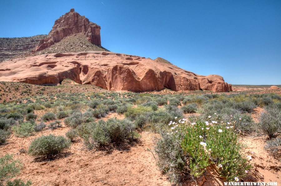
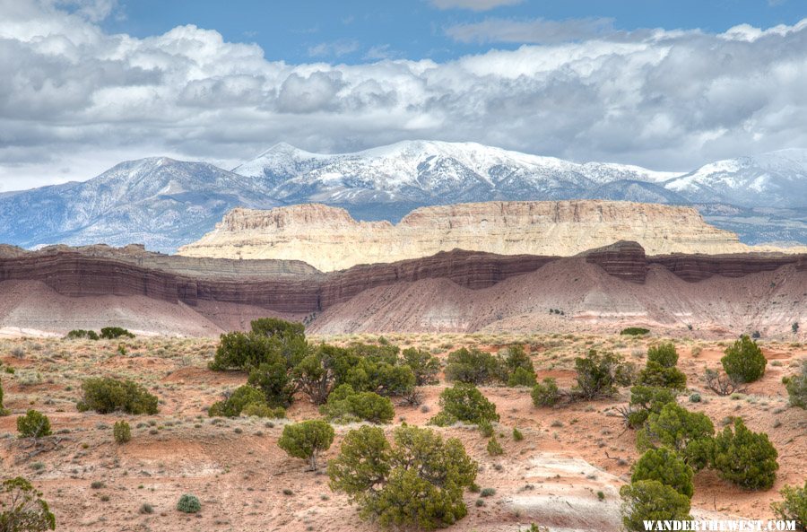
In Escalante (the town) I stopped at the Interagency Visitor Center, got information about the condition of the Hole In The Rock Road (“better than it’s been in years – a little washboard”, she said) and bought a couple maps and a new hiking guide. I headed out of town and down the H-I-T-R-Road. I drove all the way down to the end – 54 miles, pleased to see all the vehicles heading out, day-trippers it looked like. Even with flat midday light, it’s a cool area – this photo from somewhere in the middle of the route.
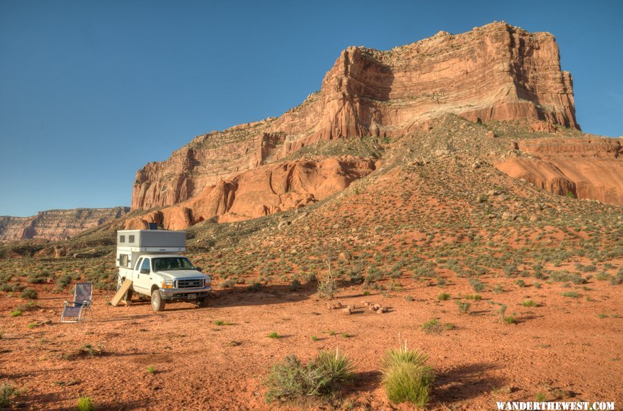
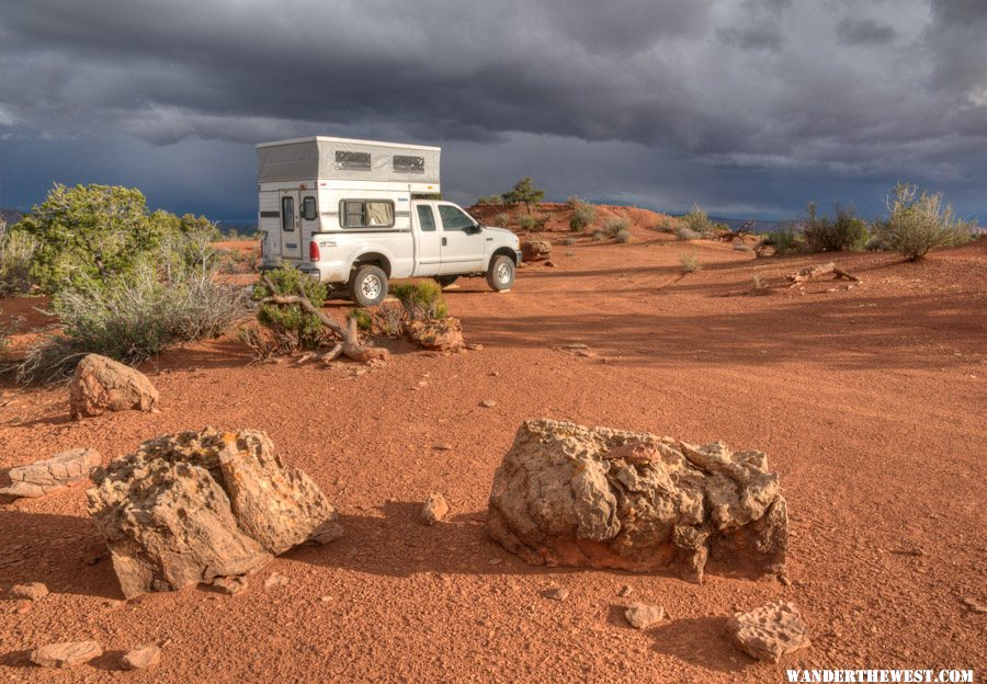
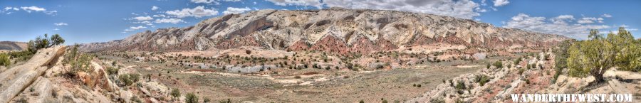
At the end of the road, at the historic “Hole in the rock” spot, I chatted for a bit with a couple from Sacramento who had an older FWC rig, then I turned around and drove back to find the closest “legal” (previously-used, non-trailhead) spot to camp. The road is closest to the scenic/slick-rock/canyons nearest its end, so preferred it down there. I found a spot on the south side of the road, near “50-Mile-Point”, a short walk from the beginning of infinite slickrock, that was pretty good – except for all the cow sh!t…but acceptable nevertheless. I spent 3 nights (May 5, 6, 7) there; Elevation 4822 ft. As the sun dropped in the sky and light started getting good I took a few photos, including a panorama from the edge of what I referred to as “infinite slickrock”, a short walk from my campsite.
Here’s a link to a full-size version of this image: Pano1
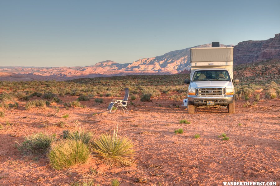
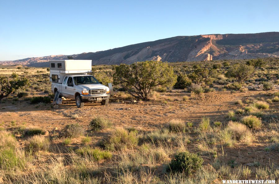
I got up before sunrise next morning and took a few photos, and I’d planned to do a hike (early, before it got hot) along/down Davis Gulch, but I noticed that my head hurt when I shook it, and I decided that getting my blood pumping in a hike probably wasn’t a good idea for a headache. So I just hung-out, relaxed, read, sat in the shade as it moved around my camper. I did this the next day, too, as my headache got a little worse. I considered that maybe this was dehydration-related, so I drank enough water that I was urinating frequently, but that didn’t seem to help. "Fifty-Mile Point" is the formation behind my rig.
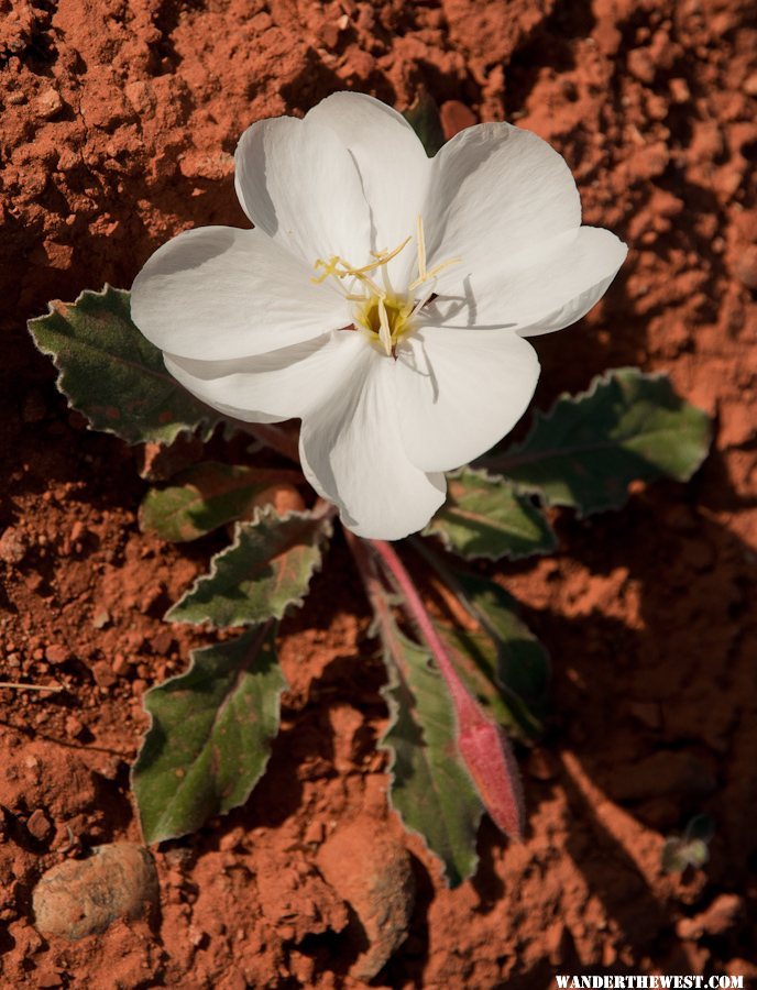 Evening primrose??
On the third morning in this spot – even though I’d done no hiking in this area that I’d planned to hike a lot – I decided that it was time to go, so I packed up and drove back to Escalante (town) and checked into the Prospector Inn motel (recommended!). I was due for a shower, and I figured that the cool comfort of a motel might do my head good. I’d posted my headache issue on my Facebook page, and a concerned friend called and insisted that I call my doctor (or on-call-substitute), so I did. The P.A. who returned my call was very rational, i.e., no need to overreact, no need for emergency CT scan, just “wait and see”.
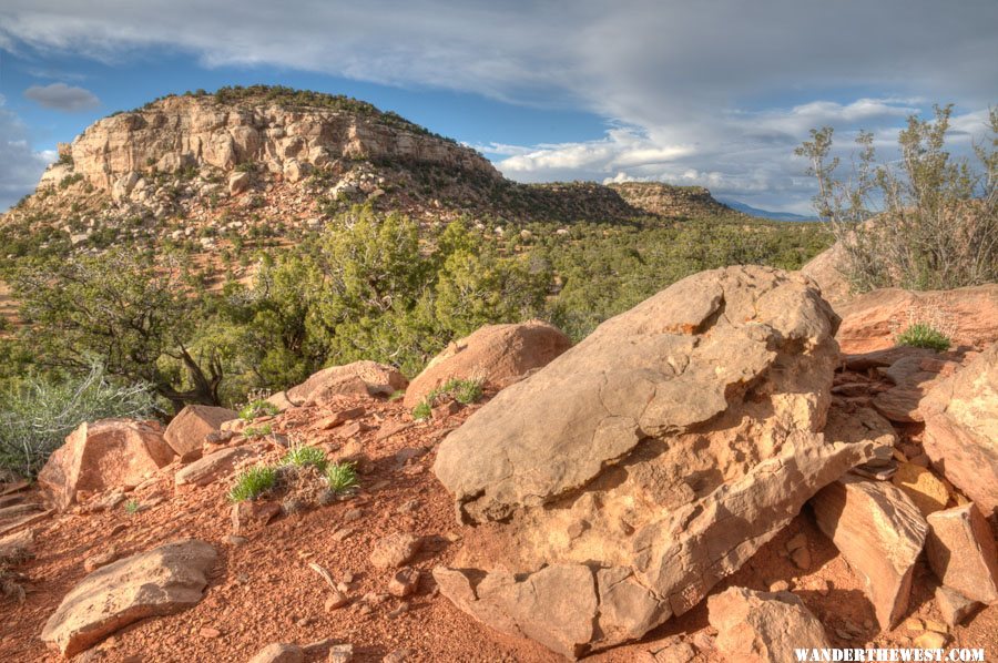
Next morning, May 9, my headache was less (though not gone), and I decided that I was well enough to continue my trip. I had a nice breakfast at the “Circle D Eatery”, where I had a chat with the staff about the cold wet spring that both Utah and Oregon were having and headed towards Boulder and the start of the Burr Trail. The west end of the Burr Trail goes through “Long Canyon”, and it’s very cool! I stopped and spent part of an hour photo-ing and did a walk up a scenic little slot canyon.
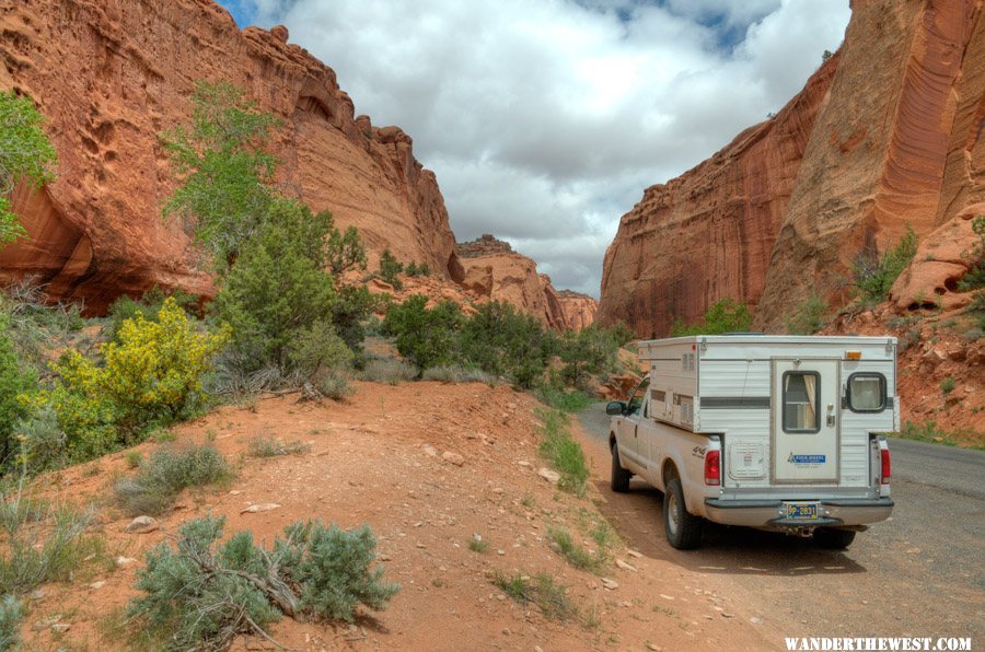
Onwards, eastward, down the Burr Trail towards Capitol Reef National Park....
In Escalante (the town) I stopped at the Interagency Visitor Center, got information about the condition of the Hole In The Rock Road (“better than it’s been in years – a little washboard”, she said) and bought a couple maps and a new hiking guide. I headed out of town and down the H-I-T-R-Road. I drove all the way down to the end – 54 miles, pleased to see all the vehicles heading out, day-trippers it looked like. Even with flat midday light, it’s a cool area – this photo from somewhere in the middle of the route.
At the end of the road, at the historic “Hole in the rock” spot, I chatted for a bit with a couple from Sacramento who had an older FWC rig, then I turned around and drove back to find the closest “legal” (previously-used, non-trailhead) spot to camp. The road is closest to the scenic/slick-rock/canyons nearest its end, so preferred it down there. I found a spot on the south side of the road, near “50-Mile-Point”, a short walk from the beginning of infinite slickrock, that was pretty good – except for all the cow sh!t…but acceptable nevertheless. I spent 3 nights (May 5, 6, 7) there; Elevation 4822 ft. As the sun dropped in the sky and light started getting good I took a few photos, including a panorama from the edge of what I referred to as “infinite slickrock”, a short walk from my campsite.
Here’s a link to a full-size version of this image: Pano1
I got up before sunrise next morning and took a few photos, and I’d planned to do a hike (early, before it got hot) along/down Davis Gulch, but I noticed that my head hurt when I shook it, and I decided that getting my blood pumping in a hike probably wasn’t a good idea for a headache. So I just hung-out, relaxed, read, sat in the shade as it moved around my camper. I did this the next day, too, as my headache got a little worse. I considered that maybe this was dehydration-related, so I drank enough water that I was urinating frequently, but that didn’t seem to help. "Fifty-Mile Point" is the formation behind my rig.
Evening primrose??On the third morning in this spot – even though I’d done no hiking in this area that I’d planned to hike a lot – I decided that it was time to go, so I packed up and drove back to Escalante (town) and checked into the Prospector Inn motel (recommended!). I was due for a shower, and I figured that the cool comfort of a motel might do my head good. I’d posted my headache issue on my Facebook page, and a concerned friend called and insisted that I call my doctor (or on-call-substitute), so I did. The P.A. who returned my call was very rational, i.e., no need to overreact, no need for emergency CT scan, just “wait and see”.
Next morning, May 9, my headache was less (though not gone), and I decided that I was well enough to continue my trip. I had a nice breakfast at the “Circle D Eatery”, where I had a chat with the staff about the cold wet spring that both Utah and Oregon were having and headed towards Boulder and the start of the Burr Trail. The west end of the Burr Trail goes through “Long Canyon”, and it’s very cool! I stopped and spent part of an hour photo-ing and did a walk up a scenic little slot canyon.
Onwards, eastward, down the Burr Trail towards Capitol Reef National Park....
FWC Hawk (2005) on a Ford F250 Supercab, 6.8L V10 gas (2000)
#25
MarkBC
-
- Site Team
- 6,602 posts
The Weatherman
- LocationBend, Oregon
Posted 26 May 2011 - 05:09 PM
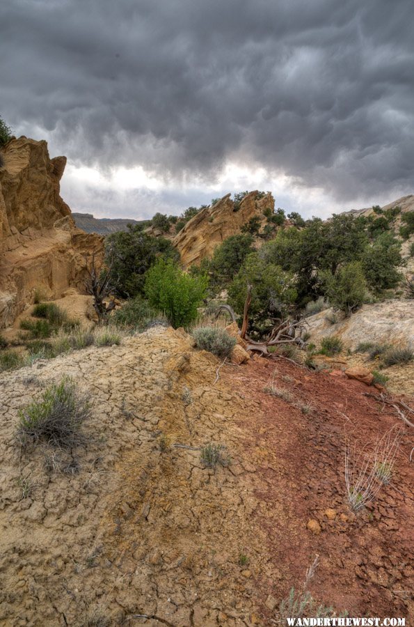
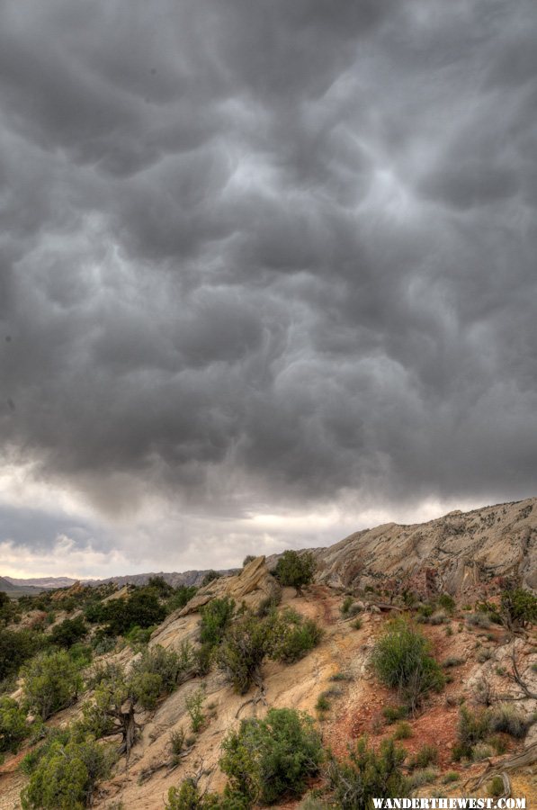
My plan was to find a place to camp along the Burr Trail west of Capitol Reef National Park – preferably a place with a big view. I ended up on a dirt road a couple miles south of the Burr on the east side of Studhorse Peaks. It had a pretty nice view, and I had it to myself. Elevation 6836 ft. I spent the nights of May 9 and 10 there, mostly just hanging out (as my headache continued to fade) and amusing myself with photography around/from my camp...trying to be arty at times. 
My campsite for 2 nights.
The rock in the foreground reminded me of a smiling dinosaur head.
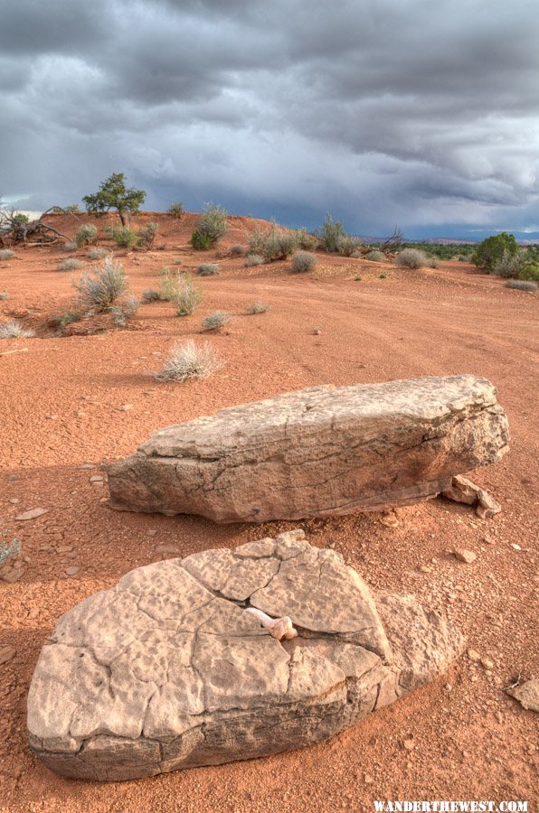
I liked the bone in the rock.
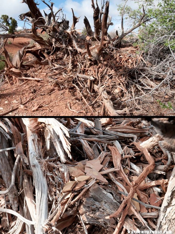
I noticed a packrat nest, and on closer examination I noticed that the critter had incorporated flat rocks as part of its roof -- like a slate roof on a human house.
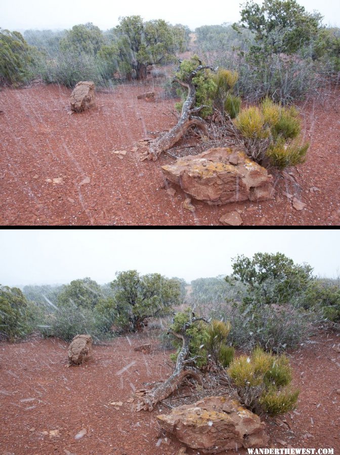
It snowed enough that surrounding hills turned white, but it didn't stick much where I was. Two different shutter speeds here:
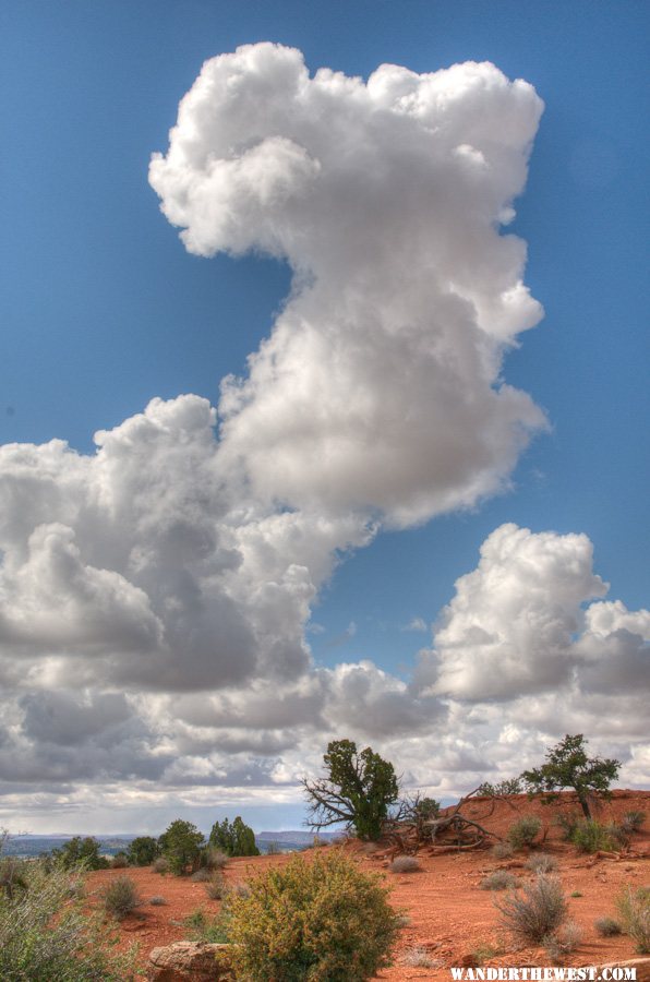
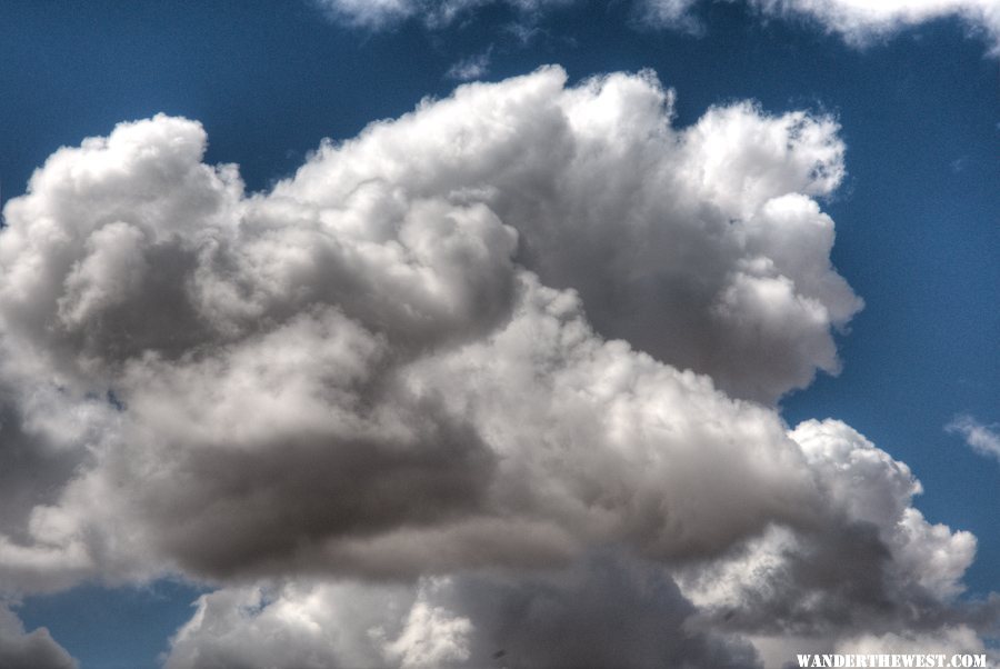
I spent some time watching clouds develop. I‘ve always said that the coolest, most-awesome things I’ve ever seen have been cloud formations– better than Alaskan Mts, better than Yosemite, Grand Canyon, Swiss Alps. Not these in particular, which are kinda ordinary, but still… (Contrast detail assisted by HDR photography)
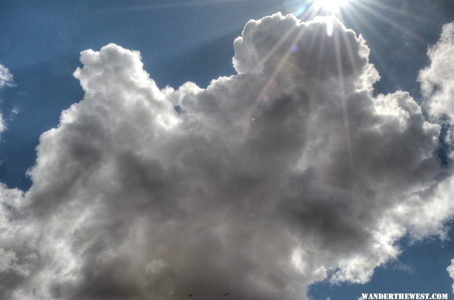
This one looks like a huge gaping mouth, ready to swallow passing aircraft.
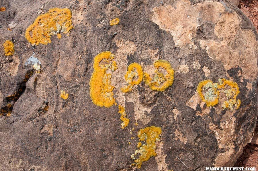
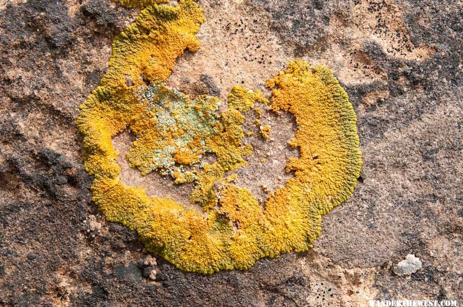
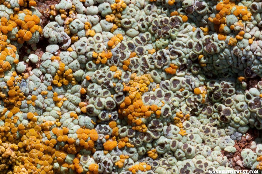
I also spent some time exploring details of lichen on boulders in camp,including a little macro-lens fun.
Next, Capitol Reef National Park.
My campsite for 2 nights.
The rock in the foreground reminded me of a smiling dinosaur head.
I liked the bone in the rock.
I noticed a packrat nest, and on closer examination I noticed that the critter had incorporated flat rocks as part of its roof -- like a slate roof on a human house.
It snowed enough that surrounding hills turned white, but it didn't stick much where I was. Two different shutter speeds here:
I spent some time watching clouds develop. I‘ve always said that the coolest, most-awesome things I’ve ever seen have been cloud formations– better than Alaskan Mts, better than Yosemite, Grand Canyon, Swiss Alps. Not these in particular, which are kinda ordinary, but still… (Contrast detail assisted by HDR photography)
This one looks like a huge gaping mouth, ready to swallow passing aircraft.
I also spent some time exploring details of lichen on boulders in camp,including a little macro-lens fun.
Next, Capitol Reef National Park.
FWC Hawk (2005) on a Ford F250 Supercab, 6.8L V10 gas (2000)
#26
MarkBC
-
- Site Team
- 6,602 posts
The Weatherman
- LocationBend, Oregon
Posted 26 May 2011 - 05:54 PM
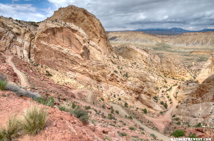
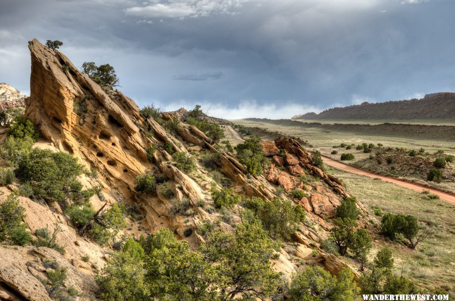
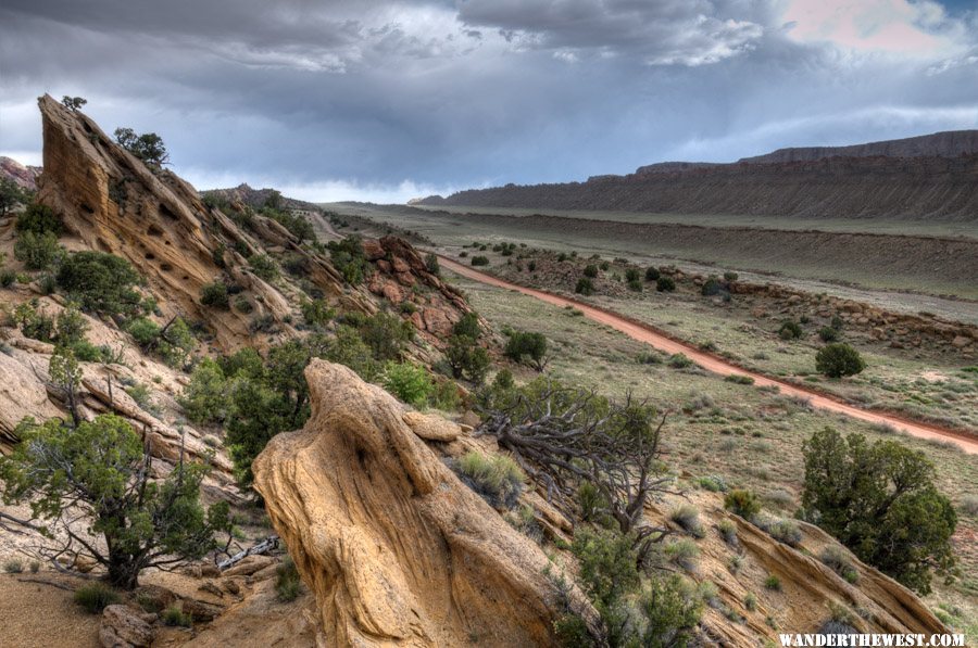
The Burr Trail Road is all paved west of Capitol Reef N.P., but turns to dirt/gravel (generally good-quality, high-speed) after it enters the Park.
High speed is not recommended on these switchbacks, however, which drop down/over the Waterpocket Fold to the east side of the Park :
:
Fresh snow on the Henrys to the east:
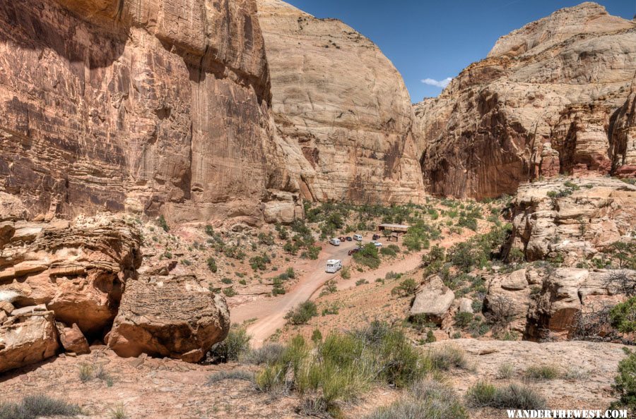
I drove all the way north up the east side (the road here generally called the "Notom-Bullfrog Road") to the junction with UT 24 and then a few miles west to the Park Visitor Center for more maps (for current use and future trips), guidebooks, geology books, etc. -- spent $99, but I don't mind $ going to these Natural History gift shops. I got a spot in the main Fruita Campground (I don't mind "official camping" once in a while), then headed 12 miles west to Torrey for truck fuel, food-supplies, and more ICE for the ice chest!. I spent one night (May 11) in the Fruita C.G., which was fine; elevation 5577 ft.
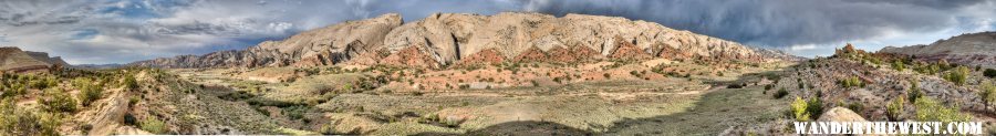
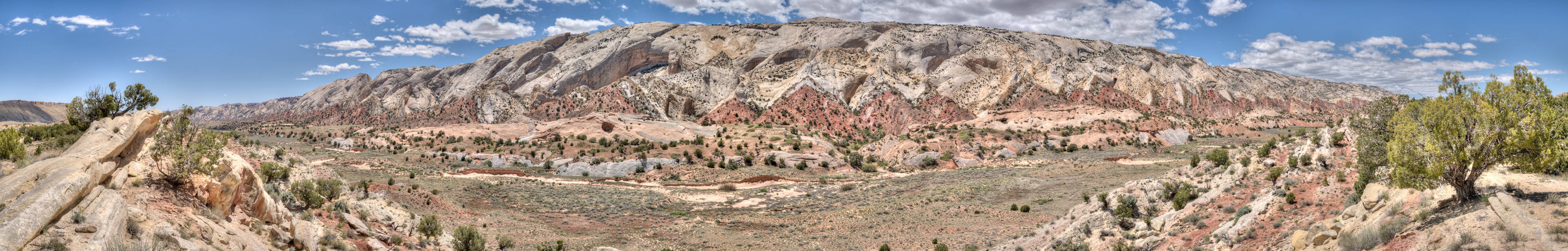
Next day I wandered back down the east side of the Park, down the Waterpocket Fold, south, on the Notom-Bullfrog Road. I took this panorama, west-facing looking at a cool spot of the east side of the Fold, midday:
Here's a link to a full-size version of this image: Pano3
Late in the day I spent -- wasted? -- quite a bit of time driving back and forth searching for a suitable BLM spot for camping -- the Cedar Mesa "primitive" c.g. was full. Eventually I took the BLM spur road that led to/past the "Hall's Creek Overlook" just inside the Park. I camped just outside of the Park at this spot for two nights, May 12 & 13; elevation 4869 ft.
High speed is not recommended on these switchbacks, however, which drop down/over the Waterpocket Fold to the east side of the Park
:Fresh snow on the Henrys to the east:
I drove all the way north up the east side (the road here generally called the "Notom-Bullfrog Road") to the junction with UT 24 and then a few miles west to the Park Visitor Center for more maps (for current use and future trips), guidebooks, geology books, etc. -- spent $99, but I don't mind $ going to these Natural History gift shops. I got a spot in the main Fruita Campground (I don't mind "official camping" once in a while), then headed 12 miles west to Torrey for truck fuel, food-supplies, and more ICE for the ice chest!
. I spent one night (May 11) in the Fruita C.G., which was fine; elevation 5577 ft.Next day I wandered back down the east side of the Park, down the Waterpocket Fold, south, on the Notom-Bullfrog Road. I took this panorama, west-facing looking at a cool spot of the east side of the Fold, midday:
Here's a link to a full-size version of this image: Pano3
Late in the day I spent -- wasted? -- quite a bit of time driving back and forth searching for a suitable BLM spot for camping -- the Cedar Mesa "primitive" c.g. was full. Eventually I took the BLM spur road that led to/past the "Hall's Creek Overlook" just inside the Park. I camped just outside of the Park at this spot for two nights, May 12 & 13; elevation 4869 ft.
FWC Hawk (2005) on a Ford F250 Supercab, 6.8L V10 gas (2000)
#27
chnlisle
-
- Members
- 3,811 posts
Post Master
- LocationThe Old Pueblo
Posted 26 May 2011 - 06:06 PM
One of our favorite trips. Thanks for the great pix.
Special Engel Pricing For WTW Members
Click here to see my ATC Cougar
JayAronowSales.com
(520)579-9610
jayaronow@gmail.com
#28
MarkBC
-
- Site Team
- 6,602 posts
The Weatherman
- LocationBend, Oregon
Posted 26 May 2011 - 06:26 PM
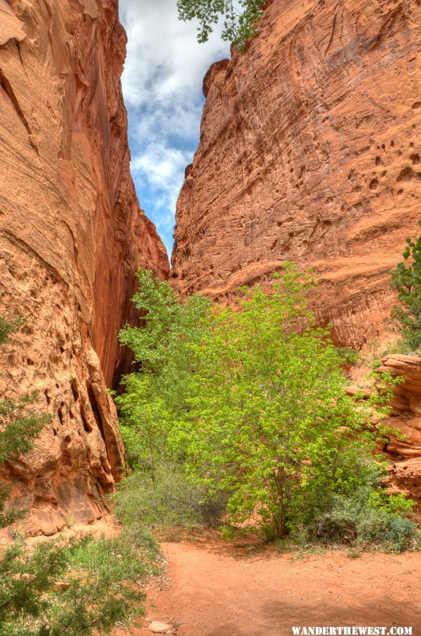
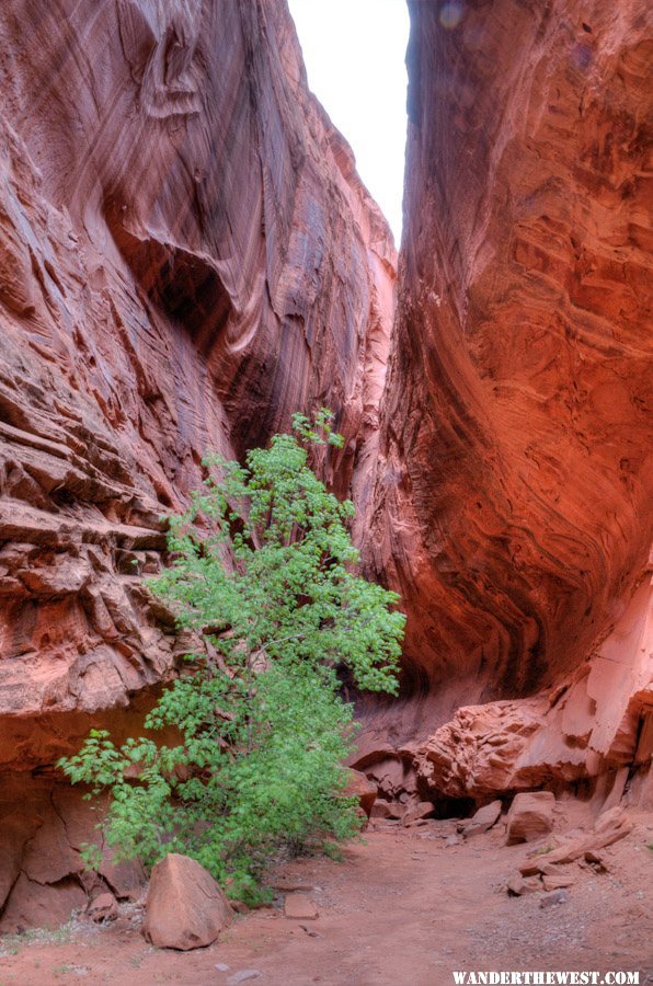
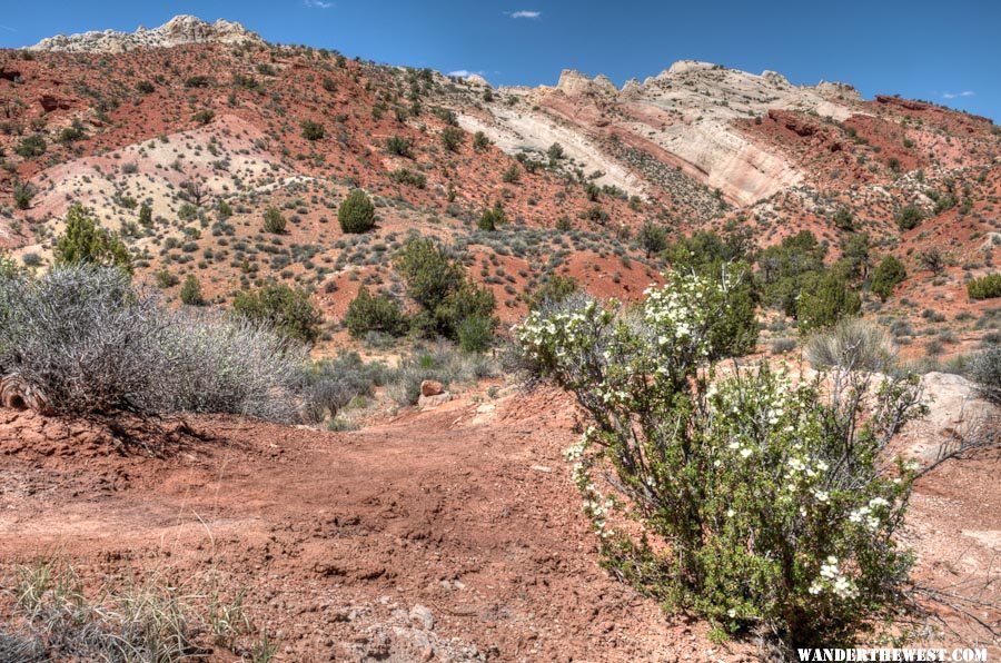
Next morning, headache ~gone, I drove north a few miles to the trailhead for my first real hike of the Utah part of the trip -- finally! Headquarters Canyon. It was only 3.2 miles roundtrip and flat, but I wasn't complaining -- it was beautiful and had a short-but-significant real slot to it.
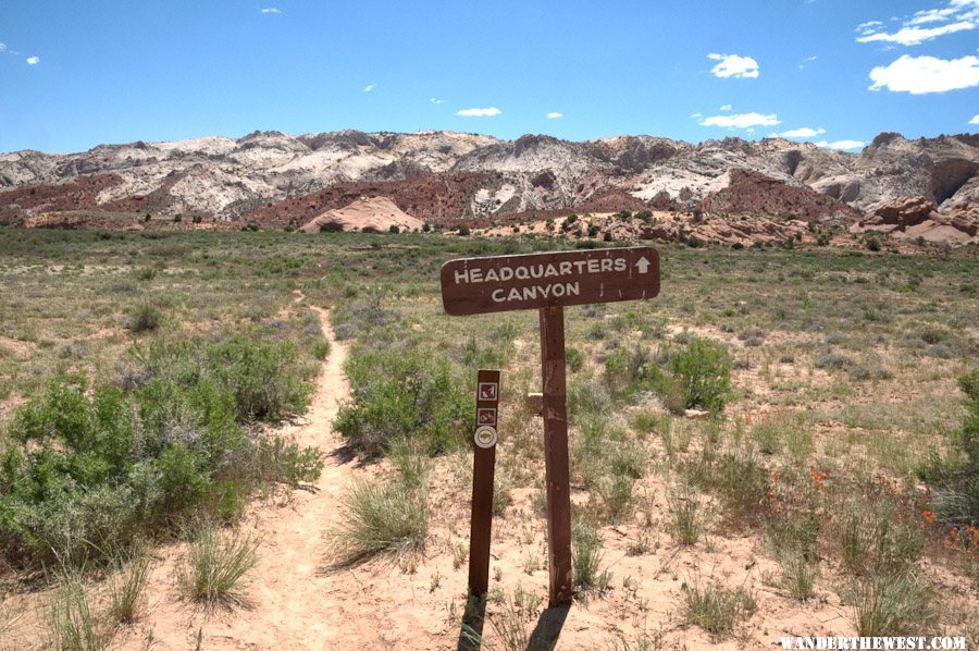
I think it's beautiful how the colorful rock degrades into colorful dirt!
After hiking up an open wash the actual canyon of HQ Canyon starts with the slot:
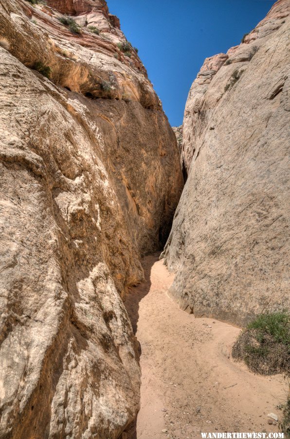
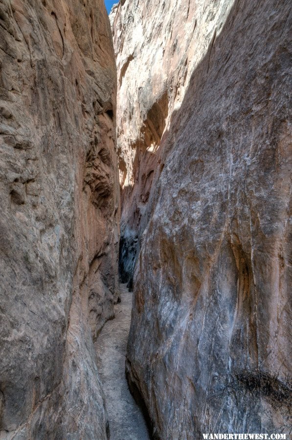
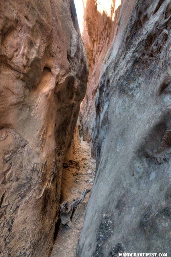
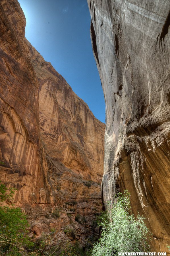
Then it opens up into a regular narrow kinda canyon.
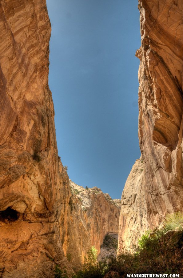
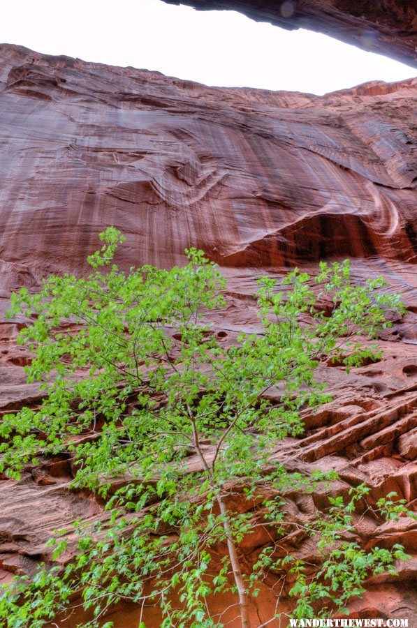
The rock walls have lots of contrast-color and lots of texture at a range of scales:
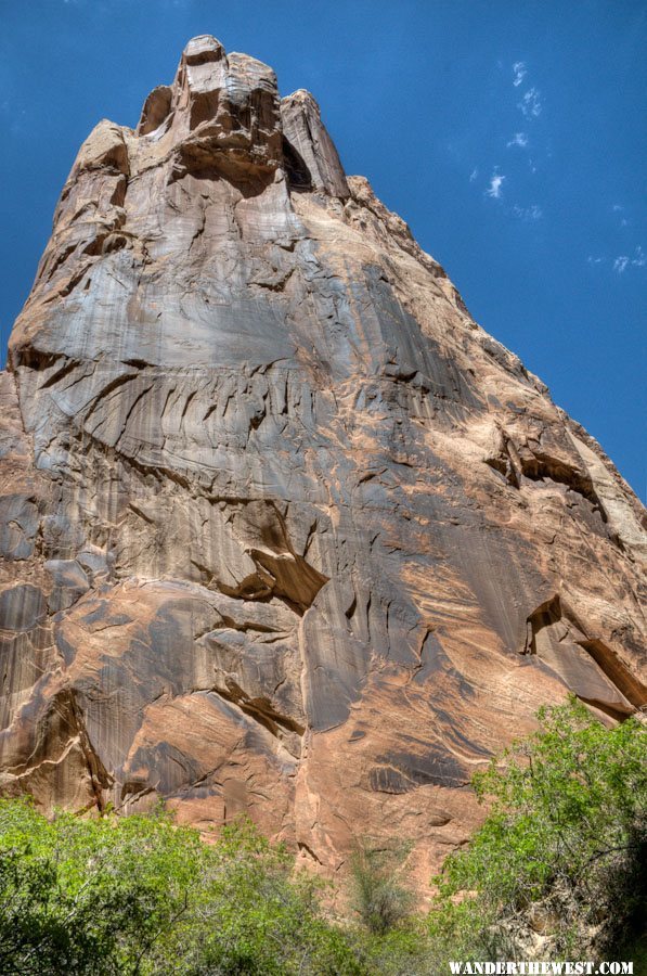
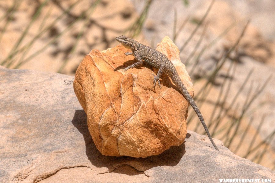
I called this "The Watchful Sentinel":
This lizard picked a great rock for posing; thank-you Mr. Lizard!
I brought my tripod on this hike to use for shooting 360° panos. They didn't turn out that special, but it does show how it looked from one point in the canyon, so here's a link to the better pano: Pano6 (use QuickTime viewer/player/plug-in to view). You can pan up and down a bit as well as round-and-round.
It was a nice hike!
I returned to my previous BLM campsite near Hall's Cr Overlook for a second night.
I think it's beautiful how the colorful rock degrades into colorful dirt!
After hiking up an open wash the actual canyon of HQ Canyon starts with the slot:
Then it opens up into a regular narrow kinda canyon.
The rock walls have lots of contrast-color and lots of texture at a range of scales:
I called this "The Watchful Sentinel":
This lizard picked a great rock for posing; thank-you Mr. Lizard!
I brought my tripod on this hike to use for shooting 360° panos. They didn't turn out that special, but it does show how it looked from one point in the canyon, so here's a link to the better pano: Pano6 (use QuickTime viewer/player/plug-in to view). You can pan up and down a bit as well as round-and-round.
It was a nice hike!
I returned to my previous BLM campsite near Hall's Cr Overlook for a second night.
FWC Hawk (2005) on a Ford F250 Supercab, 6.8L V10 gas (2000)
#29
MarkBC
-
- Site Team
- 6,602 posts
The Weatherman
- LocationBend, Oregon
Posted 26 May 2011 - 06:58 PM
Next morning, May 14, I got packed up before sunrise to get photos of dawn on the Waterpocket Fold. It was really nice. On the drive north a few miles to my planned spot I saw a bobcat standing in the road ahead of me.  SUPER cool! Only the second time I've seen one of these kitties in the wild! He ran off before I got close enough to even think of getting a photo.
Here's a link to a full-size version of this image: Pano07
I liked the light on this, and I especially liked the dark clouds providing dramatic backdrop to the magnificent rock.
I took a few other photos after the pano work as the clouds moved in completely and things got a little darker.
These two are looking north, along the more-eroded layers of the Waterpocket Fold, along the Notom-Bullfrog road.
I liked the colored dirt layers -- remnants of what had been colored-rock layers.
HDR photography brought out a lot of contrast-detail in the clouds.
After this early-morning photo-fun I continued north a bit to the Cedar Mesa (official, Park, dry) Campground, where I snagged the primo spot. Elevation 5603 ft. I spent the night there. During the evening as I sat in the camper reading I caught a glimpse of movement across the floor of the camper: A mouse/rat/rodent-of-some-kind. It had gotten in through a slightly-open turnbuckle access panel, which means it had crawled up into the bed of the truck. When I moved it ran back out the open panel, and I closed it. Later I heard it trying to get back in again... ...afraid I might wake up with my nose gnawed off . But the camper stayed rodent-free the rest of the night.
SUPER cool! Only the second time I've seen one of these kitties in the wild! He ran off before I got close enough to even think of getting a photo.Here's a link to a full-size version of this image: Pano07
I liked the light on this, and I especially liked the dark clouds providing dramatic backdrop to the magnificent rock.
I took a few other photos after the pano work as the clouds moved in completely and things got a little darker.
These two are looking north, along the more-eroded layers of the Waterpocket Fold, along the Notom-Bullfrog road.
I liked the colored dirt layers -- remnants of what had been colored-rock layers.
HDR photography brought out a lot of contrast-detail in the clouds.
After this early-morning photo-fun I continued north a bit to the Cedar Mesa (official, Park, dry) Campground, where I snagged the primo spot. Elevation 5603 ft. I spent the night there. During the evening as I sat in the camper reading I caught a glimpse of movement across the floor of the camper: A mouse/rat/rodent-of-some-kind. It had gotten in through a slightly-open turnbuckle access panel, which means it had crawled up into the bed of the truck. When I moved it ran back out the open panel, and I closed it. Later I heard it trying to get back in again...
...afraid I might wake up with my nose gnawed off . But the camper stayed rodent-free the rest of the night.
FWC Hawk (2005) on a Ford F250 Supercab, 6.8L V10 gas (2000)
#30
MarkBC
-
- Site Team
- 6,602 posts
The Weatherman
- LocationBend, Oregon
Posted 26 May 2011 - 07:28 PM
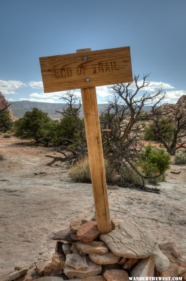
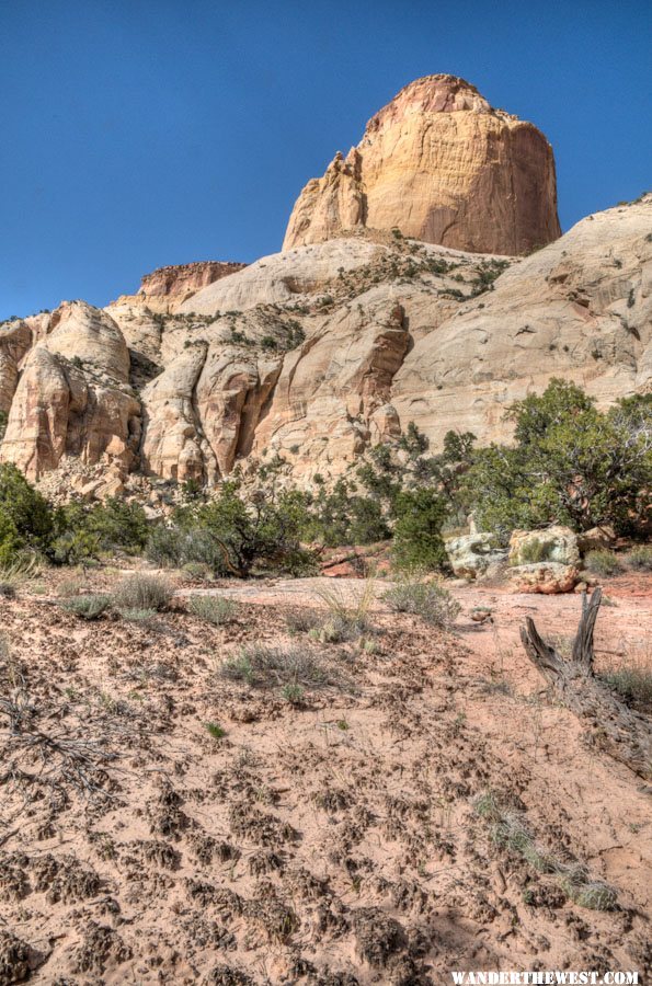
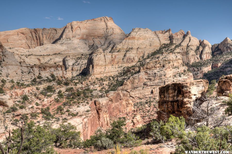
Next morning, May 15, late morning, I left the C.G. and headed back up to Torrey and got a room in the Rim Rock Inn motel; elevation 6525 ft. As it was only mid-afternoon I drove back to the park to do a hike that the new Capitol Reef Hiking Guide recommended doing late-afternoon for best light: Golden Throne. It's at the end of the Scenic Drive -- the "official" scenic drive.
Looking back and down at the parking area for this hike's trailhead and for the more-popular Capitol Gorge hike.
In case hikers didn't know when to stop:
Now turn around and look at the object/namesake of the hike -- the Golden Throne:
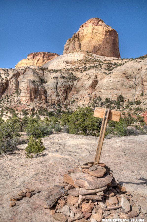
Don't step on the crypto! (cryptobiotic soil, that is)
Most of the trail has been set to stay on bedrock to protect delicate soils.
This is the dome-y zone of the park:
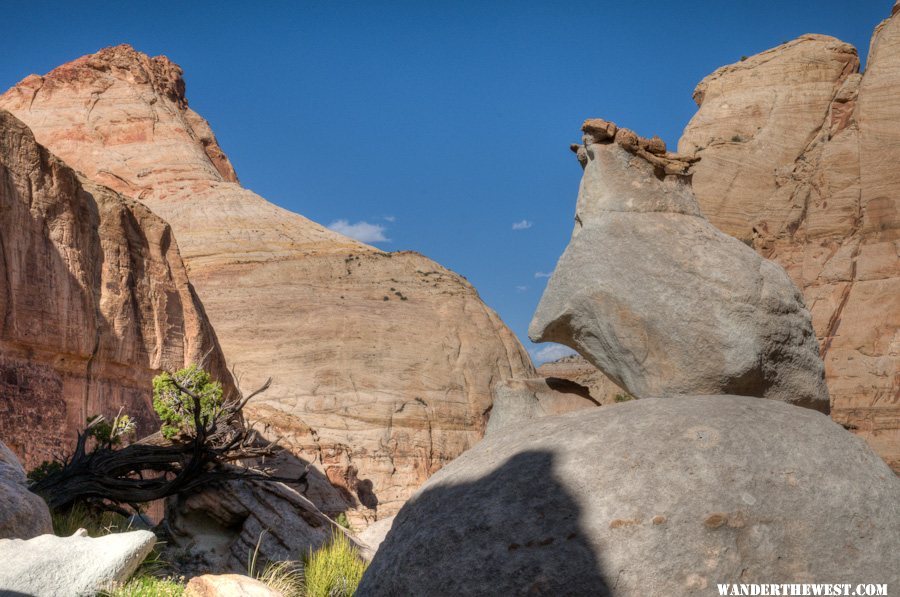
I noticed several interesting/odd rocks next to the trail:
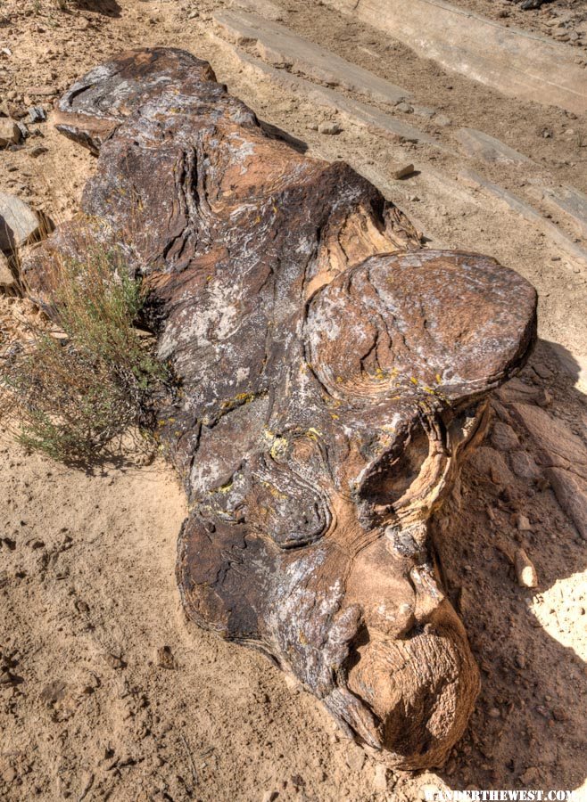
This big boulder was delicately perched on the precipice, poised on just a couple of points of contact above the void:
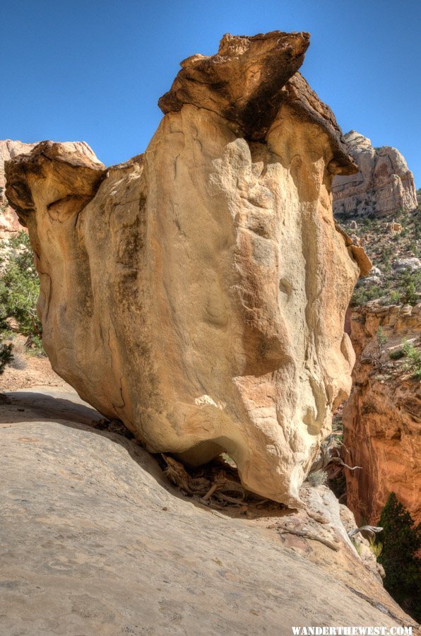
I thought this one, the grey one, looked like a rear-quarter view of some kind of short-legged critter with it's left-front limb raised...and some kind of hat.
It was a nice hike, and late-afternoon was the right time to do it.
I enjoyed the shower back at the motel....after a dinner of cheeseburger, fries and chocolate shake from "Slackers" in Torrey.
[To be continued later today...I need a break!]
Looking back and down at the parking area for this hike's trailhead and for the more-popular Capitol Gorge hike.
In case hikers didn't know when to stop:
Now turn around and look at the object/namesake of the hike -- the Golden Throne:
Don't step on the crypto!
(cryptobiotic soil, that is)Most of the trail has been set to stay on bedrock to protect delicate soils.
This is the dome-y zone of the park:
I noticed several interesting/odd rocks next to the trail:
This big boulder was delicately perched on the precipice, poised on just a couple of points of contact above the void:
I thought this one, the grey one, looked like a rear-quarter view of some kind of short-legged critter with it's left-front limb raised...and some kind of hat.
It was a nice hike, and late-afternoon was the right time to do it.
I enjoyed the shower back at the motel....after a dinner of cheeseburger, fries and chocolate shake from "Slackers" in Torrey.
[To be continued later today...I need a break!]
FWC Hawk (2005) on a Ford F250 Supercab, 6.8L V10 gas (2000)


0 user(s) are reading this topic
0 members, 0 guests, 0 anonymous users

