Jump to content


Photo
- - - - -

Pine Mountain


  • Please log in to reply
25 replies to this topic

#1 MarkBC

MarkBC

    The Weatherman

  • Site Team
  • 6,602 posts
  • LocationBend, Oregon

Posted 15 August 2011 - 06:34 PM

This is starting as a pre-trip-report right now...but this afternoon I'm heading up to what I call the "Summer Solstice Summit" of Pine Mt, about 25 miles east of Bend, Oregon, on US Highway 20 -- a couple of days of camping and hanging out...shooting panos and other photo stuff (and napping). At ~6400 feet.
Posted Image

Posted Image

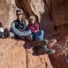
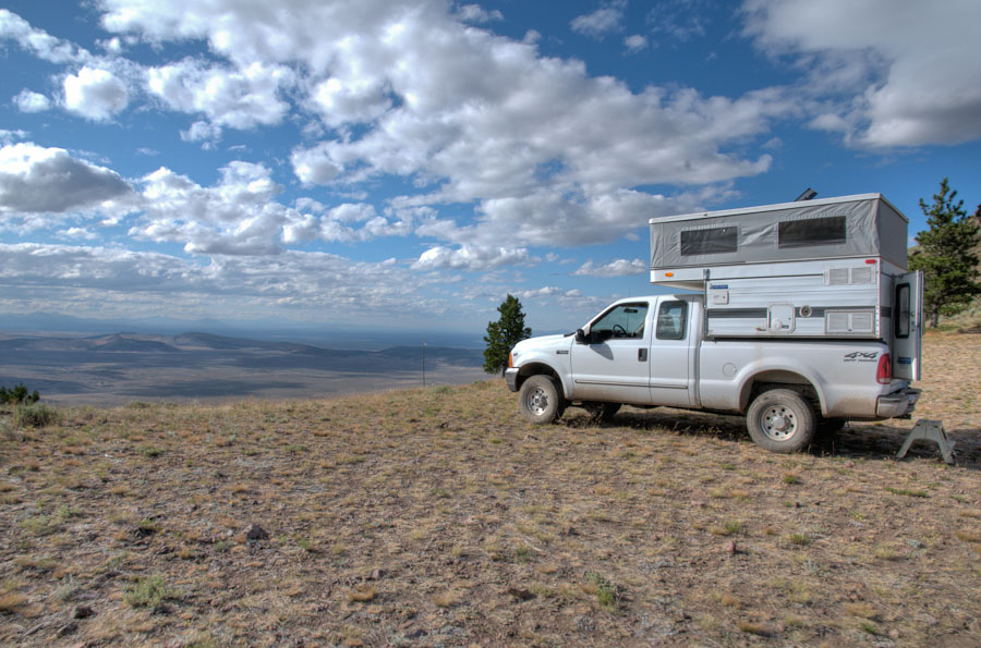
I call it the Summer Solstice Summit because that's where I usually go with friends to view the sunset on the summer solstice (though we didn't this year), a tradition of many-a-year. It's also known as the "Launch Summit" 'cause it seems to be a favorite launch spot for para-gliders....which is why there's a wind-sock on the summit knob. (for some reason, even the 24k-scale topo maps don't show that the road leads up to the base of that summit. It's like that 4x4 road has been drawn SE of it's true location, which actually takes off at the apex of the hairpin turn)
Posted Image

I think I'll have broadband access up there, so I may upload any worthwhile photos from there.

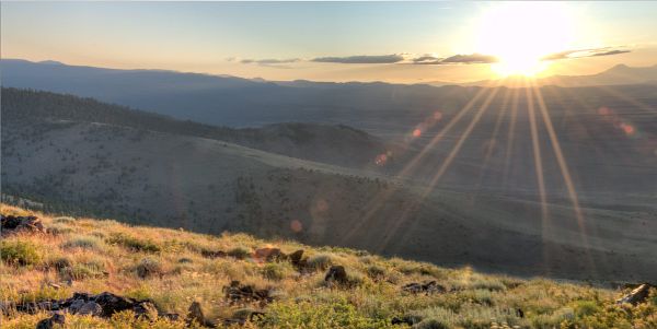
I may also head over to what I call the "Radio Summit", so-called because of all the radio (microwave and cellular) towers and radio shacks up there. With all that technology humming it's not exactly a wilderness experience...but it does have a mighty-fine view to the south/east (as well as north).Posted Image

Later...
  • 0

FWC Hawk (2005) on a Ford F250 Supercab, 6.8L V10 gas (2000)


#2 Lighthawk

Lighthawk

    Weekend warrior

  • Members
  • 3,319 posts
  • LocationNevada City, CA

Posted 15 August 2011 - 08:04 PM

Nice pre-post, Mark. How do you get those topo's online? Jpegs? From what source?
I use Backcountry Navigator which can use MyTopo.com for on or offline mapping, but it doesn't allow me to cut & paste as it appears you have done.

Have a great trip and good shooting!
  • 0

2021 RAM 3500 Crew 4x4, 6.4 hemi/8 speed trans with 4.10 gears, Timber Grove bags, Falken Wildpeak 35" tires.

OEV Aluma 6.75 flatbed, Bundutec Odyssey camper on order for 2024

For this year we're still using our 2008 FWC Hawk with victron DC-DC charger, 130w solar, MPPT controler

with 2000w inverter and external 120v output and 12v solar input with 100w portable solar.   http://lighthawkphoto.com


#3 MarkBC

MarkBC

    The Weatherman

  • Site Team
  • 6,602 posts
  • LocationBend, Oregon

Posted 15 August 2011 - 08:33 PM

Nice pre-post, Mark. How do you get those topo's online? Jpegs? From what source?
I use Backcountry Navigator which can use MyTopo.com for on or offline mapping, but it doesn't allow me to cut & paste as it appears you have done.

Have a great trip and good shooting!

Andy -
I use National Geographic TOPO! State Series -- the CD sets, one set of 8 -10 CDs for each state (~$80-$100/state). Over the years I've bought a set for each/all of the Western states, and I've copied them all to the harddrive in my laptop, so they're always with me when traveling. Each map has 5 levels of zoom, each corresponding to the scale of a "real" map (e.g., 1:24,000). There's a function for selecting a region (draw a rectangle) and copying to the clipboard, etc. The only downside is that these are "dumb" maps -- just bitmaps, really, (rather than a smart GIS format) -- scans of the USGS series' (24k, 100k, etc.) I should add that the maps are "aware" of the elevation of wherever your cursor is, so they're not completely "dumb".

Of course, whatever source puts a map on your screen, in Windows OS you can always do the [Shift] [PrtSc] (that is, print screen), which copies the whole computer screen to the clipboard from which you can paste into whatever image editor your want and crop/edit...as I'm sure you know, but maybe somebody else doesn't. Posted Image

It's clouding up now...but I'm hoping that leads to dramatic skies -- maybe thunderstorms -- and not just flat overcast. Anyway, tomorrow and the rest of the week are supposed to be clear, and I'm still heading out, in any case.
- Mark
  • 0

FWC Hawk (2005) on a Ford F250 Supercab, 6.8L V10 gas (2000)


#4 Alley-Kat

Alley-Kat

    Elder Statesman

  • Members
  • 989 posts
  • LocationPacific Ocean

Posted 15 August 2011 - 10:03 PM

Of course, whatever source puts a map on your screen, in Windows OS you can always do the [Shift] [PrtSc] (that is, print screen), which copies the whole computer screen to the clipboard from which you can paste into whatever image editor your want and crop/edit...as I'm sure you know, but maybe somebody else doesn't. Posted Image
- Mark

I use Screen Hunter, it's free and has all the features for capturing any part you want from a computer screen. The technique I like the best is the rectangular capture tool... just drag the size and shape of rectangle you want. You can specify to save to your clipboard or to your hard drive and also choose the exact folder you want to store the image to.
  • 0

#5 MarkBC

MarkBC

    The Weatherman

  • Site Team
  • 6,602 posts
  • LocationBend, Oregon

Posted 15 August 2011 - 10:14 PM

I use Screen Hunter

And if you have Windows 7 there's a function built into the OS, called "Snipping Tool" (under Start>Accessories), that sounds similar to Screen Hunter.
  • 0

FWC Hawk (2005) on a Ford F250 Supercab, 6.8L V10 gas (2000)


#6 billharr

billharr

    Senior Member

  • Members
  • 2,824 posts
  • LocationStockton CA

Posted 15 August 2011 - 10:34 PM

And if you have Windows 7 there's a function built into the OS, called "Snipping Tool" (under Start>Accessories), that sounds similar to Screen Hunter.


Thank you I did not know about Snipping Tool I just pined to my task bar. :D
  • 0

#7 brett13

brett13

    Lovecock

  • Members
  • 1,026 posts

Posted 15 August 2011 - 11:48 PM

And if you have Windows 7 there's a function built into the OS, called "Snipping Tool" (under Start>Accessories), that sounds similar to Screen Hunter.

Awe, and I just bought SnagIt for this very purpose! Ah well, a business expense.
  • 0
Once had 2007 Tundra TRD 4x4 5.7 SR5 w/ Firestone bags, Bilstein 5100s in front, Total Chaos shackles rear, 275/70/18 E rated Michelin LTX AT2
2007 ATC Bobcat for sale

Now, just roaming around in a stock Land Cruiser (not stock for long though... bawahahha [evil laugh])

#8 simimike

simimike

    Senior Member

  • Members
  • 860 posts
  • LocationSimi Valley Ca.

Posted 16 August 2011 - 03:47 AM

Come on Mark, stop beating around the bush. Where exactly is this "Pine Mountain" you're going to? If you want to keep it a secrete that's fine but don't tease me with vague details. Just kidding, I like that mapping info you provided.

Mike
  • 0

#9 DirtyDog

DirtyDog

    Captain Leisure

  • Site Team
  • 3,157 posts
  • LocationEugene, Oregon

Posted 16 August 2011 - 07:02 PM

Looking forward to some HDR Photos!
  • 0

#10 MarkBC

MarkBC

    The Weatherman

  • Site Team
  • 6,602 posts
  • LocationBend, Oregon

Posted 16 August 2011 - 09:00 PM

After spending last night camped at the northern/Solstice/Launch summit of Pine Mt., I'm parked about a half-mile of road away from the "radio summit", waiting for a construction (transmitter? tower? cable?) crew to get out of the way...I had to back down the road this far 'cause there was no place to turn around! Posted Image
Anyway...

A few "getting there" photos -- mostly for simimike's benefit, to try to make up for my crappy directions. Posted Image
The turn-off from US Highway 20 at the ruins of Millican, 26 miles east of Bend:
Posted Image

The road that leads to the Observatory, though that's on a different summit than my destination. I'm headed to the obvious pointy peak (which is the true summit):
Posted Image

Much of the Ponderosa Pine forest on Pine Mt. is open and park-like with little understory. This is the 2-track that leads to my destination (after turning off the main road):
Posted Image

The beautiful, flat saddle -- 250 feet below the summit knob -- where I come to watch the summer solstice sunset most years and where I'm camping. My truck is pointing west-ish, overlooking the Millican Valley 2000+ feet below, and west to Horse Ridge, Bend and the Cascades in the distance:
Posted Image

I shot a couple of 360° panoramas from the summit knob last night and one this morning. They're too big and wrong format to post here, but I'll post links to them.
Here's a thumbnail snapshot from one of them -- "pre-sunset":
Posted Image

Here's a link to the full 360° rotatable "pre-sunset" panorama. You need Quicktime viewer/player to open/view it and the file is 3MB in size.

More later.
- Mark
  • 1

FWC Hawk (2005) on a Ford F250 Supercab, 6.8L V10 gas (2000)


0 user(s) are reading this topic

0 members, 0 guests, 0 anonymous users